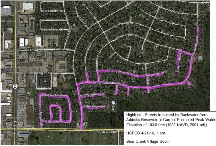
The Army Corps of Engineers will begin releasing water from the Addicks and Barker dams later this evening; nonetheless, water levels in the reservoirs are still expected to rise high enough to cause street flooding in the Bear Creek subdivision north of Clay Rd. The Corps also notes that nearby residential areas should anticipate that wildlife inhabiting approximately 26,000 acres of forested land in the 2 reservoirs may flee the rising water and enter nearby neighborhoods. That wildlife may include the feral pigs previously targeted by Harris County Precinct 3’s trapping-and-foodbanking program; sightings of animals such as deer, coyotes, and bobcats have also been reported in the reservoirs.
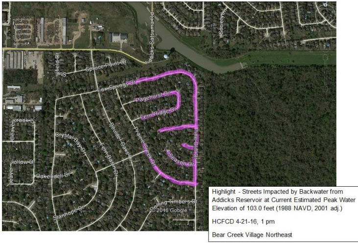
Harris County Flood Control District has published a list of streets that could be impassible for days or weeks due to flooding, as well as a few maps (one of which is shown above). Here’s the other map below, highlighting in pink the streets south of Addicks Satsuma Rd. and Langham Creek expected to get water when the level in Addicks reaches 103 feet:
***
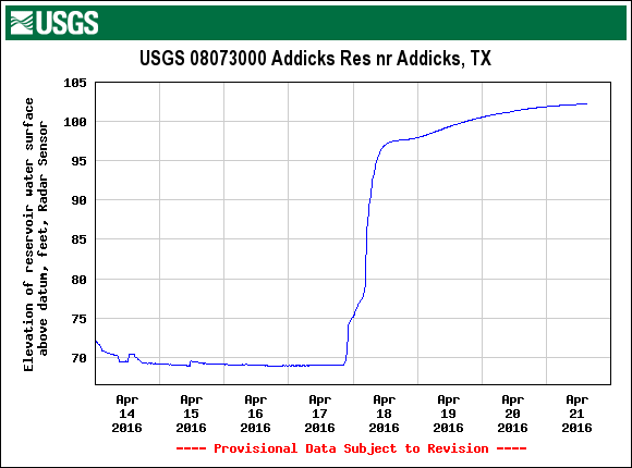
Those predictions are subject to change depending on the weather over the next few weeks, as well as how quickly water can be released downstream of the dams. Here’s the USGS’s measurements of the water levels in the Addicks reservoir, creeping higher at a less frantic pace since Monday’s 28-ft-jump:
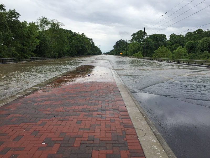
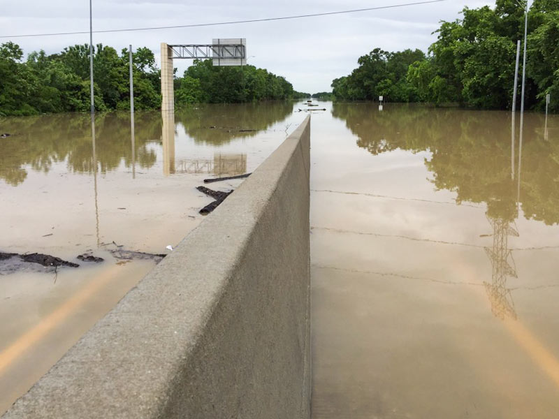
And here are a few looks at Hwy. 6 this afternoon, from TxDOT:
- Addicks Reservoir Press Release [HCFCD]
- Addicks Reservoir Monitoring Data [USGS]
- Addicks, Barker reservoirs at record levels; threaten adjacent neighborhoods [KPRC]
- Previously on Swamplot: City Watching Addicks and Barker Do Their Own Dam Thing; Flooding Keeps Yale St. Bridge Open But Closes Hwy. 6 and 290; A Quick Update on the ‘Extremely High Risk’ Dams Protecting Downtown and Central Houston; Hiding in Plan for West Houston: New Streets Cutting Through George Bush Park, Addicks Reservoir; Turning the Feral Hogs of Barker and Addicks Reservoirs into Pork Chops for the Needy; Last-Ditch Grand Parkway Defense Spotlights Dangerous Conditions at Addicks and Barker Dams;What Happens If You Don’t Garden the Wild
Images: TxDOT (photos); HCFCD (maps); USGS (chart)


I lived in the shadow of the dam for several years. After a big rain event in 2009, our apartment complex was visited by snakes, possums, armadillos, raccoon, and bees fleeing the rising waters. We would have probably had the bobcats and deer too if they weren’t too large to fit through the fence. During my time there, the Highway 6 viaduct over the reservoir was never submerged like it is now.
If you find wildlife, contact Wildlife Center or rescue them and take into them to rehab. http://www.wildlifecenteroftexas.org/
I grew up in this neighborhood in the 80s and 90s. The Addicks reservoir was always full after a big rain event, as it was designed to be, and the narrower streets around the reservoir would sometimes remain impassable for a few days or even weeks after a big storm. My street was prone to flooding, but it always receded quickly and never got into anyone’s house. Then my parents’ house flooded for in 2002 during a big rain event, and they sold the house and moved shortly after completing the renovations. They have heard that their old house has flooded multiple times since they moved, including Monday. I have to wonder if the neighborhood is becoming some sort of detention pond to all the newer developments that have sprouted up in west and northwest Houston over the last 20 years. I wouldn’t be surprised if the government condemned the entire subdivision like they did to parts of Galveston County years ago. It saddens me to see this happening to my old neighborhood.