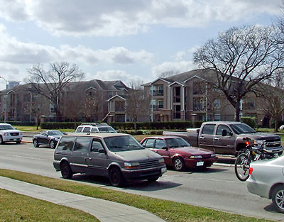
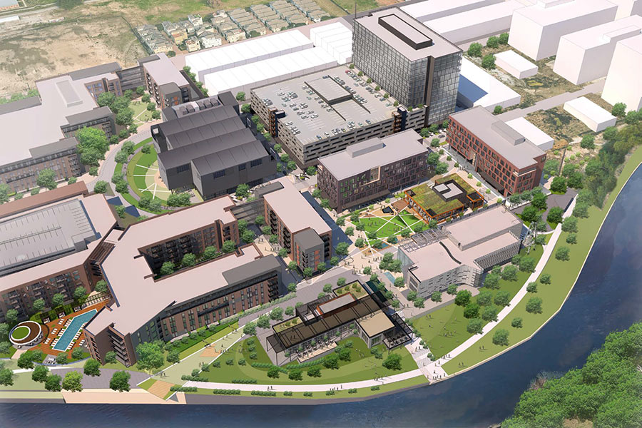
The long-delayed piece-by-piece redevelopment of the 28-acre Archstone Memorial Heights compound at the corner of Studemont and Washington Ave. into a denser style of apartment complex appears to be back on track. Residents of the 3 existing 3-story “garden-style” buildings in the southwest corner facing Heights Blvd. have received notice that they will need to vacate their apartments by August 1st. (“I was trying to figure out why rent prices went up $300 in 5 months,” a resident quips to Swamplot: “Now I know why.”) Did those letters from management sound familiar? Residents of the same buildings were cleared out in March 2008 in anticipation of a similar redevelopment. A letter sent to Memorial Heights tenants refers only to a new 4-story apartment building planned for the site of those structures: Buildings 7, 8, and 9.
***
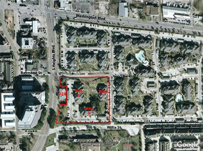
- Previously on Swamplot: Redeveloping the Memorial Heights Apartments: The Inside Story, Memorial Heights Apartments: Washington Fences Will Stay, Memorial Heights Apartments: How Long Is Your Lease?
Photo: Charles Kuffner. Map: Michael W. Jones


“at the corner of Studewood and Washington Ave.”
That would be an interesting intersection (I don’t think it exists).
You mean Washington and Heights, right? More specifically, Heights & Raymond.
Great news, even if it is replaced with a 4 story “core-esque” tinder-box. My only request is that the developer make their box more open and accessible. The current apartments seem so out of place for its location and have long past their useful life, even if the development itself isn’t that old. The complex is absolutely MASSIVE and seems to serve as a giant black hole between we the more developed west-end of Washington and the up and coming east side.
@Mark L.: Was supposed to be Stude*mont* and Washington (fixed now), but you’re right — Heights and Raymond make for better coordinates for the portion being redeveloped first.
I’m confused by this location as well. Washington crosses StudeMONT. So, are we talking south of Washington, between Studemont and Heights?
The SN 22 and the TIRZ district for that area has big hopes for this property. With it’s direction connection to the trails and to the new Washington Ave development, it can become a central mixed-use site for the corridor. Not to mention having a road on each side with direct access from I-10. Picture Rice Village for Washington Ave.
I’d rather they just bring back the bon ton room, but I’m old.
kjb434,
Apartments on the three southern “blocks”?
Retail fronting Heights and Studemont?
mixed use on the three northern “blocks”?
Or all retail/mixed use, more like Rice Village?
????????????????????
think of the traffic:)
As someone who lived in Building 1 (Northwest corner of complex) during the last aborted redevelopment (I moved out last November for North Texas), I know the original plan was to have the retail only on the Studemont end of the complex. The apartments would still face Heights Blvd.
The current driveway from Heights would be extended through the eventually razed management office and all the way to Studemont, creating the main access road for all six buildings.
Still unanswered though, is the disposition of the gutted building at 225 S. Heights. It has been in that state since before the last attempt, and has been a frequent haven to the vandals and homeless.
Wait. When this place was built it was out of place because it was a brand spanking new apartment complex in the Washington Corridor which (with a few exceptions) was a dead area / no man’s land of heavy industrial uses and crumbling residential shacks.
Now these well maintained, 20 year old garden apartments are woefully obsolete and cry out for demolition because they aren’t dense enough, hip enough, or mixed use enough for surrounding neighborhood.
How can you not love this city?
I was the GM at the Satellite Lounge from Feb ’96 until August of ’98 and the first complex was developed then. The vast majority of tenants were folks from out of town with “corporate” apartments. The complex filled the units closest to us with these part-timers and very soon we were forced to permanently seal the big aluminum and glass roll-up doors on the front of the building (still there- it’s actually called the Silverberg building, built in 1928) because of weeknight sound drift. It worked out OK, but we were soon awarded “best Place to Gag on Stale Smoke’ by the Houston Press’ “Best of Houston” that year. I still have the plaque, as the owners were pretty furious. I kind of thought it funny, and won my battle to install Smokeeters (if you want to quit smoking, clean a Smokeeter sometime)at a cost of nearly $4000 to the club. A moot point now since indoor smoking is no longer allowed in H-town, but we gained nearly no new business out of the new complex and I said at the time that those units were built to last 15 years before they started to crumble. They were put together with drywall and nail gun staples, 2X4s and hot glue. I will say that auto break-ins definitely decrease once the lot was developed, but that eventually led to a parking issue between Rockefeller’s, Satellite and later Star Pizza. Contrary to popular opinion, the club closed not because of meanness on the part of the Star Pizza landlords (Satellite property was sold by a managing partner without a lease) but because of late rent as the club outlived its prime time. Anyway, it’s still missed and the Wash Ave replacements don’t hold a candle to the cool stuff that was going on nearly every night there from about ’95 until around 2000. No surprise that the units are going down to be replaced by same but larger and more expensive. It was my dream to see Wash Ave become a vibrant street in 1991 when I first started working at Rockefeller’s in ’91 as a 20 year old live music, old Houston and club buff. I guess it’s finally made it, but I never could have predicted what it has become. – D Beebe
awp,
This is in in-the-loop on one of the hottest development areas of the city because the land is more reasonably price than say Midtown.
The coming traffic apocalypse for Washington Ave is already underway. This is part of the reason connecting the feeders roads along I-10 is so important. It’ll provide a quick way to move along the corridor without getting stuck on Washington Ave. You just take the north-south street nearest to your destination on Washington Ave.
Also, once you park, you can walk to most places. Washington Ave is how a truly walkable neighborhood forms naturally without the hideous touch of central planning. A truly walkable neighborhood grows out of an area that can be easily traveled by car. The density of residential in single family, town, and apartment homes is providing the base for the commercial. The commercial is also turning the area into a destination.
Also, if traffic is something you are worried about along Washington Ave, you should petition METRO to stop making it hard on private transit options. Private transit options like WAVE provides excellent service far beyond anything METRO is remotely capable of yet METRO is doing whatever it can to kill the WAVE service (or seriously mame it). Hell, METRO was killing an eco-friendly downtown shuttle service. The point is that solutions to the traffic problem have presented itself, yet the one agency that should be providing a good transit service is doing what it can’t to make things worse. Also, Yellow cab has a hand in this mess too, but it’s been mostly METRO’s doing on Washington Ave.
Like I said, Washington Ave is becoming more like Rice Village. Traffic has been horrendous there for years, yet people still go there. Want to throw in the Westhiemer corridor (specifically the lower end)? It’s traffic isn’t really smooth sailing either.
I miss the Satellite Lounge, too, David. Saw some exceptional shows in that club.
If you want to see what apartments like this will look like in the future, drive around the Greenspoint area (if you dare).
There’s nothing to these. They were ugly and out of place when they were built and they still are ugly and out of place.
There’s nothing worth saving, just cheap wood and Tyvek house wrap.
Washington is not walkable. It is one long street with no grid. it has many strip shopping centers close together with fast food places and old Mexican C Stores in between, but that is not walkable.
for sure it is a huge improvement from where it was 10 years ago, but it is not a “walkable” neighborhood.
Yeah, I don’t get how Washington is “walkable”. Not only is it one long arterial, but many of the streets off Washington don’t even have sidewalks.
I think this is the site of the old Humane Society. I adopted a doggie there years ago.
kjb,
“think of the traffic:)”
I thought the :) sign was an accepted emoticon for sarcasm. Sorry for the misunderstanding.
awp
@rsb320 #16, it was the SPCA. I adopted a dog there in 1994, and the next dog I adopted in 1998 was from their new digs off of Old Katy.
Montrose is being destroyed by fools that value money over aesthetics. I’m sure the Heights is suffering just as much. If they want density and mass transit, pick a spot outside the city and build 20 story apartment buildings and all the shopping they need in walking distance and ONE mass transit route to downtown. There is no reason to turn Houston into a hell hole. Humans are the only creature that crowd themselves together to the point of causing emotional problems. They can contaminate themselves elsewhere.
Work has begun at this site and the land has been cleared.
Now that the 4 story apartment building is built, could you do an update on this story? I’ve lived in an apartment by the office for about 3 years and would love to know if they have (near) future plans to knock more buildings down…
Would agree that Washington in its current form is not “walkable” outside of weekend night with bar patrons going from place to place. There is no interesting retail aside from the Pawn Shop and the Mid Century place 2 miles away. Save just a handful of restaurants outside of the Shepherd Durham intersections which are scattered too far apart for any synergy,. This corridor is a perfect example of our Laissez afire development standards –rag tag and already in decline. I’ll go out on a limb and say Westheimer from Wilcrest to Dairy Ashford is more walkable.