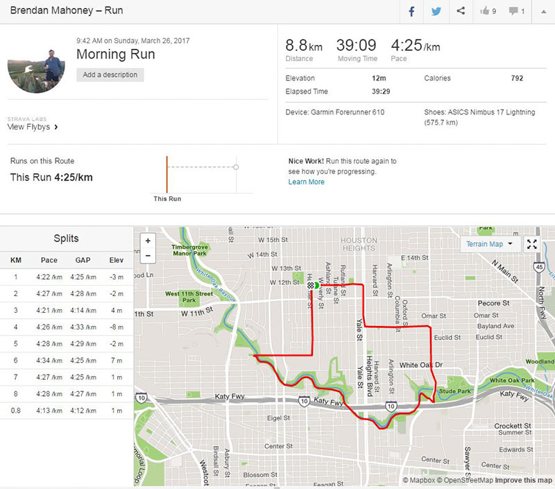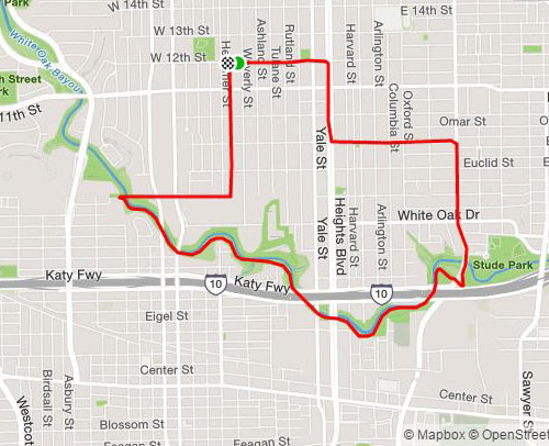
Swamplot reader Brendan Mahoney, an Aussie transplant, writes in to report a discovery he and his running partner made just a few weeks ago while out on a run in the Heights area: “The new 2 mile section of the White Oak Bayou Greenway that opened recently looks like the great state of Texas.” Mahoney’s kinda-familiar path (and split times) are visible in the screenshot of his running app, above. Here’s a closeup:
***

Images: Brendan Mahoney
Heights Lone Star-ish Lap


He thinks Texas looks like that, bless his heart.
@Memebag – Bless your heart for lacking imagination. Certainly you can see the general shape of Texas, right?
@GL: I might if I was from Australia.
Not Texan if you are measuring your runs in non ‘Merican units of measurement
GL: Only if it is fat and out of shape
Texas aint measured in kilometers, yall.
This is what Texas looked like if the U.S. had not won the Mexican-American War so decisively. In negotiating the Treaty of Guadalupe Hidalgo, the Mexican government was especially adamant about holding onto their claim that the Nueces River ought to be the southern border of Texas; they just had no leg to stand on.
Know it alls – ruining fun since the internet was invented.
While not a perfect replica of a Texas map, I still have to cheer for the Aussie runner who is spicing up his run. Lord knows this Southerner doesn’t run in the humid Houston heat.
.
As the road signs say: “Drive Friendly” and, by extension, let’s extend some Texas friendship. The map is as close as the local topography is going to let it.
Very creative, Brendan – kudos!
.
@meh, I think these posters are jealous…
Are you guys seriously maintaining that you can’t see the general shape of Texas in that image? The internet, where killjoys come to play.
My comment was made in jest, killjoys.
Crickey !!!