COMMENT OF THE DAY: WHAT MADE THE GEOGRAPHY THAT MADE HOUSTON  “Air conditioning had little to do with it. Chicago out-paced Houston because of its location as the geographic nexus of industrial transportation during the industrial revolution. It connected to the east through the Erie Canal and Great Lakes and to the west with the ever-growing railroads. A linchpin city grows. A growing city builds. Houston had no such geographic importance — and had a hurricane not made Galveston nonviable, Houston would probably still be a modest town. We had to build our port to earn any geographic value. It’s impressive that we did so. Houston shouldn’t exist. We made it exist. Now that’s cool.” [Matt, commenting on Comment of the Day: When Houston Chilled Out and Grew Up] Photo of Houston Ship Channel: Russell Hancock via Swamplot Flickr Pool
Tag: Geology
PERMITS ISSUED TO STORE TEXAS WIND ENERGY IN GIANT UNDERGROUND SALT CAVE, TOO Meanwhile, in Tennessee Colony: As Fairway works on retrofitting some of those giant salt caves south of the Astrodome to store crude oil, a company called APEX says it has the permits all lined up to outfit a cavern in Anderson County’s Bethel Salt Dome to store some of Texas’s excessive wind energy. The plan, if the company gets the rest of the necessary funding, is to buy excess electricity from the grid to run an air compressor, pumping air into a salt chamber as deep as the Empire State Building is tall. That compressed air (with a boost from some natural gas combustion) would then be used to turn a turbine when needed. Energy analyst Paul Denham tells David Fehling that only a few spots in the US along the Gulf Coast have the kind of salt dome geology being put to work by the Bethel project (and by the only other major compressed air plants in the world, currently operating in Germany and Alabama); a few other companies, however, are now working on taking underground caverns out of the equation. [Houston Public Media; previously on Swamplot]

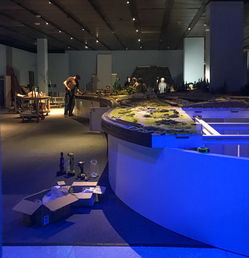
A through-the-curtains peek at at the reassembly of about 2,500 sq. ft. of miniaturized Texas landscape (made by T W Trainworx for the Houston Museum of Natural Science’s soon-to-open model train exhibit) comes from a reader who snuck a glance on Thursday. The exhibit, which should open some time after the 2nd week of installation wraps up, looks like it’ll include hand-carved models of some of Texas’s less flat geographies, including the Balcones Escarpment and Texas’s own pretty darn grand canyon, Palo Duro. The official details on opening and closing dates aren’t out yet, but a behind-the-scenes event description on the museum’s website notes that the exhibit will also show off some more familiar Gulf Coast features like “oil country salt domes, prairies and wetlands.” Natural stone landmarks, like Enchanted Rock, and unnatural stone monuments, like the state capitol, will also be part of the display.
Photo: Swamplot inbox

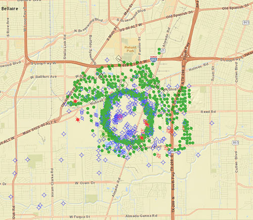
Right next door to the fairways of the Wildcat Golf Club, Fairway Energy Partners is moving forward with plans announced this summer to put nearly half a billion gallons of crude oil back into the ground, right in the center of the once-wild Pierce Junction oil field just south of the Inner Loop between S. Main St. and Highway 288. (The field, which a 1956 Time Magazine article called the site of “the biggest of all Gulf Coast oil booms,” still pumps out oil.) Fairway announced in November that they’ve picked engineers to help them retrofit 3 of the 8 man-made caverns dissolved into the Pierce Junction salt dome for crude storage. A dense ring of current and closed oil wells (mapped as green dots above) traces the uppermost reach of the migrant salt, buried approximately 950 feet below the surface and extending several miles deep to its source layer.

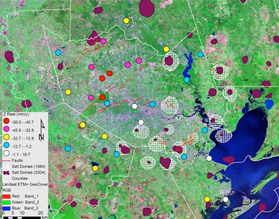
Parts of Jersey Village have been subsiding by about 2 inches a year, according to 2 UH professors and a former grad student who’ve been studying a decade’s worth of GPS data from 2 dozen area measurement points. Associate professor of geology Shuhab Khan, geology professor Kevin Burke, and former Ph.D. student Richard Engelkemeir note there’s been gradual subsidence in a “sprawling” 324-square-mile area of northwestern Harris County, but Jersey Village is the fastest to fall.
Just what is it that makes this little community so down-to-earth? Reports Khan:
The most likely reason for the sinking of Jersey Village is the withdrawal of water from deep beneath the surface. While groundwater withdrawal has ceased in most of the Houston area, it continues in the northwestern part of the county that has seen a rapid growth in population.
Continued subsidence, of course, will also help the entire northwest Houston area collect more water when it rains. But it isn’t all downhill for Houston.

