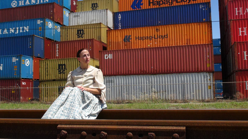
COMMENT OF THE DAY: WHAT MADE THE GEOGRAPHY THAT MADE HOUSTON 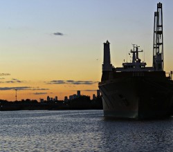 “Air conditioning had little to do with it. Chicago out-paced Houston because of its location as the geographic nexus of industrial transportation during the industrial revolution. It connected to the east through the Erie Canal and Great Lakes and to the west with the ever-growing railroads. A linchpin city grows. A growing city builds. Houston had no such geographic importance — and had a hurricane not made Galveston nonviable, Houston would probably still be a modest town. We had to build our port to earn any geographic value. It’s impressive that we did so. Houston shouldn’t exist. We made it exist. Now that’s cool.” [Matt, commenting on Comment of the Day: When Houston Chilled Out and Grew Up] Photo of Houston Ship Channel: Russell Hancock via Swamplot Flickr Pool
Sign up for the Newsletter
Tag: Ship Channel

COMMENT OF THE DAY: YOU CAN LOVE THE BAY YOU’RE WITH AND STILL HARBOR SHIP CHANNEL FANTASIES 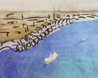 “I know that Galveston Bay is the economic engine of the Houston area, but it’s fun to ponder what 42 prime bayside acres could be other than a barge staging area, or what the bay woulda/coulda been had oil not been discovered nearby. Coulda been San Francisco, got Can Cerisco.” [JoeDirt, commenting on Kirby To Lease New Ship Channel Barge Parking Area, Pay for Barge Collision Oil Spill] Illustration: Lulu

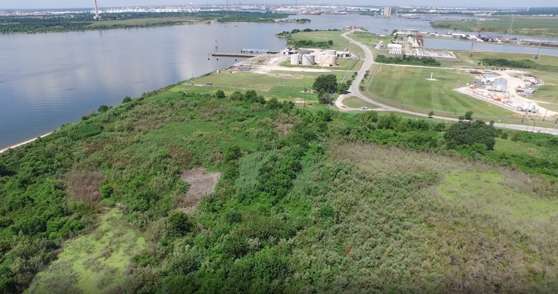
Some of the 42 acres of land just purchased for development by Avera Companies are shown here from above, east across the Ship Channel from the San Jacinto Battleground (that’s the bottom half of the star-topped obelisk visible toward the top left).  The property is on a peninsula of land about 2 miles downstream from the I-10 bridge and the San Jacinto Waste Pits. The eastern terminal of the Lynchburg Ferry can be seen here at the end of Independence Highway, with the Lynchburg reservoir lying  to the north.
The company says Kirby Inland Marine is set to be the first tenant for the property, and will use a section of the property to let up to 76 barges tie up and hang out as necessary. Kirby just agreed last month to a $4.9-million settlement with the Department of Justice over its role in that March 2014 barge-meets-carrier oil spill that shut down the Port for a few days and spread oil along roughly 160 miles of Texas coast between Galveston Bay and Padre Island National Seashore. (Kirby Offshore Marine, another of the corporation’s subdivisions, is currently dealing with fallout from last week’s tugboat-meets-shore fuel spill off the coast of British Columbia.)
Here’s a view of the rest of the property, showing a bit of Burnet Bay on the left and the San Jacinto River upstream toward I-10 on the right:
Floating Around Near Baytown

To cap off a series of Houston-landmark-linked performances carried out over the past few years, Karen Stoke’s dance company will put on bayou-and-space-themed DEEP: Seaspace at Hobby Center the weekend after next (that’s October 20th through 22nd). Stokes, whose previous work includes that well-timed dance about flooding in Discovery Green right after Memorial Day last year, tells Swamplot she has been mulling over appropriately grand Ship Channel choreographies since at least 2003, when she cut a related section from her piece Hometown with plans to tackle the topic later in greater depth.
On the list of historical places given a nod in the choreography (or in the short film to be shown during the live performance): Ship-Channel-side spots like the site of Santa Anna’s capture near the San Jacinto battlegrounds (the historical marker for which is located along Federal Rd. where the Washburn Tunnel crosses under the waterway); Allen’s Landing in Downtown; and the area around the former Willow St. Pump Station (just north of where White Oak Bayou meets Buffalo, by the Harris County Jail) — that spot is shown below, with dancers placed for atmosphere:
Industrial Art

WAIT, DID THE 2008 RECESSION UP THE CHANCES OF A FUTURE HOUSTON CHEMICAL CATASTROPHE? 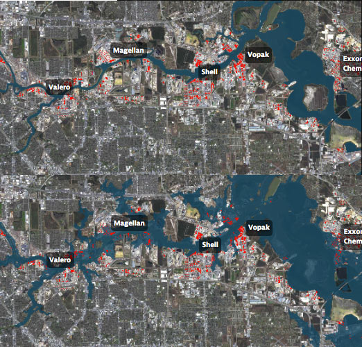 Roy Scranton imagines “a wave of water sweeping toxic waste into playgrounds, shops and houses” in Magnolia Park in his op-ed this morning, written after touring the Ship Channel and speaking with the local A&M and Rice research teams pushing for variations on a series of region-scale coastal barriers to hunker down behind whenever the next gigantic hurricane hits the Houston region, in hopes of avoiding deadly flooding and catastrophic chemical spills. But the researchers tell Scranton that pushing for federal and state funding for a response is a slow endeavor; Jim Blackburn (a main player on the Rice team) tells Scranton that he’s “heard more than one person say our plan is to wait until the next hurricane comes, then depend on guilt money from Washington to fix the problem.” Scranton writes that the best chance for that guilt money so far might have been in 2008, when Hurricane Ike landed just 30 miles northeast of the zone that modelers say could have caused thousands of deaths and irreparable ecological devastation to the area, on September 13th — 2 days before the Lehman Brothers filed for bankruptcy, pulling global attention and national funds to other issues as markets began to crash. [NY Times; previously on Swamplot] Model maps of potential storm surge flooding along the ship channel, with chemical storage marked in red: Texas Tribune
