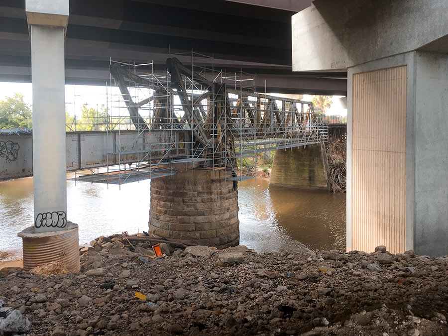
Here’s one of Houston’s latest walkable undertakings: converting the former railroad bridge beneath 59 to a pedestrian bridge that’ll link the trail along the bayou’s north bank to planned pedestrian segments south of waterway. It’s now overshadowed by the tangle of overpasses directly above it, but might not be once TxDOT starts straightening out 59 by nudging it east (and pairing it with a parallel segment of I-45) as part of its grand plan for north Houston highway improvement.
No southern trail segments are in place yet to greet the bridge upon its landfall just east of Downtown, but they will be soon: TxDOT’s already broken ground on a trail that’ll skirt the bayou as it crosses through the Houston Housing Authority’s Clayton Homes Neighborhood east of 59.
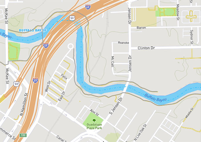
It’ll link up with the southern trail segment that does exist and runs east toward Lockwood Dr., as indicated by the gray line in the map below:
***

And on the west side of things, a new southern path will soon crawl its way along the upper reaches of Downtown, running through a trio of county buildings, as well as surface parking off Elysian St. and CenterPoint-owned property west of McKee on its way to bridge.
- Previously on Swamplot: How Buffalo Bayou’s Newest South-Side Trail Segment Will Inch Its Way from Fannin St. Toward 59;Â Houston’s Bayou Biking Connector Is Now Complete; The Great Heights–Buffalo Bayou Bike Trail Hookup Is Almost Ready
Images: Buffalo Bayou Partnership (photo); Houston Parks Board (map)


Some info on this bridge: https://bridgehunter.com/tx/harris/bh52634/
That is cool! I’m really glad they are using that old footer. Was that a swing bridge?
@J ….. if you click thru the pictures you see that the bridge had a counterweight and tiled up from one side, so not a swing bridge but a bascule bridge.
While I appreciate the concept here I am a bit concerned about the elevation of this new bridge crossing/impeding Buffalo Bayou floodwaters? Looks suspiciously low from the photos. Construction will soon be underway to elevate most of the old bridges crossing Brays Bayou and elevate them to provide more conveyance capacity and hopefully reduce flood potential in the area. It would seem that this project is not held to the same principles. Again, hard to tell just from the photos but I would think a low bridge like that would simply trap debris and impede water during the next big rain event.
This side of the bayou did not top, but the currents were strong enough to create landslides that caused some of the trails to fall apart. Because of the steep banks, I would worry more about erosion than flooding. I dont know how you mitigate this other than planting vegetation. Also, Swamplot, the trails along the east side of the bayou and parallel with McCall were all demo’d.
It’s an awesome bridge – glad they’re fixing it up instead of tearing it down. I did a little exploring around there a year ago and took some photos. There’s a cool plaque with some historical info. It appears there was a fire at some point, so it’s nice that the city is making the bridge passable again. Photos with more detail here: https://flic.kr/s/aHsmpSHReR
Well-it’s about 40-50 years OVERDUE. Big question: will the COH /HC/TxDot ( City of Houston /Harris County /Texas Dept. of Transportation) connect ALL of the various segments. And the erosion / embankment collapses ARE a vexing project that wipes out some improvements.. I say elevate future construction on piers /pillars /columns !! Houston flooding WILL get worst..
this is awesome, although with the homeless camps around there, I doubt I’ll ride over there.
Toasty. Hurt your eyes or does it hurt your soul?
I suppose it hurts my eyes, when the smell wafts through my nostrils, it makes my eyes water.
.
I also actively avoid riding under the waugh street bridge for similar reasons, although the bat colony has a different scent than the homeless encampment, I suspect feces are at the heart of both smells.