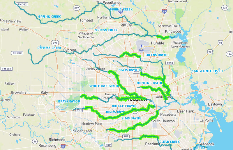
Don’t feel like hopping on your bike to see how construction on that northern piece of the White Oak Bayou hike-and-bike trail is coming along? The click-and-drag-able digital map released this week by the Bayou Greenways 2020 folks may be a decent substitute for the real thing (depending on how often it ends up getting updated). Zoom in closer on the map above to check out completed trail sections (outlined in green), under construction spots (traced in dark purple), and areas planned for trail-ification at a later date (highlighted in a purple haze).
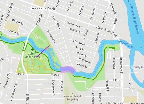
Here’s the area around Mason Park (where that double-V suspension bridge is under construction at the moment):
***

At a lower zoom level, the map drops all the details and just shows a green highlight for areas that either already or will eventually have trails, if all goes according to the project plan:

- Bayou Greenways 2020 Map [Houston Parks Board]
- Previously on Swamplot: Houston Parks Board Releases Flock of Bayou Greenway Sightseeing Suggestions; Largest Oil Spill in U.S. History Will Fund Greenways on Clear Creek; Lookee What the Kinder Foundation’s $50M Is Gonna Help Build Along the Bayous; Parks By You’s Feel-Good Campaign To Build More Bayou Parks by You
Images: Houston Parks Board Bayou Greenways 2020 Map Viewer


Some interesting stuff on that map. Surprised to see the stuff by Gus Wortham listed as completed. It’s just a paved path, no landscaping anywhere around it. And the section going through Mason park is definitely not an acceptable bike path, that’s a jogging trail. Don’t think I’ve ever seen a bike there.
Kudos to all the progress, but there are still some key gaps that haven’t been addressed. Two of them that I can think of immediately on Brays Bayou are the death trap crossover at Buffalo Speedway, and the missing bridge at Hermann Park (between Holcombe and Cambridge). Also, there is still no good, safe north-south connector between the Montrose area and Buffalo Bayou. There have already been fatality incidents on Waugh, which is the designated bike route. I know the expansion effort has to add significant long-length segments at some point, but they will be underutilized if not adequately connected into a contiguous network.
@SuperDave. Getting N/S by ANY mode sucks inside the loop. What does the dotted line grey line mean? Also interesting to see the connection between BB Park and Memorial park along Memorial. Not sure there is space there for any greenway or train expansion.