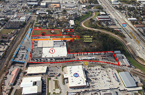
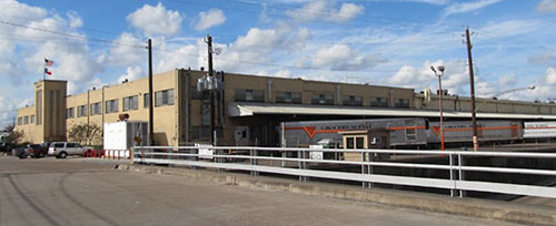
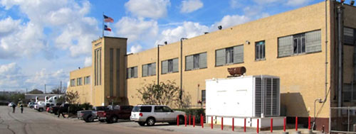
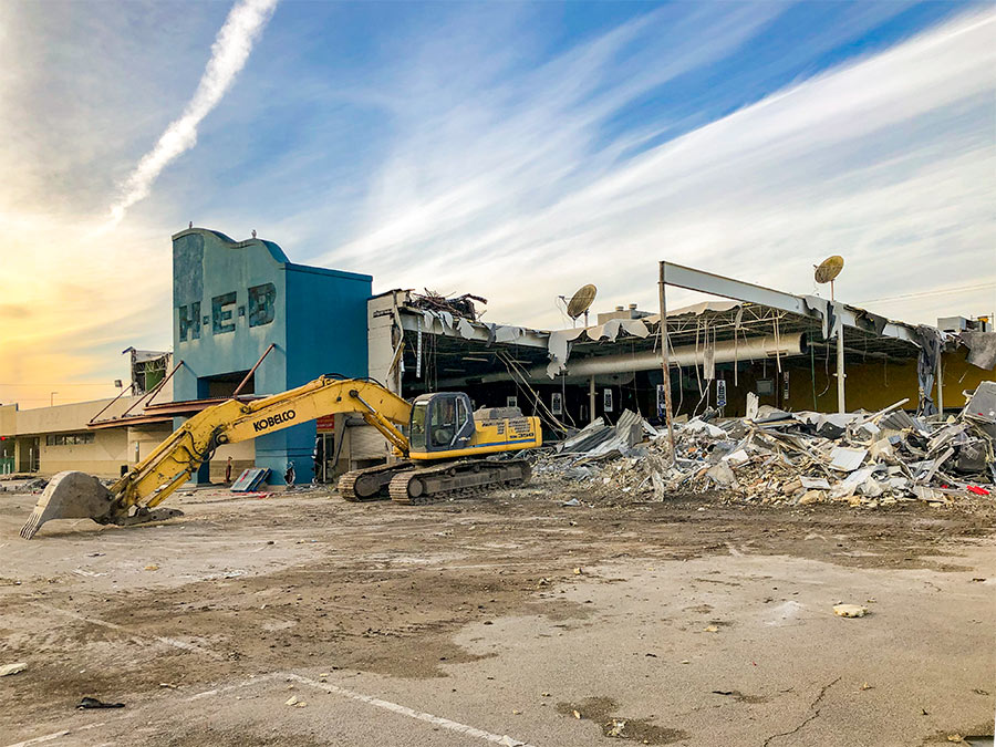
The group that completed the purchase of a 15-acre agglomeration of tracts at the southwest corner of I-10 and Studemont this week says it’s planning a mixed-use development for the site, including an apartment complex. Most of the land was owned by Grocers Supply, which has operated a 232,352-sq.-ft. produce warehouse and big-rig parking lot there for 42 years. The facility at 3000 Hicks St. is yet another chunk in the First Sixth Ward-area once-industrial swath south of the Heights that’s been turning to big-box-flavored retail bit by bit over the last decade, and now stretches from Target on the east near Sawyer to Walmart just west of Yale St. Here’s an aerial view of that district from 1990, when it was still entirely industrial (you can see the western edges of Downtown in the background):
***
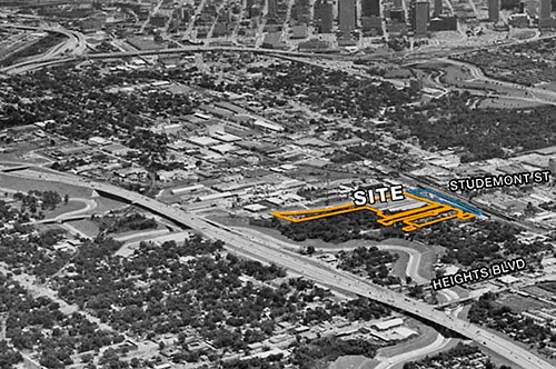
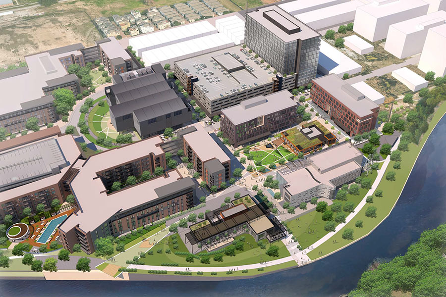
Under the deal, Grocers Supply will have 2 years to wind up operations on the site and establish a new distribution center on a chunk of land elsewhere that it currently has under contract. In the meantime, Capcor Partners and multifamily operators and developers Kaplan Management say they are planning a combination of uses for the site, including approximately 400 apartments.
Capcor is run by real-estate developers Josh Aruh and Avi Ron. “Aruh said he has already discussed possibilities for the property with grocers, cinemas, restaurants and several big box retailers,” writes the Chronicle’s Erin Mulvaney. “The developers are also working with the city to expand a street to split the property and reduce traffic, he said.”
The Olivewood Cemetery sits directly north of the site; diagrams on the property’s sales flyer indicate that a request has been made for the city to abandon the segment of Court St. that stretches from Hicks St. to just south of the cemetery.
- Upscale apartments to go on warehouse site near downtown [Houston Chronicle ($)]
- Land for Sale [UCR Realty]
- Previously on Swamplot: Studemont Kroger Would Break on Through to the Still Industrial Side, Olivewood Cemetery’s Grave Situation: Not Washed Down to the Bayou Yet
Photos: UCR Realty


The developers need to be careful with the Court St. closure. It appears to be the only link to Olivewood Cemetary: an old African-American graveyard that has attracted attention recently for its historic value and lack of upkeep. Eliminating public access could be its death knell. I doubt they care. But, at the same time, they don’t want negative publicity either.
Not in the First Ward – Sixth Ward. http://en.wikipedia.org/wiki/File:HoustonWards1920.jpg
@TimberGrove: You’re right. Looks like Target’s in the First Ward, but the rest of the district is in land once known as the Sixth. We’ve fixed it above, but that whole area really does need a name.
TG’s right, but I think the modern convention is 1st Ward = North of Washington, 6th Ward = South of Washington.
It’s the 6th ward. Not to be confused with “the old sixth ward”.
Detering Lumber will likely be next.
Yes, it’s on the market through Boyd Commercial. The bakery is a big question mark. Lots of retail potential.
I think the stretch of land North of Washington but South of I-10, where all the big-box retailers are going in, should be called Katyville.
Yayyyy, more density with first floor retail, ugh, I think I just threw up a little in my mouth…
The lot behind the Chase at Center and Studemont appears to be up for sale as well, if it hasn’t changed hands already.
this area is known as the heights. if the walmart is in the heights, then so is all the rest of this suburbia.
Studemont in that area is getting very congested; another 400 residential units will really bite.
this is extremely depressing. the construction of grocer’s supply has served to damage so much of Olivewood that I can’t imagine what a huge development fully surrounding it would do. there are already burials eroding into the bayou from runoff created by grocer’s supply’s poorly-planned and thoughtless parking lots….
Wichman St. goes all the way back to Olivewood. While there are certainly going to be concerns about impacts on the cemetery, the abandonment of Court St. should be harmless. Street access to this tract is pretty minimal. The rail line and grade separation at Studewood make access to Washington ave tricky. The bayou cuts off access to the I-10 feeder without having to go up Studewood. But, this is Houston. Take the parcels with decent road access and do strip malls and leave the parcels with poor access for the dense mixed use developments.
A newly-built (read: expensive) apartment jammed between a rail siding and a cemetery? Where do I sign?!?
it’s going to be brutal. Studewood and Montrose move at a crawl now, and more Apartments, this is really depressing. The streets are pitiful shape. don’t tell me the taxes will cover road improvements , sidewalks and drainage . it never seems to happen. the tax dollars just go poof.
@ Dave – “rail siding?” Nuh uh. It’ the UP main line. It is, however, at least a quiet zone.
I remember when I moved to the Old Sixth Ward in 1989. The area was so quiet! Trinity Steel where the townhomes on Center St and the Wall to Wall Mart are now. San Jacinto Stone was the best! There were grain silos where the Walgreens and the townhouse neighborhood on Studemont @ Washington are. The SPCA and an abandoned neighborhood were across the street. The area was safe, central to everything, and traffic was nearly non-existent. Had to go to Montrose or Galleria area for shopping. Was like living on an island. Hooray for big money, no zoning, and property rights. Meh.
Is there any chance that the city could require that the developer put some work into preserving the cemetary and making it more accessible to the public?
with 20years of voulteering to reclaim Olivewood Cemetery, we are hoping that redevelopment of the land
around the cemetery will be win-win for our master plan to restore this historic site. Anything would be
better than our current landlord whom has done a death blow to this site.
i wonder why the owner held on to the tract nearest the railroad and ground leased it? i hope the city requires the new development to build superior sidewalks, lighting and benches. overall i think this is a better use for this dirt than it’s current use.
dream
I’m with Dream. And for those whining about traffic, really? We live in a city, you should expect traffic and congestions. Take the goddam bus once in awhile or someone might start thinking of using a train on those tracks to move people.
I agree with GlenW regarding the traffic whiners, which is a repeated mantra around these parts. Next time you are stuck in traffic, remember that you ARE traffic. You don’t really have much of a right to complain about the traffic you are sitting in, because, well, you are part of the problem. And when did people think they could live in the urban core of the fourth largest city in the United States and not have to deal with traffic? Saying that a new development will result in “increased traffic” really is the most ridiculous rationale that one could provide against such a development. I dislike traffic as much as anyone else, but I also like density and density means more traffic. Maybe if some of our representative politicians didn’t fight tooth-and-nail against alternative forms of non-automotive transportation we could all enjoy the benefits of increased density without increased traffic.
There is NO option on that particular chunk of Studemont to do anything but either drive or have a death wish. There is no bus line, there is no bike lane, and the sidewalk only goes down one side of Studemont under the railroad tracks. The closest buses are at White Oak to the north, Sawyer to the east, Washington to the south, and Heights to the west – much further than Tiffany and the brobots are likely to want to walk from their luxury apartments. As it sits, this tract has one point of access that’s reasonably easy to get to, and it’s on Studemont. There are only a couple other access points if one ups the ante to knowing how to get across the tracks and/or onto the street that appears to morph magically beside the tracks.
It’s not a zero sum game. One of the reasons that downtown works better on a day to day basis as opposed to Uptown/the Galleria area/whatever you want to call it is that there is a functional street grid. My point, granted not well stated at first, is that adding a significant resident load to an already strained infrastructure is going to require some additional infrastructure.
According to the boundaries of the Superneighborhood, it is actually First Ward (http://www.sn22.org/download/sn22_comprehensive_map.pdf). According to Timbergrove’s 90 year old map, the light rail line goes through 5th ward, and Woodland Heights is actually First Ward. That dog don’t hunt.