03/09/09 12:19pm

The advance rail intelligence unit known as Christof Spieler puts together another map showing Metro’s latest plans for the new 2012 lines. What’s changed since last time?

Texas Southern University now has no stop alongside campus. There is a station called “TSU,” but it’s three blocks from campus, on the opposite side of a public housing project. Rice, UH, St. Thomas, and UH Downtown all get excellent connections to the 2012 system, but TSU is getting left out because METRO couldn’t figure out how to work with a neighborhood to get a Wheeler/Ennis route figured out. That’s an unfortunate situation for a university that’s trying to raise its profile.

CONTINUE READING THIS STORY

02/19/09 4:20pm

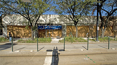
Midtown’s lone island of light-rail-lining nightlife will likely be expanding one block north, Jay Lee reports:

The folks who brought you The Continental Club, Sig’s Lagoon, Tacos-A-Go-Go and Shoeshine Charley’s Big Top Lounge are at it again. This time right next door @ 3600 Main.

The new owners of the long-vacant one-story building have discovered some Deco-ish detail underneath the more recent stucco.

If you squint just right and imagine it with some paint to bring out the original design you can just make out what a wonderful space this is going to be. There’s already plans for a coffee shop and a pizza/burger joint and if Pete [Gordon, manager of the Continental Club] has his way, a new club called “Wallpaper”…

CONTINUE READING THIS STORY

02/09/09 11:05am

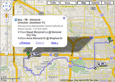
It’s now a whole lot easier to figure out how to get around Houston using public transit: Metro routes have at last been embedded in Google Maps. Which means if you use Google to plan a local trip, figuring out how to get there by bus or rail is now as simple as choosing “By public transit” from a dropdown menu. Schedule info is right there too.

So far, the public transit option shows up whenever you use Google Maps to get directions in Houston — or you can start from a separate Google Transit gateway here. Not yet activated for Houston: Google’s Transit Layer, which in other cities lets you see all the routes at once.

Even more convenient: If you can get Google Maps on your mobile phone, you now have access to bus and train directions and schedules there too. Here’s a video demonstrating how that works:

CONTINUE READING THIS STORY

06/12/08 6:31pm

Rendering of Proposed Office Tower at 3100 Post Oak Blvd., Uptown, Houston

A kind tipster sends us a link to this new 17- 26-story (including the parking garage), 452,000-sq.-ft. office tower planned for 3100 Post Oak — near Richmond, just across the Lakes on Post Oak from Randall Davis’s Manhattan fantasy in the Galleria. And right next to the new rail line. The plans show room for a ground-floor restaurant, directly on one of the lakes.

A couple more images after the jump!

CONTINUE READING THIS STORY