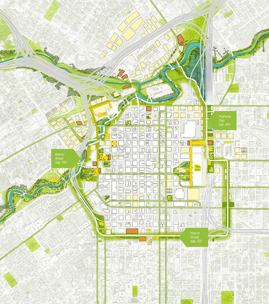
Is Houston ready for yet another loop road? Here’s the proposed Green Loop, a 5-mile network of parks, trails, and other public spaces that the neighborhood supergroups behind Plan Downtown imagine ringing in Houston’s bicentennial — if it’s completed by 2036. One of 10 separate proposals in the plan, the city’s littlest loop is meant to take advantage of TxDOT’s proposed rerouting of I-45 to the east side of Downtown — by wrapping the district tightly with a transportation and recreation circuit that could attract adjacent development and help link the city center to adjacent neighborhoods.
Plan Houston’s new report flags ideas and renderings for 3 spots along Downtown’s proposed Emerald Choker: At Buffalo Bayou, on top of I-69 and I-45 once they’re sunk behind the George R. Brown, and on Pierce St. at the Midtown border.
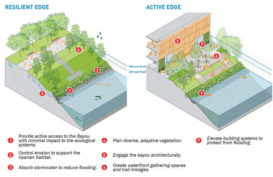
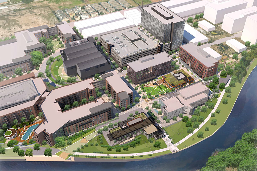
New buildings at the northwest corner of Downtown would face Buffalo Bayou as well as the surrounding streets, lining the waterfront with flood-worthy attractions:
***
Here’s a closeup of the plan for this section:
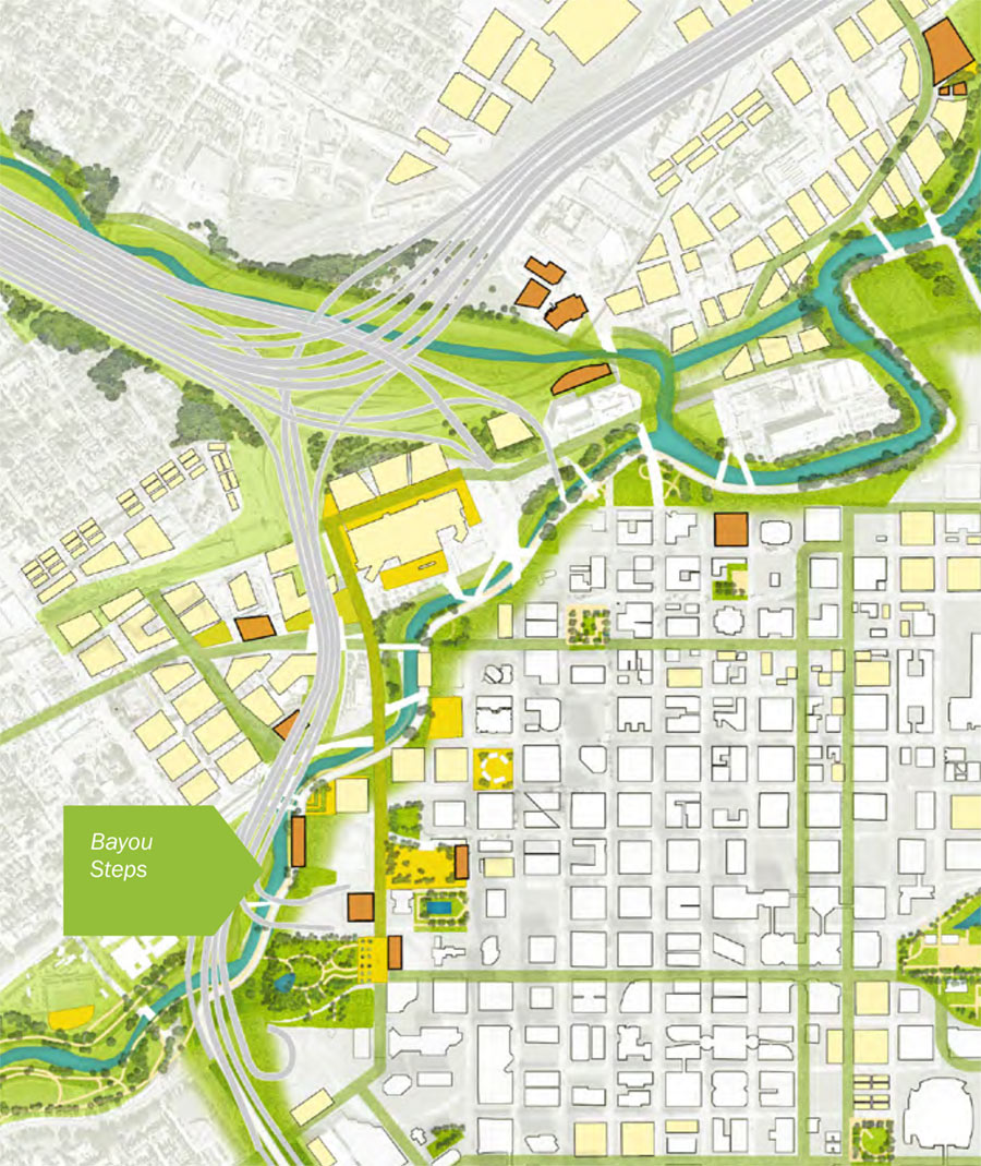
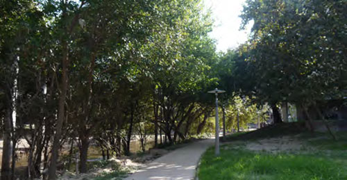
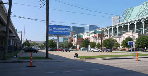
This portion of the new loop running circles around Downtown is meant to serve as a trailhead for the entire Bayou Greenways system, which then heads west along Buffalo Bayou Park. Here’s a sorta-before-and-after view for this zone:
What about the east side of Downtown?
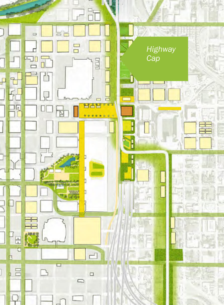
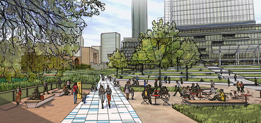
Here, soccer fields and other recreational areas (pictured on the left side of the rendering below) would be fitted directly on top of the sunken highways. The rendering shows segregated roadways for pedestrians, bikes, and cars paralleling Hamilton St., opening the convention center and nearby Discovery Green to an eastern approach:
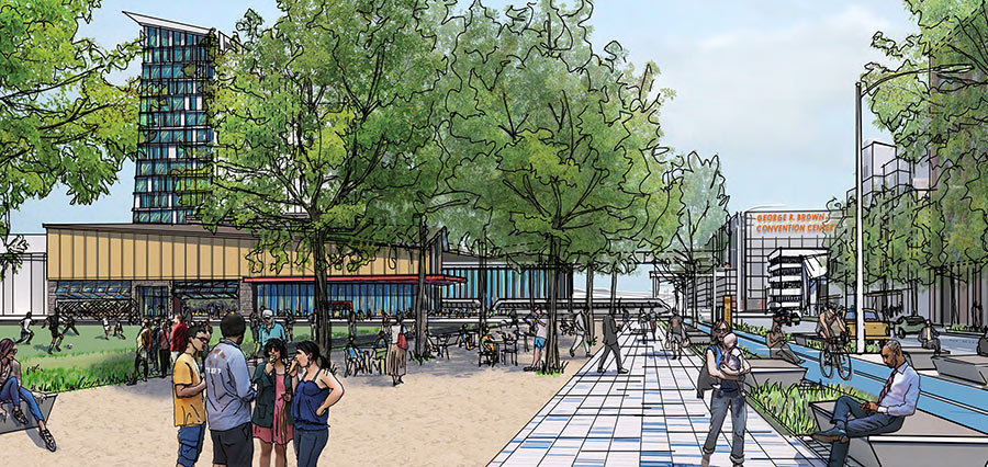
The Green Loop’s conquest of Downtown’s southern border might end up a little less green:
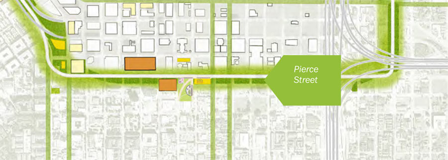
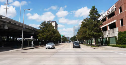
The rendering of this east-west portion shows lots of leafy trees, but finesses the whole should-we-tear-down-the-Pierce-Elevated argument by surrounding the concrete behemoth with greenery — and relegating it to the far left side of the image:

Can you even see it? (Note what looks like a stairway on the far left, leading up to some sort of public market mounted on top of a possibly abbreviated Pierce Skypark.) Here too, separate bike and walking paths are shown sandwiched between the Pierce St. roadway and street-level shops with outdoor seating.
- Plan Downtown Final Report (PDF) [Plan Downtown]
- ‘Green Loop’ is the center of a downtown plan [Houston Chronicle]
- Downtown Unveils Bold Bicentennial Vision [Bisnow]
Images: Plan Downtown




Losing the pierce elevated as a link from west to east and vice versa would be an incredible waste. The fact that they are considering this is mind boggling. Re-route I-45 but maintain this thoroughfare connection.
this will complement the piles of homeless feces nicely
It appears the final report pdf link does not work.
It’s all nice and dandy but the hobo problem has to be solved before anyone will use these in earnest.
@Triton: We’ve fixed the link. Thanks!
It’s a thing of beauty! I hope it comes to fruition…..albeit many years from now.
“The Emerald Choker”
There are more people in the sketches, than I have ever seen downtown. Ever.
@bocepus
Surely your comment was sarcasm, but just last week there were hundreds of thousands (if not a million) of people downtown for the Astros parade. As someone who frequents downtown, you’d be surprised how popular the area has become on weekends (especially the nightlife). I’d recommend you check it out yourself, it’s definitely become a scene.
@bocepus
Assuming you didn’t go to the Astros parade or any of the superbowl activities?
@bocepus You obviously weren’t downtown last week for the Astros parade.
Assuming they DO decide to “remove” the pierce elevated, they should instead repurpose it as a trail/walkway ala the Highline in NYC. A public market at the head of it would be awesome too.
Why not? There are an additional 15,000 housing units being added downtown. A ton of housing has been added to midtown and the east side is getting a lot of new construction. By 2036, the old KBR site should have something built on it and Hardy Yards should also be built up. There are only going to be more and more people in and around downtown as time goes on. So, this would be great if it ever happened.
It is insane how much nicer this would make downtown Houston.
Discovery Green will just be overrun with homeless!
.
Wait! Errrrrr… hold on, let me update….
.
This Green Loop will just be overrun with homeless!
@bocepus You must have missed Friday’s Astros parade……
I hope this does happen. Still so much potential downtown!
A submerged multi-lane highway with a cap. Less than a mile away from a bayou that regularly overflows its banks….
What could possibly go wrong?!
Houston to New York to New Houston
You guys know that across the US there are plenty of examples of underground roads that have a tendency to flood, and there are ways to deal with it. I mean look at NYC. Massive amounts of that city are built below the water line, and yet the subways run and basements don’t constantly flood. I’ve even heard of some areas where they have built a “tunnel” under water. Madness.
The “edge” of downtown isn’t fixed. This seems like it would establish an artificial boundary based on our current location of downtown, sort of like a medieval wall.
NO more sunken roadways in Houston. Harvey clearly demonstrated that concept is a big FAIL!! Otherwise. love this plan.
If you’ve ever visited Boston, this sounds exactly like what they did to I-93 during the big dig. I worry about losing Pierce Elevated but love the idea for taking 59 underground on the east side. It’s going to be a feat though because of our soil and water table.
How about a green loop canal? Might be a really beautiful flood control project.