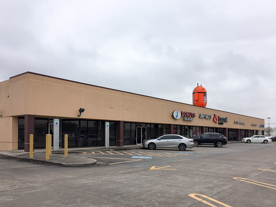
01/16/19 1:45pm

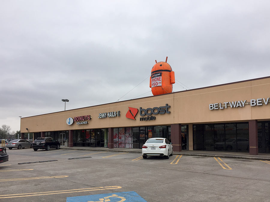
Like some kind of otherworldly brand ambassador, this large larger-than-life-sized inflatable now looks dutifully out over the strip center parking lot off Belway 8 and Woodforest Blvd., its antennae twitching in the wind. The building it tops — home to Jenny Nails II, J Donuts, Betlway Beverage, Dominos, a hair salon, and Boost Mobile — was once part of the Randalls-anchored retail complex dubbed the Eastbelt Centre that stopped being a thing when Galena Park ISD moved its administrative offices into the supermarket’s building nearly 2 decades ago.

That converted structure lies just next door to the strip building . . .

CONTINUE READING THIS STORY

Roadside Attractions of Beltway 8
10/11/17 5:00pm

EPA: YEAH, BETTER CLEAN OUT THE DIOXIN PITS FROM THE SAN JACINTO RIVER NOW THAT THEY’VE LEAKED A bit later than had been urged by those alarmed by the longterm presence of pits full of toxic waste sealed only with a tarp on top hanging out in the San Jacinto River, the EPA has now approved a plan to remove most of the dioxin stored within them. “As exemplified today, EPA is prioritizing Superfund clean-up by making decisions in a decisive, timely manner,” reads a statement from administrator Scott Pruitt released this afternoon. “The San Jacinto Waste Pits site was added to the National Priority List nearly a decade ago.” What’s the rush? As predicted by EPA studies and many a casual observer, the pits appeared to have leaked extensively after Hurricane Harvey flooding. Under the new $115 million plan, cofferdams will be installed around the pits and almost 212,000 cubic yards of dioxin-contaminated material will be excavated — leaving just enough behind that the agency can, it says, ensure controls that will “prevent access, eliminate off-site migration, and monitor the natural recovery into the future.” [EPA; more info; Houston Chronicle; previously on Swamplot] Video of waste pits after Harvey flooding: Greg Moss

11/29/16 11:00am

San Jacinto River at I-10 Crossing, Channelview, TX 77530

Weather permitting, an area along the edge of the San Jacinto Waste Pits Superfund site under the I-10 East bridge should be getting around 800 cubic feet of new rocks piled onto it this week and next, according to this month’s EPA update on the project. The agency asked International Paper and McGinnis (which might be on the hook financially for much of the final cleanup) to cover up some recently-discovered areas of the nearby riverbed that were scoured as deep as 8 feet in some places by this spring‘s torrential flooding; the tarp-with-rocks-on-it armored cap itself doesn’t appear to have been damaged, but the EPA says the extra rocks will help ensure its continued protectiveness.

CONTINUE READING THIS STORY

Armor Under I-10
06/09/16 2:15pm

San Jacinto River at I-10 Crossing, Channelview, TX 77530

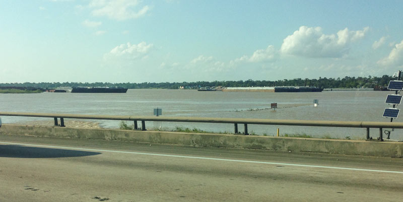
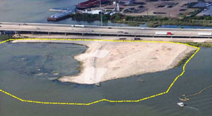
Aerial View with Delineated San Jacinto Waste Pits Cap, I-10 at San Jacinto RiverAnother effect of the Memorial Day weekend and early June floods: the EPA says it has had to pause some of its latest study efforts near the 1960s industrial waste pits in the San Jacinto river (shown at the top looking a bit more submerged than usual on May 31, facing north from the I-10 bridge). New rounds of sample-taking were triggered by the discovery in December that the Superfund site’s armored cap (which is made of special tarp material held down by a layer of rocks) had a 25-ft.-long hole where the rocks were missing. The EPA also notes that the damage was found within an area of the cap where no tarp was actually initially placed, in light of concerns that the rocks would slide off of it. 

CONTINUE READING THIS STORY

More Fun With Superfund
04/20/10 3:22pm

HOW TO PREPARE SAN JAC RIVER STEW What’s the local recipe for that San Jacinto River fishin’ favorite, toxic redfish? “The dioxins come from submerged waste pits north of the Interstate 10 bridge. McGinnes Industrial Maintenance Corp., which is no longer in business, owned and operated the pits in the 1960s, filling a 20-acre site on dry land with waste from a now-closed paper mill near the Washburn Tunnel. In the bleaching process, paper mills generated large amounts of dioxins, a family of compounds so toxic that scientists measure them in trillionths of a gram. The EPA says there is no safe level of exposure to the chemicals, which are known to cause cancer and disrupt immune and reproductive systems. The San Jacinto River began to run through the waste pits by the early 1970s because of subsidence — the sinking of soft soils as water is pumped from underground. With the McGinnes pits under water, the dioxins spread into the river and worked their way through the ecosystem, becoming more concentrated at each step in the food chain. For more than a decade, the Texas Department of Health has warned that fish and crab caught along this stretch of water, north of the Lynchburg Ferry, are tainted with cancer-causing dioxin, pesticides and PCBs. . . . In July, the EPA identified the International Paper Co. and McGinnes, which became part of Waste Management through a series of mergers and acquisitions, as the firms responsible for the dioxins problem. Under the Superfund law, the two companies will be required to evaluate and clean up the contamination. They paid about $65,000 for the fencing and roughly 50 warning signs in English, Spanish and Vietnamese, a McGinnes spokesman said.” [Houston Chronicle]

09/04/08 11:48pm

Neighborhood Guessing Game 23: Living Room

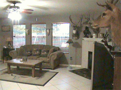
Your guesses for this week’s Neighborhood Guessing Game challenge? All over the place! We had votes for Humble, Silverlake, “off Augusta near San Felipe,” “old Pearville,” off NASA Rte. 1 toward 6 in Friendswood or Alvin, Jersey Village, Mt. Belvieu, Spring, Clear Lake, Atascocita, off Bering, Cinco Ranch, around the Astrodome, The Woodlands, and Gessner near Memorial City. No pileups!

Oh, but this was a tough one. None of you even came close.

Maybe if we had thrown in a few pics of the back yard . . . ?

CONTINUE READING THIS STORY