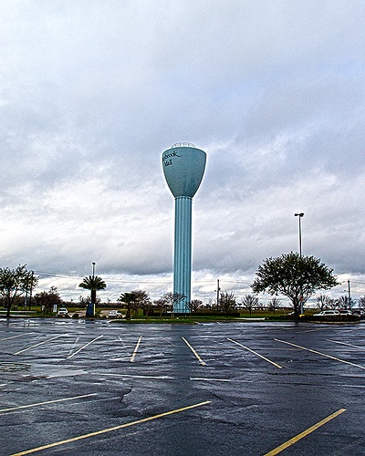
02/16/12 8:30am

Baybrook Mall water tower: Mike Fisher [license]

02/15/12 9:52pm

COMMENT OF THE DAY: BUT A SPOONFUL OF SUGAR WILL HELP THE HISTORY GO DOWN “If you won’t drink coffee at the former Mary’s building, then you probably don’t want to know what went on at The Empire Cafe, when it was known as The Locker.” [Darogr, commenting on Restored Mary’s Mural on Westheimer Painted Over Again]

02/15/12 9:08pm

A real-estate firm out of Indianapolis with a keen interest in developing mixed-use projects plans to build a midrise apartment complex on 2 vacant blocks in Midtown, just south of the Pierce Elevated and 4 blocks east of the light rail line running down Main St. Like almost every other recent residential development in the area built before or after the Post Midtown Square about a dozen blocks to the west, though, the Milhaus Midtown won’t include any lease spaces for stores or restaurants. If you’re wondering why not, the company has a detailed explanation ready.

CONTINUE READING THIS STORY

02/15/12 12:11pm

ALLEN STANFORD’S UPTOWN STAGECRAFT “The place was always odd. There was always more elegance, more shine . . . and yet there weren’t always people to fill the desks. There was more real estate than people. There was just such pomp. It felt like 1955, the way people were dressed and were ushered in and offered coffee in fine china. They had a private dining room — everything was over the top . . . and you’re like, OK, maybe some of these enterprises are making some money. In retrospect, it was like a Hollywood town. It was like the front, but if you peek around the back, it’s just two-by-fours holding it up.” — Houston videographer Dave Henry, who plans to craft a documentary using footage he created for the Stanford Financial Group, describing the company’s former headquarters on Westheimer. [Houston Business Journal; previously on Swamplot] Still: Magpie River Films
02/15/12 8:30am

Photo of North Line construction: Transit Nerds [license]

02/14/12 11:45pm

COMMENT OF THE DAY: YOU CAN’T HANDLE THE DATA VISUALIZATION “I think this tool is wonderful for home buyers, now they can actually do research that us agents do. However there are still some very important reports available only to agent. What my clients see so useful is a map/grid type of report. I can take a certain section of a neighborhood and include criteria like … sqft 2000-2500, bedrooms 3-4, counter = granite, built between 2000-2005, one story homes only, lot size 5000-7000, located on a cul de sac, and the house faces WEST…. Realtors have AMAZING TOOLS AVAILABLE TO THEM.. the only problem is some realtors DO NOT know how to use them. Hence our slogan is “Leave Realty to The Pros” …hahahahhaha… Well hope this info helps, if you have any questions please let me know.. IM HERE TO HELP.” [texasrealtypros.com, commenting on New Real Estate Listings Website Reveals Hidden Price Histories]

02/14/12 4:36pm

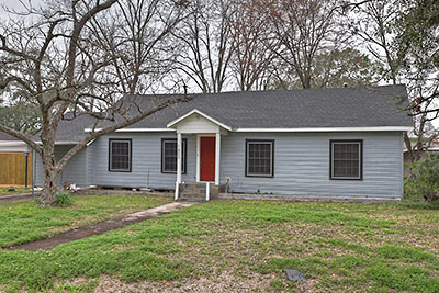
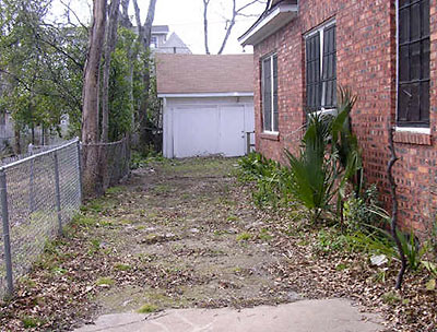
Only 5 interior walls are left in this 1,275-sq.-ft. house in Clark Pines, west of Shepherd from the Heights. The 2-bedroom, 1-bath property on a 8,093-sq.-ft. lot is listed for rent — for $2,100 a month. A Swamplot reader reworked the property over the course of 2 years. “This is my first remodel and I’m hoping for feedback,” writes the landlord. (Some feedback has already arrived, in the form of a “possible tenant.”)

What sort of work has been done to this place?

CONTINUE READING THIS STORY

02/14/12 1:59pm

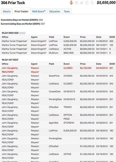
There are more than enough bugs to go around in the NuHabitat beta that officially went live yesterday, but the brand-new real-estate listings website does have one killer feature with the potential to shake up Houston’s real-estate landscape. To registered users, NuHabitat coughs up a set of details that until now were available only to real estate agents: date-by-date, blow-by-blow pricing histories for listed properties — even if the MLS numbers have changed. With these little kittens wandering out of the bag, there aren’t a whole lot of top-secret MLS data fields left to the exclusive domain of real-estate agents.

CONTINUE READING THIS STORY

02/14/12 9:00am

Photo of Asia Society Texas Center north gallery: Architangent

02/13/12 10:35am

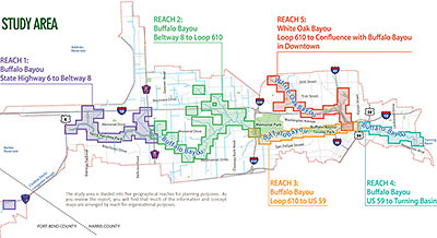
Looks like that Charting Buffalo (as in Buffalo and Lower White Oak Bayous) draft report might not have gone over so well. A popup note shown to first-time visitors to the project’s website, posted just last Friday, dryly notes the entire report has been pulled — only 2 days after it first went out for community feedback: “In light of compelling issues regarding the presentation of certain concepts in the Charting Buffalo draft report, the Harris County Flood Control District is in the process of modifying the report. The District is suspending the report’s distribution, review period and all scheduled community meetings until further notice,” it reads. The feedback period for the report, intended to form the foundation of a master plan for reducing flood damage along the entire Buffalo Bayou and lower White Oak watersheds from the Barker Reservoir to the Ship Channel Turning Basin, was originally scheduled to extend until April 1. Possible flashpoint: the “more than 40 options for reducing flooding risks and damages” spelled out in the report. The Charting Buffalo project was the flood control district’s response to a City of Houston request to “provide land” for stormwater detention.

Map of Study Area: Charting Buffalo