THE MANY DILAPIDATED PROPERTIES OF SCOTT WIZIG 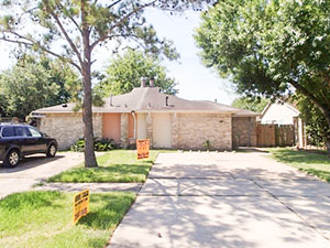 Writer Rachel Monroe catches up on the real estate empire of Scott Wizig, whose extensive operation scoops up properties at tax sales — and lets you know about it by means of those often hand-scrawled bandit signs offering them for seemingly sympathetic terms. Using a scrambled web of LLCs, Monroe explains, the Bellaire resident became the biggest private owner of derelict houses in Baltimore: “Wizig wouldn’t speak with me for months. When he finally agreed to, he didn’t want to discuss how he profits from buying up distressed properties. By the time we spoke, he was trying to rid himself of his Baltimore properties, just as he’d done before in Buffalo. He presented his work as a form of charity: In his view, he helps the city by selling homes and providing financing to people who otherwise couldn’t afford them. (The Houston Press has reported on his company’s sales of legally uninhabitable houses to undocumented immigrants.) He donates to local minority youth groups and hosted a book signing last year for Martin Luther King III and Representative John Lewis. . . . It’s true that in Baltimore, unlike in Buffalo, Wizig focused on selling his properties to other investors rather than renting them out to low-income tenants. But to those who live next to his unmaintained properties, the precise shading of his business model offers little comfort.” [The New Republic] Photo of 5441 Ridge Wind Ln., for sale in Quail Ridge: Wizig’s SWE Homes
HOW IT CAME TO PASS THAT HUNDREDS OF FAMILIES PURCHASED HOMES INSIDE HOUSTON’S RESERVOIRS  Many of the flooding victims upstream of Addicks and Barker dams learned for the first time that their homes were inside government-designated reservoirs only after rains from Harvey flooded their neighborhoods, reports Naomi Martin. How had they come to live there? “The corps didn’t feel the need to acquire all the land at the time the reservoirs were built, [the Army Corps of Engineers’ Richard] Long said, because that land was nothing but rice farms and fields where cattle grazed. It didn’t stay that way. In 1997, developers came before Fort Bend County government for approval to put subdivisions on the pastures. Aware of the flood risk to the area, the county was in a bind. It didn’t have the authority to prohibit development or establish zoning rules, said County Judge Robert Hebert, who has been in office since 2003. So the county insisted, ‘over great objection’ by developers, on including a warning on the plat, Hebert said. The county, he said, ‘felt it was a defect on the land that should be pointed out.'” The warning appeared as a small note on the plat document establishing some later Fort Bend County subdivisions, but equivalent declarations were absent on documents establishing nearby Harris County subdivisions. [Dallas Morning News] Aerial view of flooding in Canyon Gate, Cinco Ranch: Michael Fry

It’s coming a little late for many homes in Meyerland, but excavation crews are once again at work widening the segment of Brays Bayou just downstream of that flooded neighborhood. Work on the segment between Buffalo Speedway and S. Rice Ave. began this past summer. The widening is a part of the decade-plus-old Project Brays, begun before but accelerated as a result of flooding during Tropical Storm Allison in 2001.
Water levels on the bayou have returned to a manageable level; this photo, sent in by a Swamplot reader, shows an excavator at work on its south bank just west of the inlet between Timberside Dr. and Bevlyn Dr.
Photo: Swamplot inbox

- City Hall Water Supply Found To Be Unsafe To Drink [Houston Chronicle]
- Texas A&M University’s AgriLife Extension Service Will Test Your Well for Contaminated Water for Free [Houston Chronicle]
- Flood-Damaged Wortham Theater Center Will Be Closed Through at Least May 15 [New York Times]
- Home Depot Signs Large Houston Warehouse Lease After Harvey [HBJ ($)]
- Judges Order Landlords To Stop Removing Renters’ Belongings in Harvey-Damaged Forest Creek Apartments and Grand on Memorial [Houston Chronicle]
- Houston Homeowners ‘Begging’ for Contractors as Work Piles Up [CNBC]
- Congressman McCaul Calls for Levees at Cypress Creek To Prevent Future Flooding [abc13]
- How Would Houston Property Values Be Affected If Data on Every Property’s Flooding Experience During Harvey Were Easily Available? [Watershed Texas]
- Checking In on Kashmere Gardens After Harvey [OffCite]
- Houston’s Low-Income Residents Struggle After Losing Vehicles in Floods [The Texas Tribune]
- How Houston’s Restaurants Rewrote the Playbook on Disaster Relief [Esquire]
- Recent Rains Set Yearly Record for IAH Measuring Site [Houston Chronicle]
- The Impact Mayor Turner’s Proposed Property Tax Hike Could Have on Restaurants [HBJ ($)]
- Prelude Coffee & Tea Now Open Inside Downtown Tower 609 Main [HBJ]
- Texadelphia Returns to Houston on Oct. 2 [Culturemap; previously on Swamplot]
- Marq’E Entertainment Center Nightclub Drink Houston Closes, Citing Loss of Business from Harvey, Curfews [HBJ]
- Taco Bell Planing To Open Up to 350 Drive-Thru-Free Locations, Many Serving Booze, Over Next 5 Years in Mostly Urban Areas [Food and Wine]
- Estimating How Many LEGO Bricks It Would Take To Construct Houston Landmarks [Houston Chronicle]
Photo of M.L. Wisdom (formerly Lee) High School demolition: BOldbury via Swamplot Flickr Pool
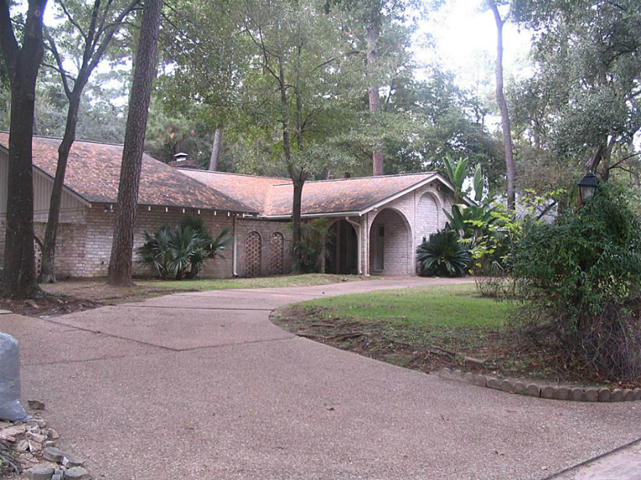
Swamplot’s Daily Demolition Report lists buildings that received City of Houston demolition permits the previous weekday.
The great business of demolition is to be, to do, to do without, and to depart.
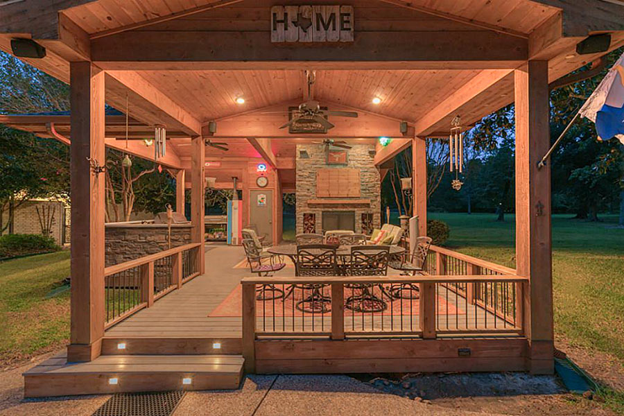
- 15252 Saddlewood Dr. [HAR]
COMMENT OF THE DAY: DISASTER EVICTION DISASTERS  “This just brings into focus how landlord tenant law is totally inefficient when it comes to natural disasters. When a landlord cannot repair the leasehold in a timely manner, they have no choice but to terminate the leases. While it certainly makes sense that you would want to free people from having to pay rent on a residence that was not habitable, the unintended consequence is that people are uprooted from their community and scattered about the city with little chance of returning to their homes. Likewise, landlords are forced to empty out their premises and pray that they will be able to fill up their building once renovations are completed. Why not give the landlord the option to obtain temporary housing for tenants and keep the lease in place. When repairs are complete, the tenants can move back in without worrying about breaking a lease and do not have to compete with other tenants for space. Tenants could keep their address, which is very helpful for getting credit.” [Old School, commenting on Residents of 2100 Memorial Senior Highrise Now Have 5 Days To Move Out of Their ‘Uninhabitable’ Apartments] Photo of fire-safety warning sticker at 2100 Memorial: Swamplot inbox
The 2 very different videos above give a taste of what the last few weeks have been like in Nottingham Forest, the Memorial neighborhood along the north side of Buffalo Bayou between Dairy Ashford and Kirkwood south of Memorial Dr. Nottingham Forest filled with water after Hurricane Harvey — and releases of water from the oversubscribed Addicks and Barker reservoirs. The first video, taken by Swamplot reader Gatewood Brown from a GoPro mounted on a kayak, shows portions of the neighborhood underwater during rescue operations 3 days after Houston was first hit by the storm. The second video was taken yesterday by reader Kyle Steck, using a mobile phone he carried while biking hands-free through Nottingham Forest’s now dry but extensively garbage-lined streets.
Videos: Gatewood Brown; Kyle Steck
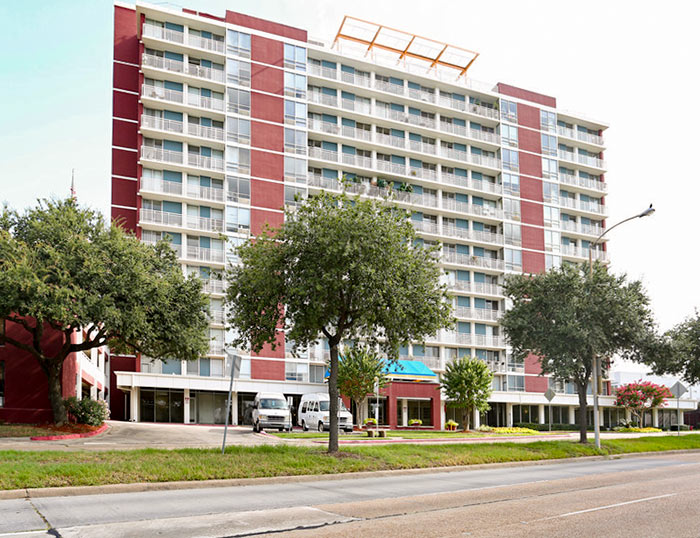
A notice sent yesterday to all tenants of the 2100 Memorial senior-living facility just west of Downtown declares that the 14-story former Holiday Inn has been rendered “totally unusable for residential purposes” in the aftermath of Hurricane Harvey. All 198 elderly residents have been given 5 days to remove themselves and their belongings from their apartments.
The building is a tax-credit property of the Houston Housing Authority that includes both low-income and market-rate units. The notice, which came from V.J. Memorial Corp., a nonprofit entity owned by the authority, states that the company only recently learned that the building’s electrical and fire control systems were compromised by the flooding.
“Due to the damage and health & safety reasons, the building is uninhabitable and we must exercise our right under your lease to terminate the lease effective September 23, 2017,” reads the notice, a copy of which was obtained by Swamplot. A separate lease termination document sent in by a reader declares that “the damage to the Apartment is so extensive the Apartment has become as a practical matter totally unusable for residential purposes due to health and safety reasons. Furthermore, the damage could cause health and safety hazards to you and your family, if you returned to live in the Apartment in its present condition.” Residents have until 5 pm on the 23rd to get out: “If you do not remove your personal possessions by that time. we will be forced to remove your possessions and store them at a cost to you,” the document states.
- Last 900 Harvey Evacuees Leave GRB Convention Center [Houston Chronicle]
- NRG Park To Close Shelter Saturday with 2,100 People Remaining [KHOU]
- Slideshow: Here’s Where Houston Flooded the Most and Least During Harvey, Based on Texas Division of Emergency Management Data [HBJ]
- Graphing Harvey’s Impact by Neighborhood, Income, and Race [The Urban Edge]
- Flooded Vehicles a Big Problem for Low-Income Houstonians [Texas Tribune]
- GRB Has Not Canceled a Schedule Convention Since Harvey [Houston Chronicle ($)]
- Some Grocers Shuttered by Harvey Won’t Reopen Until Next Year [Houston Chronicle]
- How JSW Steel Employees Saved the Baytown Mill During Harvey [HBJ ($)]
- Federal Reserve Bank: Harvey Contributes To First U.S. Industrial Sector Drop in Months [Houston Public Media]
- Fire Burns 2 Buildings, Kills Child at The Landing Apartments on Corporate Dr. and Westwood Place Dr. [abc13]
- Breaking Down the Key Differences Between Hyperloop One and High-Speed Rail in Texas [Bisnow]
- Largest U.S. Toy Store Chain, Toys ‘R’ Us, Files for Bankruptcy Ahead of Holiday Season [Reuters]
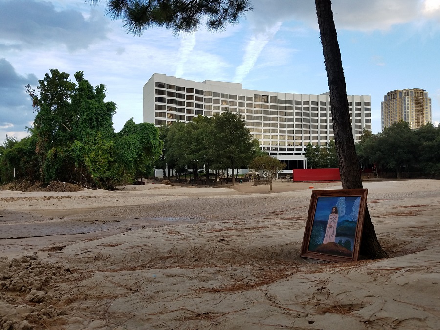
Photo of Omni Houston Hotel, 4 Riverway: Marc Longoria via Swamplot Flickr Pool
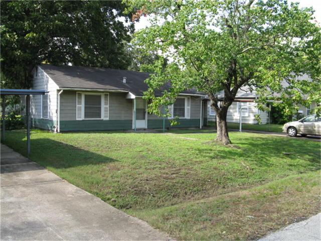
Swamplot’s Daily Demolition Report lists buildings that received City of Houston demolition permits the previous weekday.
Never give up and demolition will find you.

- 2727 Kirby Dr. Unit 14E [HAR]
COMMENT OF THE DAY: SHORTER OZYMANDIAS  “How quickly nature would erase the ground-level remnants of civilization should we all suddenly perish.” [Dana-X, commenting on A Photo Tour of the Brand New Beaches Along Buffalo Bayou] Illustration: Lulu
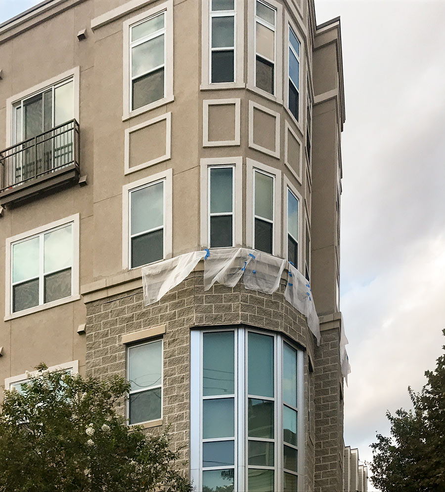
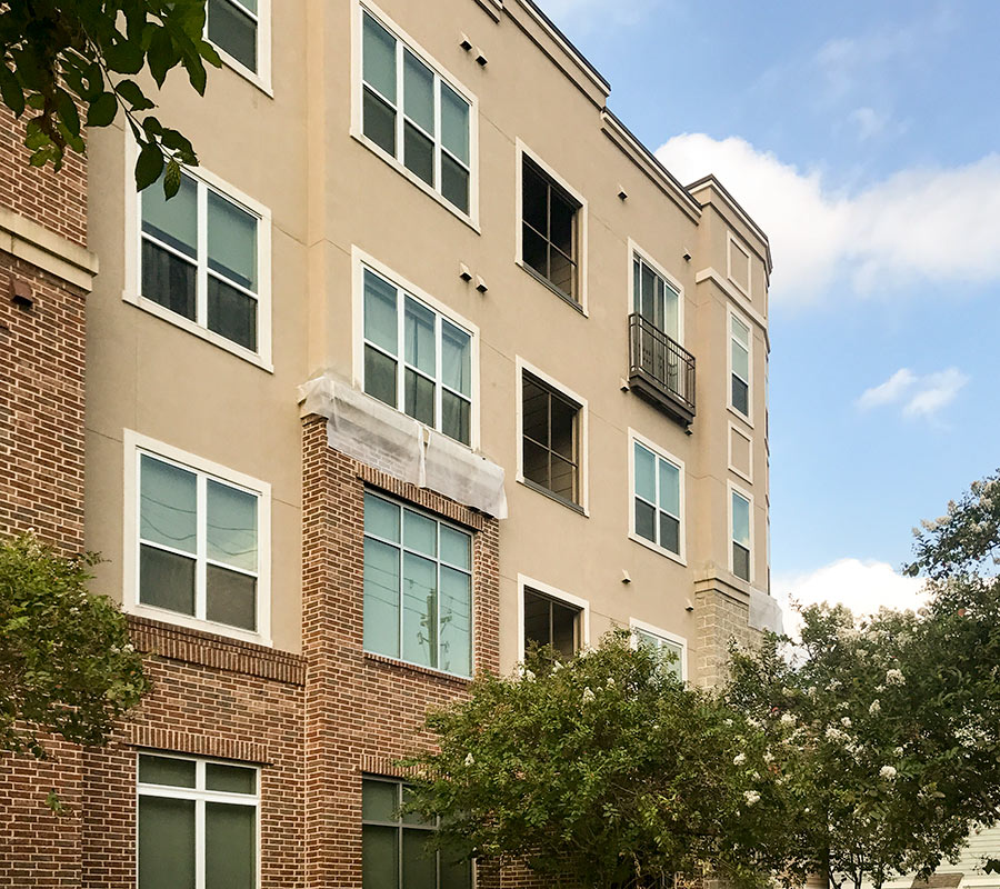
The District at Washington Apartments at the corner of T.C. Jester and Schuler in Cottage Grove now feature apron-like attachments of plastic sheeting meant to provide cover to select masonry-stucco intersections on the façade. The reader who sent the photos to Swamplot says the tarps have been up for a few weeks now, and that repair work appears to be underway:
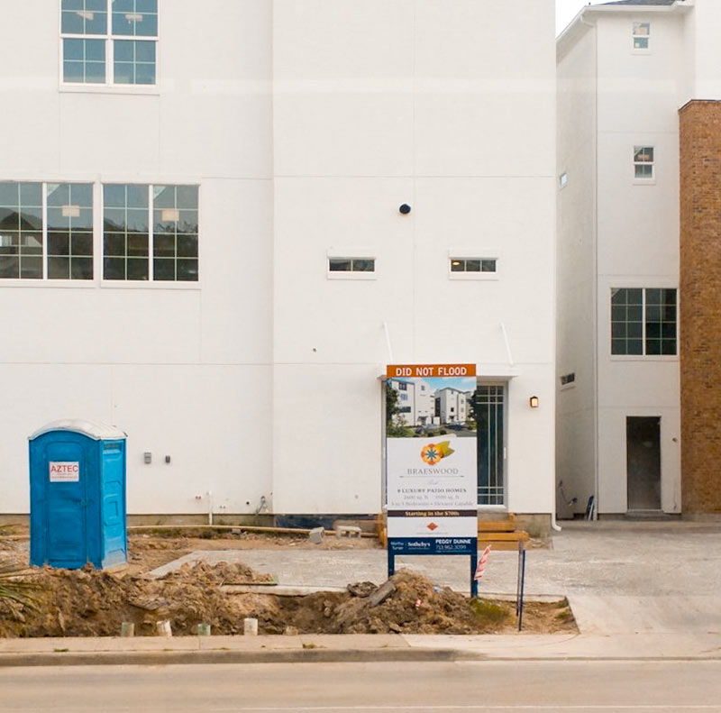
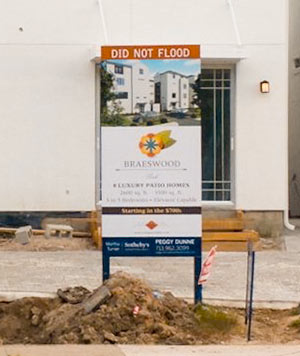 Popular yet again in Houston: The DID NOT FLOOD sign topper. Here’s a new one spotted by wandering photographer Joshua House in front of the Covington Builders 4-story townhome development at 3821 N. Braeswood Blvd., one block north of Brays Bayou and a couple blocks east of Stella Link.
Where have you spotted signs like these in Harvey’s aftermath? Please send pics and coordinates to us. Swamplot wants to know what DID NOT FLOOD.
- 3821 N. Braeswood Blvd. [HAR]
Photo: Joshua House

