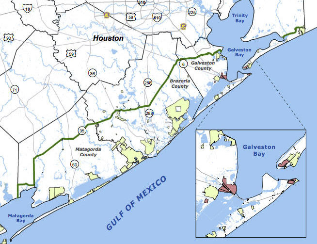
SCENIC UPPER TEXAS COASTAL SWAMPS, BEACHES, PLANTATIONS A LITTLE CLOSER TO GOING NATIONAL  Jefferson County’s commissioners are the latest to give a formal thumbs up to a proposal for the Lone Star Coastal National Recreation Area, which would bundle together a patchwork of parks, historical sites, and variously refinery adjacent nature preserves from the Bolivar peninsula down to Matagorda Bay. The concept for a regional rec zone was developed shortly after Hurricane Ike’s big splash on the Texas coast in 2008: researchers noticed that some of those larger patches of undeveloped wetlands helped buffer storm surge damage, and started looking at whether keeping them around could be profitable in other ways. No new land would be scooped up for inclusion in the 4-county zone, unless it were offered voluntarily — but the whole region would be marketed under the National Parks Service’s banner as a package to birdwatchers, beachgoers, Strand-walkers, and the like. The proposed area would still need some level of National Parks Service staff, and approval from Congress — which is currently considering major cuts to the Department of the Interior’s budget. [Beaumont Enterprise; Houston Chronicle] Map of proposed Lone Star Coastal National Recreation Area: LSCNRAÂ
Tag: Parks and Recreation

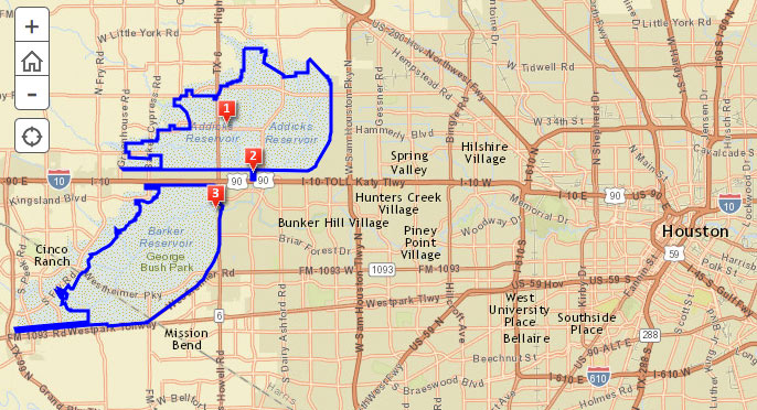
The Army Corps of Engineers is holding a public meeting amid this evening’s predicted thunderstorms to chat about the recently begun replacement work on the Addicks and Barker dams, which have each won the rare and highly distinguished label ‘extremely high risk’ through a combination of structural issues and close proximity to Houston. For those not planning to flood the Corps with questions and comments in person, there’s a somewhat-outdated online survey, as well as an online map of updates on the project’s progress. Work to replace the outlet structures of the dams began in February, and is expected to take about 4 years.Â
The 2 reservoirs, spread out across 26,000 acres on either side of the Katy Fwy. near Highway 6, starred in the Sierra Club’s 2011 lawsuit over the construction of Segment E of the Grand Parkway through the reservoirs’ catchment area. The club claimed development spurred by the road could send major additional runoff to the reservoirs, increasing the chance of dam failure, which Dave Fehling of Houston Public Media reports “could do an estimated $60 billion dollars in damage to downtown Houston, to industries along the Houston Ship Channel, [and] even to the Texas Medical Center.” The judge didn’t stop construction of Segment E, but did order new studies on its potential flooding impacts.

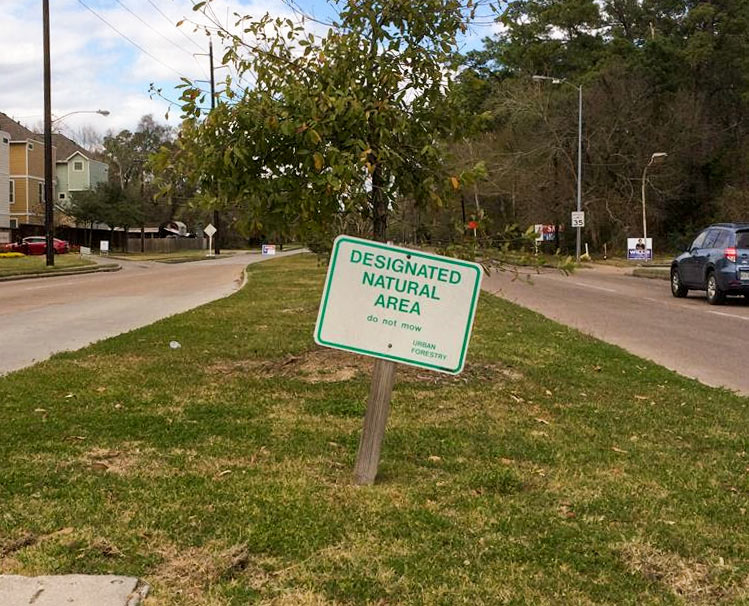
Here’s the southernmost end of the newest work from the Art Guys: the designation of an existing ‘designated natural area’ in Garden Oaks/Oak Forest as part of their series of situation sculptures. The grassy median strip along Wheatley St. between Pinemont Dr. and Tidwell Rd. is evidently one of the no-mow zones labeled by the city’s parks and recreation department that spurred complaints in 2011, when area residents alleged that newly planted trees had blocked sight lines and created hazardous driving conditions. According to the city’s website, the zones are carefully placed to “help promote the natural regeneration of the urban forest.”
As for techniques employed by the artists: per their other pieces in the series, the duo appears to have left the area alone. They have, however, provided GPS coordinates and a Google map to help visitors avoid losing their way.

