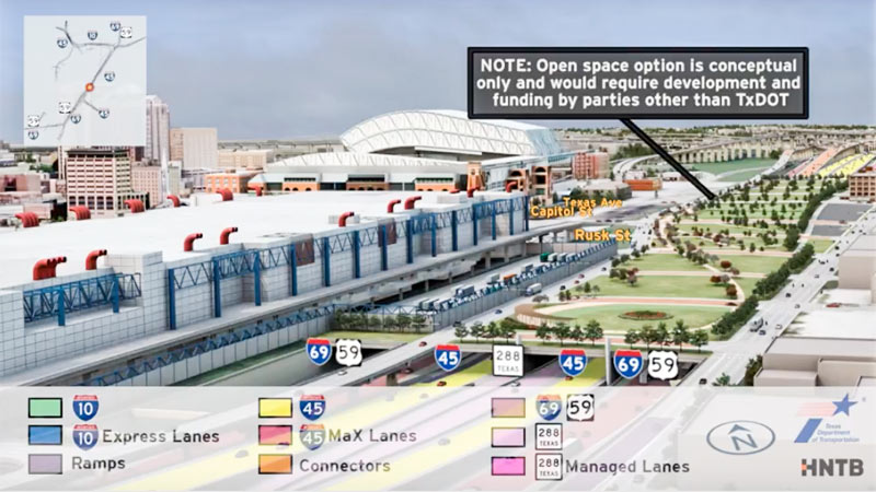
In between showing off various multicolored interchange tangles, the new flyover preview video of the huge changes proposed for I-45 North and the downtown freeway circuit glides viewers by a handful of areas where freeways will dive underground — while splicing in some new renderings of the tops of those tunnels-to-be as they could look, if somebody wanted to pay up to turn them into a park. (The animation is careful to emphasize once again that said parks would have to be developed and funded by a source other than TxDOT — and so far, there are no signs that anyone has stepped up.)
The rendering up top shows the would-be-parallel sections of 45, 59, and SH 288, running behind the convention district where 59 sits now — the whole bundle would be pulled down below flood grade and covered up, evidently with concrete if the park thing doesn’t work out. (A clip of just that section of the 10-minute animation is included above; a tiny rendered version of the Cheek Neal Coffee building can be spied along the edge of the freeway, though SEARCH Homeless Service’s new building one block north isn’t specifically drawn in next to it.)
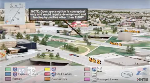
The video also gives the section of 59 from Main to San Jacinto streets the same burial and dressup treatment:
***
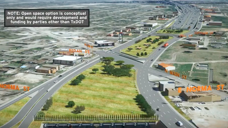
And the section of I-45 from N. Main to just past Cottage St., alongside the Hollywood Cemetery, gets it too:
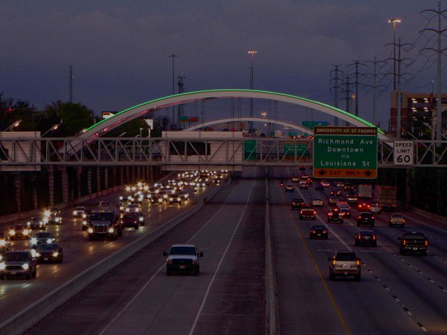
The length of 59 between the splitoffs of 288 and 45 South doesn’t appear to get covered over in the same manner— it does, however, pick up some bridges that look a lot like double-wide versions of the curved ones that got re-lit for the Super Bowl this year:
- Previously on Swamplot: Latest Mindboggling TxDOT Video Shows Off Rainbow Tangles of Spaghetti-tastic Downtown Freeway Redo Plans in Simulated Drone View; Big I-45 Downtown Rerouting, Grand Parkway Expansion Get Go-Aheads; TxDOT To Pierce Elevated: Your Years Are Numbered, Probably; TxDOT’s Plans for Freeway Expansion Around and Below the Newly Protected Cheek-Neal Coffee Building; Wacky TxDOT I-45 Redo Renderings Now Available in Mind-Boggling Video Format; The 5 Wackiest Images from TxDOT’s Plans To Reroute I-45 and Abandon the Pierce Elevated
Images: HNTB and TxDOT (stills and video); Benjamin Pawlik (existing bridges over 59)



Moreover why not just expand the convention center over the freeway at least to some extent, and onto the other side as well (I believe Seattle does this). Keep the open space/parks too, hey maybe integrate the two.
There will be flying cars before any of this happens. And there will still somehow be gridlock.
Why does a city that floods want to go underground? Wouldit not make sense to go higher for the freeway so people can still traverse the city with blockage from flood waters?
TxDOT will build series of box beams over those spots in case somebody wants to build the flat spaces and put ggedn spaces on them. Had people not lobbied for them, TxDOT would just have specified open trenches.
Agree with Dean K’s comment: those underground freeway tunnels will just become death traps when the flooding happens.
@Mark, Sounds like you ‘ve hinted at it, but in the case parks are a no-go (a park 59/main is laughable & we’ve already spent a fortune building up parks on other side of GRB) is it correct to assume that no actual retail/commercial development could go on top or be retrofitted unless fixed as part of the original design?
@ Dean K & Scarlet Fever: Trenched roads include sumps that are capable of keeping the roadways from flooding from ordinary rain events, but are designed to become flooded in an emergency, acting as additional stormwater detention. Every cubic foot of stormwater that goes in there is a cubic foot that isn’t at the same elevation as city streets, businesses, and houses. It is a feature, not a bug.
@ The Niche: Thanks for the reminder of this feature. But, there’s always a fool or dozen fools that drive into the thing then are featured on the news being rescued by the fire department.
@TheNiche, then in an Allison-type event, how are residents of the south and east supposed to evacuate? Hope that they find a route that is not washed out up to I-10?
@confused – evacuation is about getting out AHEAD of the storm, not after.
@The Niche: Do you work for &/or are paid /compensated by TXDot to sway people that TxDOT’s designs work? Quit advocating for another DOOMED, disaster prone , insane idea that most could likely result in INCREASED flooding in a flood prone city …As for the “new” design(s) acting as stand-by “retention ponds /off-sets ” during flooding , is once again on TxDOT’s part completely absurd . Those morons
couldn’t design/engineer their way out of a wet paper bag. Look at at how their other projects DON’T work during storms. They FLOOD and people DIE …Those NEVER work as they’re inundated by massive amounts of water that NO plan can contain /offset from the already flooded streets & roads.
typo edit: The voters need to UNELECT most….
@ScarletFever or, as was the case with that one small Uptown trenched entrance ramp about a year ago, even HPD divers called to the scene can’t rescue the people who drive in there and get pulled down by the pumps…now that is a bug, not a feature…
@ confused: In an Allison-type event which would be characterized by heavy rain over the course of several days, people in affected watersheds should evacuate to officially designated local shelters. These usually include schools and other public buildings on high ground. They can use surface streets, which shouldn’t flood as much if some of the stormwater is sitting in a trenched freeway. People on the east side of the I-45 project should be especially grateful for the project because it will detain water that otherwise would have flowed overland toward their neighborhoods.
.
I hope that I have ameliorated your confusion, confused.
I for one think the underground freeways near the urban downtown area would be an excellent idea for Houston. The obvious flooding problems would be mitigated by the numerous detour options at grade. The sumps + pumps would be useful for normal everyday rain events, and as @TheNiche mentioned a major rain event would result in these areas acting as additional detention which would HELP surrounding areas avoid significant flood damage.
The underground freeways would open up currently obstructed views, reduce noise, and with some at-grade pedestrian/vehicle crossings make it more accessible to all users of the public right-of-ways. Eventually, if necessary, a double-decker like system could be installed to further increase the freeway capacity or allow for installation of more rail and mass-transit networks. I admit that this project will be massively expensive, but it is the type of project that our great state and city sorely lacks when compared to the great world cities. We have to make these investments in our infrastructure to ensure we remain a vibrant, accessible, and enjoyable place to live and work.
@ HappyGoLucky: I’ve done a lot of work for a lot of entities, but to my knowledge I have never been directly or indirectly compensated by TXDoT or by any large contractor thereof.
.
That being said, I don’t think that you’ve been paying attention very closely to my input. I am very concerned about the bottlenecks ramp placement, and how traffic will flow on/off the freeways on surface streets. I wonder about the extent to which TXDoT has been coordinating with other stakeholders like the City and METRO, the quality of their coordination (if any), and I am concerned that more attention seems to be getting paid to unfunded parks and aesthetic flourishes than to comprehensive mobility. Something seems very amiss. And I know enough about past TXDoT workarounds to technical constraints in order to satisfy their unspoken political constraints that…well I just don’t trust them as an entity.
.
Nevertheless, the idea of improving the I-45 and downtown loop is a good idea. it needs to get done. And as much as I’d like to see legislative reforms to the way that Texas does all manner of transportation projects, those are exceedingly unlikely to be forthcoming. If we’re stuck with TXDoT, that doesn’t mean that I want them to stop doing what they’re doing; the perfect project is the enemy of the good project.
Houston is always borrowing from other cities, for better or worse (and it’s hardly the only city to do so). In this case it seems Houston would be replicating the L.A. River. Very interesting!
@HappyGoLucky
I’m going to echo the other posts on here and say that buried freeways are designed to be a last-resort water retention system in the event of a major storm. How could they “create” flooding? Freeways do not determine the amount of rain that falls from the clouds, but they do provide a good area to contain it. I’d rather the freeways flood than the neighborhood (homes and businesses). The freeway is FAR cheaper and easier to cleanup.
Now, as for the morons who drive into submerged roads, there’s not much you can do about them….
“Parks to be funded by others”. A polite way to stay that these green spaces will not be included in this $6 billion boondoggle. Or, don’t gripe if the lovely green spaces are missing when this mega project is finishes. The community has several years, 8?, to find funding sources.
Without the green spaces we’ll have another Monteose freeway.
Way to copy Dallas!