COMMENT OF THE DAY: THE RISKY GAME HOUSTON’S BEEN PLAYING ALL THESE YEARS  “It is really amazing to look at the total disaster that Harvey caused (And Ike. And Allison. And the Tax Day flood. And the Memorial Day flood.) and say to developers and regulators in the Houston area, “Doing a heck of a job, Brownie.†Developers and regulators built thousands of homes and strip malls all across Houston during the boom cycles of the ’60s, ’70s, and early ’90s that had completely insufficient stormwater drainage infrastructure. Regulators allowed people to build too close to flood zones and builders did not think twice about building right up to bayous and rivers. The response from regulators was to require better development practices moving forward in some areas and apply a few band aids in other areas. This lax development attitude worked for a long time because it helped keep housing relatively affordable compared to other large metro areas. But after Harvey, people looking to come to Houston will have to consider whether the affordable housing and economic opportunities are worth the risk of losing everything in another big flooding event. The reassurance that developers are doing a better job with new projects does nothing to allay fears that existing housing is prone to devastating flooding. Houston’s failed development practices are now an albatross around the City’s neck.” [Old School, commenting on Comment of the Day: What Out-of-Town Reporters Don’t Understand About Houston-Area Development Regulations] Illustration: Lulu
HAPPY BELATED BIRTHDAY, HOUSTON, YOU LOVABLE, MISIDENTIFIED SWAMP 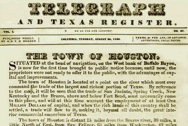 Possibly overlooked amid the Harvey hubbub: Yesterday was the City of Houston’s 181st birthday — or more accurately, the 181st anniversary of the launch of an advertising campaign announcing its establishment, pursued by the soon-to-be-city’s founding real-estate hucksters. “It is handsome and beautifully elevated,” the Allen Brothers wrote of the Houston they imagined in that ad, “salubrious and well watered, and now in the very heart or centre of population, and will be so for a length of time to come.” [Previously on Swamplot] Image: Houstorian
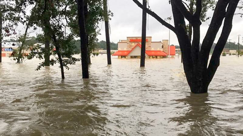
How’s this image for establishing flood cred? The photo above — of the submerged Whataburger at 4545 Kingwood Dr. in Kingwood — accompanied the fast-food chain’s announcement yesterday of plans to spend a million bucks helping its own employees recover from Hurricane Harvey and donate half a million to local food banks and $150K to the Red Cross. If the water-waisted burger joint located near the intersection of the appropriately named W. Lake Houston Pkwy. otherwise looks kinda shiny and new in the pic (you can see more of its flooding experience here, here, and here), it’s because it is. Whataburger Unit 1125 at this location opened for the first time on July 31.
Photo: Whataburger
- Explosions Reported This Morning at Flooded Crosby Arkema Chemical Plant [Houston Chronicle]
- Harvey’s Flooding Spurs Concern About Houston’s Toxic Waste Sites [The Texas Tribune]
- Texas Fails To Penalize 97% of Illegal Air Pollution Releases [Environment Texas; previously on Swamplot]
- TCEQ Issues Ozone Action Day for Houston Area for Today [Air Alliance Houston]
- Number of People Housed at GRB Now Down to 8,000 [Houston Chronicle]
- Red Cross, Others Having Problems Getting Needed Supplies to Shelters [Houston Chronicle]
- AccuWeather Estimates Harvey the Costliest Natural Disaster in U.S. History; Federal Spending May Reach $160 Billion [Houston Chronicle]
- Houston’s 47,000 Vacant Apartments and 21,000 More Units Under Construction Should Help Meet Demand from Displaced Residents [Houston Chronicle]
- TxDOT Installs Mile-Long Temporary Dam Along Westbound Lanes of I-10 [Houston Chronicle]
- HISD May Not Start School Tuesday as Planned; Assessments of 300 Facilities Underway [abc13]
- Mail Service in Houston Suspended Until Further Notice [Houston Chronicle]
- Some Guidelines for Contractors Wanting to Be Part of the Cleanup and Construction Efforts [HBJ]
- What To Do If You Lost Your Car in Flood Waters [Houston Chronicle]
- Stories of Some of The Victims Who Died During Harvey [New York Times]
- Some Interesting Charts and Maps Related to the Storm [Washington Post]
- Space City Weather’s Eric Berger: Houston Will Never Be the Same [Ars Technica]
- Former Mayor Bill White, Who Opened Houston To Katrina Evacuees, a Flood Victim Himself [Washington Post]
- Harvey Raises Questions About Houston’s Model of Perpetual Growth [New York Times]
- How a Federal Insurance Program Made Harvey Far More Costly [Politico]
- Signs of Life Return to Houston After the Rain Stops [New York Times]
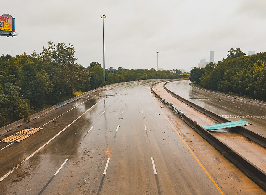
Photo of I-45: Marc Longoria via Swamplot Flickr Pool
Swamplot’s Daily Demolition Report lists buildings that received City of Houston demolition permits the previous weekday.
No new demolition permits have been issued by the city yet – stay tuned and we’ll post ’em when we get ’em.
SMELLING BLIND IN THE EAST END 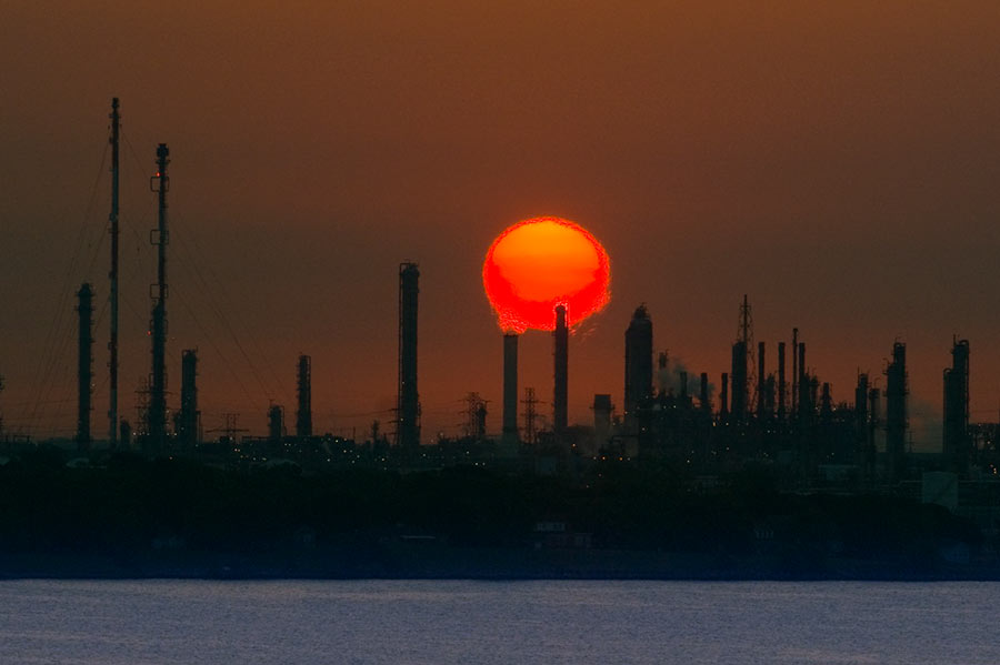 A possible cause of the nasty smells that caused East End residents headaches, sore and scratchy throats, and itchy eyes as Hurricane Harvey approached and inundated the area? Houston-area industrial plants in the last week released more than 2.25 million pounds of emissions above legal limits, according to an Environment Texas tally of Texas Commission on Environmental Quality data. The reason: plant shutdowns before the onset of the storm and startups after it left. “So far,” writes Emily Atkin, “TCEQ has not indicated these events have triggered health impacts. . . . TCEQ Media Relations Manager Andrea Miller told me the agency or local emergency officials would contact residents if an immediate health threat were to occur. What’s more, Miller said companies were probably reporting higher emissions that what actually occurred, ‘since underreporting can result in higher penalties.‘ It’s unclear, however, how TCEQ would check many of the companies’ reports, since the agency turned off all its air quality monitors in the Houston area before Harvey hit. Miller confirmed as much on Monday, saying devices were either turned off or removed “to protect against damage or loss of these sensitive and expensive instruments.†[The New Republic] Photo of ExxonMobil Baytown refinery: Louis Vest [license]
HOW IT LOOKS FROM THE DRY SIDE OF THE BAYOU 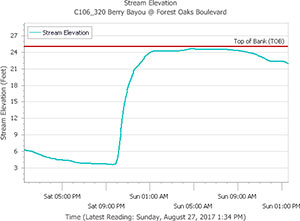 Chronicle features editor Lisa Gray says her Meadowcreek Village home escaped water damage during the flood, but it was close — and many others weren’t so lucky: “Berry Bayou — the middle of which forms my back property line,” she writes, “received more than 45 in. I’ve seen it in national weather-nerd articles where people are marveling how fast a bayou can rise. My husband says we were half an inch away from the bayou coming out of its bank in our back yard. He sent a graph, showing that on Saturday night, at the monitor I can see from my back yard, it was literally at bank level. But the water broke first on the other bank, into the yard of one of my favorite people in the neighborhood, and up and down the yards on that side. Lots of houses flooded. ‘Dry privilege’: That’s the headline of the essay I ought to write.” [Previously on Swamplot]Â Graph of Berry Bayou water levels at Forest Oaks Blvd. on August 26th and 27th: Harris County Flood Control District
COMMENT OF THE DAY: WHAT OUT-OF-TOWN REPORTERS DON’T UNDERSTAND ABOUT HOUSTON-AREA DEVELOPMENT REGULATIONS  “. . . I must LOL whenever I see one of these articles blaming our flooding on our lack of zoning, and as an example of our lack of zoning, the article will show some subdivision in Sugar Land or Katy. Last time I checked, neither of those places are inside the city limits of Houston. Also, don’t those subdivisions have zoning up the ying yang? . . .” [XCellKen, commenting on Harvey’s Record Rainfall; Crosby Plant Explosion Risk; A Ponderosa Forest Boat Ride] Illustration: Lulu
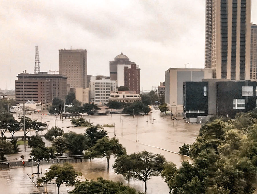
City Hall, the City Hall Annex, the Bayou Lofts, Market Square Tower, The Rice (formerly the Rice Hotel), Hogg Palace, the Theater District and Tranquillity Park parking garages, Bayou Place, the Downtown Aquarium, the Houston Ballet Center, the Wortham Theater Center, Jones Hall, the Alley Theatre, the Hobby Center, and the some of the historic homes in Sam Houston Park are all buildings that were damaged in some way by floodwaters rolling in after Hurricane Harvey’s days-long assault on the city, according to a statement released by the Downtown District today. Damage mostly came from water pouring into first-level or basement spaces, though the building at 1415 Fannin St. did catch on fire.
High water flowed to Downtown’s low points, to the north and west — primarily in the Warehouse, Historic, and Theater Districts. How did the tunnels fare? Only sections adjacent to the Theater District and Civic Center garages were damaged, according to the district.
Other structures that took on water: The Spaghetti Warehouse, the new AIA Houston offices under construction across from that restaurant on Commerce St., the Sunset Coffee Building, the Dakota Lofts, and the Cotton Exchange Building on Travis St. Here’s the complete list (with addresses):
STUFF YOU PROBABLY SHOULD KNOW ABOUT THE ADDICKS AND BARKER RESERVOIRS 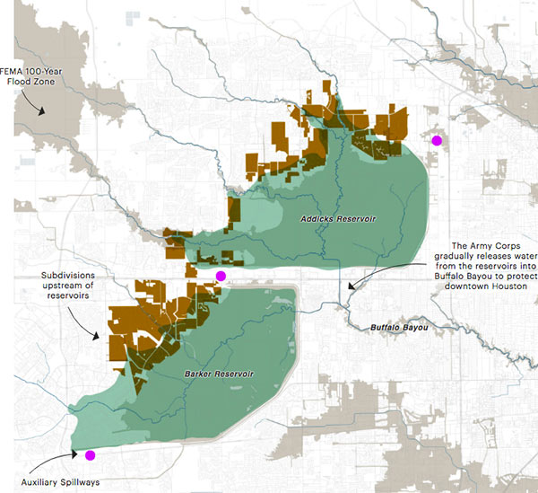 Lived in Houston for years but still coming up to speed on how the Addicks and Barker dams are supposed to work — just as the reservoirs reach to their highest-ever levels? This brief explainer from Kiah Collier and Neena Satija of The Texas Tribune Al Shaw and Lisa Song of ProPublica should overfill you with info: “As of now, the Army Corps says there’s enough excess water in the reservoirs that some of it will flow around (not overtop) these auxiliary spillways. . . . The Army Corps can’t say exactly what areas might experience additional flooding, but local officials listed 53 subdivisions in the Addicks watershed and 40 in the Barker watershed (shown in brown in the map above) at high risk of flooding. Jeremy Justice, a hydrologic analyst at the Harris County Flood Control District, said two subdivisions near the Addicks reservoir—Twin Lakes and Lakes On Eldridge—are particularly vulnerable to flooding from the Addicks spillway. Those homes ‘probably should never have been put there,‘ he said.” Thousands of homes around the reservoirs have now flooded — some because they’re close to rising bayous, and some because of bad neighborhood drainage, they write. “But many are flooding because they are in an area that the Army Corps actually considers to be inside the reservoirs. (See map.)” [Texas Tribune; ProPublica version with links; previously on Swamplot] Map: ProPublica
- 1.5 Mile Radius Around Crosby Arkema Organic Peroxides Plant Evacuated Yesterday Amid Explosion Risk [abc13]
- Brazoria County Judge: Columbia Lakes Levee Breaching a ‘Nightmare Event’ [KHOU]
- Harvey Broke a National Rainfall Record for a Single Tropical Storm, with More Than 4 Ft. of Rain [Vox]
- Moody’s Analytics Estimates Destruction to Southeast Texas at About $75 Billion So Far [HBJ]
- 10,000-Bed Shelter Opening at NRG Park [Houston Chronicle]
- Joel Osteen’s Lakewood Church Opens Its Doors To Evacuees [Houston Chronicle]
- More Than 1,500 Patients Evacuated from Houston-Area Hospitals So Far [Houston Chronicle]
- At Least 40,000 Galveston County Residents Have Been Displaced by the Storm [Galveston County Daily News]
- Talks To Convert Greenspoint-Area Subsidized Housing Complex Arbor Court into Detention Basin Are Ongoing, Owner Says [Houston Chronicle]
- Congress May Dole Out Hurricane Harvey Relief in Multiple Installments [Politico]
- Mapping the Devastation of Harvey in Houston [New York Times]
- Columbia Lakes Residents Build Artificial Barrier To Hold Back Water [Houston Chronicle]
- A Boat Ride Through Flooded Ponderosa Forest in North Houston [Click2Houston]
- Saint Arnold Brewery Gave Free Beer in Exchange for Hurricane Harvey Relief Supplies [Houston Chronicle]
- Opening of New Location of Lone Star Flight Museum Delayed [HBJ; previously on Swamplot]
- What Judge Emmett Says He Might Have Done Differently in Storm Response [Houston Chronicle]
- What Rebuilding in Houston Might Look Like [NBC News]
- Houston’s Flooding Made Worse by Unchecked Urban Development and Wetland Destruction [Quartz]
- Hurricane Harvey Showing Us the Future of Climate Change [Curbed]
- Houston’s Drainage System Designed To Clear Out Only 12 to 13 In. of Rain per 24-Hr. Period [AP]
- Houston Needs To Invest More in Infrastructure To Ensure Its Future [The Atlantic]
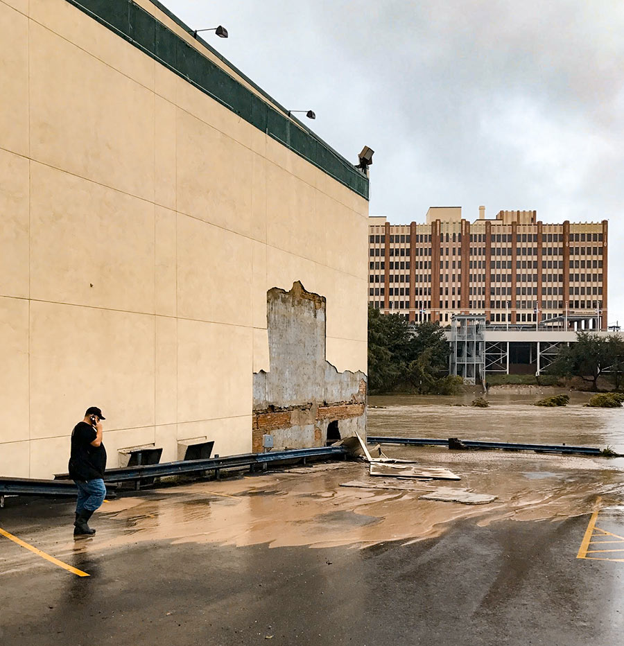
Photo of Spaghetti Warehouse, 901 Commerce St., Downtown: Kelsie H. Dos Santos
Swamplot’s Daily Demolition Report lists buildings that received City of Houston demolition permits the previous weekday.
No new demolition permits have been issued by the city yet – stay tuned and we’ll post ’em when we get ’em.
Here’s another helpful online tool from the civic hackers at Sketch City, this one for would-be volunteers: a crowdsourced, interactive map showing which shelters near you are in need of what resources — and which ones might need people to come over and help out. Each icon on the map represents a shelter or providing organization that’s helping evacuees who’ve been put out of their homes by Harvey flooding. Click on one and a panel on the left will indicate any supply needs or volunteer needs identified by the site. (A larger, full-browser-width version of the map is here.)
The map was put together by Amanda Shih, Dr. Neeraj Tandon, and Chris Ertel, and is linked to data assembled and continually updated by a group of dozens of local and not-so-local volunteers hooked up to the project by Sketch City, a Houston nonprofit technology group. (The same bank of is behind Sketch City’s other new mapping project — one that simply identifies available Harvey shelters to people seeking them.) The volunteers have been making regular phone calls to update the information in a shared Google Doc. (If that kind of call-and-type-from-home work is your preferred method of volunteering, go ahead — you’ll find a direct link to the underlying spreadsheet in the map.)
- Harvey Needs [Sketch City on Github]
- Previously on Swamplot: The Quickest Way To Find the Nearest Hurricane Harvey Shelter That Isn’t Already Full
Here’s a crowdsourced, interactive map showing more than 180 shelters and shelter-ish locations set up in the last few days to take in evacuees separated from soggy homes as a result of Harvey flooding. Most of the indicated locations are in the Houston area, but others farther afield have been added (and are welcome) as well.
To use the map, you’ll first want to click on the icon just below the top left corner to toggle off the legend. Then you can zoom in or out or pan around, and click directly on each location to read details — such as the address, phone number, whether there’s room for more people, and how recently the information has been updated. You can access a larger version of the map directly by going to houstonsheltermap.com.
If the map provides more info than you need right now, there’s an easier way to find the closest shelter to you that’s still accepting newcomers: Just text your Zip Code (the one where you are; it doesn’t have to be your home address) to 346-214-0739. It’s set up to text you back the location of the nearest open hurricane shelter.
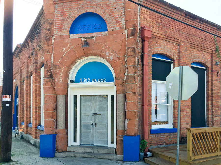
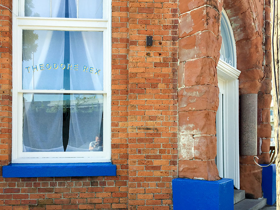
Just days before Harvey hit Houston, the newest corner restaurant at 1302 Nance St. in Downtown’s old warehouse district looked ready to debut. The photos here, taken by Swamplot reader Will Breaux shortly before the rains came and the waters swelled, show the spot formerly occupied by Oxheart sporting a new exterior paint job and window nameplate.
Inside, renovations had been taking place for months. Proprietor Justin Yu had plans to open Theodore Rex later in August. But the restaurant flooded. Now, he writes, “it might take a little more time to open.”
- Justin Yu’s Theodore Rex Sustains Flood Damage In Hurricane Harvey Flooding [Eater Houston]
- Justin Yu Could Debut Theodore Rex By the End of the Month [Eater Houston]
- Previously on Swamplot:Â Justin Yu To Close Oxheart, Spend Some Time in the Heights;Â Dharma Cafe to Ray’s Franks to Latin Bites to Oxheart
Photos:Â Will Breaux

