01/13/16 4:00pm

Renderings of Houston Botanic Garden at Glenbrook Park Golf Course, Glenbrook Valley, Houston, 77017

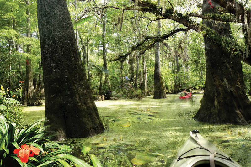
Bright and shiny renderings from the recently-released master plan for the Houston Botanic Garden show that design firm West 8 is aware of the challenges involved in straddling a world-class park across Sims Bayou, on the site of Glenbrook Park Golf Course just across I-45 north of Hobby Airport.  The Dutch firm, known internationally for unusual bridges and unconventional landscape design, has planned for many of the Garden’s displays to flood at will; the shores of Sims Bayou on the Garden’s property will also be resculpted. And to combat Houston’s just-shy-of-year-round heat, shade trees would be preserved or planted throughout the park, including the towering cypresses depicted in the bayou-side wetland gardens shown above (parts of which will be explorable by kayak).

Meanwhile, the more formal garden spaces planned for the park are shown with their own built-in shade (complete with custom ceiling fans): Colonnade structures (like the ones picture below) will ring each of the major collection gardens, which are designed to be “entered, enjoyed, and contemplated from the comfort of the shaded perimeter”:

CONTINUE READING THIS STORY

Glenbrook Valley Garden
12/07/15 9:15am

Map of Oil Wells in and Around Pierce Junction Salt Dome, Houston

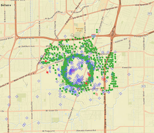
Right next door to the fairways of the Wildcat Golf Club, Fairway Energy Partners is moving forward with plans announced this summer to put nearly half a billion gallons of crude oil back into the ground, right in the center of the once-wild Pierce Junction oil field just south of the Inner Loop between S. Main St. and Highway 288. (The field, which a 1956 Time Magazine article called the site of “the biggest of all Gulf Coast oil booms,” still pumps out oil.) Fairway announced in November that they’ve picked engineers to help them retrofit 3 of the 8 man-made caverns dissolved into the Pierce Junction salt dome for crude storage.  A dense ring of current and closed oil wells (mapped as green dots above) traces the uppermost reach of the migrant salt, buried approximately 950 feet below the surface and extending several miles deep to its source layer.

CONTINUE READING THIS STORY

Partners in Brine
01/04/13 10:28am

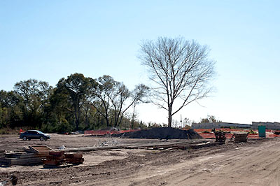
Last month, Cite magazine editor Raj Mankad hiked 8 miles through the Katy Prairie to see the prehistoric human remains found during the construction of Grand Parkway’s Segment E for himself. He brought back a few photos and an essayist’s-eye-view of the archaeological saga:

It appeared as if TxDOT had aimed the 15-mile-long highway segment directly at the burial ground. The highway was suspended, figuratively and physically, like an unintentional monument honoring the burial grounds, like Texas was trying to tell anyone in an airplane or spaceship to LOOK HERE. . . . What I saw were several pieces of plywood, propped up on five-gallon paint buckets, covering what I presume to be the human remains and the tools, buffalo teeth, and other objects found with them. The plywood was weighted down with rocks. . . . To my amateur eyes, the excavation looked makeshift and tenuous, not systematic or professional.

Photos: Brett Sillers

10/27/11 10:16am

A new report from Rice University’s Shell Center for Sustainability includes a few suggestions for the future of Galveston: step all development back from the beach in anticipation of continuing erosion; use a map of the island’s cataloged geohazards to guide where development should go; or permanently abandon the west end of the island entirely. That third recommendation comes with 2 possible natural enforcement mechanisms: a projected future hurricane headed for the western tip of the island, or a combination of sea-level rise and continuing retreat of the shoreline. All 3 scenarios encourage concentrating residents and visitors in the “higher, thicker, wider” East End. A collaboration between earth scientists and the School of Architecture chock-full of charts and diagrams, the Atlas of Sustainable Strategies for Galveston Island includes a series of large-scale design proposals cooked up by Rice architecture students.

CONTINUE READING THIS STORY

07/12/10 10:41am

AND NOW A TALL BLAST OF HOT AIR FROM THE GULF See, this ginormous methane fart is gonna shoot up from deep beneath the Gulf of Mexico, and then we’ll all be outta here like the dinosaurs: BP’s Deepwater Horizon drilling operation may have triggered an irreversible, cascading geological Apocalypse that will culminate with the first mass extinction of life on Earth in many millions of years. . . . If the methane bubble—a bubble that could be as big as 20 miles wide—erupts with titanic force from the seabed into the Gulf, every ship, drilling rig and structure within the region of the bubble will immediately sink. All the workers, engineers, Coast Guard personnel and marine biologists participating in the salvage operation will die instantly. Next, the ocean bottom will collapse, instantaneously displacing up to a trillion cubic feet of water or more and creating a towering supersonic tsunami annihilating everything along the coast and well inland. Like a thermonuclear blast, a high pressure atmospheric wave could precede the tidal wave flattening everything in its path before the water arrives. When the roaring tsunami does arrive it will scrub away all that is left.” [Helium; deprogramming available on Reddit; both via Rex Hammock]