- 7516 Del Monte Dr. [HAR]
COMMENT OF THE DAY: WHERE’S HOUSTON’S REAL-TIME FLOOD MAP?  “Has anyone posted a map of the residential streets that flooded yesterday? I’ve seen neighborhoods mentioned wholesale, but I also understand it was hit-and-miss from street to street. Thank you!” [Heather, commenting on Houston Floods Again; Kingwood’s Rise; How the East End Got Its Rail] Illustration: Lulu
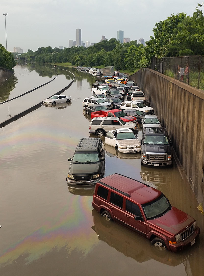
If you’re compiling a list of best photo spots for during or after another one of Houston’s every-dozen-years-or-so never-seen-anything-like-it flooding events, you’ll probably want to make room on it for the stretch of I-45 North between the N. Main St. and Patton St. exits. Back in 2001, images of cars and trucks floating along an insta-lake in this same spot made national news. And yesterday, pix of the automotive flotilla pictured above found their way to Facebook feeds and front pages around the globe.
But the low spot just north of Downtown wedged between Brooke Smith and the Near Northside was also a tough place to be when the water started rising, reports the Chronicle‘s Dane Schiller. Drivers found an early morning traffic jam in the rain changed nature quickly: “A surge was coming at them, squeezed by high barrier walls into the confines of the interstate. In less than 15 minutes, there was nothing to do but abandon ship.”
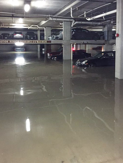
 A resident of the bayou-side North Montrose apartments at 2121 Allen Pkwy. now known as AMLI 2121 (and formerly as the Bel Air; see the pictured monument sign) has cataloged a few of the nicer cars that were likely totaled yesterday as they took on water in the lower level of the garage of the complex. Included: a Lexus IS250, a Nissan 370z, and an Audi A4.
The pop-up lake that appeared on Allen Parkway and the adjacent Buffalo Bayou Park has already subsided considerably, though underpasses are still filled with water. Liquid levels lowered in the garage too, which sits underneath the apartment structure, just east of Montrose Blvd.
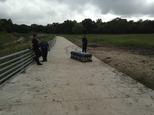
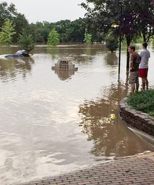
Photo of casket on Keegans Bayou hike and bike trail: KHOU
COMMENT OF THE DAY: WHERE THE HOUSTON PEAFOWL HANG  “Additional peacock groups: in the Rivercrest subdivision 77042 – approximately 1 block West of Gessner, North of Westheimer Rd., on the south ends of E. Rivercrest & W. Rivercrest. Access from Briar Forest Dr. one light north of Westheimer, use Gessner as access is blocked @ Westheimer; Also on the East side of Austin St., just north of Rosedale St., 77004 (north of the Children’s Museum, in the Binz District). Also, east of Dairy Ashford, north of Briar Forest Dr. — there are lakes tucked into the Ashford Forest subdivision and there’s a flock of Pea Fowl aka peacocks. I used to live in far North Harris County — near Hooks Airport on 100 acres, which had 12 peacocks- 1 female and 11 males. The mating ritual is hilarious.” [Padraig, commenting on New Vargos on the Lake Won’t Serve You Dinner, but You Can Cook in the Kitchen Yourself, and Stay a Whole Lot Longer] Illustration: Lulu

From earlier today: A series of drone’s-eye-views from above and around Allen Pkwy., just west of Downtown, surveying from high and low points above how the new Buffalo Bayou Park functioned in its latest role as a part-time retention basin. The still above, from Rakesh Agrawal’s later flights with a DJI Phantom 2 Quadcopter, shows the Houston Police Officers’ Memorial (at right) in its island guise. A couple more, pointed toward the Downtown skyline:
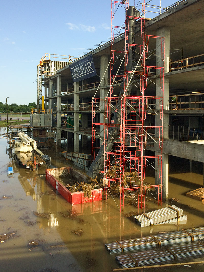
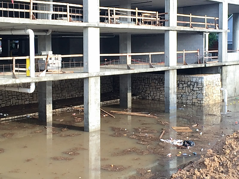
Future residents of Greystar’s Elan Heights: Do not fear high water. Sure, the Skylane Central on the same White Oak Bayou-fronting site regularly had floodwaters up to its second floor after rain events like this. But Woodland Heights renters at the Elan will be perched much higher than that, and not just for the Downtown views. Floodwaters will have to rise through 4 levels of concrete-framed parking garage to get to the 7 floors of steel-stud-framed apartments above. And the concrete structure’s bottom level doesn’t even count as parking.
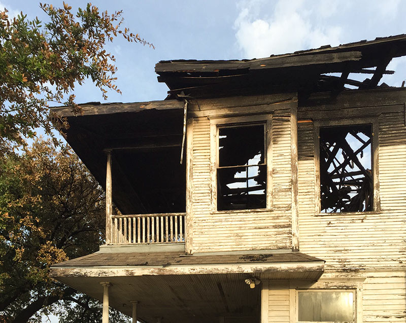 While much of the rest of Houston is recovering from — or still dealing with — high water after last night’s torrential rains, the long-vacant house at 116 Westheimer Rd. is showing off the scars it incurred from a disaster of a different sort. A fire raged through the structure Friday night.
The 1904 building is adjacent to the Jus’ Mac macaroni and cheese outlet in the 106 Westheimer strip center at the corner of Bagby St. A Swamplot reader sent in these photos showing the home as it appeared this morning:
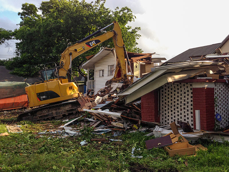
Swamplot’s Daily Demolition Report lists buildings that received City of Houston demolition permits the previous weekday city offices were open.
You’ll pry these house parts from my cold, dead, steel hands.
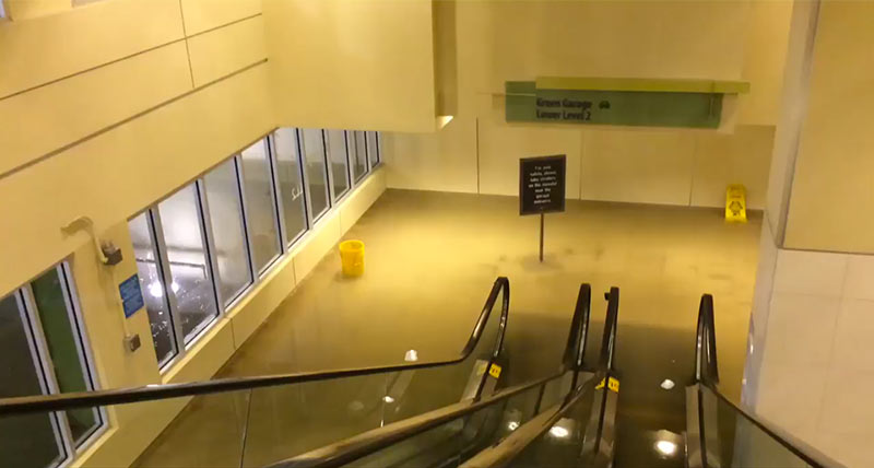
Photo of Galleria garage this morning: cheyne’ nechelle
And let’s not forget the true meaning of Memorial Day: to remember those who have fallen in service to us all. Swamplot will be back in action next Tuesday.
Photo of 2103 Crockett St.: Swamplot inbox
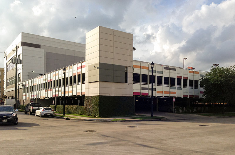
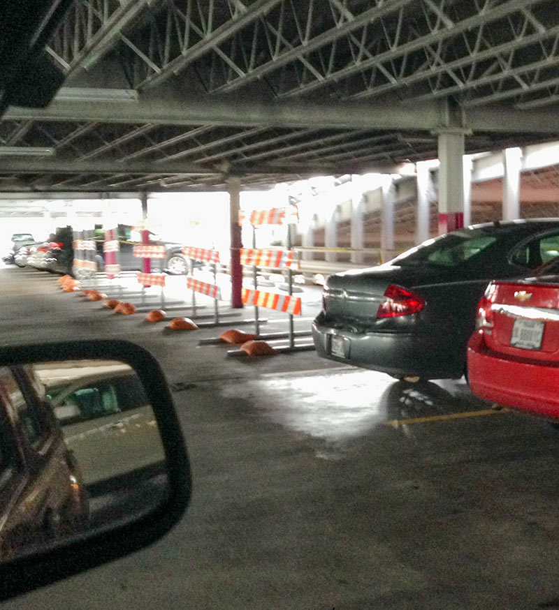 The parking garage behind the Mix at Midtown retail center between Louisiana and Milam south of Elgin St. is still in operation after last week’s fire, but photos sent to Swamplot yesterday from the scene show that the steel 3-level structure behind 24 Hour Fitness, Holley’s Seafood Restaurant, Piola, and other businesses facing Milam St. isn’t operating at capacity. At least a dozen parking spaces on the middle and top level are blocked off, noted as unsafe because of fire damage to the structure:


