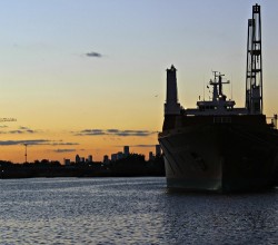
COMMENT OF THE DAY: WHAT MADE THE GEOGRAPHY THAT MADE HOUSTON  “Air conditioning had little to do with it. Chicago out-paced Houston because of its location as the geographic nexus of industrial transportation during the industrial revolution. It connected to the east through the Erie Canal and Great Lakes and to the west with the ever-growing railroads. A linchpin city grows. A growing city builds. Houston had no such geographic importance — and had a hurricane not made Galveston nonviable, Houston would probably still be a modest town. We had to build our port to earn any geographic value. It’s impressive that we did so. Houston shouldn’t exist. We made it exist. Now that’s cool.” [Matt, commenting on Comment of the Day: When Houston Chilled Out and Grew Up] Photo of Houston Ship Channel: Russell Hancock via Swamplot Flickr Pool
Tag: Port of Houston


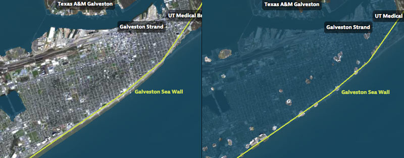
That’s Galveston Island going for a dip in the before-and-after captures above, from a set of interactive timelapse maps released by the Texas Tribune and ProPublica yesterday (along with several articles by authors Kiah Collier and Neena Satija). The new maps model flooding across the Houston region during Hurricane Ike — as well as what would have happened if Ike had actually hit just south of Houston, as meteorologists initially expected.
The maps are your chance to relive an old disaster, or to see how many of your neighbors you can take out with a hypothetical-but-not-unrealistic future storm: users can pick between Ike, south-er Ike, a storm 15% stronger than Ike (nicknamed Mighty Ike), and a modeled 500-year storm (which the article suggests may actually be a concern on the every-few-decades-or-so level; ‘500-year’ has always meant ‘a low probability in any year’, and climate change is shaking up old modeling assumptions). The graphics also include a few dramatic face-offs:Â Mighty Ike and the 500-year storm VS. 2 of the miles-long multi-billion-dollar coastal protection projects being studied for the upper Texas coast.
You can even search for your home address in the map system to see what flood levels might look like in your own back yard. Here’s what the maps show happening to the Clear Lake, Seabrook, and League City areas at the peak of the 500-year storm model’s storm surge, which the article says is a “not if, but when” event:
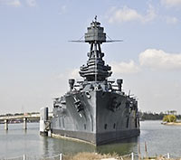
BATTLESHIP TEXAS BACK IN ACTION  The leaky ol’ boat is taking on a new role in national security: This week, it has become the training ground for a 6-ft.-long drug-sniffing robot tuna. A group out of Boston has designed the BIOSwimmer, described in the Sugar Land Sun as a “highly maneuverable, unmanned underwater vehicle that is equipped with a sophisticated suite of sensors.” Already having served dutifully in 2 world wars, the veteran ship is now helping to protect our ports: “The test team is planting packages of mock contraband of varying sizes in tight, hard-to-reach spaces on the battleship’s hull and putting the BIOSwimmer through the paces to see if it can successfully detect them.” [Sugar Land Sun; previously on Swamplot] Photo: Candace Garcia


Over in La Porte, a Bayside Terrace home has — a bay-side terrace. The waterfront property has a panoramic view of Upper Galveston Bay and its existing spill islands and wildlife refuge. And that vista just dodged a soggy bullet: On Wednesday the Port of Commission nixed a plan that would have placed a 475-acre island of sludge in the bay in the middle of it, built from material dug up from dredging at the Bayport Container Terminal in neighboring Shoreacres, near the Houston Yacht Club. (The dredging will go ahead, but the material go onto berms at Atkinson Island instead.)
PLENTY OF ROOM AT THE PORT Lots of space is available in Houston’s industrial soft spot — on the far east side of town: “A lot of developers built huge facilities on spec at the Port of Houston. However, with trade down due to the global slowdown, the Port is starting to feel some pain, too; as is the real estate that sprang up to serve it. Exports are falling off, while imports are going from ship, to intermodal, to the rest of the country rather than remaining in Houston warehouses. Added to the fact was that building was out of control in that area during the mid-2000s. ‘Three or four years ago, everyone wanted to be at the Port, so everyone put their buildings there,’ [Grubb & Ellis Senior Vice President John] Nicholson says. ‘It was crazy.’ The result is a lot of vacant product, especially warehouse space, in the far east submarket. Transwestern’s report puts the East-Southeast Far submarket at 13.5% vacancy, including sublet space. The total inventory in that area is 34 million square feet, with 1.8 million square feet under construction. The Grubb & Ellis numbers for East Southeast Far have 30 million square feet of inventory and a 20% vacancy. And all of Houston is hunkering into recession mode in the area of lease negotiation. Nicholson and [Transwestern managing director Brian K.] Gammill say short-term deals are more common, as are more free-rent concessions.” [Globe St.]
 John Nova Lomax chronicles another pedestrian adventure with drummer pal David Beebe in Houstoned—this time through desolate pockets of Houston’s East Side. Their potion-and-perspiration-soaked journey begins at the southern end of the Fifth Ward.
There, on the corner of Lyons Avenue and McKee, a dry-heaving stray dog in its death throes welcomed us to central Houston’s Chernobyl, a cursed warren of rusty train tracks, crumbling warehouses, and whole blocks that have reverted to wild coastal prairie.
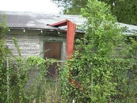
Ruins of an entire neighborhood molder back here – unpainted shotgun shacks collapsing in on themselves scattered around a blocky brick building that looked like it was once a bar or liquor store. It had been stripped of all metal fixtures by street urchins and cut off from the electrical grid, but a sign in the window indicated it was for sale. “Call Bob,†it said. And evidently it was not so long ago a place of some importance, as a street teamer for a rapper named Marcelo had plastered a few promo posters on its door.
Next stop: Clinton Dr., where the “rank stench” of the 69th Street Wastewater Treatment Plant guides their path.
Lord have mercy on Clinton Drive. Save for a couple of islands of activity like the huge fenced-in KBR headquarters (which is rumored to be for sale), Clinton is now little more than a decrepit strip of ruined factories, warehouses fast crumbling into rubble, and decaying 1950s office buildings with broken windows and mold-stained walls.
It reminded me of 19th Century British gadfly William Cobbett’s description of the village of Deal, Sussex: “Deal is a most villainous place. It is full of filthy looking people. Great desolation of abomination has been going on here; tremendous barracks, partly pulled down and partly tumbling down and partly occupied by soldiers. Everything seems upon the perish. I was glad to hurry along through it…â€
It wasn’t always such. From the Ship Channel’s opening until the advent of containerized shipping in the early ‘80s, Clinton and surrounding streets were bustling by day and by night, dotted with rice beer-soaked bars with names like the Cesspool, the Worker’s Bar, the Seafarer’s Retreat, the Mermaid Café, Tater’s Last Chance and Dottie’s Snug Harbor.
In those days, it could take a week to unload a cargo ship, and for much of that time, sailors were free to roam the port, dine in the restaurants, carouse in the bars, and find companionship where they may. The same went for the thousands of shore-based workers – the mechanics, channel pilots, stevedores, and tug boat crews.
Neighborhood on the waterfront: Coulda been a contender.
- The East End Trek [Houstoned]
Photo: David Beebe and John Nova Lomax

