Articles by

Christine Gerbode

01/30/17 1:45pm

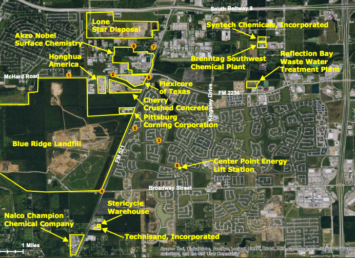
Map of TCEQ Shadow Creek Ranch study area

The city of Pearland’s Odor Task Force is hosting a meeting on February 8th to give some updates on the saga of the Shadow Creek Ranch stench, the Chronicle‘s Margaret Kadifa reports. The map above shows industrial sites noted by the TCEQ in the vicinity of the master-planned community during the environmental agency’s long-running search for the source of the odor. Early last summer the come-and-go smell was finally officially linked to emissions from the slowly rising Blue Ridge Landfill, which sits across FM 521 from the subdivision, just outside the Pearland border in Fresno, TX. The agency says that 81 investigations had been launched in response to more than 1,900 complaints from the neighborhood, as of January 1st; TCEQ started sending enforcement letters to the landfill in October, and a class action lawsuit on behalf of area residents was filed in November.

Map of industrial sites and air sampling locations around Shadow Creek Ranch: TCEQ

Blue Ridge Mountains
01/30/17 11:30am

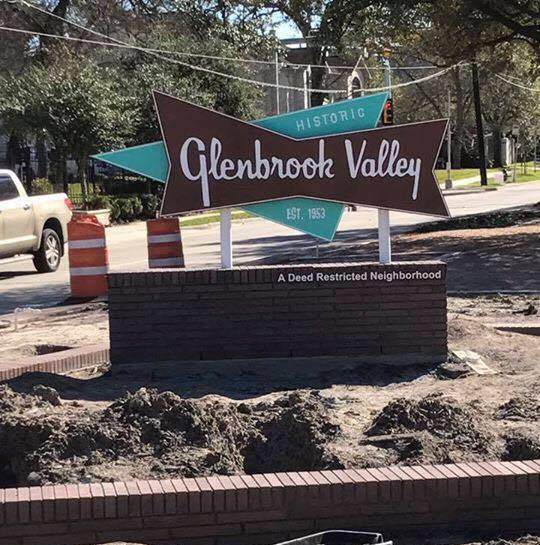
Glenbrook Valley neighborhood signage, Glenbrook Valley, Houston, 77061

Glenbrook Valley neighborhood signage ca. 1956, Glenbrook Valley, Houston, 77061The retro Glenbrook Valley neighborhood entry sign above is now standing on Broadway St. north of the intersection with Santa Elena St., Robert Searcy notes. The neighborhood civic club’s new Mod marker echoes one that stood in the area shortly after the subdivision’s early 1950s founding (shown here in a black and white excerpt from a brochure for the 1956 Parade of Homes tour) and replaces the much more rectilinear sign long planted in about the same spot. The new sign’s cursive also mimics the throwback style of the script on the nearby Glenbrook Valley Apartments on Bellfort St.:

CONTINUE READING THIS STORY

Pregaming on Broadway St.
01/27/17 3:00pm

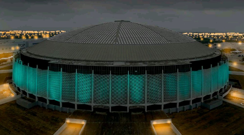
Astrodome Super Bowl Lighting Rendering
 
After a few years of mulling it over, the Texas Historical Commission voted this morning to give State Antiquities Landmark status to the Astrodome (formally known, the agency notes, as the Harris County Domed Stadium). About a dozen Houston buildings have the designation (which can also go to shipwrecks and archaeological sites); the status means that any attempts to “remove, alter, damage, salvage, or excavate” the Dome — a spread of activity which probably includes installing that parking garage in the bottom — will now also need a permit from the state. 

THC’s Executive Director Mark Wolfe says in this morning’s statement that the Dome is “one of the most significant sports and entertainment venues in history, setting the standard for modern facilities around the world.” The structure will continue adding to its sports resume during the impending Super Bowl week by storing Super Bowl-related things and being lit up nearby (as rendered above).

CONTINUE READING THIS STORY

Under State Protection
01/27/17 12:30pm

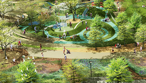
Rendering of Levy Park, 3801 Eastside St. at Richmond Ave., Upper Kirby, Houston

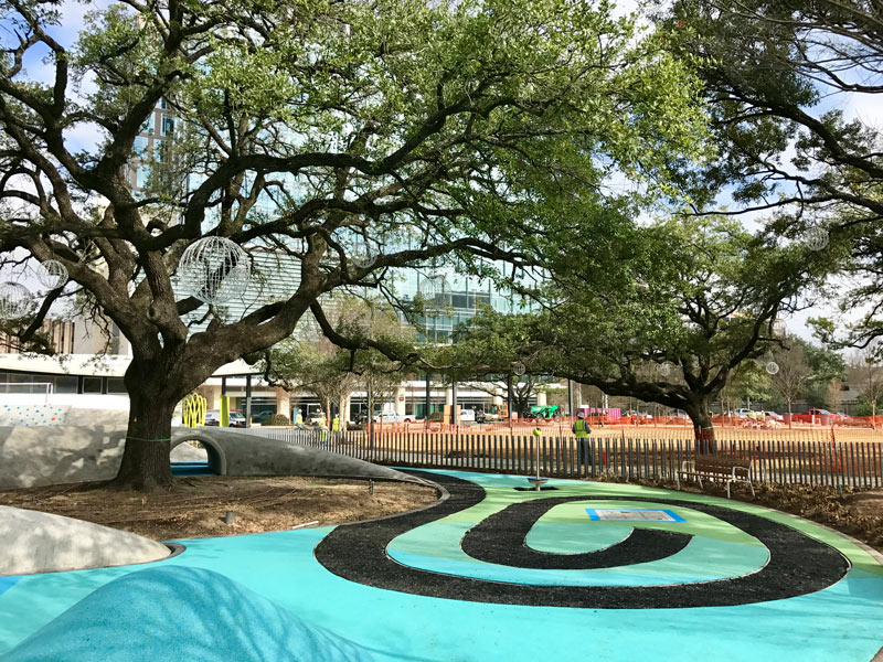
Levy Park, 3801 Eastside St., Upper Kirby/Greenway Plaza, Houston, TX 77098
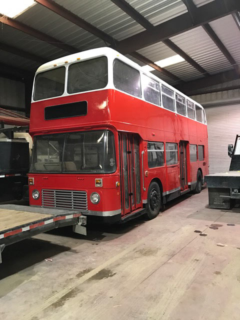
Levy Park, 3801 Eastside St., Upper Kirby/Greenway Plaza, Houston, TX 77098The new swirls and swoops around Levy Park are starting to look more like those previously released renderings of the space’s total facelift, as a planned February 25th reopening date draws near. The Levy Park Conservancy is throwing an opening party that day, including art performances, workshops, gardening demos, and piano music (presumably from the moveable park piano.) The group sends along some photos of the increasingly colorful construction site, from the spiraling walking path both pictured and rendered above, to the repurposed double-decker bus that’ll eventually sit alongside the park’s main open greenspace to tend a beer garden. The bus previously made an appearance in this rendering of the lumpy triangular dog park:

CONTINUE READING THIS STORY

Sprouting in Kirby Grove
01/27/17 9:30am

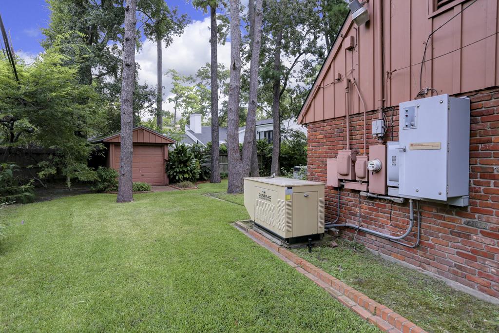
DECADES-OLD JIMMY’S ICE HOUSE ON WHITE OAK DR. TO TURN BRAUN, CHANGE NAME, TENANTS Jimmy's Ice House, 2803 White Oak Dr., Houston Heights, Houston, 77007 The current owners of Jimmy’s Ice House at the corner of White Oak Dr. and Threlkeld St. are in the middle of working out a sales agreement with serial redeveloper Braun Enterprises, Jim Reynolds reports this week. The late eponymous Jimmie Murray opened the place back in the late 1940s; the bar is currently owned by a group including Jimmie’s son’s widow. Current co-owner Eric Quinn says the likely plan is for Braun to lease the space out to a new tenant, who definitely won’t use the Jimmy’s Ice House name; he also notes that various grandfathered building code violations mean remodeling may be prohibitively expensive. Jimmy’s Ice House sits across Threlkeld from the Studewood BB’s Cafe, and across White Oak Dr. from the South Heights Retail Center, near both Fitzgerald’s and Christian’s Tailgate. The -ie to -y swap looks to have happened around the time the current owners bought the place in 2008, as part of the signage switch from Jimmie’s Place. [The Leader] Photo of Jimmy’s Ice House at 2803 White Oak Dr.: David Richmond/Houston Ice House
01/26/17 1:45pm

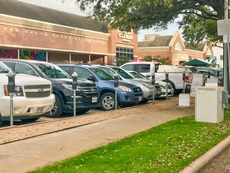
Rice Village parking meters, Morningside Dr. at University Blvd., Rice Village, Houston, 77005

The latest edits to the Rice Village area’s look include the installation of the above parking meters for the spaces along Morningside Dr., as captured by a reader this morning. The Rice Village District folks announced in January that the formerly free spots around shopping complex will become pay spots in February. There will still be free parking in the area, for those who watch the clock: parking in the garage between Morningside and Kelvin St. and on the rooftop lot on across Kelvin will be free for the first 2 hours.

The changes appear to fall in line with some of the suggestions made in a 2015 Kinder Institute report on the area’s parking congestion and access inefficiencies; the authors noted at the time that the shopping district always had at least 1,000 unused parking spots even at times when parking seemed hardest to find (like during the peak of the weekday lunch rush).

The to-be-metered zones are marked in light blue in the map below; those zones include the spaces around the former Village Arcade structures between Kirby Dr. and Morningside along University, as well as parts of Times and Rice boulevards and parts of Amherst St.:

CONTINUE READING THIS STORY

Spot Spotting
01/26/17 11:15am

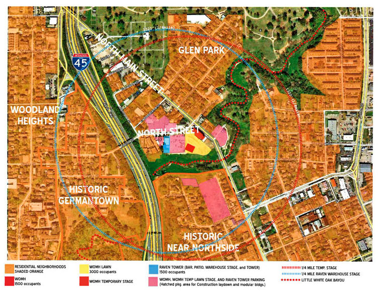
WHITE OAK MUSIC HALL’S OUTDOOR SOUNDMAKING CAPPED UNTIL TRIAL IN MAY White Oak Music Hall Lawsuit Map, Near NorthsideThe judge judging the lawsuit filed by some Near Northside residents against White Oak Music Hall has issued another temporary injunction this week, this time limiting the venue to no more than 2 events on the venue’s outdoor Lawn area between now and May 15th, according to a document filed with the county clerk’s office. That means the Pixies show recently announced for April will still happen as planned (though the venue will have to pay for sound monitoring to prove they’re not passing city decibel limits, or cranking up the bass more than the order allows). Chris Gray writes that outdoor shows at the Raven Tower aren’t affected, as long as they comply with the volume and vibration metrics; a press release from the venue says all the indoor shows at both venues are still on as well. [Houston Press; previously on Swamplot] Image of map submitted in Theresa Cavin et al v. White Oak Events, LLC: Harris County District Clerk’s office

01/25/17 5:30pm

Metro Red Line, University of Houston Downtown, Downtown, 77002

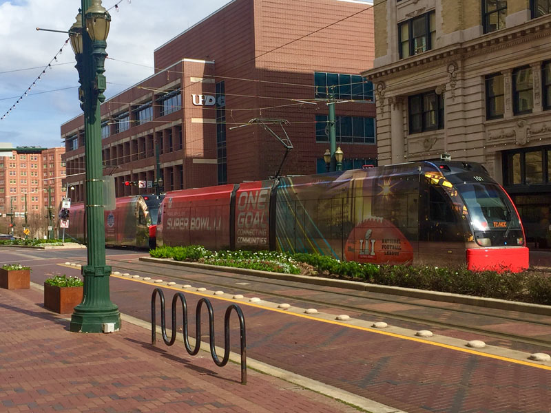
On the growing list of things getting dressed up for the Super Bowl: this Red Line light-rail train, caught above at the corner of Main and Franklin streets this afternoon wearing a shiny new red-and-stadium-colored suit. Buildings around the Discovery Green and George R. Brown Convention Center complex have also been getting advertising wraps draped in place in the past week or 2, as have a few other buildings around town (including the BBVA Compass building near the Galleria). Across the intersection, a reader also noted the installation of new security cameras at the Islamic Da’wah Center, founded after former Rocket Hakeem Olajuwon bought the 1928 former Houston National Bank building in 1994:

CONTINUE READING THIS STORY

Downtown Prep
01/25/17 4:00pm

Astrodome Super Bowl Lighting Rendering

Judge Emmett’s office passes along the rendering above today, showing plans for the Astrodome’s Super Bowl vestment — namely, a new swath of blue-green lighting around the stadium’s exterior wall. That proposed projected light show on the roof got shot down in the fall, along with the possibility of holding any events in the building; Brent Schrotenboer of USAtoday notes the Dome currently holds the distinction of “biggest and most famous storage facility in Texas,” however, and as such will be carrying out its related stuff-holding duties for a variety of Super Bowl lead-up events. 

Rendering of Astrodome Super Bowl lighting: Super Bowl Host Committee

Local Color
01/25/17 10:15am

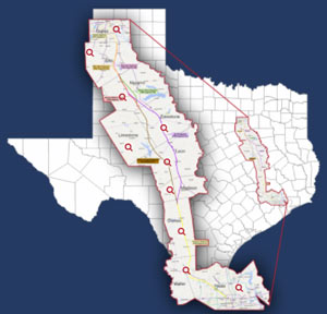
HOUSTON-DALLAS BULLET TRAIN SHOWS UP ON TRUMP INFRASTRUCTURE PROJECT LIST Proposed High Speed Rail Routes MapThe already-in-lawsuit-phase Dallas-to-Houston high-speed rail project is number 13 on a list of 50 “Emergency & National Security Projects” floated around by the Trump transition folks, according to a report from McClatchy and the Kansas City Star (which posted the document online this week). The list looks closely related to one sent out by the team to the National Governor’s Association late last year, soliciting other ideas for projects that a hypothetical future investment program might target for funding; the bullet train project shows up only on the more detailed version of the list (which could be just another draft). Both versions of the list include the Cotton Belt Line commuter rail project, which would connect Dallas-Fort Worth International Airport to Plano. [McClatchyDC via Texas Tribune; previously on Swamplot] Map of proposed high-speed rail routes: Texas Central

01/24/17 4:00pm

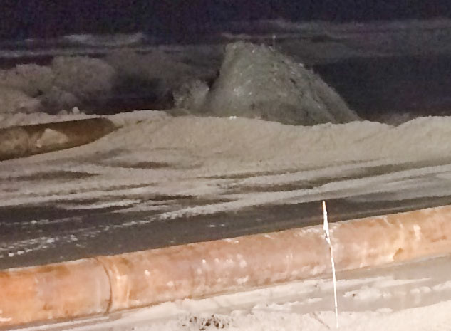
Galveston Beach Sand Addition, January 2017

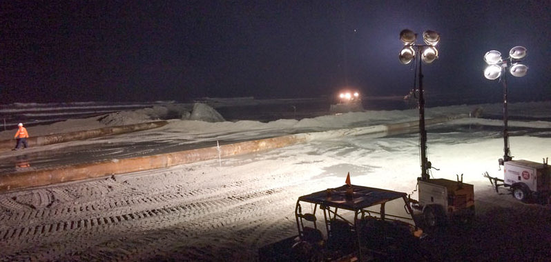
Galveston Beach Sand Addition, January 2017The shot above captures the Saturday night scene along the Galveston seawall southwest of Stewart Beach, where bulldozers were pushing around the gush of sand and water being piped in as part of the latest round of beach building on the island. The crews were still at it around 9 pm; the shot below shows the Pleasure Pier over-water amusement park still lit up in the distance to the west:

CONTINUE READING THIS STORY

Seawall Spread
01/24/17 1:45pm

COMMENT OF THE DAY: WATER BORDER PROS AND CONS Find Your Watershed map, 2016“Abolishing arbitrarily-bounded entities with taxing powers like the HCFCD and instead creating entities that are specific to individual watersheds seems like it might make some sense. I do worry that certain areas, especially less affluent ones, would suffer from poor or corrupt leadership; and you can’t simply merge watersheds as the T.E.A. would merge school districts. However, that’d certainly be more democratic and accountable. That’s a trade-off which might be worth making.” [TheNiche, commenting on Group Petitions for 13-County Flood Planning] Watershed boundaries superimposed across Houston-area county boundaries: Galveston Bay Foundation and Houston Area Research Council’s Find Your Watershed map