 The headline suggestion in a 6-page policy paper published last week under the banner of Rice University’s Baker Institute comes in item 2 of a helpfully numbered list of 15 things Houston might want to do or think about to make future never-seen-this-before flooding events a little less catastrophic: Author Jim Blackburn, an environmental attorney, pioneering Houston-area naturalist, and longtime let’s-not-flood advocate, proposes a “fair but extensive home buyout and removal program” targeted at homes that have been flooded 3 or more times since Tropical Storm Allison in 2001: “It is unlikely we can develop strategies to protect them from severe rainfall events that are much more frequent than labels such as ‘100-year’ or even ‘500-year’ rainfall events suggest,’ he writes.
Among the less radical proposals put forward in his list is the suggestion to map and categorize the Houston region by its propensity to flood: “safe” areas that didn’t flood — and should therefore become “the backbone of the Houston of Tomorrow” — “transitional” areas (only “single-event” flooding); and “buyout” areas — which can be targeted for parks and “future green infrastructure.”
Other ideas and issues from the paper that Blackburn hopes will “initiate a conversation” are summarized here:


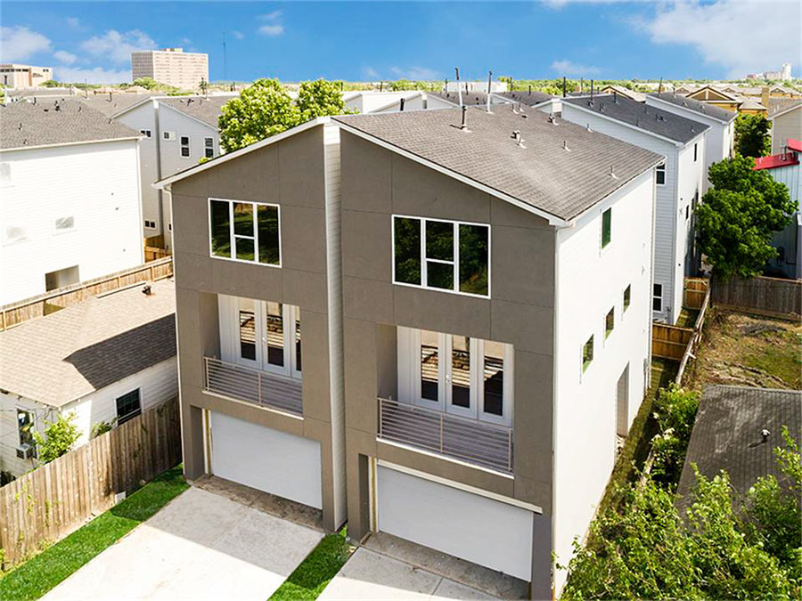 “The City of Houston’s codes are different for a ‘free-standing’ or ‘detached’ ‘single-family’ home, as opposed to a two- or multi-family property of some sort. Detention, lot coverage, building code, legal description, all different. So maintaining even the tiniest gap means you have a fee-simple, stand-alone property.” [
 Homeowners in the area would be wise to keep a keen eye as to the elevation of the current Fiesta property, document with photos and watch as the builders elevate the ground of the property two or more feet above existing grade. This elevation of property will push water off the commercial property and onto lower lying homeowners and existing small businesses. I attended a talk this week with a flooding expert from Texas A and M who pinpointed development as the primary driving cause of Houston’s flooding. This was a highly intelligent and well regarded college professor and researcher. He says he gets phone calls from first time flood victims and always asks if anything was recently built in the area. Often they will say that a Wal-Mart or something similar was built immediately before their flooding problem started. This is real, everyone. Document your lawsuit evidence today.” [
 “If you attend a TIRZ meeting at 8:00 AM on a Friday morning, you will realize the distrust and dissent that the TIRZ has created in a once cohesive community. As the meeting convenes, you can hear the roar of the cement truck in the background, covering every square foot of the TIRZ district with parking garages and multistory apartments. And where is the detention for all this impervious surface? The storm water runoff is detained in the residential streets and private homes of the surrounding neighborhoods. Just try signing up for the Public Comment period. Your 2 minutes disappear as the Chair detects an speaker unsympathetic to the TIRZ and cuts the mike. Your questions are not answered, so you try again, this time with an Open Records Request. Now you meet the TIRZ lawyers, plural, a sassy bunch, who can look you in the face and say with impunity that the record does not exist. It was just a typo.” [
“If you attend a TIRZ meeting at 8:00 AM on a Friday morning, you will realize the distrust and dissent that the TIRZ has created in a once cohesive community. As the meeting convenes, you can hear the roar of the cement truck in the background, covering every square foot of the TIRZ district with parking garages and multistory apartments. And where is the detention for all this impervious surface? The storm water runoff is detained in the residential streets and private homes of the surrounding neighborhoods. Just try signing up for the Public Comment period. Your 2Â minutes disappear as the Chair detects an speaker unsympathetic to the TIRZ and cuts the mike. Your questions are not answered, so you try again, this time with an Open Records Request. Now you meet the TIRZ lawyers, plural, a sassy bunch, who can look you in the face and say with impunity that the record does not exist. It was just a typo.” [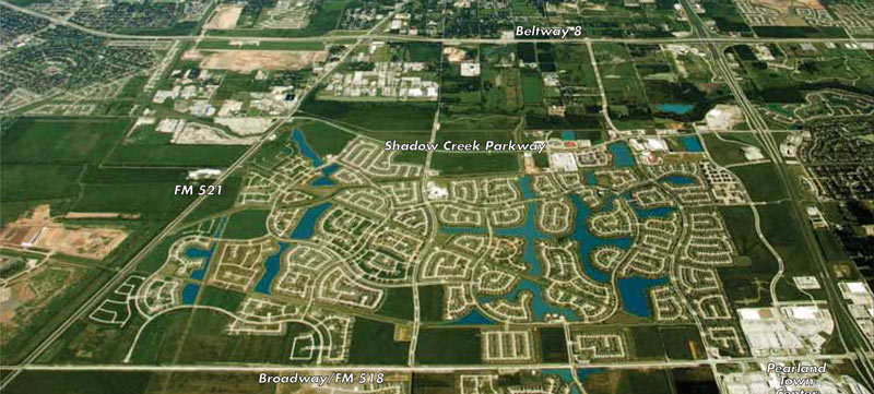
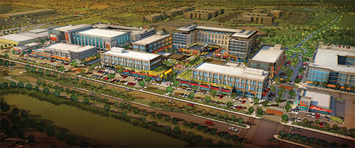
 “Someone needs to name the cycle of excitement and disappointment of watching new construction in Houston. The cycle begins with confusion over demo of a current structure, then rising excitement in anticipation of something new and novel, a small dip when you see what is being built looks like a generic suburban building, and the ultimate disappointment and resignation when you find out it is . . . an Olive Garden.” [
 “. . . That is, and always has been, Houston. That unruly sprawl, those cookie-cutter suburbs, generic strip malls, traffic congestion, that all existed long before the Beltway was built. I grew up here, in a cookie-cutter suburb called ‘Sagemont’ located next to a 2 lane stretch of blacktop named ‘South Belt.’ My dad grew up in a cookie-cutter suburb 10 miles closer in, filled with generic strip malls, just outside what would become the 610 Loop. Today I live in another cookie-cutter suburb farther west, about half way between 610 and the Beltway. Still lots of congestion, sprawl, strip centers, etc. This is Houston, baby.
And just about everything in Houston exists because some powerful person (not necessarily a politician) owned tracts of land. All of those hip dense neighborhoods? They were empty fields that some speculator bought for next to nothing, then bribed . . . er, influenced someone in government to build something, often with tax dollars. That’s how things get done.” [
 Here’s a freshly baked city-development paradigm that’s a pretty good, but imperfect match for Houston, writes Christopher Andrews: “Houston’s inner core, at least that area within the I-610 loop, predominantly west of I-45, makes up most of the ‘new donut’ downtown area, even though Houston’s currently gentrifying and historically vibrant neighborhoods lie just outside of its downtown district. Our ‘Inner Suburbs and Inner Core’ portion of Houston (think Alief, Sharpstown, Southwest and Southeast Houston, Northside, Acres Homes) is continuing to age, and is evidenced when we look at home sale prices. Naturally, then the newer homes in the ‘Collar Counties’ (think Sugarland, Cinco Ranch, The Woodlands, Kingwood) attract families and professionals looking for new housing. That comprises Houston’s ‘new donut’ paradigm.” Why stop there? There are scone and English muffin models to consider too. But which breakfast item best describes the shape of the city? “While I love donuts, I like bagels too,” Andrews writes. “