12/04/15 9:15am

Wildcat Golf Club, 12000 Almeda Rd., Pierce Junction, Houston

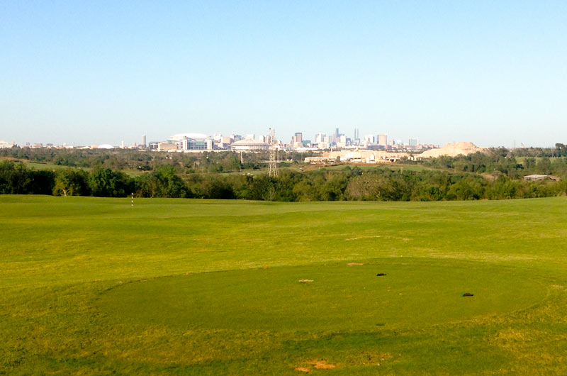
Looking for an overview of the new site of UT’s recently-announced Houston campus? Your best bet may be to stop in at the Wildcat Golf Club, located directly across Holmes Rd. from the site of UT’s planned purchase. Native Houstonians may experience a touch of vertigo trekking up the club’s grassy peaks to catch the view of NRG Park and downtown (see above) — hills on the site reach more than 115 feet above sea level in places. (Downtown, for comparison, stands at roughly 50 feet, and the big hill at Miller Outdoor Theater tops out around 65.)

The golf club’s topography is a byproduct of its original gig as a major municipal landfill, operating for nearly two decades until 1989; clay and topsoil were imported to sculpt the waste heaps into today’s smoothly rolling hills and water features:

CONTINUE READING THIS STORY

Houston Hill Country
12/01/15 10:00am

UT Houston Campus Site, Buffalo Lakes, Houston

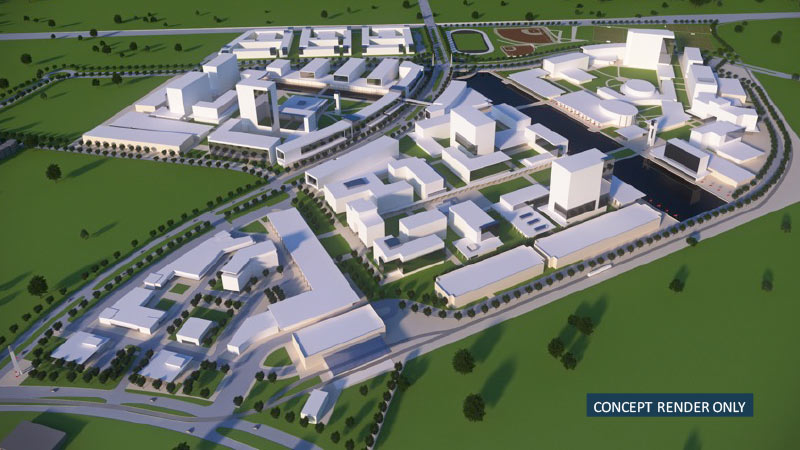
Some zoomy conceptual renderings of the University of Texas’s coming Houston campus, centered on the largely undeveloped intersection of Buffalo Spdwy. and Willowbend Blvd., made their debut at last month’s Board of Regents meeting, where the intended purchase of land for the project was announced. Buffalo Spdwy. gently winds through the drawings of the new campus to a track and several baseball diamonds along Holmes Rd. (which runs horizontally across the top of the image above).

Although the images are only “concepts”, the pictures do provide a sense of how the campus might unfold: For example, that linear water feature shown at the center of the campus aligns with an existing drainage ditch on the property, and the 3 long, low structures in the foreground are good candidates for parking garages, which will be needed regardless of the new institution’s yet-to-be-decided purpose.

Existing residential communities and industrial parks are here rendered as sparsely-treed fields — the boundary of the land slated for purchase by UT currently houses several apartment complexes on the north side and the Orkin Industrial Surplus facility to the south.

But another conceptual rendering (this one looking northwest across Holmes Rd. towards the distant Williams Tower) shows the campus in place amongst some of its eclectic neighbors:

CONTINUE READING THIS STORY

Welcome to the neighborhood
01/03/13 1:30pm

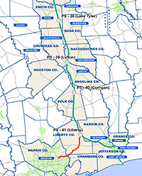
UP IN THE PINES TO STOP THE KEYSTONE XL PIPELINE Three hours north of Houston in Cherokee County, reports Brantley Hargrove, protesters interfering with a 485-mile section of TransCanada pipeline being built to carry diluted bitumen south to refineries on the Gulf Coast faced some resistance of their own: “[An] 18-wheeler bearing a cherry picker to pluck protesters out of trees slowed as it approached a shouting, sign-wielding crowd. Several young men leaped in its path. One fell beneath the truck. The others screamed and pounded the hood with their fists. A deputy rounded the front of the truck and drove the protesters back, loosing clouds of pepper spray. [A 75-year-old woman], standing off to the side of the road, caught a gust of the burning mist.” Separately, TransCanada’s website notes its plans for the Houston Lateral Project (shown in red on the map), a 47-mile spur that will come close to Beltway 8. [Houston Press; Gulf Coast Project] Map: TransCanada

09/21/09 1:21pm

COMMENT OF THE DAY: WHAT LIES BENEATH “. . . roads go over top of petroleum pipelines all the time with an agreement & bond to protect them. Citie$, countie$ and large entitie$ do it all the time. The whole of the Woodlands Town Center, including the regional mall there, is built atop a pipeline, which runs alongside the foundation of the Anadarko Tower. Even Lake Robbins, though it’s not at all deep, is on top!” [movocelot, commenting on Comment of the Day: Where the Townhomes Ain’t]