COMMENT OF THE DAY: WHAT OUT-OF-TOWN REPORTERS DON’T UNDERSTAND ABOUT HOUSTON-AREA DEVELOPMENT REGULATIONS  “. . . I must LOL whenever I see one of these articles blaming our flooding on our lack of zoning, and as an example of our lack of zoning, the article will show some subdivision in Sugar Land or Katy. Last time I checked, neither of those places are inside the city limits of Houston. Also, don’t those subdivisions have zoning up the ying yang? . . .” [XCellKen, commenting on Harvey’s Record Rainfall; Crosby Plant Explosion Risk; A Ponderosa Forest Boat Ride] Illustration: Lulu
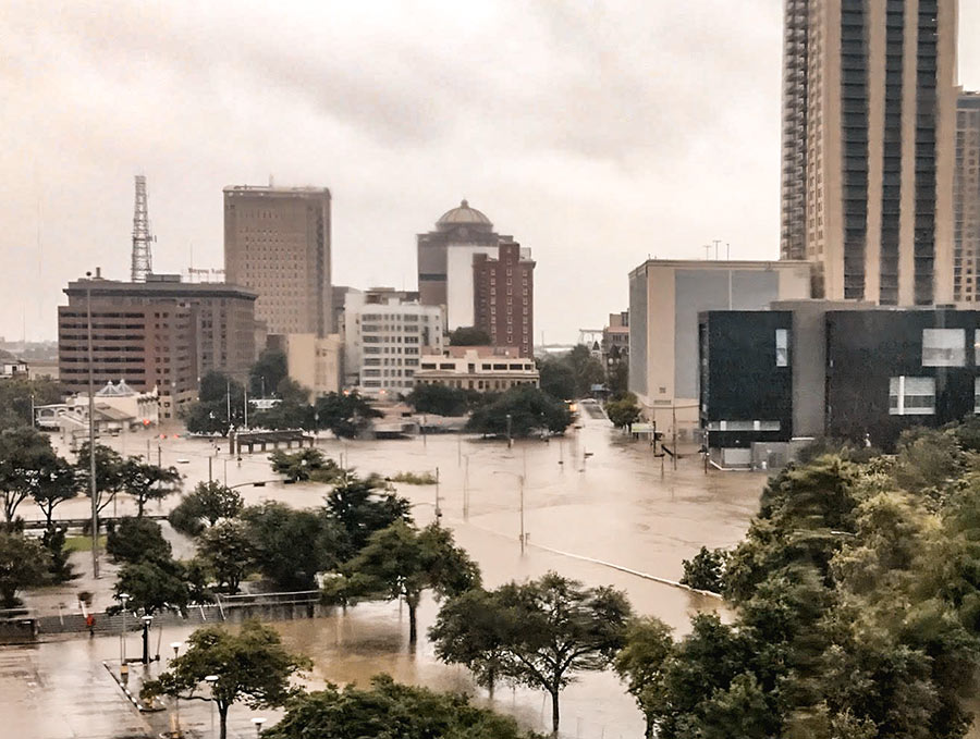
City Hall, the City Hall Annex, the Bayou Lofts, Market Square Tower, The Rice (formerly the Rice Hotel), Hogg Palace, the Theater District and Tranquillity Park parking garages, Bayou Place, the Downtown Aquarium, the Houston Ballet Center, the Wortham Theater Center, Jones Hall, the Alley Theatre, the Hobby Center, and the some of the historic homes in Sam Houston Park are all buildings that were damaged in some way by floodwaters rolling in after Hurricane Harvey’s days-long assault on the city, according to a statement released by the Downtown District today. Damage mostly came from water pouring into first-level or basement spaces, though the building at 1415 Fannin St. did catch on fire.
High water flowed to Downtown’s low points, to the north and west — primarily in the Warehouse, Historic, and Theater Districts. How did the tunnels fare? Only sections adjacent to the Theater District and Civic Center garages were damaged, according to the district.
Other structures that took on water: The Spaghetti Warehouse, the new AIA Houston offices under construction across from that restaurant on Commerce St., the Sunset Coffee Building, the Dakota Lofts, and the Cotton Exchange Building on Travis St. Here’s the complete list (with addresses):
STUFF YOU PROBABLY SHOULD KNOW ABOUT THE ADDICKS AND BARKER RESERVOIRS 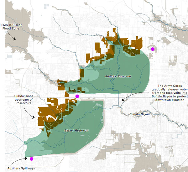 Lived in Houston for years but still coming up to speed on how the Addicks and Barker dams are supposed to work — just as the reservoirs reach to their highest-ever levels? This brief explainer from Kiah Collier and Neena Satija of The Texas Tribune Al Shaw and Lisa Song of ProPublica should overfill you with info: “As of now, the Army Corps says there’s enough excess water in the reservoirs that some of it will flow around (not overtop) these auxiliary spillways. . . . The Army Corps can’t say exactly what areas might experience additional flooding, but local officials listed 53 subdivisions in the Addicks watershed and 40 in the Barker watershed (shown in brown in the map above) at high risk of flooding. Jeremy Justice, a hydrologic analyst at the Harris County Flood Control District, said two subdivisions near the Addicks reservoir—Twin Lakes and Lakes On Eldridge—are particularly vulnerable to flooding from the Addicks spillway. Those homes ‘probably should never have been put there,‘ he said.” Thousands of homes around the reservoirs have now flooded — some because they’re close to rising bayous, and some because of bad neighborhood drainage, they write. “But many are flooding because they are in an area that the Army Corps actually considers to be inside the reservoirs. (See map.)” [Texas Tribune; ProPublica version with links; previously on Swamplot] Map: ProPublica
Here’s another helpful online tool from the civic hackers at Sketch City, this one for would-be volunteers: a crowdsourced, interactive map showing which shelters near you are in need of what resources — and which ones might need people to come over and help out. Each icon on the map represents a shelter or providing organization that’s helping evacuees who’ve been put out of their homes by Harvey flooding. Click on one and a panel on the left will indicate any supply needs or volunteer needs identified by the site. (A larger, full-browser-width version of the map is here.)
The map was put together by Amanda Shih, Dr. Neeraj Tandon, and Chris Ertel, and is linked to data assembled and continually updated by a group of dozens of local and not-so-local volunteers hooked up to the project by Sketch City, a Houston nonprofit technology group. (The same bank of is behind Sketch City’s other new mapping project — one that simply identifies available Harvey shelters to people seeking them.) The volunteers have been making regular phone calls to update the information in a shared Google Doc. (If that kind of call-and-type-from-home work is your preferred method of volunteering, go ahead — you’ll find a direct link to the underlying spreadsheet in the map.)
- Harvey Needs [Sketch City on Github]
- Previously on Swamplot: The Quickest Way To Find the Nearest Hurricane Harvey Shelter That Isn’t Already Full
Here’s a crowdsourced, interactive map showing more than 180 shelters and shelter-ish locations set up in the last few days to take in evacuees separated from soggy homes as a result of Harvey flooding. Most of the indicated locations are in the Houston area, but others farther afield have been added (and are welcome) as well.
To use the map, you’ll first want to click on the icon just below the top left corner to toggle off the legend. Then you can zoom in or out or pan around, and click directly on each location to read details — such as the address, phone number, whether there’s room for more people, and how recently the information has been updated. You can access a larger version of the map directly by going to houstonsheltermap.com.
If the map provides more info than you need right now, there’s an easier way to find the closest shelter to you that’s still accepting newcomers: Just text your Zip Code (the one where you are; it doesn’t have to be your home address) to 346-214-0739. It’s set up to text you back the location of the nearest open hurricane shelter.
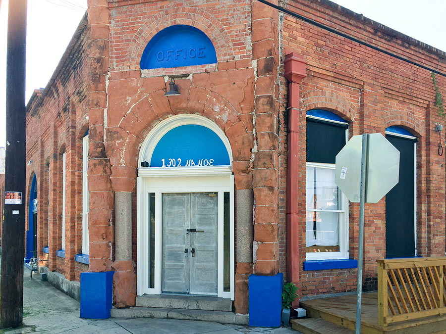
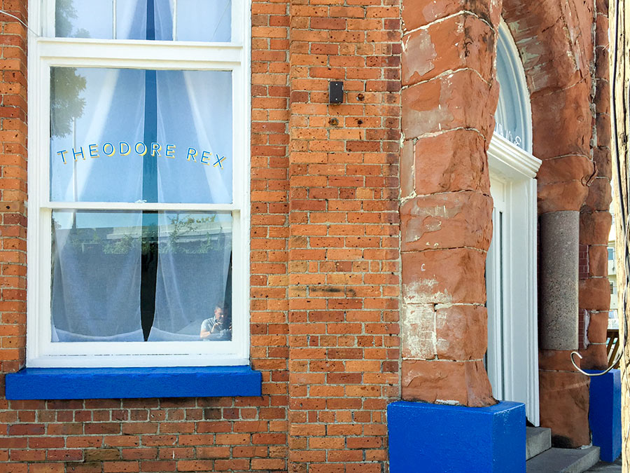
Just days before Harvey hit Houston, the newest corner restaurant at 1302 Nance St. in Downtown’s old warehouse district looked ready to debut. The photos here, taken by Swamplot reader Will Breaux shortly before the rains came and the waters swelled, show the spot formerly occupied by Oxheart sporting a new exterior paint job and window nameplate.
Inside, renovations had been taking place for months. Proprietor Justin Yu had plans to open Theodore Rex later in August. But the restaurant flooded. Now, he writes, “it might take a little more time to open.”
- Justin Yu’s Theodore Rex Sustains Flood Damage In Hurricane Harvey Flooding [Eater Houston]
- Justin Yu Could Debut Theodore Rex By the End of the Month [Eater Houston]
- Previously on Swamplot:Â Justin Yu To Close Oxheart, Spend Some Time in the Heights;Â Dharma Cafe to Ray’s Franks to Latin Bites to Oxheart
Photos:Â Will Breaux
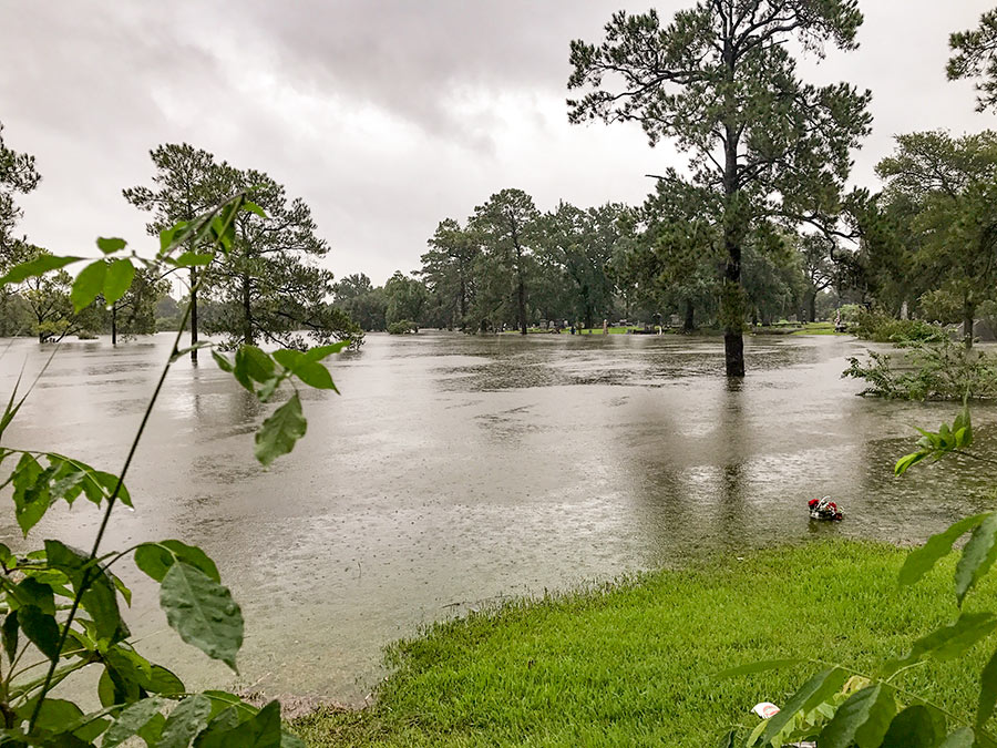
“If you don’t know that’s a big dip,” reports a reader who scouted the scene of the impromptu lake formed over the weekend on the lawn of the Near Northside’s Hollywood Cemetery, “you don’t appreciate just how much water that is.” The cemetery lies between Little White Oak Bayou and I-45, along the northeast edge of N. Main St. The water level has lowered a bit since these photos were taken on Sunday. Do note the bouquet, presumably perched above one of the completely submerged gravestones, in the right foreground of the view above.
More views of Lake Hollywood:
HARVEY UPSTAGES HARVEY 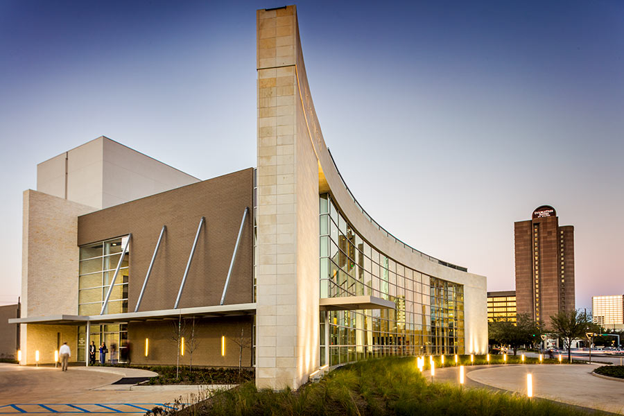 The A.D. Players‘ new 450-seat Jeannette and L.M. George Theater at 5420 Westheimer just west of the Galleria, which opened earlier this year, “has stood the storm well,” its operators report today on Facebook. But not so much the very first set of shows in the resident theater company’s new season: Because of Hurricane Harvey’s devastation, a production of Mary Chase’s 1945 Pulitzer Prize-winning play about a 6-ft., 3-and-a-half-in.-tall invisible rabbit named Harvey (scheduled to begin a 3-and-a-half-week run on September 8th) has been put off — for a while, at least: “Harvey the storm has not been our friend. ‘Harvey’ the show will go on — more details to come,” reads a note posted by the theater last night. “When it does, we want it to be a lighthearted lift to our beloved community, which has suffered so much in just a few short days.” The theater company began planning its production of Harvey months ago, but says it had been promoting the production “in earnest” for only a little more than a week. [A.D. Players] Photo of George Theater: A.D. Players
The map above outlines the actual locations of neighborhoods designated by officials yesterday as being at risk from flooding over the back sides of Houston’s dual Buffalo Bayou reservoirs — in advance of actual spillovers, which began last night and continued this morning. The map was put together by Chronicle data reporter John D. Harden, using information from the Harris County Flood Control District. Zoom in and you can identify specific streets and neighborhoods on the upstream side of Addicks (in red) and Barker (in blue) reservoirs.
Names of the affected neighborhoods are listed on the map’s fly-out panel, available by clicking on the icon at the top left corner of the map. Click on the icon at the top right corner to enlarge the map if you need to.
To lessen the risk of flooding to these areas, officials have been releasing water out the other end, through the Addicks and Barker dams into Buffalo Bayou — possibly (depending on bayou water levels) endangering neighborhoods and structures downstream.
- A weary Houston likely to endure catastrophic flooding through Wednesday [Houston Chronicle]
- Officials fear rising rivers, failing levees [Houston Chronicle]
Map: Houston Chronicle
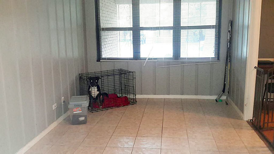
- 3419 Linkwood Dr. [HAR]
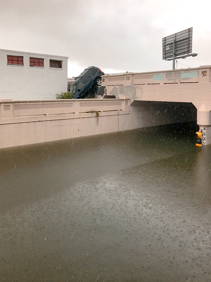
Water levels from Harvey have made the underpass just north of Center St., where Houston Ave. tucks under the rail lines, impassable. But there are consequences to trying to drive around the underpass structure, as this photo taken yesterday afternoon by a Swamplot reader attests: The ground drops off sharply on the south side of the tracks to the west of the street, and that’s not so easy to see if you’re driving south.
Photo: Kelsie H. Dos Santos
WHERE SWAMPLOT READERS CAN CHECK IN ON EACH OTHER AND SHARE THEIR HARVEY STORIES 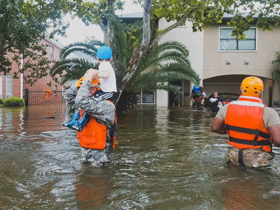 Got a story to share? Or just want to let folks on Swamplot — who might only know you by your commenting handle — know how you’ve been weathering the rising waters? No, the rains aren’t done yet, but if today or in the coming days you’d like a space to report on your experience or neighborhood, or just let everyone know if things are okay, please do so by adding a comment below. Photo:Â Lt. Zachary West , 100th Mobile Public Affairs Detachment [License]
WHY YOU MIGHT WANT TO FILE YOUR HARVEY INSURANCE CLAIMS BEFORE FRIDAY 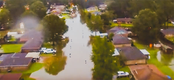 Suffered property damage from Hurricane Harvey and have access to a smartphone, computer, pen and paper, or your insurance agent? Forget about waiting for waters to recede before filing any insurance claim. You’ll want to do it now — or at least before Friday. What’s the rush? The new Texas law formerly known as House Bill 1774, passed by the Texas Legislature this session and signed by Governor Abbott in May, goes into effect on September 1. The “hailstorm lawsuit reform” measure reduces property owners’ leverage with insurance companies in weather-related claims — by making it more difficult for homeowners to sue agents successfully, increasing the obstacles to filing and carrying through with lawsuits over insurance coverage, and limiting the penalties insurance companies could face if they lose a lawsuit against you. To prevent your coverage from falling under these stipulations, notify your insurance provider of your claims before the law goes into effect, and document your correspondence. [Community Impact; Texas Tribune; Property Insurance Coverage Law Blog] Photo: Randy Poole
With water levels on Buffalo Bayou around Shepherd Dr. now forecast to recede, this drone video of one stretch of the waterway — taken yesterday during a lull in the rains — may turn out to be one of the best views available of the extent of flooding at the northwest corner of Montrose. A few video highlights, still visible above the floodwaters: The top floor of The Dunlavy, high above the now-complete-subsumed Lost Lake; the fuzzy treetop semi-circles formed by the twin stands of crape myrtles at Waugh Dr.; the Waugh Dr. bridge itself, now looking like a causeway; and the patterned grounds of the Beth Yeshurun Cemetery.
Video:Â Evan Mallett
WHERE THE SHELTERS ARE OPEN NOW 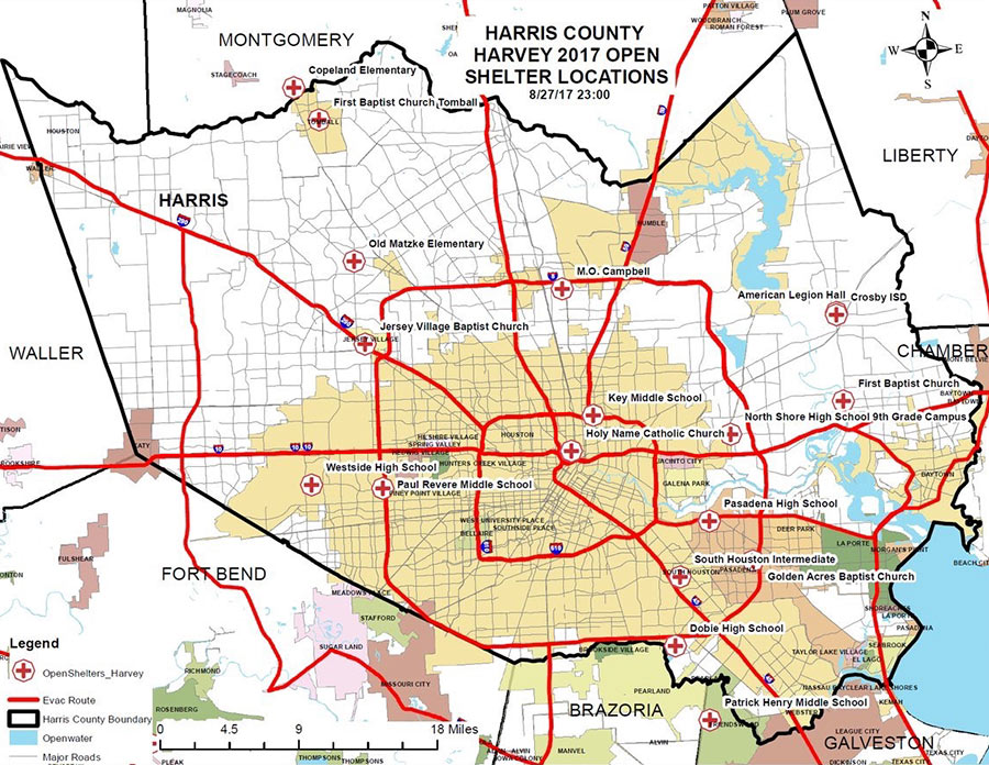 A few places you can hunt for shelters open now, whether you’re hunting for family or friends, looking for a volunteer opportunity, or have suddenly discovered your area is now under an evacuation order (as parts of Conroe and Missouri City found themselves this morning, following orders for Bay City and parts of Ft. Bend County and Rosenberg yesterday): Harris County’s Office of Homeland Security and Emergency Management has this list (last updated just before midnight last night, as of this writing), accompanied by the map above (though do ignore its overly optimistic delineation of evacuation routes). The Red Cross maintains a map of its own facilities, which covers a wider area but does overlap with the county’s list. Not yet included on either list: shelters that opened for the first time this morning at Katy ISD’s Morton Ranch and Cinco Ranch high schools. Update, 10:15 am: The list for Galveston.[ReadyHarris; Red Cross; Katy ISD] Map: Harris County Office of Homeland Security and Emergency Management

