HOUSTON PLANNING DEPT. LAUNCHES WEBSITE TO LAUNCH PLAN FOR HOUSTON  Efforts to create an actual “general plan” for the city of Houston have revved into high internet gear with last week’s launch of the Plan Houston website. There, the planning department has floated its mission-statement-like Draft Vision for the city and is requesting public input before an April 17th deadline. In addition to the draft (shown here in full), there’s an only slightly meatier draft list of goals posted on the site (in this PDF) to mull over. (Later, the site is intended to host a mapping tool meant to allow users to look up all the plans on file for an area — capital improvement projects, parks, or TIRZ efforts, for example.) Can’t stand the phrase “resilient communities”? Think we should set our sights higher than “dynamic partnerships”? Now’s the chance to express yourself, before it gets down to the neighborhood nitty-gritty. A complete General Plan is expected to be completed by late summer. [City of Houston]
Tag: Planning & Development Department
AN ONLINE HOW-TO GUIDE FOR HOUSTON’S WOULD-BE PRESERVATIONISTS 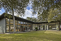 The Planning and Development Department has just launched a website that helps navigate the finicky process of historic preservation. It’s still under construction, of course, but the website works like a manual, explaining, among other things, how to plan a project and obtain those all-important Certificates of Appropriateness. If you’re not into the nuts and bolts of preservation, the website includes a map of the city’s 17 historic districts — including Glenbrook Valley, where this mod at 7919 Glenview was recently restored. Each district is given a little narrative treatment, with drawings of architectural styles and descriptions of pertinent building features included. And if you have no idea what a modillion or a soffit is, there’s even a glossary. [City of Houston Historic Preservation Manual; previously on Swamplot] Photo: Benjamin Hill Photography
A SETBACK SETBACK FOR HEIGHTS MICROBREWERY  Justin Engle and Steven Macalello want to build a microbrewery at this 9,714-sq.-ft. lot that they own on Cavalcade near the intersection of Main, Studewood, and 20th St. in the Heights; Swamplot reported in November that Engle and Macalello were constructing a tap room, brewery, and beer garden from a trucked-in kit of Houston-fabricated steel parts; they told investors then that they would be open by now. So where’s the beer? The brewers write on their blog that the city rejected their plans on account of the 25-foot setback requirement from a major road like Cavalcade: “Essentially,” the brewers write, “Planning and Development staff would rather have us create a sea of concrete and asphalt in front of our building, than let us preserve green garden space inside urban Houston.” But an update yesterday suggests that the taps just might flow, after all: “In a last minute meeting with City Planning and Development staff and director, we went through all of the plans and their pros and cons,” they write. “As a result, our architects have a lot to do.” But the brewers do say they think they’ll soon have something the city will be ready to approve. [Town in City Brewing Co.; previously on Swamplot] Photo: Town in City Brewing Co.
OAK FOREST’S 350-FT.-TALL HOAX TOWER 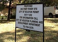 Two signs posted last week on a half-block west of Ella at 1250 Du Barry Ln. that appear to serve notice of a 350-ft. tower coming to the site — and include reference to a permit number — are some kind of trick, Charlotte Aguilar assures us. Planning Dept. spokesperson Suzy Hartgrove tells her the permit number may be connected to a 5-year-old project; the listed city phone number is obsolete. She says she doesn’t “know why anyone would do that.” [The Leader] Photo: Charlotte Aguilar
THE NEW ONLINE HOME OF HOUSTON’S MAP TOP TEN 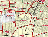 Zip Code maps, super neighborhood maps, crime maps, city boundary maps — if there’s a city-produced map of Houston you’re looking for, you’ll find it at the planning dept.’s just-unveiled My City Maps and Apps page. The page is peppered with (mostly working) links to the city’s main GIS My City map viewer (newly updated with 2010 aerial photos) and other services such as the still-in-beta, still Internet-Explorer-only electronic Development Review Cycle system for tracking platting, variance, and development applications. [Planning Dept.]
TINY “FREESTANDING” INNER-LOOP BARS AND RESTAURANTS ESCAPE INCREASED PARKING REQUIREMENTS [Note: Story corrected and updated below.] The planning commission has made a few adjustments to the proposed changes to the city’s parking rules it’s likely to forward to city council after a meeting today. The revised draft ordinance exempts freestanding restaurants smaller than 2,000 sq. ft. and bars smaller than 1,000 2,000 sq. ft. from the major increase in parking spaces the new rules will be requiring of most new eat-and-drinkeries — as long as they’re inside the 610 Loop. Also included: a major potential boon for bike parking. By providing 4 bicycle spaces in place of each required car space, new Inside-the-Loop businesses would be able to reduce their parking requirements by up to 10 percent. [Planning & Development (see 3 PDF links at bottom of page); previously on Swamplot] Update, 1:45 pm: As a few local restaurateurs have noted, the exemption may turn out to be not much of a change at all: “The major bright, flashing verbiage in that should be ‘free-standing,’” notes chef Justin Yu of the just-announced Oxheart. “I’ve looked for the past 4 years for a quality free standing building under that size. Unless I build it myself, it doesn’t exist.”

The recommendations of a planning commission subcommittee aren’t going to get any Houstonians in the growing anti-free-parking crowd too excited — they only propose a series of incremental adjustments to the city’s existing off-street parking regulations. Among the newly issued report’s more notable suggestions: requiring shared-driveway townhome developments to provide a single guest parking space for every 6 units, or at least preserve on-street spaces; allowing takeout- or drive-thru-only restaurants and dessert shops to provide fewer off-street spaces and requiring all other restaurants, bars, and clubs to provide more; a minimum 5-year length for any parking lease agreements used to meet minimums, as well as language that automatically revokes an establishment’s certificate of occupancy when they expire; extending the maximum distance to offsite parking to 800 ft. and giving the planning director the authority to stretch it further in some instances; more notification — including signs — when parking variances are applied for; adjusting the rules for how locations can be “grandfathered” under previous parking requirements; and allowing the creation of new “parking districts” in free-for-all areas such as Washington Ave.
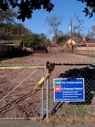
Planning director Marlene Gafrick is recommending that city council shrink the boundaries of the proposed Houston Heights South and Woodland Heights historic districts before approving them — but only slightly. In this morning’s meeting, Gafrick presented a map of Houston Heights South with “squared off boundaries” in the southeast corner and western edges of the district, and that excludes a number of residences on Oxford St. For Woodland Heights, her map cuts out some properties on Omar St. She proposed making no changes to the proposed boundaries of the Glenbrook Valley district. The actual designation and boundaries of the districts will be up to city council.
- Historic Districts coverage [Swamplot]
Photo from 800 block of Columbia St.: Swamplot inbox
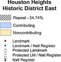 Planning director Marlene Gafrick’s recommendation that only one property be excised from just one of the 6 existing historic districts up for reconsideration (a 7th, Heights South, is going through the same process even though it hasn’t officially been approved yet) is just that — only a recommendation. Houston’s city council can still decide to alter the boundaries of any of those districts. And you can bet the maps provided by the planning department that show the repeal-survey responses and where they came from will be a major focus of attention as council members discuss the issue. Plus, hey — isn’t it fun to be able to see how your historic-district neighbors came down on the issue? Here’s the map for Heights East:
Swamplot will have more details later, but here’s the news all you historic-district junkies and haters have been waiting for, just out this morning: The official tallies and maps of the repeal surveys from historic districts that went through the process, plus planning director Marlene Gafrick’s recommendations to city council for changing their boundaries. The gist? As reported earlier, none of the existing districts were able to muster owners of 51 percent of their tracts to send in repeal slips, which would have dissolved the districts. For Norhill, Avondale West, Boulevard Oaks, Heights West, and Heights East, Gafrick notes that “surveys requesting repeal . . . were dispersed throughout the district,” and is recommending that the districts maintain their current boundaries. For First Montrose Commons, Gafrick is recommending “changing the boundary to exclude a tract of land where the owner is the sole tract in the blockface on the edge of the district. The community has stated that they never intended for this tract to be included within the district.” That’s it. What happened to Heights South, the 7th district facing possible dissolution? That’s a “pending” district, planning department spokesperson Suzy Hartgrove tells Swamplot, and its status will be addressed at another date. Mayor Parker is presenting the recommendations to city council at today’s meeting.
- Historic Districts coverage [Swamplot]
WE’LL STILL HAVE THE NORHILL HISTORIC DISTRICT TO KICK AROUND The planning department has tallied all the surveys from property owners in the Norhill Historic District — the last of 7 historic districts subject to the one-time “reconsideration” provisions of the revised preservation ordinance city council passed last year. Department spokesperson Suzy Hartgrove says the number of surveys returned was below the 51 percent threshold that would have dissolved the district, but she hasn’t provided the actual percentage. Planning director Marlene Gafrick “has been meeting with council members whose districts are affected” by the reconsideration process, Hartgrove tells Swamplot. “We should have maps ready when this goes to council which may be as early as next week. The Planning Director is still working on her recommendations.” [Previously on Swamplot]
Yesterday Swamplot reported that planning director Marlene Gafrick had signaled to city council that 5 of the 7 historic districts being “reconsidered” had not met the threshold that would have triggered dissolving them (the return of surveys representing owners of 51 percent of the properties in a district). The survey processes in the 2 remaining districts, Norhill and First Montrose Commons, are a little behind the others: Neighborhood meetings required by the revised preservation ordinance have been scheduled, but owners there haven’t received their survey forms yet.
But even if those last 2 districts don’t make the 51 percent cut either, the process spelled out by the new ordinance won’t come to an immediate halt. Once the votes have been tallied for all 7 districts, Gafrick will be required to send a report to city council recommending one of 3 options for each of them. For Heights East, Heights West, Heights South, Boulevard Oaks, and Avondale West, the first option — dissolving the district entirely — is out. But Gafrick can still recommend adjusting the boundaries of a district — even if the returned surveys didn’t reach the 51 percent threshold. (Her third option: recommend city council do nothing — and keep the district as it is.)
Update, 1/5: Unless, of course, city council decides to shrink a few of them anyway.
The results are in, and it looks like the great campaign to dissolve Houston’s historic districts has been a bit of a bust. Houston planning director Marlene Gafrick reports that the “survey period” for Heights East, Heights West, Heights South, Boulevard Oaks, and Avondale West historic districts has closed and that the planning department has determined that “none of the districts achieved the 51% threshold that requires the Planning Director to recommend repeal of the designation or, in the case of Heights South, recommend denying the designation.” Neighborhood meetings and subsequent “surveys” for 2 more districts — Norhill and First Montrose Commons — haven’t taken place yet (the meetings are scheduled for January 8th and 18th, respectively). That’s it for the 7 districts where petitions from owners triggered the “reconsideration” provisions of the preservation ordinance changes city council approved last fall. According to the new ordinance, if owners of 51 percent of the lots in any of the districts had returned notices sent to them by the city, the districts might have been dissolved — or, more likely, had their boundaries adjusted.
Opponents of the preservation-ordinance changes had focused their dissolution campaign on the Heights historic districts. But if the 51 percent threshold wasn’t attainable in those districts, it seems less likely their efforts will succeed in Norhill and First Montrose Commons. Meanwhile, the city’s planning commission and archeological and historic commission have both recommended that city council approve 2 additional pending historic districts, in Woodland Heights and Glenbrook Valley.
8 OUT OF 16 HOUSTON HISTORIC DISTRICTS ARE NOW UP FOR “RECONSIDERATION” Planning department spokesperson Suzy Hartgrove tells Swamplot the city has received petitions from 8 of the city’s designated historic districts: Avondale West, Boulevard Oaks, First Montrose Commons, Houston Heights East, Houston Heights South, Houston Heights West, Norhill, and Westmoreland. The department is currently verifying them. Do they all meet the 10-percent threshold that’ll trigger balloting and possible dissolution? “Our initial glance tells us that they probably do but we must conduct a thorough check,” writes Hartgrove. Okay, who’s left? Audubon Place, Avondale East, Broadacres, Courtlandt Place, Freeland, Shadow Lawn, and West Eleventh Place, carry on: You may continue to live in the past. [previously on Swamplot]
Note: Planning and development weighs in. See update below.
Tonight’s 6:30 meeting at the George R. Brown is the only public meeting scheduled to discuss the latest round of proposed changes to Houston’s preservation ordinance, dubbed the “final draft” in some documents. The planning department came out with this revised set of proposed amendments last week, but figuring out what’s in them isn’t so easy. The department hasn’t created any summaries of the new proposal — thought it did for the last round — and it hasn’t specified what’s different from the earlier proposed amendments either. Even more fun: The new amendments have only been released as image scans, making text searching — and what should be the simple task of comparing one set of amendments to the other — a not-so-simple task.
So what’s in the latest round of proposed changes? Swamplot outlined the new proposed method for existing historic districts to “reconsider” — and possibly shed — their historic designation last week. But since then, the department has only released a presentation given by the planning director. Working from that, here’s the best summary of the rest of the provisions we can piece together:

