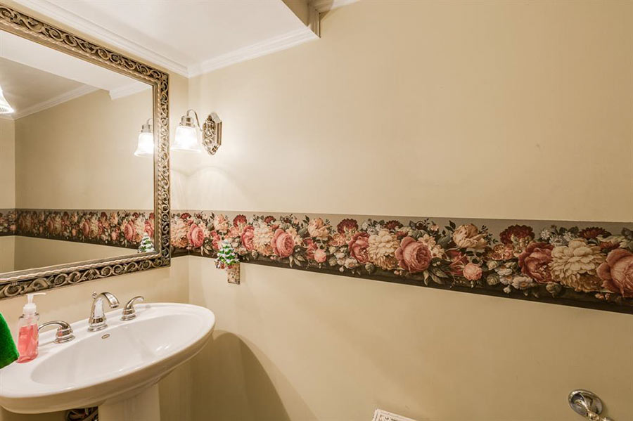
- 7603 N. Hollow Cir. [HAR]

COMMENT OF THE DAY: THERE’S A BIG ORANGE ARROW OF DEMOLITIONS POINTING TOWARD DOWNTOWN 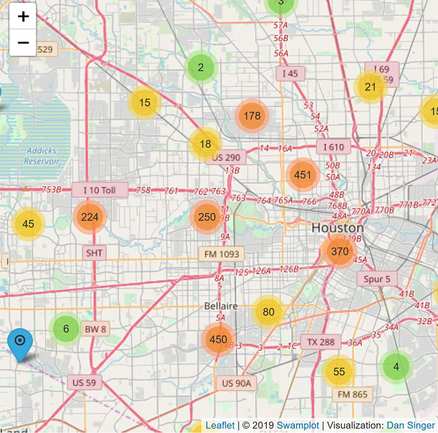 “Play around with the zoom level on the map while centered roughly on the Galleria. What you find will shock you (or probably not if you’re a regular here).” [TimP, commenting on Every Houston Demolition of 2018, Mapped; previously on Swamplot]
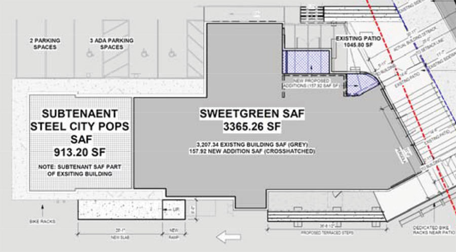
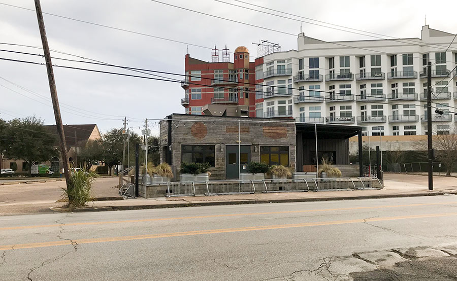
Documents put out by Houston’s planning commission reveal that Sweetgreen isn’t the only tenant signed up to take over Doc’s Motorwork’s empty structure at 1303 Westheimer; there’s also a Steel City Pops on the way to the back of the building. The site plan at top shows it grabbing about 900 sq.-ft along Graustark St., leaving the rest of the 4,400-sq.-ft. building reserved for the plant-based anchor tenant.
This is Sweetgreen’s first step into Texas, according to Eater’s Alaena Hostetter (or second, if you count the other not-yet-open location it has planned for Rice Village) and it wants to make Doc’s building look like this before setting foot in it:
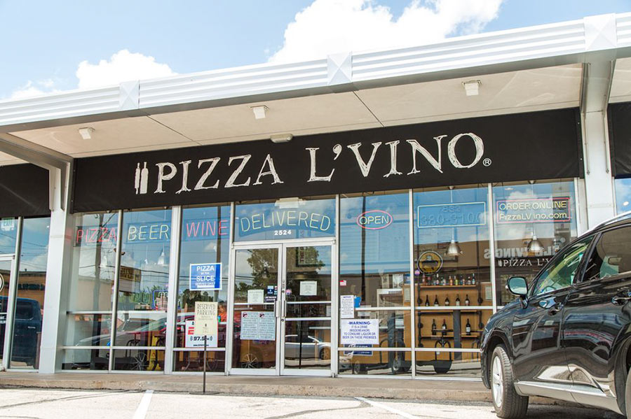
Shuttered Rice Village pizza parlor Pizza L’Vino is set to become the second Reach Stretch Studio in Houston and fifth across the greater Houston area: Katy, Sugar Land, The Woodlands, and Memorial branches of the wellness chain are already up and running. A building permit filed last Friday for the 2,100-sq.-ft. storefront at 2524 Rice Blvd. — across the street from Buffalo Wild Wings — indicates conversion work is about to begin.
Pizza L’Vino’s other location has also closed down in the Waugh Dr. shopping center it once shared with competitive axe-throwing venue The Ratchet Hatchet.
Photo: Pizza L’Vino
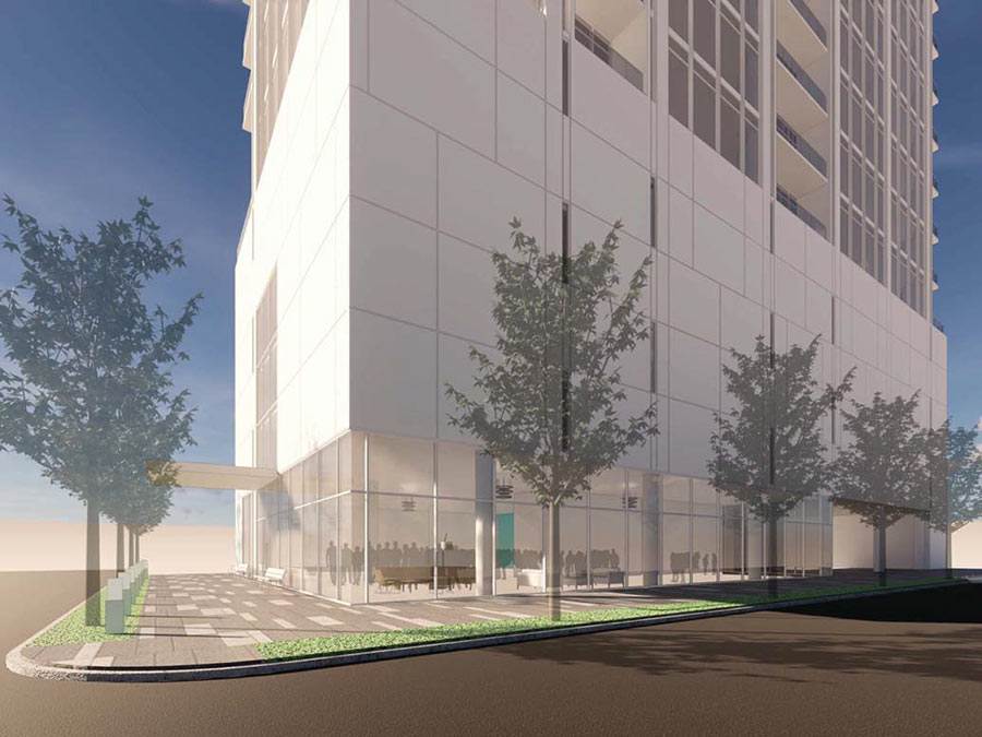
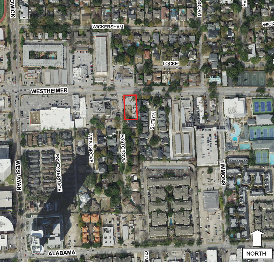
The rendering above looks east from the corner of Westheimer and Eastgrove St. to show the first few floors of a new 20-story condo tower that developer Randall Davis wants to build on the just-under-0.4-acre lot formerly home to the Krispen Home furniture store. Plans for the highrise made their first appearance before Houston’s city planning commission yesterday, where they were deferred until the group’s next meeting in 2 weeks, but not before residents and representatives of the site’s neighboring subdivisions got a few words in. Roughly a dozen speakers from Westgrove Court — the 2-dozen-home residential neighborhood that lies southwest of the would-be tower, along Westgrove and Eastgrove streets — were particularly loud in decrying it. They noted that Westgrove St.’s current narrowness already makes creates tight squeeze for passing traffic.
The same goes for Eastgrove St., where a site plan submitted by the developer shows curb cuts giving access to a driveway at what’d be the southwest corner of the building:
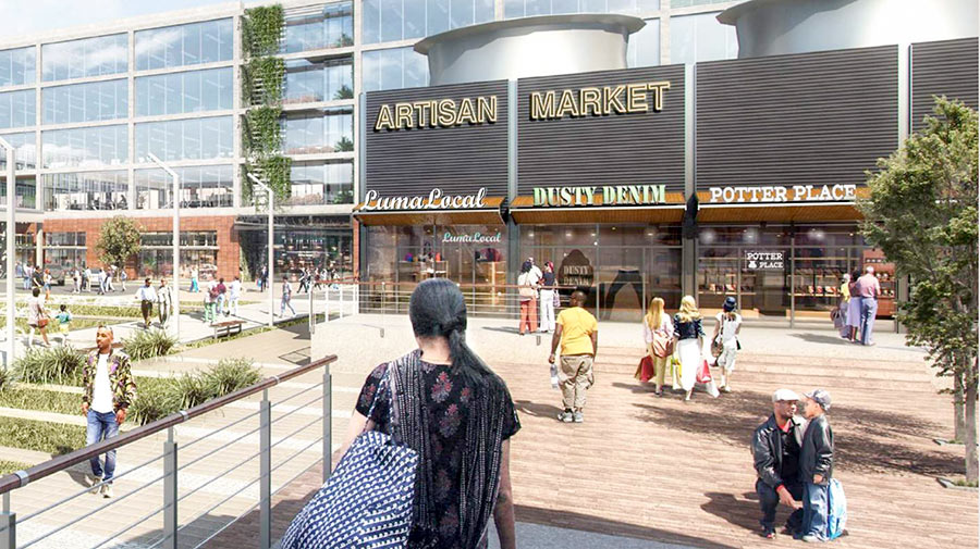
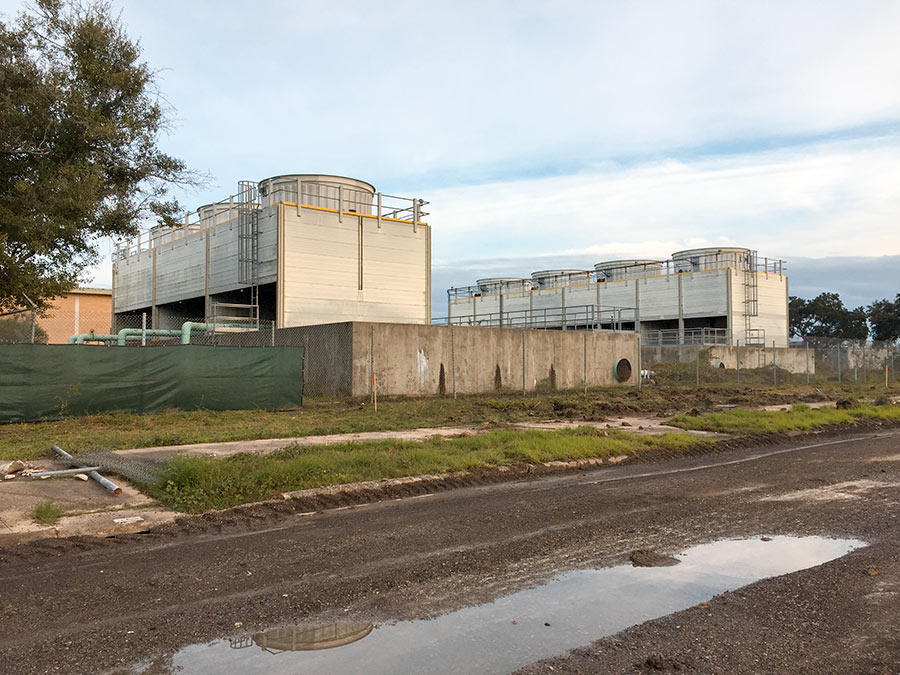
Sure, there’s been a whole lotta talk lately about how In-N-Out Burger is on its way to the redo of Texas Instruments’Â 192-acre Stafford campus that developers have dubbed The Grid. But what about those not-yet-named retailers that renderings put out by Gensler, the architect for the project, show taking over the air conditioning towers that TI left behind at the site? The photo above shows what those decommissioned cooling units looks like right now.
They sit behind the centerpiece of the site, TI’s abandoned office building:
NINTH HOUSTON-AREA SPROUTS DEBUTS IN SUGAR LAND THIS MONTH 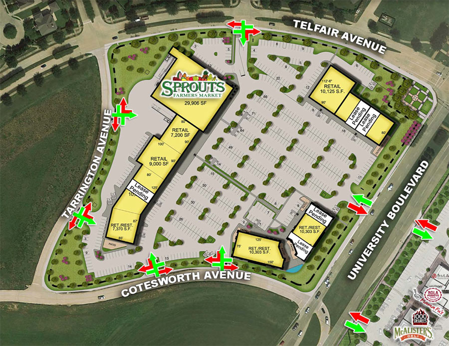 Workers are putting the finishing touches on the Sprouts Farmers Market inside Sugar Land’s new University Commons Shopping Center off 59, a 150,000-sq.-ft. complex that includes everything depicted in the rendering above, plus a whole extra crop of retailers and restaurants that are already open on the other side of University Blvd. The grocery store’s opening date: January 16, at which time it’ll become the ninth Sprouts store operating in the Houston area (and the
 only second one in Fort Bend County). About 150 new hires will be on duty inside following a successful job fair Sprouts hosted on December 6 at the Hilton Garden Inn Houston-Sugar Land just up the street in the University Plaza shopping center. [Houston Chronicle] Site plan of University Commons Shopping Center Phase II: Capital Retail Properties
It’s the most wonderful time of the year to take stock of everything that’s been ripped to shreds around town recently, so we built this tool to help you do so. The map above shows the location of every demolition permit filed with the City of Houston in 2018. Here’s a full-size version. In total 2,312 properties were tagged for demo, some of which — like, say, apartment or industrial complexes — saw multiple structures go down on their premises. Zoom in and you’ll see the clusters start to break down into individual address markers that tell you more about what went down. (Multi-building demos are indicated by the bullseye icons with multiple rings.)
Recognize any of last year’s high-profile disappearances? The Shelor Motor Company Building at 1621 Milam St., for instance? KHOU’s flooded newsroom at 1945 Allen Pkwy.? The Depression-era Harris County District Attorney’s Building at 201 Fannin, Clark Gable’s former house at 411 Hyde Park Blvd., the northeast portion of the River Oaks Shopping Center at 1958 W. Gray St., La Colombe d’Or’s ballroom at 3410 Montrose Blvd., architecture firm Caudill Rowlett Scott’s former HQ at 1177 West Loop South, Exxon Chemical’s old conference building at 13501 Katy Fwy., the mysterious Heights corner compound at 620 W. 9th St., Shake Shack’s Burger King predecessor at 1002 Westheimer, the last traces of KBR’s Fifth Ward complex at 2720 Clinton Dr., the bungalow at 610 Allston St. where Mary Cerruti — the homeowner who refused to make room for Trammell Crow’s adjacent Yale at 6th apartments — was found dead inside one of the walls?
They’re all there. This time, however, they’re sharing the spotlight with all their fellow, but significantly less fussed-over knockdowns, the kinds that form the bulk of Houston real estate turnover. For a look at where across-the-board demo activity was the most concentrated last year, take a look at our 2018 demolition heatmap:
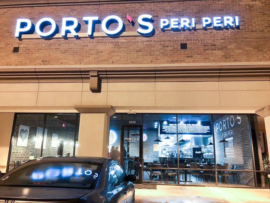
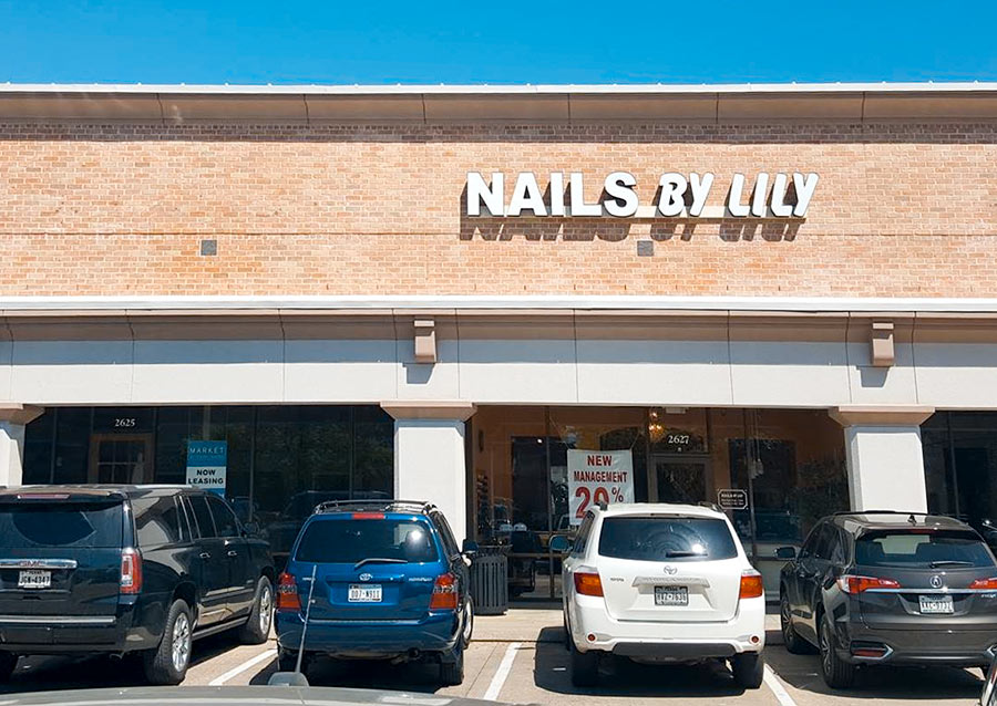
This just in from Eater: One of those alliterative spicy chicken spots is now open between Smashburger and Nails By Lily in the standalone retail building across Town Center Blvd. from Sugar Land’s city hall; its name: Porto’s Peri Peri. Note: That’s not to be confused with The Peri Peri Factory — which opened on Westheimer near Hillcroft in April — nor Chick’n Cone, a NYC import that debuted its chicken with peri-peri sauce in the Woodlands in August,” according to Eater’s Alaena Hostetter; nor the Peli Peli Kitchen that opened around the same time inside the new 365 by Whole Foods Market off 610 as spin-off of the more formal Peli Peli sit-down restaurant at The Galleria. (The spelling of their names notwithstanding, both Peli Peli locations still refer to their chicken as peri peri.)
The common ingredient in all authentic peri peri dishes: bird’s eye chili, reports Eater’s Amy McCarthy. According to her, the Portuguese recipe was first brought to the U.S. by Nando’s Peri Peri, a South African chain that started outside Johannesburg in 1987 and now has more than a thousand locations across the globe — but none in Houston. Not to worry though, our local operators plan to continue filling in the gap. Porto’s Peri Peri’s owner told Hostetter in November that he’d follow-up the Sugar Land location with more spots inside and outside the 610 Loop. And Peli Peli’s owner told McCarthy last summer that he planned to start franchising after the new year.
Photos: Nisha B. (Porto’s Peri Peri); Nails By Lily (Nails By Lily)
COMMENT OF THE DAY: THE DIAGONAL LINE BETWEEN FIRST WARD AND SIXTH 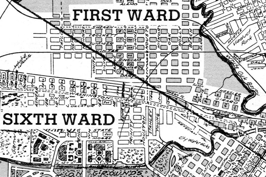 “. . . Congress Street was used as a boundary in the ward system, but that boundary, extended, does not run along Washington Avenue. It instead runs well north of Washington. A look at 1913 and 1920 maps of Houston that designate the wards shows this . . . The upshot: That church is 6th Ward, not 1st.” [Houstonreader, commenting on Vatican’s ‘Supreme Court’ Rules Shuttered First Ward Church Must Reopen, But It Hasn’t Yet] Section of 1920 Houston street map: Houston Past
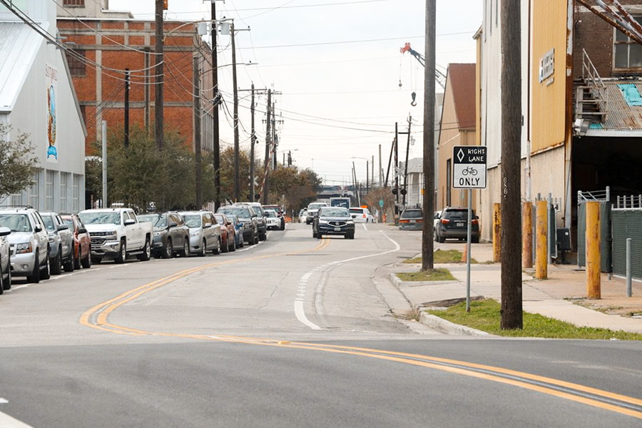
And people say Houston’s bike lanes don’t get any use! The next time someone gives you that line, there’s no need to bicker. Instead, just invite them out for a beer at Saint Arnold’s new-ish brewing cathedral off I-10. On the way there, you’ll spot the new bike lanes running adjacent to the brewery on both sides of Lyons Ave. And if the conditions in the one on the eastbound side of the street are anything like those shown in the photo above, then congratulations: It should be clear who’s right.
If, however, parked car traffic appears sparse on the day you stop by, there’s only one possible reason why: New signs must have been installed, prohibiting parking in the bike lane. As long as no ordinance exists to ban bike lane parking outright, such signage is the city’s only recourse to outlaw it.
Further east along Lyons, work to add new 6-ft. bike lanes to both sides of the street is underway and — at Jensen Dr. — has already been completed:
LEAGUE CITY’S LONGHORN CATTLE MUSEUM REOPENS 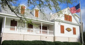 All bovine exhibits at the house-turned-museum-and-events-venue at 1220 Coryell St. are now back on view following months of renovations to address flood damage, reports the Chronicle’s Jennifer Bolton. Opened in 2009, The Butler Longhorn Museum, focuses specifically on the iconic cattle breed and the 19th century efforts of the Butler family, members of which helped save the animals from extinction through work on their land in what’s now League City, Kemah, Friendswood, and a few mainland portions of Galveston County. “While most of the exhibits could be — and were — redone, there were murals painted on the downstairs walls of the museum that had to be torn apart,” reports Bolton. Also out of commission: a separate education building that sits on the same 10 acres as the museum itself. [Houston Chronicle] Photo: Butler Longhorn Museum