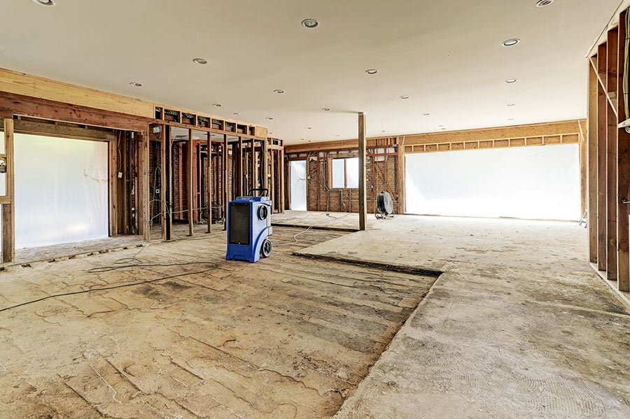
- 11959 S. Durrette Dr. [HAR]

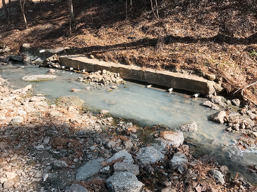
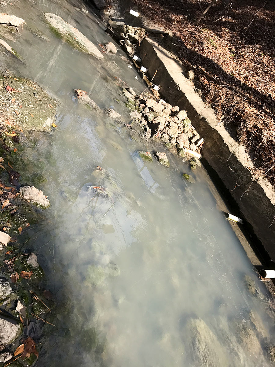
Here’s the pungent wastewater that’s been flowing through a Swamplot reader’s backyard on Stoney Creek Dr. for just over a month, according to the homeowner. The waterway pictured above — dubbed Ditch #W-151 by Harris County Flood Control — parallels Gessner on its way south from Memorial City Mall, passing through portions of Bunker Hill Village and Whispering Oaks before emptying into Buffalo Bayou. For about 3 quarters of a mile along that stretch, the ditch cuts through the backyards of homes on Stoney Creek, where owners have complained about this and similar movements in the past.
Residents suspect the issue might have to do with the sewer repair work now underway at multiple sites upstream from their neighborhood. The photo below shows a temporary pump conducting liquids across Plantation Rd., just south of Memorial City Mall’s frontage along Barryknoll:


A sandwich update is in progress along Dairy Ashford directly opposite Fern Dr., across the street from Stratford High School and the Spring Branch ISD athletics complex. The Subway sandwich shop sandwiched between the shuttered locations of a printing company and a small used-car dealership has now been torn down after a brief Harvey reprieve. A reader sends in the above series of photos panning the combined and now-cleared 1.1-acre site at 851 Dairy Ashford, where a new 4,640–sq.-ft. Panera Bread building is scheduled to rise.
Photos: Swamplot inbox

WEST HOUSTON CAN NOW FLUSH IN GOOD CONSCIENCE 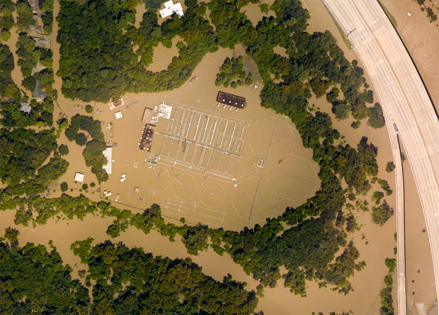 When last we (and the aircraft supplying aerial images to NOAA) left the West District wastewater treatment plant along Buffalo Bayou just outside Beltway 8 at the flooded southeast corner of Memorial Glen, it looked like this: shut down and surrounded by muddy floodwaters sorely in need of its services. That was September 3rd. As of this morning, the city’s Office of Emergency Management reports, both this plant and the one on Turkey Creek off Eldridge between Briar Forest Dr. and Memorial have been restored to full operation. This means persons in ZIP Codes 77024, 77041, 77043, 77055, 77077, 77079, 77080 and 77094 who had been following guidelines to limit their water use are once more free to shower, flush, brush, and otherwise send wastewater down their drains without special consideration of the consequences. [Alert Houston; previously on Swamplot] Aerial image of West District plant from September 3: NOAA
Here’s the latest publicly available high-resolution aerial imagery of Houston-area flooding, in an interactive map you can use to zoom in and examine in detail and by address. The imagery in the map above comes from the National Oceanic and Atmospheric Administration, and was taken this past Wednesday and Thursday, August 29th and 30th — as floodwaters subsided in many areas of the city but continued to build in a few parts west.
Included in the portions of the city photographed by NOAA: the sections of Memorial south of I-10, west of Gessner Rd., north of Briar Forest Dr. (that’s below Buffalo Bayou), and east of the Addicks and Barker reservoirs. That’s the area where Mayor Turner earlier today said residents who already have water in their homes should probably leave their homes now if they haven’t already — because water is likely to remain in them for the next 10 to 15 days as releases from the dams continue.
To zoom in on the latest aerial imagery from that area, you can click on the search box in the map above and type “Memorial, Houston,” then click on the first option that appears below where you’re typing. Then zoom in further to see where the floodwaters are and aren’t. You can identify the date of the imagery and turn on and off various layers if you click on the lower of the 2 icons on the top right of the map. To view the map larger in your browser window, navigate directly to NOAA’s Harvey site.
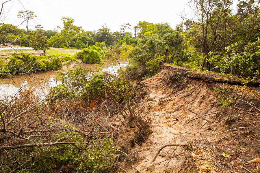
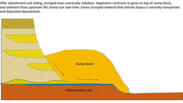
The folks fighting a longstanding battle to prevent the reconfiguration of a section of Buffalo Bayou fronting the southeast corner of Memorial Park and the River Oaks Country Club have posted a remarkable series of images showing how a section of the bayou’s bank at the Hogg Bird Sanctuary responded on its own over the course of 2 years to a soil collapse suffered during the 2015 Memorial Day flood. The geologists behind Save Buffalo Bayou claim that the promoters of the Harris County Flood Control District’s proposed $12 million Memorial Park Demonstration Project they’re trying to stop have mistaken a natural bayou-bank process called vertical slumping (or sloughing) for erosion, and that attempting to stabilize the bayou banks to fix the supposed erosion will leave the area “a wasteland of denuded and weakened banks.”
But you don’t have to buy or even follow the riverine logic the organization steps through in a lengthy article posted to its website earlier this week to appreciate one of the examples of waterway-bank adaptation exhibited there. The first image (at top) shows the immediate aftermath of the Memorial Day storm or 2 years ago on the high bluff facing the bayou at the Hogg Bird Sanctuary in Memorial Park, which stands at the downstream end of the proposed project area. According to the organization, an HCFCD consultant claims that this is one of 4 spots within the bayou area that suffers from severe lateral erosion. But to Save Buffalo Bayou, this isn’t erosion; it’s just a slump, which is what bayous do naturally, and which on their own create the distinctive bluffs on the bayou’s banks. There’s no way to fix a slump, the organization’s geologists say — if left alone it’ll restore itself.
Here’s their photo evidence. The second photo, also from June 2015, shows the slumping — and downed trees:
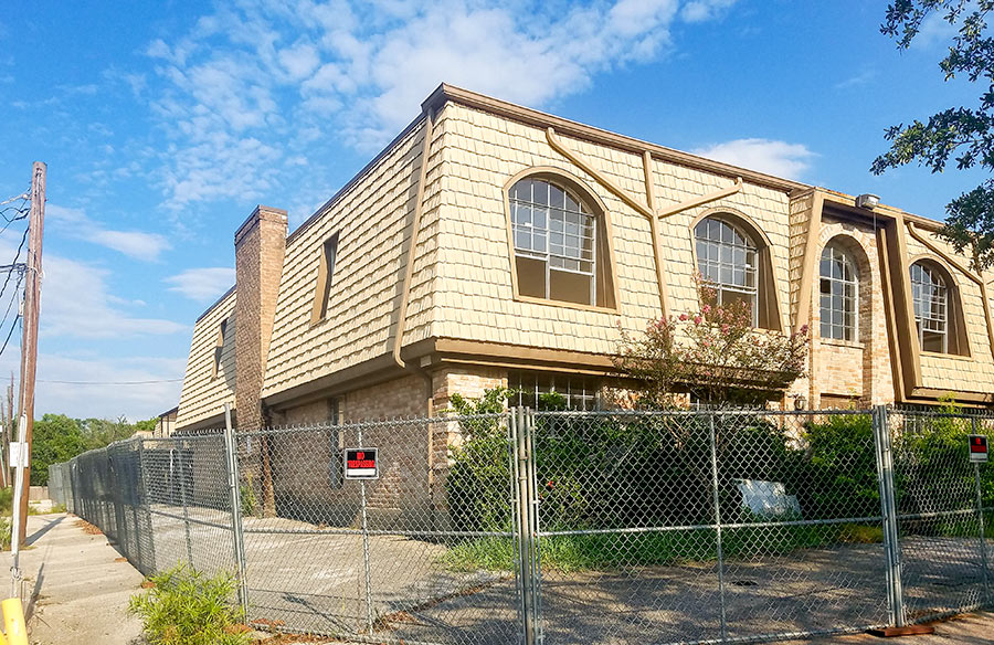
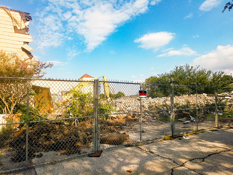
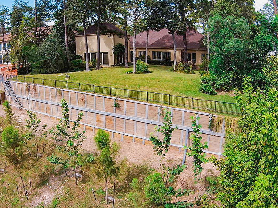
Demolition has begun, a reader notes, on the Ripple Creek Townhomes at 1015 S. Ripple Creek Dr., a 3-building assembly of 2-story structures fitted onto a 2-plus-acre site directly east of the Second Baptist Church complex on Woodway Dr. The gently named Ripple Creek Dr. is the first north-south street east of Voss on the north side of Woodway; the townhome buildings, which were built in 1970, are wedged between it and the more workaday Bering Ditch, an actual waterway known to carry actual water north to Buffalo Bayou on its straightened, concrete-lined haunches.
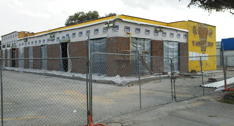
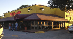 The neon signage facing the I-10 feeder road at the former home of the Mason Jar has been stripped off, as the spot gets built out for a takeover by the Goode folks (as seen in this shot captured by a reader this week). After the ongoing expansion and patio-making wraps up, the spot will offer a menu at least somewhat reminiscent of the company’s Kirby Dr. taqueria, based on barbecue heir and current owner Levi Goode’s musings to Eric Sandler last month. The new brand’ll be called the Goode Company Kitchen & Cantina; Goode told Sandler there’s a second one planned for the Woodlands.
A few old Mason Jar labels are still visible to the east of the building:
