WEST HOUSTON CAN NOW FLUSH IN GOOD CONSCIENCE 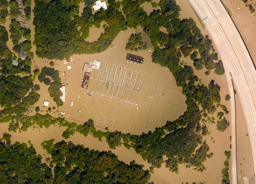 When last we (and the aircraft supplying aerial images to NOAA) left the West District wastewater treatment plant along Buffalo Bayou just outside Beltway 8 at the flooded southeast corner of Memorial Glen, it looked like this: shut down and surrounded by muddy floodwaters sorely in need of its services. That was September 3rd. As of this morning, the city’s Office of Emergency Management reports, both this plant and the one on Turkey Creek off Eldridge between Briar Forest Dr. and Memorial have been restored to full operation. This means persons in ZIP Codes 77024, 77041, 77043, 77055, 77077, 77079, 77080 and 77094 who had been following guidelines to limit their water use are once more free to shower, flush, brush, and otherwise send wastewater down their drains without special consideration of the consequences. [Alert Houston; previously on Swamplot] Aerial image of West District plant from September 3: NOAA
Flooding
COMMENT OF THE DAY: THE EVEN BIGGER REASON HOUSTON MIGHT WANT TO ADDRESS ITS FLOODING PROBLEMS  “People in Houston need to talk with people in other parts of the country to be able to understand the need for funding massive improvements in our flood control infrastructure. I had friends and family from LA to Philly telling me to get out of the city and come stay with them as soon as it was possible to travel out of the city. My sister even offered to drive her minivan over 1,200 miles to come rescue me. I still have family asking me whether they should cancel plans to visit over Thanksgiving for fear that hotels will be full and no rental cars are available.
It is easy to get all worked up about taxes when you did not get flooded and go into the usual red state “don’t tax me, tax that guy behind the tree†mode. But much more is at stake for Houston than whether parts of the city keep flooding. We run the risk of being seen as a city that is not worth the risk for existing and prospective businesses. People in Houston are getting used to these flood events and are not pressed into action by aerial footage on CNN showing Buffalo Bayou turning into a raging torrent. But everywhere else in the US, people see that and are completely freaked out by it. If we continue with applying band aids and do not make any big dramatic moves to improve our flood control infrastructure, we will not only be risking future catastrophic flooding but will also be risking losing current and future business to cities that are on higher ground away from the path of hurricanes and tropical storms.” [Old School, commenting on Comment of the Day: Abandoned Neighborhoods Make Great Detention Ponds] Illustration: Lulu
COMMENT OF THE DAY RUNNER-UP: ABANDONED NEIGHBORHOODS MAKE GREAT DETENTION PONDS  “I grew up off Fairbanks/West Little York area. TS Allison was the third time Creekside Estates and Woodland Trails West II had flooded which meant those homes wouldn’t be insured for future floods. Both of those neighborhoods are almost completely gone now, mainly just streets people use to cut through. Even with all the new construction/neighborhoods built near Breen Rd, nothing around has flooded since. The south side of WTW where Gulf Bank runs through flooded twice in late ’90s, along with Philippine St. in Jersey Village. Neither of those areas have had a third flood event; not Ike, Memorial Day flood, Tax Day flood or Harvey could flood them. A huge reason why has got to be because old Creekside Estates and WTW II hold so much of the water that would’ve flooded them out that costly third time years ago. Sometimes you have to cut loose some fat for the overall good and I know it sounds heartless but I’ve seen it work. These very flood prone neighborhoods just have to be made into retention areas because it works.” [mas, commenting on How About We Don’t Sell People Homes in Areas That Keep Flooding, and Other Crazy Ideas for Houstonians To Discuss Amongst Themselves] Illustration: Lulu
COMMENT OF THE DAY: FLOATING HOMES FOR HOUSTON 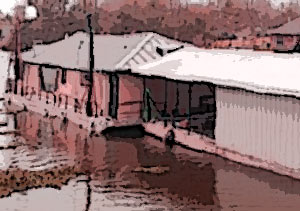 “I’m a ship designer with 20+ years of experience and I will say that a float-off house is absolutely feasible from a technical point of view. A quick check in the used barge market shows that you can get something house-sized (80 ft. by 30 ft.) for $65,000. Of course building something on-site would cost a lot more than construction in a shipyard. Not sure how this compares to what a foundation costs. But you’d need to add in some kind of anchoring system so that your house doesn’t float away when it floods. And permitting would be a whole other kettle of fish. I’m available for moonlighting if any architect wants to investigate this for a client!” [Orang Bodoh, commenting on Where Are Houston’s Floodwater-Ready Homes]
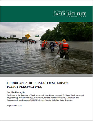 The headline suggestion in a 6-page policy paper published last week under the banner of Rice University’s Baker Institute comes in item 2 of a helpfully numbered list of 15 things Houston might want to do or think about to make future never-seen-this-before flooding events a little less catastrophic: Author Jim Blackburn, an environmental attorney, pioneering Houston-area naturalist, and longtime let’s-not-flood advocate, proposes a “fair but extensive home buyout and removal program” targeted at homes that have been flooded 3 or more times since Tropical Storm Allison in 2001: “It is unlikely we can develop strategies to protect them from severe rainfall events that are much more frequent than labels such as ‘100-year’ or even ‘500-year’ rainfall events suggest,’ he writes.
Among the less radical proposals put forward in his list is the suggestion to map and categorize the Houston region by its propensity to flood: “safe” areas that didn’t flood — and should therefore become “the backbone of the Houston of Tomorrow” — “transitional” areas (only “single-event” flooding); and “buyout” areas — which can be targeted for parks and “future green infrastructure.”
Other ideas and issues from the paper that Blackburn hopes will “initiate a conversation” are summarized here:
WHAT THE HARVEY FLOODING DID TO BUFFALO BAYOU PARK 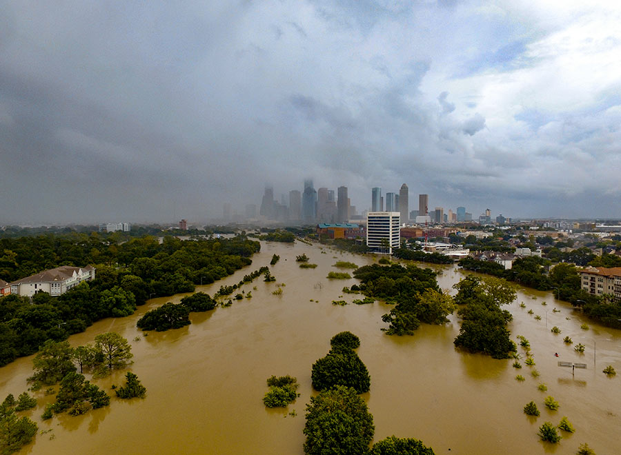 “Please know that Buffalo Bayou Park was designed to flood, although we did not anticipate three historic flooding events in 1-1/2 years,” Buffalo Bayou Partnership president Anne Olson remarks drily in an email update this afternoon. So what’s the damage? “The bottom two thirds of the park are still under water, and we expect that they will remain so for several more weeks as water is released from the Addicks and Barker reservoirs. Due to these circumstances, it is difficult for our staff to assess the impact the flowing water has had on the footpaths and landscape in these areas. We do know that the Johnny Steele Dog Park, which is still submerged, will be closed for two or three months.” Water and sediment that flooded the Buffalo Bayou Cistern is still draining, slowly, but the electrical system installed when the long-hidden underground space was made available for tours and art installations appears to be working. The Wortham Fountain and the trail lighting system have been damaged, Olson reports. The Bayou City Adventures kayak kiosk at Lost Lake
 and the Bike Barn at Sabine St. has been shut down for the remainder of the year at least; areas east of the Sabine St. bridge are mostly still underwater. But Olson reports landscaped areas in the upper areas of the park, where trails have already reopened, survived with only a small amount of damage: “We are extremely fortunate that the Lost Lake and Wortham Insurance Visitor Centers did not take on water. Both facilities are open and the Kitchen at The Dunlavy is operating with normal hours. Food trucks also are back in the entry court at Sabine Street from Thursday-Sunday.” Update: The Bike Barn at Sabine St. has resumed normal hours as of September 9. [Buffalo Bayou Partnership] Photo: Adam Brackman.
WHERE ARE HOUSTON’S FLOODWATER-READY HOMES? 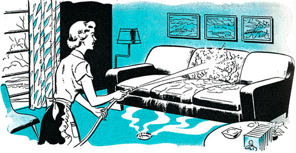 A reader asks: “Is there not a single architect in Houston who has envisioned a flood resistant home? Polished concrete floors with large area rugs instead of wood or wall-to-wall carpet? Waterproof material (instead of drywall) three or four feet up from the slab; removable of course so you can remove the wet insulation after the next flood? How much more do cabinets cost if they are made from marine grade plywood? Surely there’s a business case for a house that you can basically hose off and re-decorate after a flood, right?” Illustration: Popular Mechanics
COMMENT OF THE DAY: COULD WE BORROW BRAYS BAYOU RIGHT AFTER YOUR NEXT FLOOD, PLEASE? 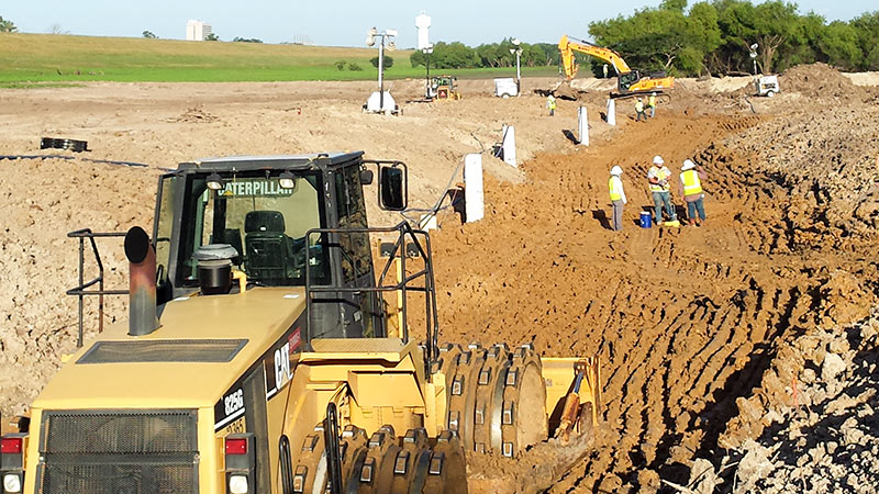 “. . . An undergound aqueduct probably won’t resolve the situation. However, this storm has made it pretty clear that having both Barker AND Addicks draining 100 percent into Buffalo Bayou may not be ideal. An addition channel that would allow USACE to divert some of the Barker outflow to Brays Bayou would allow for some flexibility.
While Brays DID flood during Harvey, the water receded very quickly, with the water back within its banks and falling quickly while Buffalo Bayou was still rising.” [Angostura, commenting on Clearing Out the Mold; Houston’s Drinking Water Close Call; The Floodeds and the Flooded-Nots] Photo of construction at Addicks and Barker Dams: U.S. Army Corps of Engineers [license]
COMMENT OF THE DAY: THE GREAT RESETTLEMENT  “I suspect you’ll start seeing ‘Didn’t flood in Harvey’ as a selling point in future real estate listings, which will drive up the land values, and drive the poor out to the flooded areas (which is par for the course). It’s no wonder that happened, though. Many of the oldest neighborhoods in Houston are also predominately minority. And the oldest neighborhoods (read, first settled) are the highest points in Houston. After all, who is going to settle in a lowland when the ‘highlands’ are still available?” [Chris C., commenting on Our Place Never Flooded] Illustration: Lulu
After Harvey hit, 2 and a half ft. of water coursed through the Adams family’s single-story home off Stella Link just north of Brays Bayou. In the video above, Tony Adams gives a tour of what was left after a dozen volunteers from Redemption Church on Timberside Dr. spent 4 hours last Thursday clearing it out and depositing the family’s ruined possessions by the curb.
Then on Sunday, more visitors came by:
OUR PLACE NEVER FLOODED 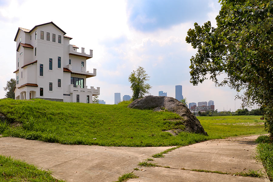 Cort MacMurray gazes into the city’s future: “. . . Houston is a cheerful amnesiac: We will rebuild in exactly the same places we built before, with exactly the same disrespect for historic floodplains. We are united, but in making this place stronger we’ll ignore fundamental inequities like school finance. We have a stronger work ethic than any other city in the Union, but when this crisis is past, we’ll slide back into affable indolence, trusting that everything is fine in our sprawling Xanadu on the Bayou.” [Houston Chronicle] Photo: Christof Spieler, via Swamplot Flickr pool
7 DAYS OF HARVEY BEFORE THE BRAZOS RIVER REACHES ITS SUGAR LAND PEAK 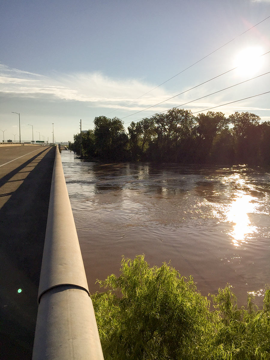 It wasn’t until early this morning that the Brazos River in Sugar Land and Richmond reached its highest level since area flooding triggered by Hurricane Harvey began. And it was a new record, reached at 5:15 am: 55.19 ft., according to the National Weather Service. The previous record, 54.7 ft. — surpassed Thursday at 1:30 am — was set by a flood last year on
 Tax Day June 2nd. The photo here shows the river during a rare moment of sunshine a day earlier than that — from Hwy. 59 where Greatwood, Riverpark, Telfair, and Sugar Land Memorial Park meet. [Houston Chronicle] Photo: Grace Carlson
Here’s the latest publicly available high-resolution aerial imagery of Houston-area flooding, in an interactive map you can use to zoom in and examine in detail and by address. The imagery in the map above comes from the National Oceanic and Atmospheric Administration, and was taken this past Wednesday and Thursday, August 29th and 30th — as floodwaters subsided in many areas of the city but continued to build in a few parts west.
Included in the portions of the city photographed by NOAA: the sections of Memorial south of I-10, west of Gessner Rd., north of Briar Forest Dr. (that’s below Buffalo Bayou), and east of the Addicks and Barker reservoirs. That’s the area where Mayor Turner earlier today said residents who already have water in their homes should probably leave their homes now if they haven’t already — because water is likely to remain in them for the next 10 to 15 days as releases from the dams continue.
To zoom in on the latest aerial imagery from that area, you can click on the search box in the map above and type “Memorial, Houston,” then click on the first option that appears below where you’re typing. Then zoom in further to see where the floodwaters are and aren’t. You can identify the date of the imagery and turn on and off various layers if you click on the lower of the 2 icons on the top right of the map. To view the map larger in your browser window, navigate directly to NOAA’s Harvey site.
This just-launched map tool from civic-minded hacking co-op Sketch City is meant to help homeowners who could use help clearing out soggy carpet and other materials from their flooded homes connect with people willing to volunteer their time and effort to help with that work. It’s called the Texas Muck Map — muck being a useful term in Houston these days. Mucking, in this context (and context truly is everything), means removing carpet or flooring, stripping drywall that was exposed to moisture and is at risk of growing mold, clearing out dirt, furniture, and other junk, and generally getting a flooded home ready to dry out.
Harvey has made sure a lot of homes around these parts will need mucking — over the next several weeks at least. Is that work you or someone you’re helping needs doing? Or work you or people you know are able to help with? The map above identifies the locations of homes people have added to it that need mucking — and the approximate locations of would-be volunteer mucker teams or individuals. (The map might appear sparsely populated now, but if you spread word about it it’s likely to fill up quickly.) Click on any of the icons to see details and contact info, which you can use to make your own connections.
To add your ready-to-be-mucked home to the map, click here and fill out the form. If you’d like to volunteer to muck homes, click here and fill out the form. To see the map in its own browser window, click here, or just go to muckmap.harveyneeds.org. Also on that site: some guidelines for using the map, a disclaimer, and links to several helpful resources about mucking and related issues.
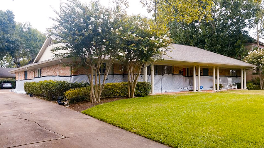
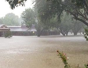 If you had been wondering whether the sandbag and tarp barrier (pictured at top) mustered around Kristin Massey’s Meyerland home was able to hold back the floodwaters once nearby Brays Bayou overflowed its banks a block to the north Monday night, here’s your answer: “We did all that we could, but it would never have been enough,” Massey wrote on Facebook the following morning.
To prepare for the storm, Massey had spent close to $5,000 to arrange a perimeter defense using 18,000 pounds of sandbags. But the water reached the 9 ft. level on Braesheather Dr. a block south of Brays Bayou and just west of the 610 Loop (above) — and up to 4-and-a-half-ft. high inside her 1961 home:

