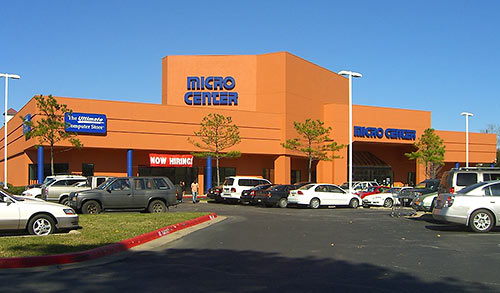
 Two days after Swamplot reported the local-tech-nerd-soul-crushing rumor that Amegy Bank has purchased the Post Oak Park–West Loop site of computer retailer Micro Center, a few new and possibly conflicting (but maybe not) pieces of information have emerged about a possible deal. Yesterday, in response to a reader question posted on the Micro Center Facebook page, the company posted what at first appears to be an outright denial of the rumor:
Amegy Coming, Micro Center Moving?


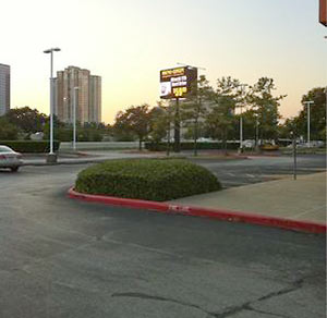
 “Why is there always construction on the feeders between Weslayan and Kirby especially when it seemed like nothing needed to be done?” writes a Swamplot reader, who is under the impression that the work started sometime last summer. “It looks like they are only redoing the road, not adding sewers, nor laying power lines, and doesn’t seem to making it wider. One side is done and then they come back and do the other side! . . . I hope you can find out why they are tearing up a perfectly good feeder road.” Alas, doing so would spoil the chance to indulge in the fantasy of having encountered along the Southwest Fwy. a truly eternal feeder-road replacement cycle. We’ll illustrate that here with the above photo from earlier today of a fresh concrete placement (with shopping cart) on the north side feeder just west of Kirby Dr. Update, 2/27: Clever reader
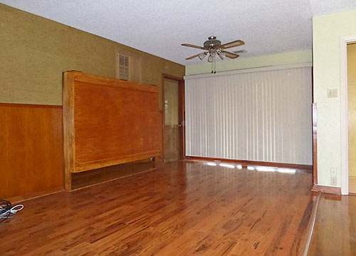
 “I once rented a self storage unit. My wife (then girlfriend) and I were condensing from two apartments to one. After a year and a half of paying the rental fee, I did the math. For what I had paid on the storage unit, I could have bought, brand new, everything I was storing in it. So we ended up emptying the unit and tossing whatever we didn’t immediately have use for. Bottom line, the storage unit was some of the worst money I’ve spent in my entire life. I suspect that’s often the case.” [


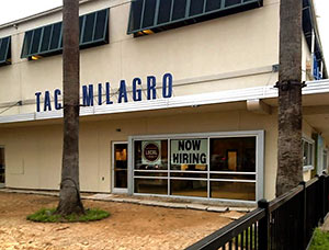 The project manager from homebuilder Frasier Homes busy turning the interior of the shuttered patio-fronting Taco Milagro space at 2555 Kirby Dr. into a second location for Benjy Levit’s upscale sandwich shop Local Foods tells Eater Houston’s Darla Guillen that construction will likely be complete in a couple of weeks. How long after that before it opens for duck confit and falafel on wheat? “Shouldn’t be too far behind that completion date,” Guillen says an employee tells her. But we’re guessing they’ll take down the old Taco signage outside before then.


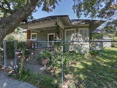
 “Instead of throwing lawsuits around, the people in River Oaks should start a Buy Protect Sell program. Buy pieces of land around their subdivision as they come up for sale. Protect those pieces of land by putting restrictive covenants on them (height regulations in particular, since their concern has been the proliferation of high rises in their area). Then sell the properties with the restrictions in place.
B/P/S has been used for about a decade by environmentalists elsewhere in the country. It could be used to preserve the low-rise character around a neighborhood. The drawback is that it can be costly for poorer neighborhoods, but River Oaks could well afford it.” [
“Instead of throwing lawsuits around, the people in River Oaks should start a Buy Protect Sell program. Buy pieces of land around their subdivision as they come up for sale. Protect those pieces of land by putting restrictive covenants on them (height regulations in particular, since their concern has been the proliferation of high rises in their area). Then sell the properties with the restrictions in place.
B/P/S has been used for about a decade by environmentalists elsewhere in the country. It could be used to preserve the low-rise character around a neighborhood. The drawback is that it can be costly for poorer neighborhoods, but River Oaks could well afford it.” [


