SAVING UPTOWN, HOUSTON’S MASTERPIECE, FROM THE SCOURGE OF DEDICATED BUS LANES 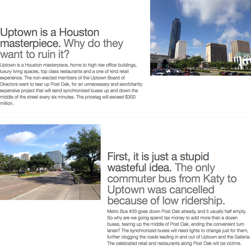 The Uptown Property and Business Owners Coalition is out today with a new website (portrayed here) meant to drum up opposition to the Uptown District and Metro’s plans to install dedicated bus lanes down Post Oak Blvd. The lanes, the last vestige of what was once a plan for an Uptown light rail line, would run from dedicated bus lanes linking to the Northwest Transit Center all the way to the proposed Bellaire/Uptown Transit Center near U.S. 59 and Westpark, where they might someday intersect with a University Line traveling eastward from that point. But the team behind the website wants none of it: “Uptown is a Houston masterpiece. Why do they want to ruin it?” reads the copy on the home page. Meanwhile, an introductory blog post on the site encourages readers to attend a friendly “town hall” meeting, tomorrow night at the Uptown Hilton, in the company of “hundreds of angry business owners and Uptown area residents.” [Save Uptown; previously on Swamplot]
Tag: Metro
THE MCCONAUGHEY IS STRONG IN THIS ONE A mere 6 months after Jim Carrey, Metro is out with its own riff on last year’s series of commercials for the Lincoln MKC emceed by a dusk-cruising Matthew McConaughey. But there’s no Texas Longhorn blocking the road for Metro’s version (above), meant to uh . . . re-introduce the transit agency’s newly reimagined bus service, scheduled to kick off in 4 months. Mixed into the atmospherics is a bus driver’s subtle diss of folks’ reliance on some of the old, less popular routes axed in the bus-map redo: “Where’re you really going on the road less traveled? Probably nowhere really great.” [Metro] Video: Metro
After a year and a half of redrawing, presenting, and tweaking, Metro’s “reimagined” transit plan was approved by the transportation agency’s board today. The interactive map above shows the whole system in all its reconfigured glory, including the new rail lines currently scheduled to begin running in April. Bus routes will switch over to the above route system in August.
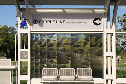
METRO PONDERS HOW TO SPEND A LIGHT RAIL SURPLUS 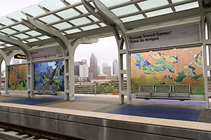 What should Metro do with the extra $39.9 million it’ll end up with after the Southeast and East End rail lines open in April (on the 11th, it now looks like)? If the money isn’t spent, it’ll have to go back to the Federal Transit Administration, reports Dug Begley. $24.9 million of that would have to be spent on projects related to the year-plus-old North Line extension (the Red line), and $14.5 million would be restricted to use on the Southeast Line (aka the Purple Line). Among the proposals: building an elevated walkway between the bus transit center and the rail line at Northline; putting in extra parking at Palm Center, at the end of the Purple Line; shelters for bus stops near stations; an additional station on the Purple Line between Elgin and Leeland; safety or operational improvements, such as a restroom for train operators at a station; a crossing arm on Texas Ave. near Chartres St. [Houston Chronicle] Photo of Burnett Station: Skyline Art Services
METRO GETTING READY TO SELL OFF THE CLOSED PINEMONT PARK & RIDE 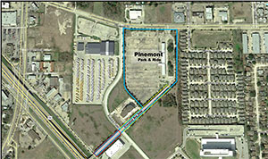 This spring the ramp connecting Metro’s Pinemont Park and Ride to Hwy. 290 was removed as part of TxDOT’s 290 widening project. The facility closed down a few weeks before the ramp vanished. Now the 14.8-acre Pinemont site could go up for sale before the end of the year. Because the Park and Ride’s construction had been partially funded by Uncle Sam, the Federal Transit Administration will have to grant Metro permission to sell. Once that hurdle is cleared, Metro will begin reading sealed bids on the property. The site sprawls out behind Hwy. 290’s Cafe Red Onion, abuts an HISD motor pool and fronts Pinemont Dr. It also sports a handy shortcut to the 290 feeder road along Federal Plaza Dr. The Collier Regional Library stands across Pinemont and a trio of parks — Rosslyn, Forest West and Pinemont — dot the cityscape within a half-mile of the site. [The Leader; more info] Photo: Metro
COMMENT OF THE DAY: ODE TO THE SOUTHEAST LINE CLEARANCE TESTING REGIMEN  “9:53 pm and I can hear the hollow, electronic train horn from my study window, the sad woot of the empty car. Despite the fact that I cannot ride the Metro train, it runs. Past me on my morning commute, it runs. Stopping traffic for 10 minutes on my way home. Always, it runs.” [crunch, commenting on Why Metro Trains Are Already Rolling Around UH] Illustration: Lulu
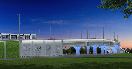

Metro has posted the latest designs for the enormous Hughes St. overpass along Harrisburg Blvd. on the far-east segment of the East End rail line. The $27-to-$42-million bridge is meant to carry cars and Green Line passengers over the Union Pacific East Belt freight rail line that runs north-south just west of Hughes St., between the soon-to-open East End line’s between the future Altic and Cesar Chavez stations. The posted design concepts, Metro notes, combine a “garden” wall and a wall noting a few 4-digit numbers important in the history of the neighborhood with a ribbon of white LED lighting above and blue accent lighting underneath and along the columns:
METRO ADJUSTS ITS REIMAGINED BUS ROUTES 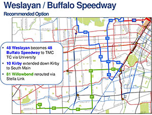 So the reviews of the proposed “System Reimagining” of Metro bus routes are in and . . . generally positive, but a big bunch of letter-writers hated what the new layout might or might not do to public transit along Weslayan, Jones Rd. and Jersey Village, and the Louetta and Vintage Lakes area. So the newly revised map, which Metro unveiled at its board meeting yesterday, recommends some adjustments to proposed service changes in those areas. The new 48 line, for example, which formerly was planned to run straight down Weslayan to the South Loop, would now connect the Northwest Transit Center to Greenway Plaza, the Rice Village, and the Med Center; the new 10 route down Kirby Dr. would now extend further south to S. Main St. Don’t like these changes to the changes? A few alternative route adjustments were presented as well. If the new plans are approved at next month’s meeting, the new bus routes and schedules should go into effect next June. Here’s the whole revised reimagined network map in one big PDF. [Metro; previously on Swamplot; all plan materials]
WHEN HOUSTON HAD A PLAN, AND FUNDING, FOR A DOWNTOWN PEOPLE MOVER 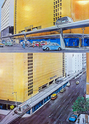 Digging into 40-some-year-old documents resting comfortably in the Houston Metropolitan Research Center at the Julia Ideson Library, Christopher Andrews pieces together the story behind the Downtown People Mover once planned for Houston. Houston was approved to receive $33 million in federal funding for the project in the mid-seventies, along with 4 other cities, but withdrew its application shortly after Harris County voters approved the creation of Metropolitan Transit Authority in 1978. After Houston dropped out (along with Cleveland and St. Paul), actual downtown people movers ended up getting built in Detroit and Miami. “The City of Houston’s 1976 proposal to the UMTA,” writes Andrews, “called for a 1.09 mile system, composed of 2.25 lane miles of track bisecting the ‘heart of the downtown core,’ stretching from the Cullen Center to the Harris County complex. It was intended to be fully owned, operated, planned and financed by the City of Houston, and was said to garner ‘strong and wide local support.'” A later report commissioned by the city showed alternatives to that north-south route along Milam St., including an elevated line running down Main St. past (and into) the (recently demolished) Foley’s building. [Not of It] Renderings: Sperry Systems Management/Houston Metropolitan Research Center
There’s still “some uncertainty” over the exact schedule, but all the pieces needed to allow Metro to open Houston’s second and third light-rail lines won’t be in place until late December, according to reports delivered to a committee of the transportation organization’s board of directors last Friday. Previously, an opening date sometime this fall had been projected for the Southeast and East End lines (though the far eastern end of the East End line won’t come on line until a newly planned overpass is built under over the Union Pacific East Belt freight rail line between the future Altic and Cesar Chavez stations). Delays in the delivery of trains aren’t the sole reason for the late openings, however.
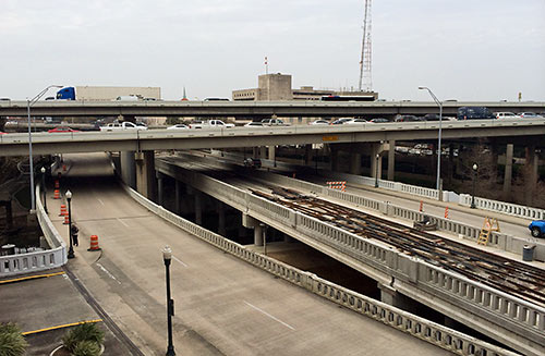
A reader who’s been watching construction of the new bridge that’s gone up over Buffalo Bayou and fitted neatly under I-45 at the far western end of the new under-construction Southeast and East End light-rail lines wonders what its purpose is. The bridge is beyond the planned Theater District stations, the last shared rail stops for the 2 lines. Is it a bridge to nowhere, or the starting point for some later western expansion along Washington Ave?
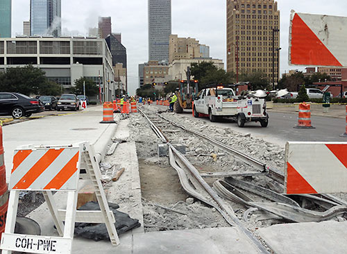
As noted in this morning’s Headlines post, yesterday Metro toted around some trains for “clearance testing” on the eastern stretches of the East End and Southeast rail lines scheduled to open later this year, in advance of electricity being brought down the lines. But downtown, repair continues on a 200-ft. stretch of track shared by the 2 lines on Capitol St. between LaBranch and Crawford — where the rails “probably shifted during concrete placement” and therefore didn’t set properly, a spokesperson for the transit agency tells Swamplot. The concrete has been torn up so the stretch can be rebuilt, level. The rework is being paid for at no cost to Metro by the contractor, Houston Rapid Transit, and will not cause any delay in opening the lines, the spokesperson says.
- East End Line and Southeast Line coverage [Swamplot]
Photo: Swamplot inbox
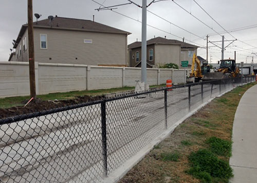
Why were crews yanking out and replacing a brand-new 240-ft.-long stretch of rail and concrete on the not-even-opened-yet Southeast Line at McKinney St. (above), next to the Columbia Tap trail in East Downtown, earlier this month? Because back on May 30th, a 7.2kV CenterPoint Energy electrical line fell onto the tracks and their overhead line three-quarters of a mile to the south, at Scott St. and Coyle St.
Zzzzzzap!
In addition to the McKinney St. burnout, 20-ft. sections of rail and track slab got zapped near crossings at Nagle St. and Elgin. At the incident site, 80 ft. of concrete and anti-vibration insulation had to be scrapped and replaced.
SNøHETTA’S CENTRAL STATION CANOPY DESIGN IS OFFICIALLY DEAD 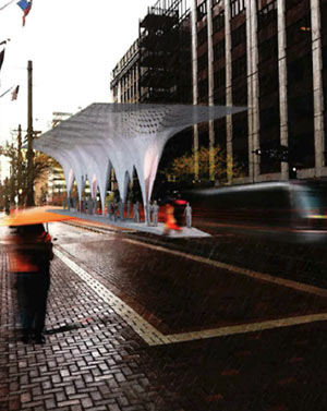 Whatever glimmer of hope supporters of a distinctive Central Station were holding out for Metro somehow following through on its design competition or for Snøhetta’s winning canopy design have officially been dashed, Dug Begley reports: “Metropolitan Transit Authority chairman Gilbert Garcia and interim CEO Tom Lambert confirmed [last] week that timing crippled any chance of resurrecting a winning design. Instead officials will build their basic canopy for the block-long stop between Capitol and Rusk streets on Main Street.” [The Highwayman; previously on Swamplot] Rendering: Snøhetta
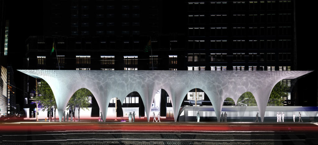
Craig Dykers of Norway-and-NYC architecture firm Snøhetta tells Chronicle reporter Dug Begley his firm has been working for more than a year on its own and with local contractors to lower the construction costs on his firm’s competition-winning design for Metro’s Central Station canopy — in between its work, that is, on a little reconstruction project for New York called Times Square. Snohetta’s design for a canopy made of thin layers of concrete was meant to highlight rainfall, making falling water “a feature of the design.”

