
- 3707 Falun Ct. [HAR]

SUNNYSIDE PASSED OVER FOR LIST OF HOUSTON PLACES THAT ALWAYS GET PASSED OVER 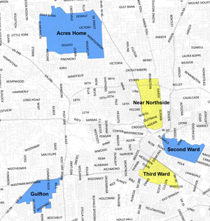 The Texas Low Income Housing Information Service released a statement right after Mayor Turner’s Monday announcement on the Complete Communities program questioning why Sunnyside didn’t make the cut, Steve Jansen reports this week for the Houston Press.  Despite the neighborhood’s oft-heralded blight resume (it made the LARA team during Mayor White’s time in office, and even got rolled into its very own tax increment reinvestment zone last year, a distinction theoretically reserved for “unproductive, underdeveloped, or blighted” areas), Sunnyside didn’t make the list of the first 5 pilot neighborhoods for the new program, which so far looks like it might shuffle existing development money toward the targeted areas without adding any new cash. The statement, coauthored by a Sunnyside-area civic association leader, notes that the neighborhood even has a ready-to-go redevelopment plan that’s been in the work for the past few years.  [Houston Press; previously on Swamplot] Map of pilot areas for Complete Communities program: City of Houston
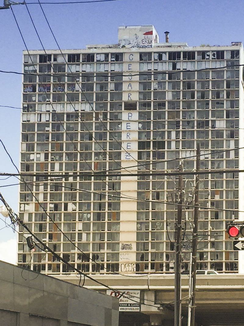
Artist and regular neck craner Bob Russell took a moment this week to capture the various works currently on display to Pierce Elevated drivers on the south side of the 30-story highrise at 801 Saint Joseph Pkwy. (former host of a variety of hotels and Vedic teaching initiatives before the building entered its more recent era of abandonment and creeping decrepitude). The uptick in broken windows in the last few months doesn’t appear to have much of a connection to the most recent plans for the stripping and remodeling of the building back into some flavor of hotel, as proposed this time around by SFK Development. As far as other signs of change, the name scrawled across the facade’s central panels has been edited since another tipster’s drive-by back in February:
WHERE HIGHWAY 87 CRUMBLED BEFORE THE TIDE  The part of Texas “[where] storms are what you talk about” is the subject of John Nova Lomax’s dispatch this week in Texas Monthly — more specifically, the 16-mile stretch of coast where the state gave up on rebuilding SH 87 after the last of a series of hurricane washouts in the 1980s. Amid nude beach signage, dolphin carcasses, and the rusting remains of pipelines and 4-wheelers, Lomax meditates on the idea that the battered stretch of coast, where Texas’s beaches and barrier islands begin dissolve away into a Louisiana-style tangle of eroding wetlands, “once functioned as a seawall: there was a natural ridgeline made of shells and sand that was used as a trail by Native Americans, then Spaniards, then Texans. Then the ridge was bulldozed and repurposed to grade Highway 87, the road that no longer exists — and the one bulwark against the sea was gone.” [Texas Monthly] Photo of eroding highway in McFaddin National Wildlife Refuge: US Fish and Wildlife Service
COMMENT OF THE DAY: A HOUSTON LITMUS TEST FOR PARKING LOT PROGRESS 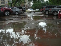 “That parking lot was epic for decades. Let’s hope it was actually reconstructed, and not just the lunar craters poured over with asphalt. The next good flood will tell.” [Miz Brooke Smith, commenting on Richmond Ave’s Contender for Worst Parking Lot in Houston Gets Smoothed Over] Photo: Swamplot inbox
BART TRUXILLO, 1942-2017 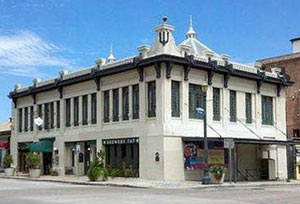 In 2006, the former brewery structure now hosting the Magnolia Ballroom was the first building in Houston to get protected landmark status — and was not the last, probably thanks in part to the life work of its restorer. Bart Truxillo bought the then-vacant building on the edge of Market Square in the late sixties, not too long before buying and restoring the crumbling Queen Anne Mansfield house in the Heights; both structures are now on the National Register of Historic Places. Truxillo later helped found what’s today known as Preservation Houston, and start the organization’s Good Brick Awards during the demolition-rich years of Houston’s first oil boom, as Lisa Gray notes today in the Chronicle; after years of work restoring historic buildings around town and serving a bunch of other history-minded groups, he died yesterday at age 74. [Houston Chronicle; previously on Swamplot] Photo of Magnolia Ballroom building on Franklin St.: Brewery Tap HTX
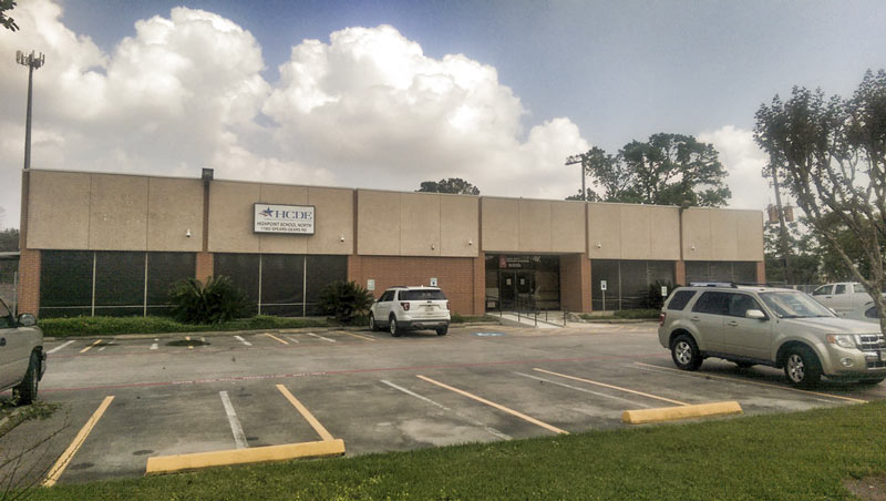
The 20,000-sq.-ft. building at 11902 Spears Gears Rd. is getting cleaned up for a new gig as a school for Harris County students in recovery from addiction and substance abuse. The spot formerly housed the county’s Highpoint School North, one of several campuses around town that took in expelled students, but has been shut down since 2015. The county Department of Education signed off on the new use for the building this week, and says the school should open in September with capacity for up to 30 post-rehab students for now. The building sits just north of Davis High School, tucked next to the 2-acre lot that’s been built up since 2014 into the grounds of Cá»±c Lạc Buddhist Temple.
Photos: Harris County Department of Education
W.A. PARISH COAL PLANT NOW RUNNING ‘CLEAN’ IN RICHMOND, HELPING BOOST OIL EMISSIONS FURTHER SOUTH 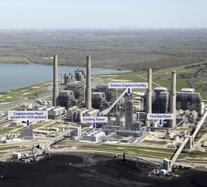 The years-long retrofitting of the W.A. Parish coal plant next to Smithers Lake in Richmond was capped off last week by a valve opening ceremony, at which the plant’s new Petra Nova carbon dioxide collection machinery was ceremonially turned on (though NRG says its been running since September). The new machinery is currently the largest such capture operation in the country, and might help knock the plant down a few notches from its recent high score on the carbon pollution rankings. Monica Simmons of the San Antonio Current, however, points out this week that whether the project actually results in a net reduction of CO2 emissions is something of a question mark: The project, which has been in the works since the over-$70-a-barrel days of 2010, is helping to pay for itself by piping that excess CO2 down to Jackson County and into the ground at the West Ranch oil field — which NRG says will help the folks there squeeze out 15,000 barrels of oil a day instead of 300. [San Antonio Current; previously on Swamplot] Photo of W.A. Parish Generating Station and labeled Petra Nova add-ons: NRG
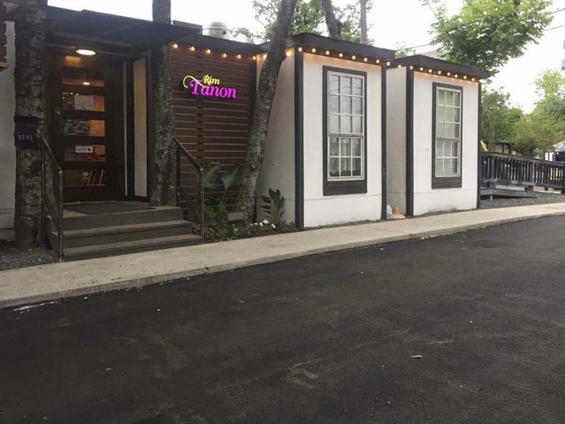
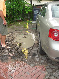 The folks at Rim Tanon (the Thai place that recently replaced the former Blue Fish House sushi spot on Richmond) send word that the hole-spangled brick, asphalt, and rubble parking lot at the center of the Portsmouth Square restaurant clump has been freshly paved over. The spot, which won top honors on a 2011 list of Houston’s worst restaurant parking lots, was resurfaced from Richmond to Portsmouth St. just in time for Tax Day. Above and below are a couple of damp shots of the lot circa some 2010 gawking:

Here’s a ghost-dotted sketch of what may soon inhabit that empty lot at the northwest corner of W. 11th and Nicholson streets; Adolfo Pesquera notes over on VBX that the project’s developers may break ground soon. (That’s both figuratively and literally — there’s a fair bit of concrete and asphalt removal involved in the job.) The medical-themed project is catty-corner from the 2-story building already housing the Heights Clinic (along with a Stewart Title office). There should be some kind of grassy buffer between the 31,010-sq.-ft. building and and the rail-turned-trail Heights hike & bike path running along Nicholson to the east, as well as a bit of open to the west toward recently opened Presidio:
SCENIC UPPER TEXAS COASTAL SWAMPS, BEACHES, PLANTATIONS A LITTLE CLOSER TO GOING NATIONAL 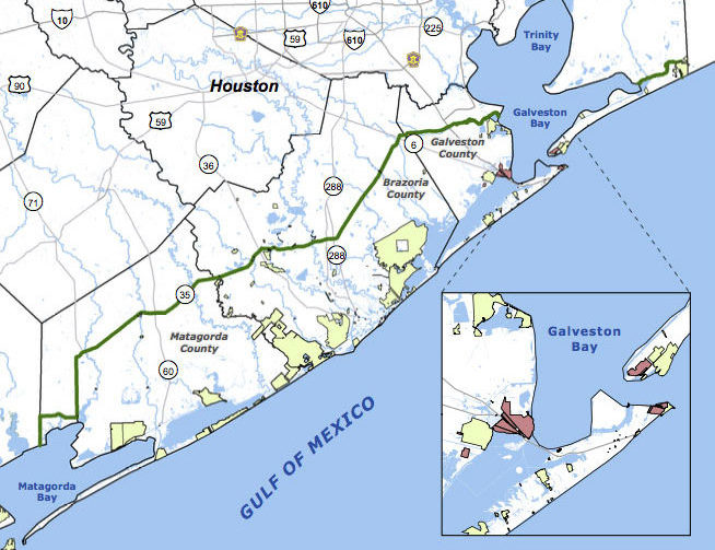 Jefferson County’s commissioners are the latest to give a formal thumbs up to a proposal for the Lone Star Coastal National Recreation Area, which would bundle together a patchwork of parks, historical sites, and variously refinery adjacent nature preserves from the Bolivar peninsula down to Matagorda Bay. The concept for a regional rec zone was developed shortly after Hurricane Ike’s big splash on the Texas coast in 2008: researchers noticed that some of those larger patches of undeveloped wetlands helped buffer storm surge damage, and started looking at whether keeping them around could be profitable in other ways. No new land would be scooped up for inclusion in the 4-county zone, unless it were offered voluntarily — but the whole region would be marketed under the National Parks Service’s banner as a package to birdwatchers, beachgoers, Strand-walkers, and the like. The proposed area would still need some level of National Parks Service staff, and approval from Congress — which is currently considering major cuts to the Department of the Interior’s budget. [Beaumont Enterprise; Houston Chronicle] Map of proposed Lone Star Coastal National Recreation Area: LSCNRAÂ
COMMENT OF THE DAY: FOR WHOM THE TRAIN ROLLS  “. . . The few large cities that you’re referring to, where central living expenses are far higher than Houston, all provide far more extensive mass transit options. I know I have multiple transit options after midnight in other large cities — not so for Houston. For those without reliable transportation and non-office hours, the availability of Park and Rides does not solve or address accessibility issues.” [joel, commenting on Grand Central Park’s Official Debut; Houston’s Not All Sprawl] Illustration: Lulu