10/10/16 5:00pm

Annunciation Greek Orthodox Church renderings, 3511 Yoakum Blvd., WAMM, Houston, 77006

Annunciation Greek Orthodox Church, 3511 Yoakum Blvd., WAMM, Houston, 77006
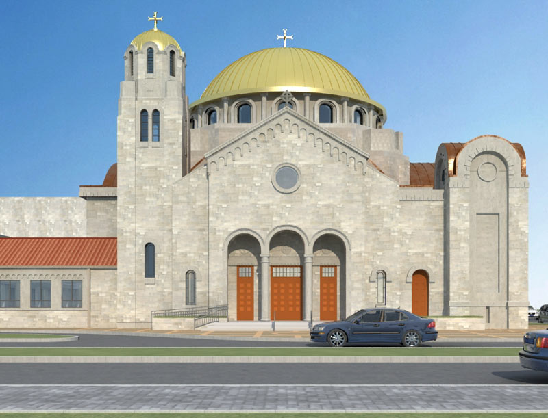
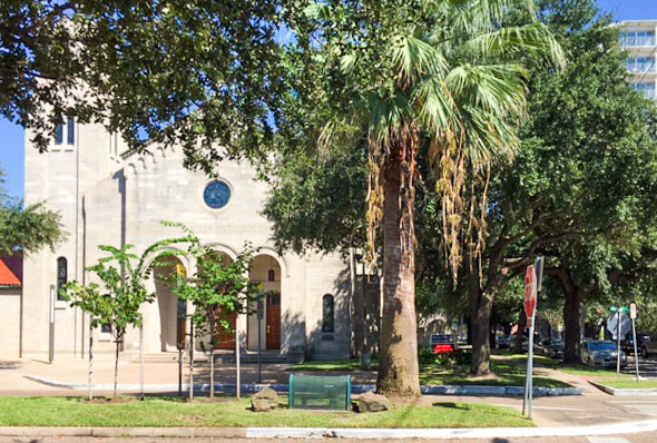
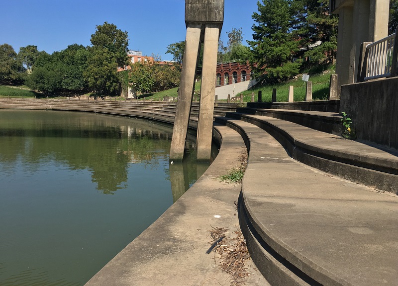
A look at the latest plans for bulking up the Annunciation Greek Orthodox Cathedral on Yoakum Blvd. at Kipling St. come from the diagrams submitted with a recent variance request for the project (and a few more now up on the church’s website). For comparison, a reader sends some leafy shots of the cathedral at its current width, snapped a few days before the setup for the annual Houston Greek Festival (which wrapped up on the church’s campus for the 50th time yesterday evening).

The expansion would widen the 1952 cathedral building to the north and south (toward and away from Kipling), about doubling the current seating capacity; the design also adds that big dome to the top (while the smaller dome along the Yoakum-side bell tower would get a new nitrate finish stainless-steel top-off to match). The church submitted the request for a 1-ft. building line setback last month, including this drawing from Philip Johnson/Alan Ritchie architects (which shows a leaf-free perspective from the corner of Yoakum and Kipling):

CONTINUE READING THIS STORY

Toward the Heavens, To the Curb
10/10/16 1:00pm

DEEP: SeaspaceDEEP: Seaspace

To cap off a series of Houston-landmark-linked performances carried out over the past few years, Karen Stoke’s dance company will put on bayou-and-space-themed DEEP: Seaspace at Hobby Center the weekend after next (that’s October 20th through 22nd). Stokes, whose previous work includes that well-timed dance about flooding in Discovery Green right after Memorial Day last year, tells Swamplot she has been mulling over appropriately grand Ship Channel choreographies since at least 2003, when she cut a related section from her piece Hometown with plans to tackle the topic later in greater depth.

On the list of historical places given a nod in the choreography (or in the short film to be shown during the live performance): Ship-Channel-side spots like the site of Santa Anna’s capture near the San Jacinto battlegrounds (the historical marker for which is located along Federal Rd. where the Washburn Tunnel crosses under the waterway); Allen’s Landing in Downtown; and the area around the former Willow St. Pump Station (just north of where White Oak Bayou meets Buffalo, by the Harris County Jail) — that spot is shown below, with dancers placed for atmosphere:

CONTINUE READING THIS STORY

Industrial Art
10/10/16 10:45am

H-E-B WILL DOUBLE DOWN ON A HEIGHTS DRY ZONE STORE OR NOT BUILD AT ALL 2-story H-E-B proposed at 5106 Bissonnet St., Bellaire, TX 77401
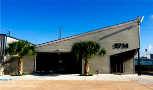
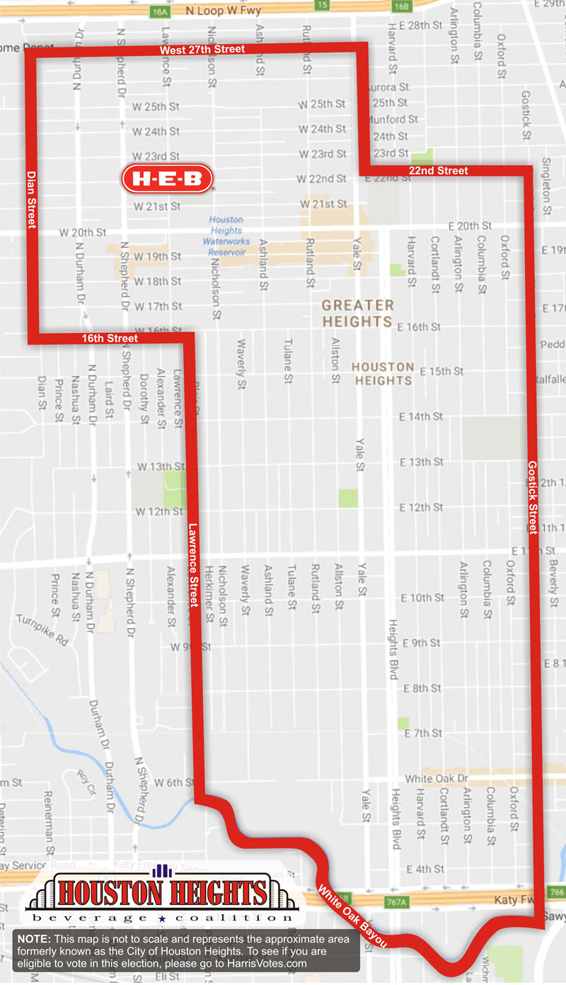
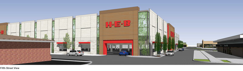
The H-E-B proposed for the former N. Shepherd Fiesta site at W. 24th St. would be another 2-story store, Houston H-E-B president Scott McClelland tells Jack Witthaus. The grocery chain is backing the Houston Heights Beverage Coalition’s dry-zone dampening campaign and showed up for the press conference last week on the now-cleared 4-ish-acre site. The company has already been planning its first double-decker Houston location (rendered above) on the 3-acre site of the existing H-E-B in Bellaire; plans for that development show about 75,000 sq. ft. of store stacked on top of an all-parking ground level. McClelland tells Witthaus that the proposed H-E-B in the dry area of the Heights would be about 80,000 sq. ft. and come with a 2018 expected completion date, but that H-E-B won’t build in the zone at all if the upcoming election doesn’t go their way. [Houston Business Journal; previously on Swamplot] Rendering of proposed 2-story H-E-B in Bellaire: Terra Associates

10/10/16 8:30am

parking-garage

Photo: Bill Barfield via Swamplot Flickr Pool

Headlines
10/07/16 2:15pm

CITY TO PUSH ALL 146 HOUSTON TAXI COMPANIES ONTO SINGLE SMARTPHONE APP Uber HQ in Houston, 5714 Star Lane, Houston, 77057On Wednesday city council approved a plan to require that all licensed Houston cab drivers start taking hails via the same smartphone app, Rebecca Elliott reports. Arro, which rolled out in New York last year and several other major cities since, will tack a $1.50 fee onto the normal cab fare for riders (with a 50 cent-plus-3-percent fee for drivers), and will centralize taxi dispatch across the city. (Limo drivers can get in on the action too, if they want to.) The plan comes in response to not-technically-a-cab-company Uber’s recent threats to pull out of Houston over requirements for fingerprinted background checks for its drivers; Elliott writes that the city wants to have the system up and running by the end of the month.  [Houston Chronicle; previously on Swamplot] Photo of Houston Uber HQ, 5714 Star Ln.: Uber Houston

10/07/16 12:00pm

Downtown Houston Skyline

Today on Swamplot our sponsor is Houston’s own Central Bank. Swamplot appreciates the continued support!

Central Bank has 4 (central) Houston branches available to meet your business or personal needs: in Midtown, the Heights, West Houston, and Post Oak Place.

Central Bank believes that change is essential to its success; the company actively pursues the latest in service, technology, and products. Central Bank aims to know its customers personally and to be their primary business and personal financial resource. The bank’s staff values relationships and strives to be available when you need them.

To learn more about how Central Bank can meet your banking needs, please call any of the following Senior Vice Presidents: Kenny Beard, at 832.485.2376; Bonnie Purvis, at 832.485.2354; Gary Noble, at 832.485.2366; or Ryan Tillman, at 832.485.2307. You can also find out more on the bank’s website.

Do Swamplot readers know what’s great about your local business? They will when it’s Swamplot’s Sponsor of the Day. 

Sponsor of the Day
10/07/16 11:30am

Sugar Land Memorial Park and Brazos River Corridor, 15300 University Blvd, Sugar Land, TX 77479

A fresh shot shows the veteran’s memorial at Sugar Land Memorial Park last weekend, which has been relatively high and dry since its brief closure following all that June flooding along the Brazos. The park is right alongside the river channel (southeast of the 59 crossing, where University and Commonwealth boulevards meet), and is designed to protect and serve the surrounding neighborhoods by storing excess floodwater in a pinch. The memorial is also designed to showcase tilt-up concrete construction methods (and was the focus of the Tilt Up Concrete Association’s annual tilt-up-related do-gooding project in 2013). Here’s an aerial view from early June from the Sugar Land Parks & Recreation folks, showing exactly why this year’s Memorial Day event at the park was cancelled (and why the neighboring Pawm Springs Dog Park, in the foreground, was closed):

CONTINUE READING THIS STORY

On Duty on the Brazos
10/07/16 10:30am

WAIT, DID THE 2008 RECESSION UP THE CHANCES OF A FUTURE HOUSTON CHEMICAL CATASTROPHE? Predicted Before and After Flood Map, 500 Year Flood Event
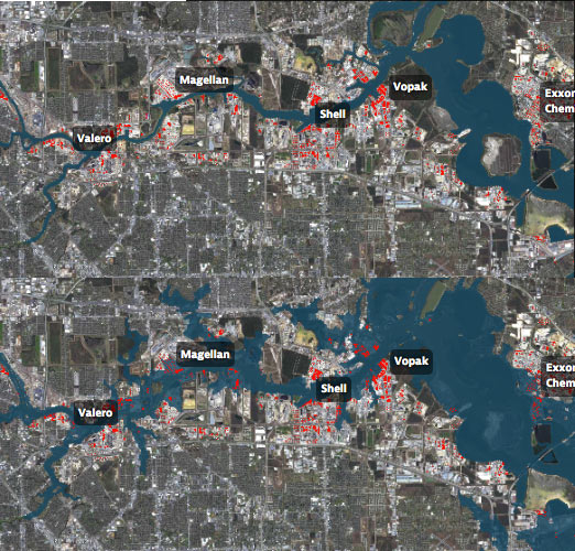
Roy Scranton imagines “a wave of water sweeping toxic waste into playgrounds, shops and houses” in Magnolia Park in his op-ed this morning, written after touring the Ship Channel and speaking with the local A&M and Rice research teams pushing for variations on a series of region-scale coastal barriers to hunker down behind whenever the next gigantic hurricane hits the Houston region, in hopes of avoiding deadly flooding and catastrophic chemical spills. But the researchers tell Scranton that pushing for federal and state funding for a response is a slow endeavor; Jim Blackburn (a main player on the Rice team) tells Scranton that he’s “heard more than one person say our plan is to wait until the next hurricane comes, then depend on guilt money from Washington to fix the problem.” Scranton writes that the best chance for that guilt money so far might have been in 2008, when Hurricane Ike landed just 30 miles northeast of the zone that modelers say could have caused thousands of deaths and irreparable ecological devastation to the area, on September 13th — 2 days before the Lehman Brothers filed for bankruptcy, pulling global attention and national funds to other issues as markets began to crash. [NY Times; previously on Swamplot] Model maps of potential storm surge flooding along the ship channel, with chemical storage marked in red: Texas Tribune

10/07/16 8:30am

buffalo-bayou2

Photo of White Oak Bayou: Russell Hancock via Swamplot Flickr Pool

Headlines
10/06/16 5:30pm

H-E-B Heights Proposed Dry Zone Site

The marker above (showing a now-officially-proposed H-E-B on N. Shepherd Dr.) is a little out of place, if it’s aiming for the former Fiesta site on N. Shepherd between W. 23rd and W. 24th streets as H-E-B says — but you get the idea, and the Houston Heights Beverage Coalition held a press conference on the site this morning to drive the point home. The red line on the map also only roughly shows the boundary of the nominal dry zone that the H-E-B-backed PAC is hoping to get loosened up a bit via that upcoming local election on take-home beer and wine sales. But you can find out for sure whether or not you’re close enough to be eligible to vote in the Houston-Heights-only election by checking your ballot at at HarrisVotes.com — and also check whether or not you’re registered, which you’ve only got until Tuesday to do. (If printing out a form is too much of a hassle, maybe try your nearest taco truck.)

Map of proposed H-E-B in Heights Dry Zone: Houston Heights Beverage Coalition

Campaign Fiesta
10/06/16 4:45pm

COMMENT OF THE DAY: THAT HIGH HORSE WON’T KEEP YOUR FLOORS DRY Flooding Coastal Homes“Wonder how many areas will sue to get out of the high risk zones, only to get flooded years later, have no insurance, and cry foul. Note to those who are able to sue or survey themselves out of a flood zone… buy the insurance anyway! If you are [put] in a high risk zone, right or wrong, you are close enough to warrant the protection.” [Rex, commenting on A Quick Tour of Spots Where FEMA Will Expand Its Flood Hazard Zone In January] Illustration: Lulu