DITCH REPAIRS, BRIDGE REPLACEMENT TO CLOSE STRETCH OF SAN FELIPE FOR NEXT 2 WEEKS 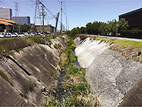 San Felipe St. near Mid Ln. and the Loop is going to be out of commission for about 2 weeks, according to the Harris County Flood Control District: After tonight’s rush hour subsides, workers will move in to remove concrete from the sides of the eroding and underperforming drainage ditch, shown here, and install closed culverts. And that means the 50-year-old bridge on San Felipe will need to be demolished and replaced. The area to be closed is near the new Liberty Kitchen spot and the luxury apartments under construction on Briar Hollow Ln. [HCFCD; previously on Swamplot] Photo: HCFCD
Tag: Streets
WHAT TIME THE EXPLOSIONS DOWNTOWN WILL WAKE YOU UP  A rep from Metro confirms that the booms of the controlled demolition of the former Foley’s at 1110 Main St. will begin booming between 7:10 and 7:20 this Sunday, September 22. (That’s 10 minutes past sunrise, for all you morning people.) And if you’ll be driving Downtown to find parking and get yourself in implosion position, note that the street closures that Swamplot reported yesterday will begin at 6 a.m. [Metro; previously on Swamplot] Photo of Foley’s: Jim Parsons
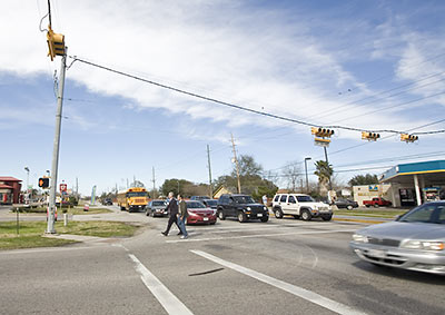
In February, the Art Guys went for distance, walking the marathon that is W. Little York Rd.; tomorrow, they’ll be going for danger. The 9th of their “12 Events” requires Jack Massing and Michael Galbreth to maintain pedestrian safety techniques and situational awareness as they cross the street, all day, at Westheimer and Hillcroft/Voss, what they’re claiming is the “busiest intersection in Houston.”
Here’s the deal: They’ll start their day off walking clockwise, and, presumably to avoid the monotony, switch things up and go counterclockwise the rest of the afternoon. It’s unclear whether they’ll be taking advantage of the various muscle supplements and joint remedies at the nearby Vitamin Shoppe in the Westhill Village Shopping Center there on the southwest corner.
- 12 Events [The Art Guys]
- Art Guys coverage [Swamplot]
Photo of Art Guys on W. Little York Rd.: Everett Taasevigen
COMMENT OF THE DAY: HOUSTON’S 6 TRULY WALKABLE NEIGHBORHOODS 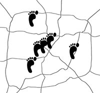 “. . . [Y]ou can have walkability even when density is just moderate. Small town downtowns are walkable even though most folks arrive by car. Many commercial neighborhoods in streetcar suburbs built before 1950 are this way. What makes them walkable: comfortable street design (sorry but 40 mph is too fast), frequent safe pedestrian street crossings, ample sidewalks in good condition, pedestrian-oriented buildings that aren’t separated by big parking lots, on-street parking (what Houston lacks in too many places), decent night lighting, and relatively small block sizes. Houston has subsets of these features in numerous places but the whole package is very rare — 19th @ Rutland, Rice Village (mainly just strip malls mushed together), Harrisburg @ 67th, the Historic District downtown, and the main gay bar area in Montrose (awful or nonexistent sidewalks though and lacking night lighting) come close, plus of course Bagby @ Gray. Hence developers building them from scratch (West Ave, River Oaks District, CityCentre, etc.) to satisfy demand.” [Local Planner, commenting on Comment of the Day: Sorry, but Houston’s Never Gonna Be Walkable] Illustration: Lulu
ALLSTON OR NOTHING: SIDE STREET NOW AT CENTER OF ALEXAN YALE APARTMENT DISPUTE 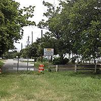 About 290 ft. of Allston St. have become the latest point of contention between developer Trammell Crow and Heights opponents to the proposed 5-story Alexan Yale apartment complex. This complex, planned immediately south of the other one, would sit on the block bound by 5th, 6th, Yale, and Rutland, with Allston running through it. The Leader reports that Trammell Crow has requested that the city abandon Allston, which dead-ends just before 5th St., so the complex doesn’t have to be discontiguous; opponents, of course, want Allston to be opened up, to help with traffic and ensure connectivity to the nearby detention basin that’s been proposed as a recreation site. The abandonment request is going to be decided upon soon by a city committee of reps from public works, planning, and the fire department — though Trammell Crow appears to have some leverage, reports Cynthia Lescalleet: “The structure could go even higher, the developer says, if it doesn’t get what it’s seeking. . . . [Trammell Crow] has ‘alternate plans’ that would add two or three floors to the building. There’s also speculation about a possible sky bridge connecting sections on either side of the still-open street.” [The Leader; previously on Swamplot] Photo of Allston St.: Allyn West
WHY NOT BANISH CARS FROM MAIN ST.? 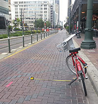 Monday morning’s fatal collision between the bicycling Rice University architecture student and a southbound Metro train seems to have occasioned the folks at Houston Tomorrow to wonder at the best uses for Main St.: Blogger Kyle Nielsen shows — with a rented B-Cycle and a tape measure — how little room there is for a motorist to give a “vulnerable road user” the 3 ft. now required by the city for “safe passing” and suggests that the Downtown corridor should be closed off, once and for all, to traffic: “It seems to me that it would enhance cyclist and pedestrian safety, encourage the type of walkable retail and bars/restaurants that Downtown needs, decrease motorist frustration at being stuck behind a bicycle, and enhance motorist and transit safety by eliminating the motorist [illegal] left turns that still hit the Metro rail cars sporadically.” [Houston Tomorrow; previously on Swamplot] Photo: kylejack
Struggling to make themselves heard above the whoosh of traffic along the Washington Corridor, Better Houston’s Pedestrian Pete (a.k.a. one-time mayoral candidate Peter Brown) and visiting Harvard prof and city planner Peter Park take a very short stroll in this recently uploaded video. Their objective? To lament the guy wires, utility poles, and other hindrances for would-be pedestrians on the few feet of sidewalk they traverse in front of Five Guys Burgers and Fries and Buffalo Wild Wings in this strip center near Leverkuhn at 3939 Washington.
- Improvements Along Wash Ave [Pedestrian Pete]
Video: Pedestrian Pete
COMMENT OF THE DAY: WHEN HOUSTON BUILDINGS WEREN’T SO SHY OF THE STREET 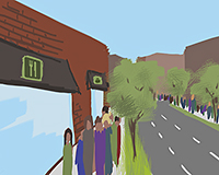 “The main reason these old buildings are so charming is their zero-foot setback from the front property line, which results in a much more pedestrian-friendly streetscape.
Ever since the City created the Chapter 42 development requirements, with 25-ft setbacks along major thoroughfares (of which Washington is one) and minimum parking requirements, retail development shifted from pedestrian-friendly zero building line (e.g. 19th St or Rice Village) to strip centers with two rows of parking in front.
After all, if you can’t build within 25 feet of the building line, you might as well put cars there.” [Angostura, commenting on A Restaurant Renovation in the Old Sixth Ward] Illustration: Lulu
COMMENT OF THE DAY: ONE WAY WASHINGTON AVE COULD GO “What is the plausibility of turning Washington Ave into a one-way, eastbound road with three lanes with one lane dedicated to on street parking? And then having Center St become the outbound counterpart –– three lanes, no parking, so that less additional right of way would be needed? [Vmel, commenting on Planning for the Future of Washington Ave]
ORDINANCE NOW PROTECTS THE VULNERABLE FROM PASSING CARS, PROJECTILES 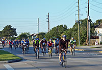 Yesterday, city council approved an ordinance requiring Houston drivers to play nicer with others. That means: No throwing things at them anymore, and no passing “vulnerable road users” without maintaining at least 3 ft. of space (or 6 ft., if you’re driving a commercial truck). And how are you supposed to know which road user is vulnerable? Maybe you can print out and keep in your car this list — not organized, presumably, by order of importance —Â from the city press release: “walkers or runners; the physically disabled, such as someone in a wheelchair; a stranded motorist or passengers; highway construction, utility or maintenance workers; tow truck operators; cyclists; moped, motor-driven cycle and scooter drivers; or horseback riders.” [City of Houston] Photo of cyclists on Fry Rd.: Flickr user josephkynguyen
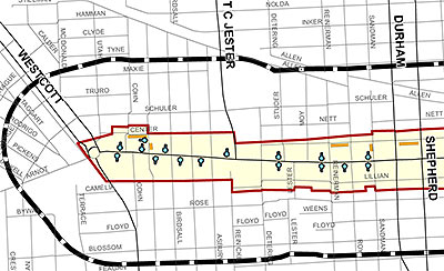
Those light-blue dots? That’s where you’ll be able to pay to park now on Washington Ave. The city’s first Parking Benefit District (or PBD) went live as of this morning, with dozens of these pay-to-stay meters installed between Westcott and Houston that will charge you about a buck an hour between 7 a.m. and 2 a.m.
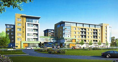
This rendering of the apartment building that Hines is replacing Cafe Adobe with isn’t current, says a company rep. And details about the building are few — though the rep says that the midrise Hines is planning for the soon-to-be-former restaurant and parking lot at Westheimer and South Shepherd will contain 215 units and no retail space.
COMMENT OF THE DAY RUNNER-UP: CAMERAS ON THE STREET, BEFORE AND AFTER BOSTON “Before Boston, my attitute on red light cameras was (1) there is no expectation of privacy on the roads, in your cars or otherwise in public, (2) no person is actually monitoring these cameras, you paranoid freaks and (3) only those who were breaking the law had anything to worry about. After Boston my attitude is the same plus (4) WE NEED MORE CAMERAS and for tapes to be saved at least thirty days to aid law enforcement!” [mel, commenting on Headlines: Challenging Keystone Pipeline Challenge; Watching ExxonMobil Campus Grow]
PANHANDLERS IN NORTHWEST HOUSTON MIGHT HAVE TO APPLY FOR PERMITS 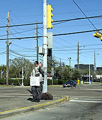 A group of residents led by Larry Lipton, public safety chair of the chamber of commerce in Northwest Houston near Cypress Creek Pkwy., is looking to implement a permit system that would require panhandlers to apply to solicit in intersections and medians, reports KHOU’s Jeremy Desel: “Many of them are criminals,” Lipton tells Desel. And a permit system, Lipton explains, “will first limit the number of people that will even do it. That will even go through it.” Desel adds that one of these solicitation permits would likely “require a fee and some form of safety training.” [KHOU] Photo of panhandler David the Sailor at Chimney Rock and Richmond: Bill Bradford
HOW TO SPOT A FAKE ‘NO PARKING’ SIGN 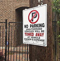 A sign like the one shown here is indicative of “a growing problem” inside the Loop, reports abc13’s Miya Shay, who claims that some homeowners and businesses are resorting to a creative way of keeping would-be parkers off the street: “If you notice,” resident Joanne Witt tells Shay, “[the sign] doesn’t have [a] police phone number and it doesn’t say where it’s going to be towed. I’m assuming it’s just put up to scare people.” And how will you know where you can park? Shay tries to clarify: “Legal parking signs by the city are uniform with a red slash across a letter ‘P.’ Signs on fences and utility poles or even physical deterrents like boulders along the street are all illegal because, like it or not, city streets are open to everyone.” [abc13; previously on Swamplot] Photo: abc13, via Facebook

