04/17/08 11:19pm

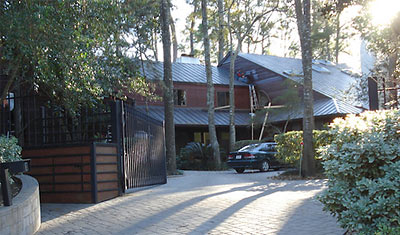
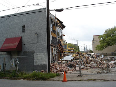
Demolition of Former Martha Turner Properties Building, 1902 Westheimer Rd., Houston, April 17, 2008

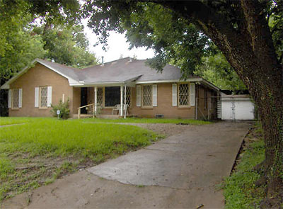
Swamplot reader Buildergeek sends pictures from the demolition of the former Martha Turner Properties building at the corner of Westheimer and Hazard.

Whatever’s happening to the site, it sure doesn’t sound like what Nancy Sarnoff reported a year and a half ago in the Chronicle:

The old headquarters of Martha Turner Properties near River Oaks has been sold for the third time in as many years to a florist who plans to gut the property, add a floral showroom and lease out space to other businesses.

The owners of Plants ’n’ Petals, a 25-year-old flower shop located near Highland Village, purchased the former real estate office at 1902 Westheimer for an undisclosed amount. . . .

The renovations will include installing windows on the Westheimer-facing facade, gutting the interior and adding a mezzanine for offices.

The building will have about 12,000 square feet of space when it’s finished by the end of 2008.

After the jump: Clearly, the building was too close to the street!

CONTINUE READING THIS STORY

04/11/08 12:05pm

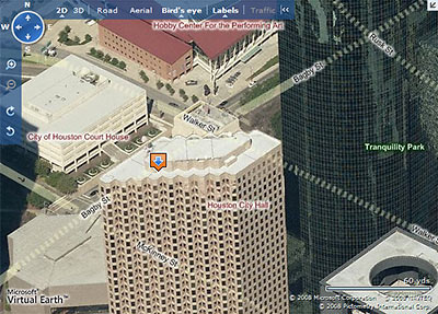
Live Search Maps Aerial View of Downtown Houston with New Street Highlighting and Labels

Microsoft has updated its Live Search Maps with a number of new features, the most striking of which is the ability to view a street-map overlay on the maps’ signature 3D aerial views. This should be especially helpful to the armchair pilots among you who have been flying blind through Microsoft’s “bird’s eye” views, trying to figure which street is which as you rotate around a property.

Since HAR’s recent update, Live Search Maps are now linked directly to property listings. However, those maps do not include the new street-highlighting feature. To see this new feature, go to maps.live.com and enter an address, then click on the “Bird’s eye” button at the top. Street highlighting automatically appears, but you can turn it off by clicking on the button at the top marked “Labels.” As before, you can rotate the direction of your view by clicking on the N, S, E, or W in the top left corner.

Now here’s a problem: What happens when the newly highlighted streets run behind a tall building? As our sample image above shows, they don’t just run — they dash!

After the jump: How to avoid traffic online!

CONTINUE READING THIS STORY

04/07/08 11:28am

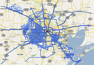
Google Street View Coverage of Houston

Last week Google rolled out a major update of its Street View feature, adding 13 new cities and a national park, and expanding its coverage in 6 cities . . . including Houston. The map above shows the extent of the Houston street-level photos now available through Google Maps.

Previously, street views from Google Maps were available only from major thoroughfares in the Houston area. Now, they are available on just about every street . . . within the areas marked in blue. South Houston, plus areas west of 290 and 288 outside the Loop are now mapped street by street. But most inside-the-loop neighborhoods are still left out.

Strangely, this means Google Map addicts can stalk Cypress subdivisions virtually street by street, but views of Southampton are limited to sideways glances from Shepherd and Bissonnet.

After the jump: a sampling of the new street-level views of westside neighborhoods!

CONTINUE READING THIS STORY

01/31/08 5:38pm

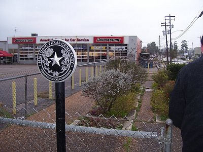
Hillendahl Cemetery, Long Point, Spring Branch, Houston

There’s just too much to take in from the latest rambling, illustrated walking tour by David Beebe and John Nova Lomax, narrated in harmony from their two separate corners of the Texan blogosphere. The pair’s latest venture — appropriately enough — runs along Long Point, through the heart of Spring Branch:

. . . primarily Long Point is a binary street combining Mexico and Korea. In contrast to the multi-ethnic riot that is Bissonnet, or the Pan-Asian explosion that is Bellaire, Long Point is binary. Some businesses fuse into MexiKorea. The Koryo Bakery, right next door to the only Korean bookstore in Houston, touts its pan dulce y pastels, for example, and it seems that many of the Korean-owned businesses aim at Spanish-speakers more than Anglos. (Someone should open a restaurant out here called Jose Cho’s TaKorea.)

The camera-and-tequila-toting duo guide us through a shady thrift-store nirvana they declare to be drab but safe, pointing out salient features along the way: cans of silkworm pupae in a former Kroger turned Korean supermarket, and the historic Hillendahl Cemetery (pictured above) carved out of one corner of a Bridgestone tire barn parking lot.

After the jump, more Spring Branch walking-tour highlights!

CONTINUE READING THIS STORY

01/29/08 4:00pm

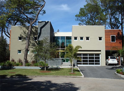
House on Cedarspur Dr. in Spring Valley, Houston

Robert Boyd rides north of I-10 and snoops around more Spring Valley homes in his latest bike tour. Highlights: The Voss mess, a cool carport, and the recent retail-Modern pad pictured above.

Photo of house on Cedarspur Dr.: Robert W. Boyd

01/29/08 1:21pm

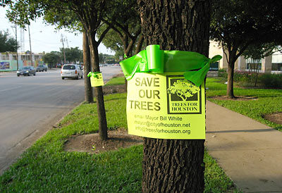
Green Ribbons on Kirby Dr. Trees

A real estate agent writes in to report that the grand compromise to save all those Live Oaks lining Kirby Dr. between Richmond and Westheimer isn’t going to save anything:

Despite a compromise that reclaimed 7 feet of paved width from a plan to revamp Kirby Drive, it now appears that all of the trees between Richmond Avenue and Westheimer Road will be lost to construction.

Houston foresters told a group of about 30 residents Thursday that after walking the site Dec. 7, it was determined that even with a roadway that is 73 feet across, the majority of trees will be unable to survive.

City Forester Victor Cordova said only eight trees within the area have a “realistic chance” of surviving, and that is because they are relatively small rather than in a viable location. He called moving those trees “a very expensive venture.”

Our agent-informant is aghast, and tells us that either the trees stay or she leaves Houston. That sounds kinda drastic, and doesn’t give much credit to the real improvements to Houston’s quality of life the Kirby Dr. reconstruction will likely achieve:

The City insists that the street be widened not to increase capacity but to increase the lane widths. A Public Works engineer told me recently that drivers of Hummers and some large SUVs find the current Kirby lane width “uncomfortable.”

01/18/08 9:05am

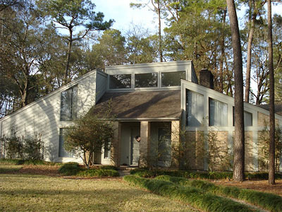
House on Winningham Ln., Spring Valley, Houston

What makes Hilshire Village and Spring Valley different from the rest of the Memorial Villages?

Both these Villages are north of I-10, which for Memorialites is sort of the wrong side of the tracks. Indeed, if you look at the household income of 77055 in the year 2000, the zip code that encompasses Hilshire Village and Spring Valley, it is $36.7 thousand. The average household income in 77024, which consists mainly of the southern Villages, is $82.6 thousand. The two northern Villages, however, are probably far closer to the Southern Villages in terms of wealth. It’s simply that as you go north and east from Spring Valley and Hilshire Village, you enter more working class neighborhoods, with lots of Hispanic and Korean immigrants. They may not be rich, but they are strivers, and the area North of I-10 on the Westside is, I think, getting wealthier and more middle class.

Robert Boyd returns from his latest bicycle tour — through Memorial’s northern outposts — with photos of his finds: wobbly Metro bike racks, shed-roof seventies Modern Memorial classics, ivy art, creekside barbecue, Tae Kwon Do parking-lot attendants, low-calorie McMansions, plus a couple of misplaced Victorians and a faux Adobe.

Photo of house on Winningham Ln.: Robert W. Boyd

01/14/08 8:50am

House on Farnham Park, Houston

Intrepid bicycle blogger Robert Boyd ventures into two more tony westside residential neighborhoods: Farnham Park and Charnwood — only to be hassled by security guards:

Now apparently some residents were alarmed to see me riding in their neighborhood taking photos. So the guards gave me a lot of shit when I left, and they strongly implied that this was private property and that I was not allowed to take photos. It was a humiliating dress-down, which I would have gladly avoided. I was afraid they’d try to hold me or call the cops, but they took my personal information (which if I had any guts, I would have denied them*) and let me go.

No pics of the security gates guarding a public street in his report, but plenty of languorous estates nestled behind twiggy foliage. A sympathetic commenter offers Boyd these words of encouragement:

I understand that these people are wealthy and value their privacy, but if you don’t want people taking pictures, don’t build such a great house.

A great number of Houstonians in other neighborhoods are already taking this advice.

After the jump: Boyd provides photographic evidence that Briarbend Park has Buffalo Bayou’s best front-row seats.

CONTINUE READING THIS STORY

01/02/08 8:41am

Woodlands Street View

Nancy Sarnoff’s short interview with the woman responsible for naming new streets in The Woodlands is just too rich:

We use a lot of words that are just appealing, pretty images, like Peaceful Canyon. That neighborhood sold really well and I think it’s because of the name. We even did radio commercials that played off the name and it really helped market the area. Others are Racing Cloud, Amber Glow and Destiny Cove. We even have ones from Star Wars. That day I was really desperate. Nothing was popping into my head. We have lots of nautical names around Lake Woodlands like Outrigger’s Run.

Woodlands Operating Co. marketing director Susan Vreeland-Wendt confirms every cliché about the origins of subdivision street names, from the historical revisionism (“One of our presidents is Alex Sutton, and we have a street named Sutton Mill”) to the what-I-drank-for-dinner-last-night story (“I’ve been known to pore over wine bottles looking for inspiration”) — except the one about suburban names coming from geographical features that were demolished or removed so the place could be built. Fortunately, The Woodlands does carry on the proud Houston tradition of naming places after imaginary or wished-for amenities:

We’ve got Arrow Canyon, Kayak Ridge, Arbor Camp and Rocky Point.

Surprisingly not on Vreeland-Wendt’s list of inspirations: Harlequin romance novels. But she does consult the internet, because it’s full of useful resources.

Photo: Flickr user kaatiya

12/04/07 6:08pm

Money Stop on Bissonnet, Houston

It’s high time for another street-walking adventure from the writing, singing, photographing, and drinking duo of quasi-professional pedestrians John Nova Lomax and David Beebe. Their latest challenge: a 14.5-mile walk along Bissonnet, from Synott Road (just past Dairy Ashford) to Montrose, which brings Lomax to this stirring conclusion on the sidewalk-transforming power of street trees:

By now, I’ve walked damn near the entire lengths of Bellaire, Westheimer, Clinton, Navigation, and Shepherd, and Bissonnet is nicer than all of them, for the simple reason that its sidewalks have far more shade. Westheimer has none between 6 and the Loop, save for a few landscaping fantasias at scattered corporate campuses; there’s none to be had on most of Shepherd unless you duck under a bridge (where you might sit on human turds); sun-baked Bellaire has none from Eldridge central Sharpstown, and the East Side streets are only a little better. Bissonnet, on the other hand, seems like a stroll through Yosemite.

Below the fold: local color.

CONTINUE READING THIS STORY

11/20/07 11:06am

4608 Roseneath Dr., Houston

Why has this property in Riverside Terrace been floating aimlessly on the market for almost five months? Sure, it’s being sold “as is” — and the “is” apparently doesn’t merit an interior photo. But the home has four bedrooms, contains 2,875 square feet of living space, and is apparently salvageable. Plus it sits on a 11,100-square-foot lot on a “lovely, tree-lined street” in a part of town that’s been pretty hot recently, no?

CONTINUE READING THIS STORY

10/15/07 10:00am

The wisdom of King Solomon lives on! The promised grand compromise on the Kirby Dr. street trees has been officially unveiled: Many of the oaks lining the busy street will get to keep most of their roots! The street surface will be expanded

to a standard of 73 feet, widening to 74 feet for left-turn lanes without signals and 77 feet at intersections with stoplights. Kirby is currently 66 feet wide.

That means up to five-and-a-half feet of trimming.

In order to protect trees during construction, a process called “water sawing” will be used to trim roots away from the construction area.

It won’t hurt a bit!