- 12010 Surrey Ln. [HAR]
A reader sends over this morning’s sunrise view of the Hotel Zaza Memorial City mid-to-highrise, now slowly rising west of Bunker Hill Dr. directly behind the Guadalajara Hacienda. Unlike the storied original in the former Warwick Hotel by Hermann Park, this one will be getting 4 floors of apartments to wear on top, and Hotel Zaza’s marketing materials also point out that it’ll be the first of the chain to be co-managed by a third party (that’d be MetroNational).  Here’s Kirksey’s rendering of what the place is supposed to look like when it’s done, and done up in a calmer beige — just imagine the Murphy, Cobalt, and Nexen office buildings spread out around it:
COMMENT OF THE DAY: THE ONGOING REWRITE OF HOUSTON’S EAST SIDE STORY  “East River? Ugh, another name copied from New York City. We’ve got the East Village being developed (or is it ‘east village’, in all lowercase?), we’ve got Downtown, Midtown, and Uptown (none of which make any directional sense like they do in N.Y.C.), and now we have this. Is the area around it going to start to be called the Upper East Side?” [GL, commenting on Midway’s Latest Plans for the KBR Site; Big Turnout for the Public Housing Vouchers Waiting List; previously on Swamplot] Photo of former KBR site at 4100 Clinton Dr.: LoopNet
 Yesterday the EPA released their recommendations for what to do about the toxic muck in the San Jacinto Waste Pits, after more than a decade of local and federal agencies poking and fishing around in the area (on either side of the I-10 crossing of the river). So far the Superfund site has been temporarily dealt with by the 2011 placement of a pretty-much-just-a-tarp-with-rocks-over-it armored cap, which the EPA says has already been repaired at least 7 times; the document released yesterday notes, however, that disturbances at the site caused by weather and previous nearby sand mining operations “could cause a catastrophic release of the highly toxic waste materials from the impoundments, if they remain in place.”
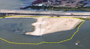
The EPA wants to remove about 202,000 cubic yards of contaminated material (roughly enough to fill the floor of the Astrodome with a 13-foot-deep layer) but says it’ll have to be done carefully so as not to accidentally stir up the waste into the surrounding river while trying to get it out; the removal would also probably take place in stages to avoid potentially exposing too much of the waste at a time to storms or flooding. Here’s the EPA’s map of the 2 sites where the paper sludge was originally dumped in the 1960s — the (capped) northern area is outlined in blue and labeled Cap Site, while the southern site (outlined in yellow and labled Southern Impoundment) is covered in part by the Glendale Boatworks building, next to Southwest Shipyard:
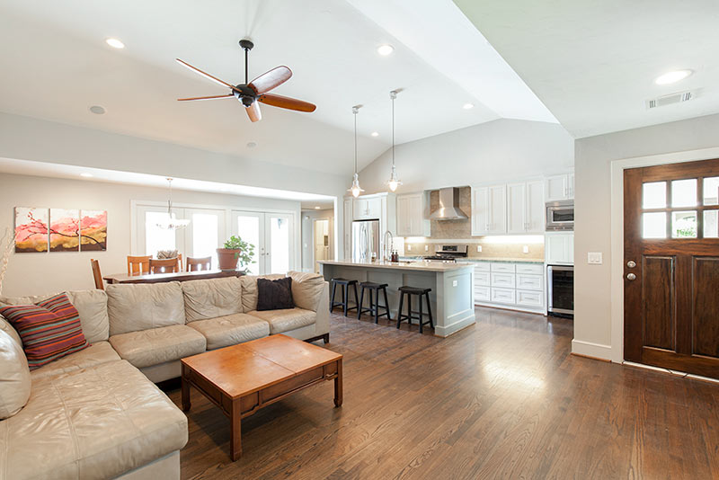
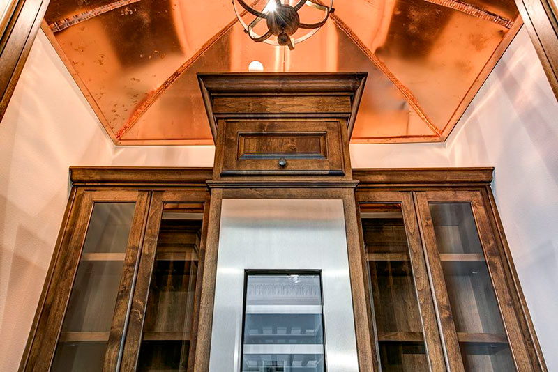
Today’s sponsor is the recently renovated 4-bedroom, 3-bath home at 1839 Viking Dr. in Oak Forest — with an asking price that was reduced just yesterday. Thanks for supporting Swamplot!
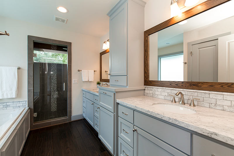
This original Oak Forest home was taken down to the studs in 2012 by a builder who transformed it into his personal home. In the process, he replaced all the electrical and plumbing systems and added a master bedroom suite. (The new master bath is pictured above.) Vaulted-ceiling living, dining, and kitchen spaces — shown in the topmost photo — now flow into each other at the front of the home. French doors lead to a covered outdoor patio space equipped with a television. New materials and finishes introduced throughout include limestone and granite countertops in the kitchen, marble counters in the bathrooms, and wood, slate, and tile floors.
The home sits 2 blocks north of W. 43rd St., about midway between Candlelight Park and the hike-and-bike trails lining T.C. Jester. Relaxation and exercise is also available at home, in the backyard pool.
If you’d like to see more of this place, check out the property website. 1839 Viking St. is listed for sale by New Leaf Real Estate, which offers unique savings programs for both sellers and buyers.
Are you ready for Swamplot’s Sponsor of the Day program? Get more information about it here.
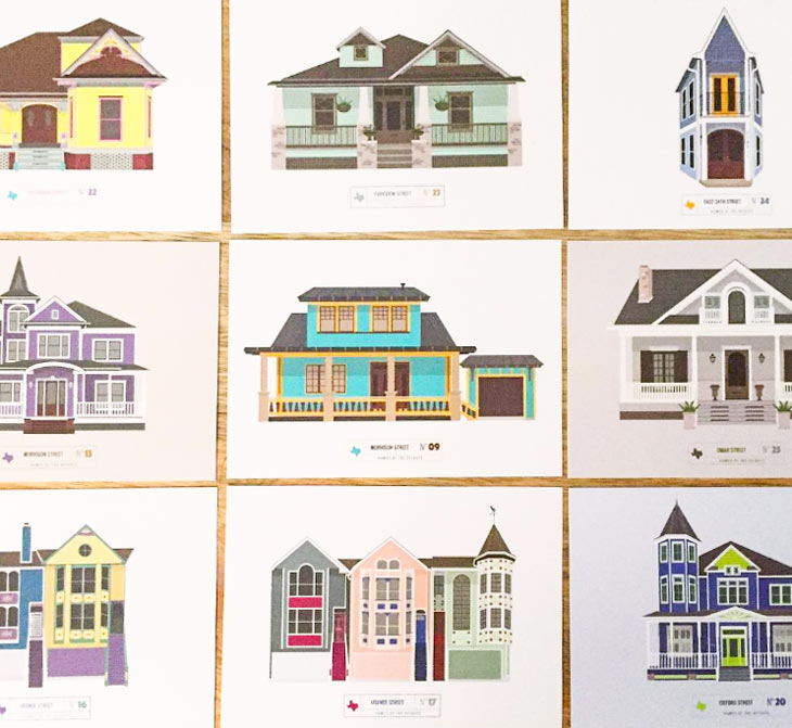
Recognize any of the images above? They’re each depictions of actual houses in the Heights area (yes, even that really skinny one in the top right corner) as drawn by local designer Dalia Rihani, who tells Swamplot she’s long been fascinated by her neighborhood’s architectural landscape. Rihani started out planning to draw 1 home per week as an outside-of-the-9-to-5 creative outlet — but says she’s found herself doing it much more frequently than that, and has since been taking commissions to illustrate specific houses as requests started to pour in. She’s also been turning the graphics into post cards that she’s sent to some of the home’s owners, as a reader showed Swamplot:
Photo: elnina via Swamplot Flickr Pool
Swamplot’s Daily Demolition Report lists buildings that received City of Houston demolition permits the previous weekday.
Standing on the defensive indicates insufficient strength; demolition, a superabundance of strength.
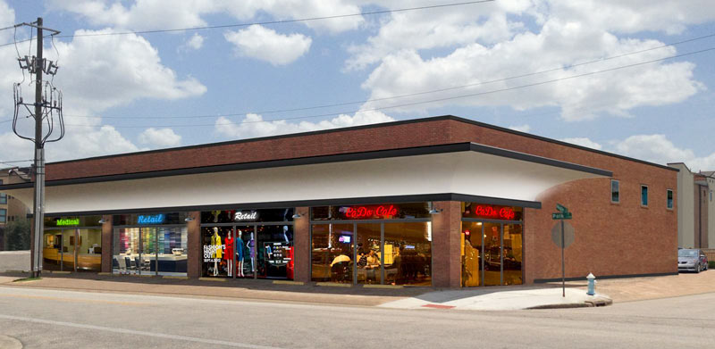
A construction fence has gone up around the former King’s Wholesale building in East Downtown, a reader tells Swamplot. The rendering above shows a planned renovation for the structure at the corner of Polk and Nagle streets, just a few blocks northwest of the purportedly-reopening-in-October Ivy Lofts sales center. The curved awning-fin isn’t new, but the glass storefronts are — below is a shot of the building’s pre-redo state, from when it last hit the market:
CONTINUE READING THIS STORY
COMMENT OF THE DAY: SAVE-THE-DOME SAGA’S PARKING GARAGE ENDING LEAVES ROOM FOR A SEQUEL 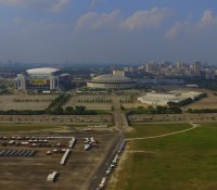 “I think people are missing the larger view here. Of course there is plenty of current surface parking — but putting parking beneath the Dome begins to open up the possibility of densification on this site and on the old Astroworld site. This is the first, and necessary, step in transforming this entire area. I am betting that in 20 years or so this site will barely resemble the vast wasteland of parking lots and open space that it is today.” [SH, commenting on County Approves First $10.5 Million for Astrodome Basement Parking Garage Plan] Photo: Russell Hancock via Swamplot Flickr Pool
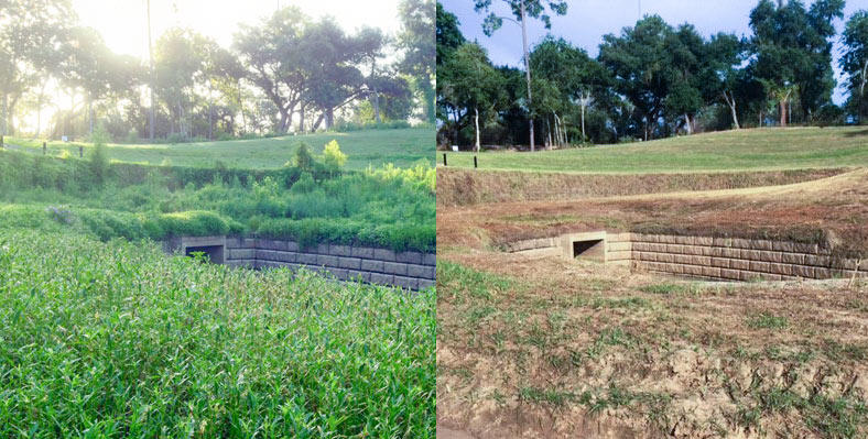
The folks at Save Buffalo Bayou send over some before-and-after photos of the Memorial Park boat launch and companion drainage structure just east of where the stream crosses beneath Woodway Dr. The group says the canoe and kayak put-in spot, on a 30-acre section of the park once used as an archery range, had been slowly greened back up by native river plants following the area’s multi-year closure and workover by the Uptown TIRZ, which involved some de-treeing work and the planting of some contractor-friendly non-native grasses on the newly reshaped slope.
Memorial Park director Jay Daniels told the group that the mowing was not planned, as park groups are currently trying to promote native plant growth in the park. Daniels said that he talked to a work group clearing some bayou access paths this weekend about removing some invasive Johnsongrass at the site; the conversation apparently led to some confusion, which led to mowing, which led to many folks being given a stern talking to.
Here’s a post-op look from July 2014 at the drainage setup (also intended to control bank erosion), partially covered in what appears to be eroding dirt and deposited sediment:
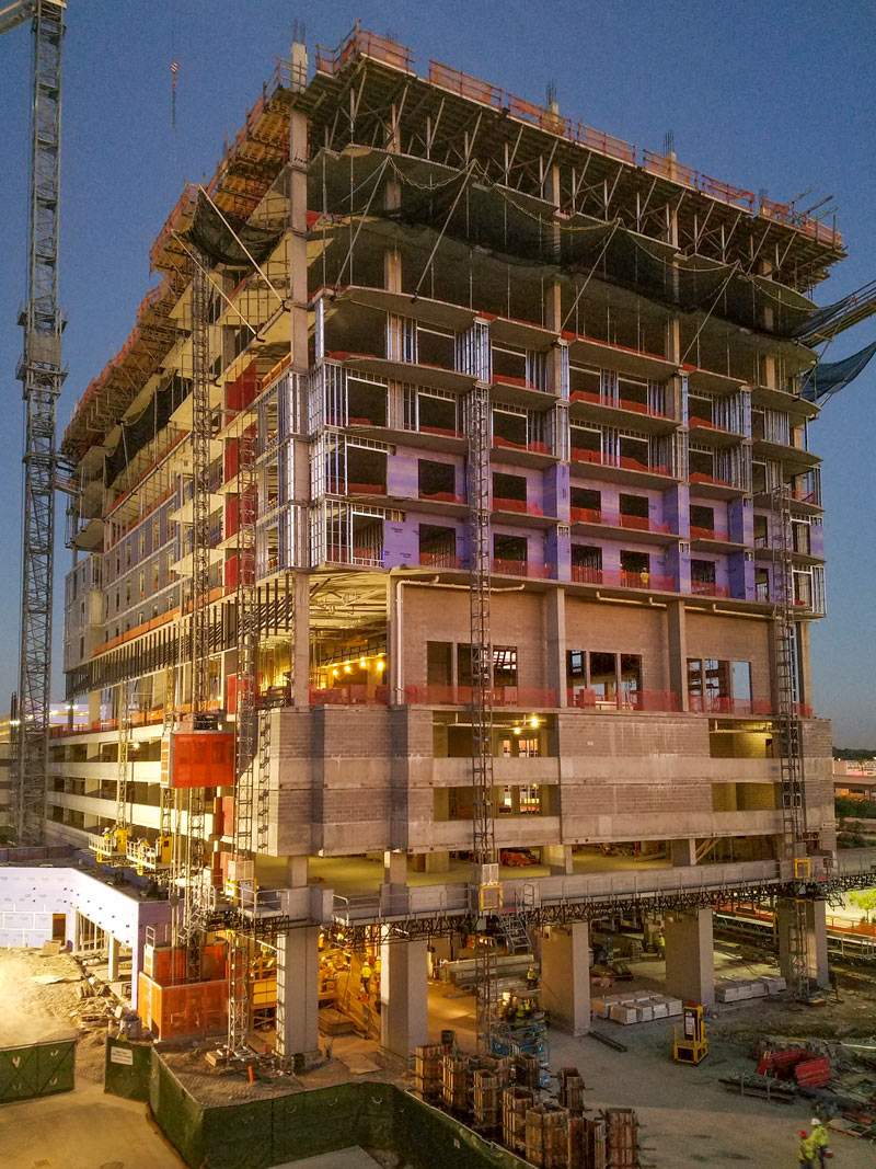
HISD TOSSING AROUND A BELLAIRE HS REBUILD ON THE CHEVRON CAMPUS UP THE STREET 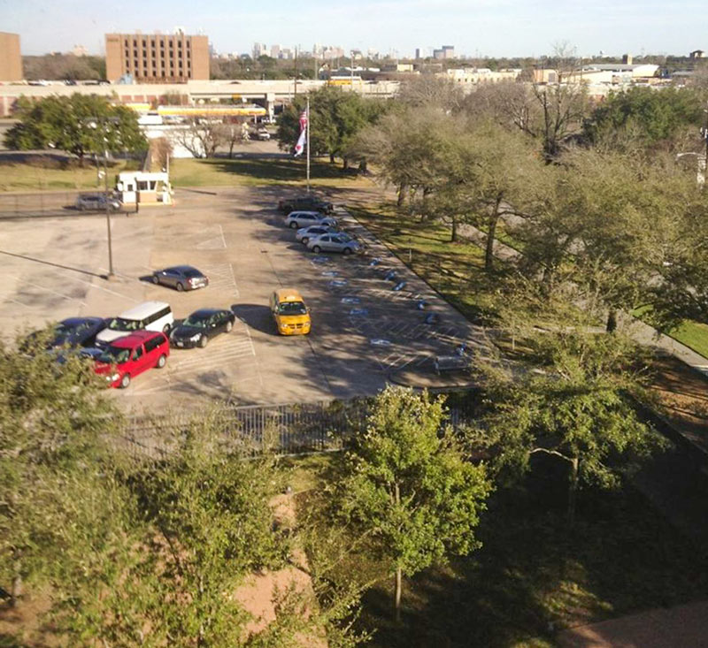 On Monday some HISD folks pitched the idea of buying Chevron’s soon-to-be-empty land on Fournace Place to a committee overseeing the lately-stagnant push to rebuild Bellaire High School, Charlotte Aguilar reports this week. The 28-acre tract, which goes on sale on Saturday, is about 2 miles north of the school’s existing 17-acre campus and also fronts S. Rice Ave. HISD trustee Mike Lunceford tells Aguilar that Bellaire, “while one of the largest high schools in HISD, is on the smallest property.â€Â Principal Michael McDonough emailed stakeholders to say that if HISD decides to back the plan and is able to buy the land, funding would probably be put to a bond election; meanwhile, the existing school would still need some work while a new one was built. The Chevron land currently has a 10-story office midrise on it; the shot above looks out the window of that building toward the West Loop and the freeway-side Shell station next door (also up for sale). [Instant News Bellaire; previously on Swamplot] Photo from 4800 Fournace Pl.: Alvin A.
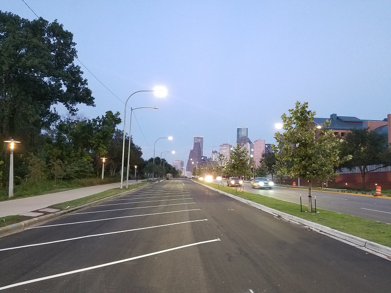
Photo of Allen Parkway parking: Marc Longoria via Swamplot Flickr Pool
Swamplot’s Daily Demolition Report lists buildings that received City of Houston demolition permits the previous weekday.
We may encounter many demolitions, but we must not be defeated.


