09/14/18 5:15pm

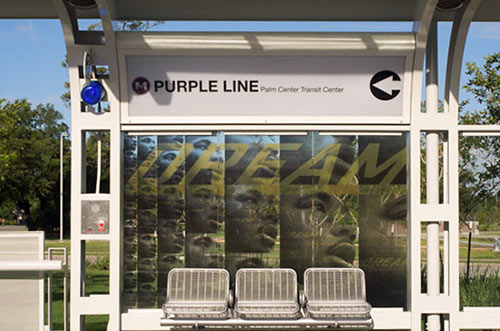
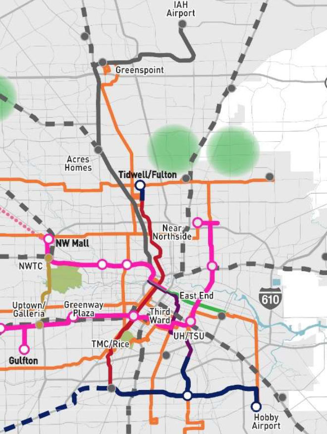
Both Red- and Purple-Line connections to Hobby Airport made METRO’s latest shortlist of proposed projects around town. They’re indicated above by the blue segment which runs east from the Red Line’s current terminus at Fannin South and past a proposed spur that’d reach up to the Purple Line’s last stop at Palm Center Transit Center. Together with all the proposed bus route upgrades colored orange, they’d cost the agency about $3 billion to build.

That price tag is on the high end of what METRO expects to have in its budget for projects over the next 2 decades: somewhere between $1 billion and $2.8 billion, according to the Chronicle‘s Dug Begley. Planning for the worst case, the agency also released a plan B — which eschews all airport rail connections in the name of frugality:

CONTINUE READING THIS STORY

Transit Wishlist
04/26/18 11:30am

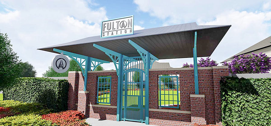
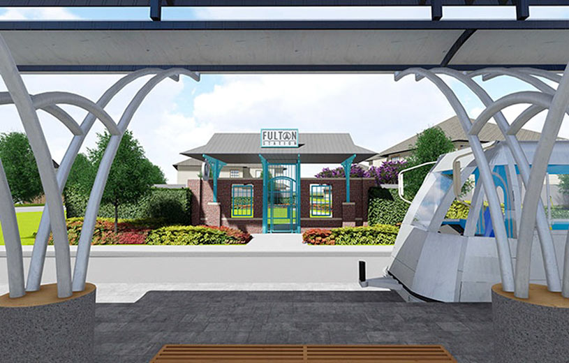
The transit-themed entryway Lennar Homes wants to build to its 39-lot development — dubbed Fulton Station — on the corner of Fulton and Cavalcade will get another shot at city approval when it goes before Houston’s planning commission this afternoon. Lennar’s new residential neighborhood hugs the Charisma Design Studios & Art Gallery Building, west of the southbound stop for METRO’s Red Line in the middle of Fulton St.

The gated entrance would go at the foot of a private park Lennar has planned just across the street from the rail platform, on the parcel highlighted red in the map below:

CONTINUE READING THIS STORY

Red Line Scenery
03/26/15 11:00am

LATE MAY OPENINGS FOR SOUTHEAST AND EAST END RAIL LINES Metro Central Station, Main St., Downtown HoustonAn official opening date has finally been set for Houston’s 2 new light-rail lines — and it’ll be later than the expected early-April debut. The East End and Southeast Lines will both open May 23rd, the Metro board announced this morning. [Houston Metro on Twitter; previously on Swamplot] Photo of new Central Station downtown: Metro
09/24/14 10:00am

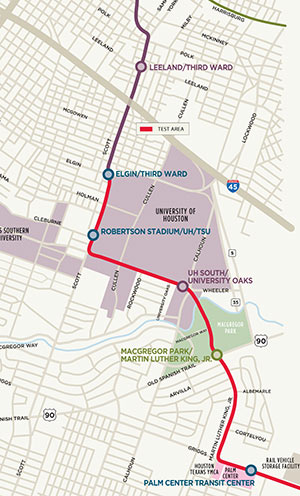
WHY METRO TRAINS ARE ALREADY ROLLING AROUND UH Map Showing Testing Area for the Southeast Line, HoustonNo, the new light-rail lines won’t be ready to carry passengers anytime this year — if you’re looking for a ride, check again in 2015. But over the next couple of weeks, you may see a Southeast Line train or 2 skirting the western and southern borders of the University of Houston. Starting today, Metro will be shuttling vehicles along the path shown in red on the Purple Line map at left, from the corner of Elgin and Scott Streets through MacGregor Park to the vehicle storage facility just past the Palm Center Transit Center — for safety testing. Map: Metro
09/15/14 12:00pm

Designs for Overpass on Harrisburg Blvd., East End, Houston

Designs for Overpass on Harrisburg Blvd., East End, Houston

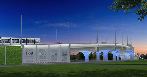
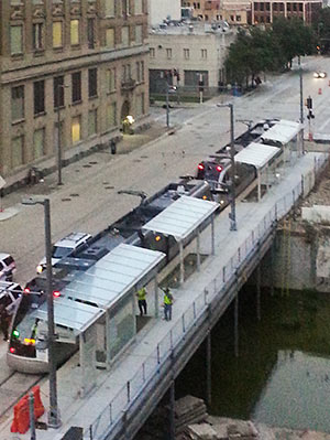
Metro has posted the latest designs for the enormous Hughes St. overpass along Harrisburg Blvd. on the far-east segment of the East End rail line. The $27-to-$42-million bridge is meant to carry cars and Green Line passengers over the Union Pacific East Belt freight rail line that runs north-south just west of Hughes St., between the soon-to-open East End line’s between the future Altic and Cesar Chavez stations. The posted design concepts, Metro notes, combine a “garden” wall and a wall noting a few 4-digit numbers important in the history of the neighborhood with a ribbon of white LED lighting above and blue accent lighting underneath and along the columns:

CONTINUE READING THIS STORY

At the End of the Green Line
08/01/14 3:00pm

Metro Light Rail Train on Capitol St., Downtown HoustonNo, no one’s expecting Metro’s 2 new light-rail lines to open any sooner than late December (as Swamplot reported last week), but some progress toward that goal is now visible on portions of the East End and Southeast lines: “Live wire” or powered testing of the downtown tracks began this week. The photo at right, sent in by a reader, shows a Metro train moving unescorted along the tracks on Capitol St. for the first time.

Photo: Nathan Juett

Power Up
07/21/14 1:30pm

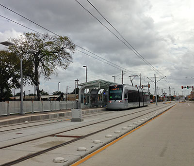
Light Rail Station at Palm Transit Center, Houston

There’s still “some uncertainty” over the exact schedule, but all the pieces needed to allow Metro to open Houston’s second and third light-rail lines won’t be in place until late December, according to reports delivered to a committee of the transportation organization’s board of directors last Friday. Previously, an opening date sometime this fall had been projected for the Southeast and East End lines (though the far eastern end of the East End line won’t come on line until a newly planned overpass is built under over the Union Pacific East Belt freight rail line between the future Altic and Cesar Chavez stations). Delays in the delivery of trains aren’t the sole reason for the late openings, however.

CONTINUE READING THIS STORY

Waiting for the Trains
12/18/13 12:45pm

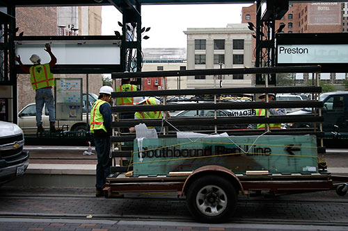
Installation of Red Line Signage, Preston Station, Main St. Line, Houston

For 10 years, you’ve known it as Houston’s only light-rail line, so what did it matter that we called the Main St. line? But in advance of 2 separate advance lines opening up next year, it’s got a color too: The Red Line. You can see workers installing signage with the “Red Line” designation in the photo above. When was that photo taken?

CONTINUE READING THIS STORY

Metro’s New Colors
11/05/13 3:45pm

There’s been a Metro train siting at the new Quitman station of the North Line extension, just south of the train’s turnoff from North Main, reader Joel Balderas reports. Unlike earlier appearances, the train appears to be operating under its own power. Here’s the photo evidence:

CONTINUE READING THIS STORY

07/24/13 10:00am

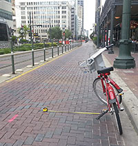
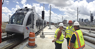
WHY NOT BANISH CARS FROM MAIN ST.? Monday morning’s fatal collision between the bicycling Rice University architecture student and a southbound Metro train seems to have occasioned the folks at Houston Tomorrow to wonder at the best uses for Main St.: Blogger Kyle Nielsen shows — with a rented B-Cycle and a tape measure — how little room there is for a motorist to give a “vulnerable road user” the 3 ft. now required by the city for “safe passing” and suggests that the Downtown corridor should be closed off, once and for all, to traffic: “It seems to me that it would enhance cyclist and pedestrian safety, encourage the type of walkable retail and bars/restaurants that Downtown needs, decrease motorist frustration at being stuck behind a bicycle, and enhance motorist and transit safety by eliminating the motorist [illegal] left turns that still hit the Metro rail cars sporadically.” [Houston Tomorrow; previously on Swamplot] Photo: kylejack
06/12/13 2:15pm

COMMENT OF THE DAY: THE TRAIN WILL GET YOU TO THE AIRPORTS — SOMEDAY “Rail to Hobby and IAH is still in the long term plan, though, given the uncertainties of funding, there’s no way anyone can give a date. Hobby is likely first in line, since it’s closer and there’s a lot more population nearby that would also benefit from the connection. And the first step is there — get on Harrisburg at the end of the east end line and just stay on the same lane and you’ll end up at the Hobby Airport parking garage.” [Christof Spieler, commenting on What Southwest Wants To Make Hobby Airport Look Like]

05/28/13 5:15pm

The very first train graced the tracks of the North Line light rail extension earlier today — though this was only a test, says Metro’s Christof Spieler. That explains why you can’t see in this photo taken near the Burnett Transit Center north of Downtown any overhead wires — the train was being towed by a diesel tractor. (Diesel tractor not pictured.) And it explains why you can see that foam bumper: That, says Spieler, was meant to catch anything built too close to the tracks. More test train should be running all by themselves this fall, he adds, and full service is scheduled to go in December.

Photo: Christof Spieler via Swamplot inbox

04/25/13 3:45pm

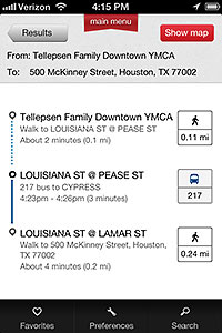
METRO’S NEW TRIP-PLANNING APP You can now download T.R.I.P., a trip-planning app that’s all Metro’s own. The Write on Metro blog first mentioned the app in October 2011, reporting that a launch was expected later that winter. Of course, that delay isn’t mentioned in today’s press release announcing that the Transit Route Information and Planning app, a screenshot of which is shown here, is up and running, ready to provide schedule and route information based on the user’s location, predict “to within 3 minutes” arrivals of the next bus or train, and generate routes. And it’s free. [Write on Metro; Ride Metro]
11/19/12 2:55pm

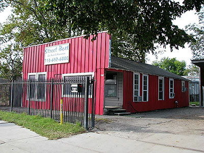
It’s either a store with small display cases or a home with really big curio cabinets. Fully-fenced and mostly burglar-barred, the shape-shifting property fronts the rebuilt roadway and drainage improvements of Fulton Street in Pine Grove, east of I-45. Metro’s Red Line extension plans its future Northline Transit Center just past Crosstimbers, 3 blocks north of the storefront-residence. Earlier this week, the mixed-use property reappeared in the MLS listings with a new agency and price, $99,900, after a 2-month market breather. That’s about twice the price of its sale for $45,500 in 2009 — but significantly lower than the $135,000 sought in a year-long listing that expired down a bit ($124,900) just this past September.

CONTINUE READING THIS STORY

10/15/12 5:06pm

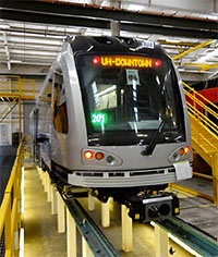
NEW METRO TRAINS GETTING BIKE RACKS Metro is showing off the first of 19 new California-made Siemens H2 S70 trains it’ll be adding to its light-rail fleet. The first new cars in 9 years are updated versions of the line’s original 18-member fleet, with one notable difference: Metro will be outfitting them with 2 bicycle racks each, at the front and rear doorways. Photo: Metro