Captured on Sunday between bands of Harvey downpour by an enterprising drone photographer hunkering in Friendswood, the video above includes a quick pan over the Brio Superfund site south of Beamer Rd. near the intersection with Dixie Farm Rd. The former chemical facility, once at the heart of both the long-gone Southbend neighborhood and of the series of lawsuits filed by Southbend residents over contamination-related birth defects and illnesses, makes its cameo around minute 3, as the drone passes over a waterlogged Exxon Mobil station and rotates from south to east down Beamer toward the San Jacinto College South Campus.
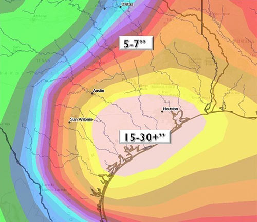
Might floodwaters flowing across the Brio site and all those other Superfund spots dotting the local map have stirred up toxin-laced sediments and spread them around? (Texas A&M Galveston scientist Wes Highfield was worried enough about the possibility to attempt a mid-flood outing from his home to try to get some water samples.) In the video, the Brio site appears to be a little less waterlogged than some of its surroundings — including the adjacent section of Beamer Rd., shown picking up a bit of kayak traffic — but likely got washed over by around 42 in. of rain altogether in the past week.
In a follow-up drone run flown on Wednesday, the site (making an appearance about 2-and-a-half minutes in) looks like it might have dried off a bit:


 “It is really amazing to look at the total disaster that Harvey caused (And Ike. And Allison. And the Tax Day flood. And the Memorial Day flood.) and say to developers and regulators in the Houston area, “Doing a heck of a job, Brownie.†Developers and regulators built thousands of homes and strip malls all across Houston during the boom cycles of the ’60s, ’70s, and early ’90s that had completely insufficient stormwater drainage infrastructure. Regulators allowed people to build too close to flood zones and builders did not think twice about building right up to bayous and rivers. The response from regulators was to require better development practices moving forward in some areas and apply a few band aids in other areas. This lax development attitude worked for a long time because it helped keep housing relatively affordable compared to other large metro areas. But after Harvey, people looking to come to Houston will have to consider whether the affordable housing and economic opportunities are worth the risk of losing everything in another big flooding event. The reassurance that developers are doing a better job with new projects does nothing to allay fears that existing housing is prone to devastating flooding. Houston’s failed development practices are now an albatross around the City’s neck.” [Old School, commenting onÂ
“It is really amazing to look at the total disaster that Harvey caused (And Ike. And Allison. And the Tax Day flood. And the Memorial Day flood.) and say to developers and regulators in the Houston area, “Doing a heck of a job, Brownie.†Developers and regulators built thousands of homes and strip malls all across Houston during the boom cycles of the ’60s, ’70s, and early ’90s that had completely insufficient stormwater drainage infrastructure. Regulators allowed people to build too close to flood zones and builders did not think twice about building right up to bayous and rivers. The response from regulators was to require better development practices moving forward in some areas and apply a few band aids in other areas. This lax development attitude worked for a long time because it helped keep housing relatively affordable compared to other large metro areas. But after Harvey, people looking to come to Houston will have to consider whether the affordable housing and economic opportunities are worth the risk of losing everything in another big flooding event. The reassurance that developers are doing a better job with new projects does nothing to allay fears that existing housing is prone to devastating flooding. Houston’s failed development practices are now an albatross around the City’s neck.” [Old School, commenting on 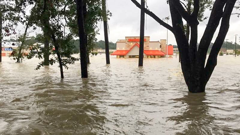
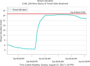 Chronicle features editor Lisa Gray says her Meadowcreek Village home escaped water damage during the flood, but it was close — and many others weren’t so lucky: “Berry Bayou — the middle of which forms my back property line,” she writes, “received more than 45 in. I’ve seen it in national weather-nerd articles where people are marveling how fast a bayou can rise. My husband says we were half an inch away from the bayou coming out of its bank in our back yard. He sent a graph, showing that on Saturday night, at the monitor I can see from my back yard, it was literally at bank level. But the water broke first on the other bank, into the yard of one of my favorite people in the neighborhood, and up and down the yards on that side. Lots of houses flooded. ‘Dry privilege’: That’s the headline of the essay I ought to write.” [
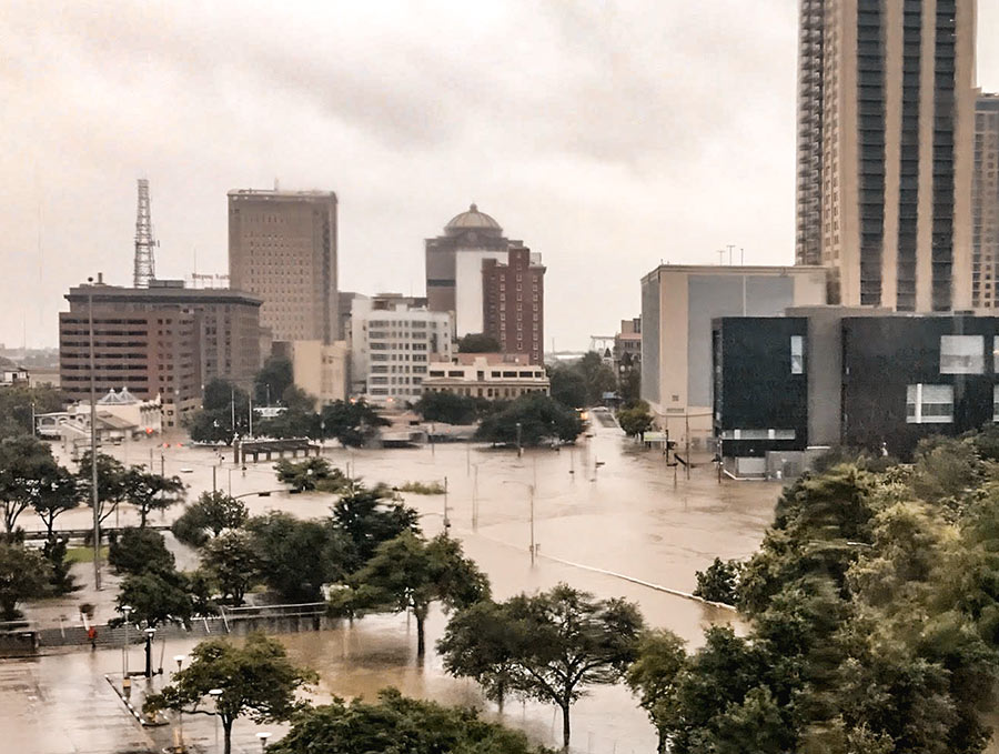
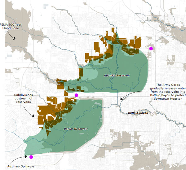 Lived in Houston for years but still coming up to speed on how the Addicks and Barker dams are supposed to work — just as the reservoirs reach to their highest-ever levels?

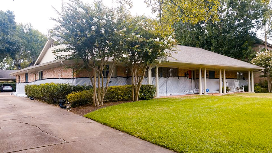 What kind of person would pay close to $5,000 to have 18,000 pounds of sandbags delivered and installed in a low stack in front of a 5-ft.-high waterproofing barrier surrounding her home? The owner of a Meyerland single-story 4-bedroom (pictured above) 1 block south of Brays Bayou that flooded “for the first time” in the Memorial Day deluge of 2015 (according to a real estate listing of that year) and then twice more in the past year or so. “
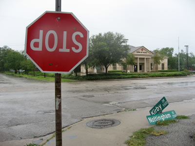 Houston’s first hurricane of the smartphone-carry era is almost upon us. Plus, at least a few of you will have drones at the ready this time (once the winds subside, of course). It all adds up to a grand possibility: Houston’s best-documented storm aftermath ever. Whichever direction you end up hunkering this long weekend, stay safe! But when the hazards recede and you venture out to see what’s up in or around your neighborhood, snap some pics or vids of notable sights and
 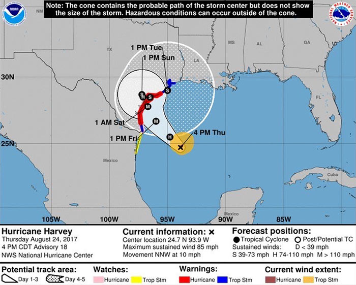 A Hurricane Harvey shown veering slightly further to the east than previous reports suggested is now expected to reach the Texas coast late Friday night or early Saturday morning as close as 125 miles southwest of Houston — with a rating at the high end of Category 3. But
  “Looks like we’re in for a real wet weekend. It will be interesting to see if all the detention ponds constructed in the past 10 to 15 [years] combined with the loss of open land due to development results in net positive flood compared to events like Allison, Rita and Ike.” [