NOW ON YOUR MOBILE DEVICE: WHY YOU CAN’T BREATHE 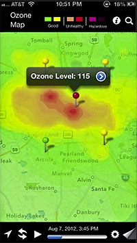 A team comprising researchers at UH, Air Alliance Houston, and the American Lung Association have launched OzoneMap, an app that “monitors chemical weather,” reports John Metcalfe of The Atlantic blog Cities. And whether the app helps explain your coughing fit or alerts you to the chance of a really pretty toxic sunset, the best part is that it’s only available in Houston! And why Houston, of all places? Besides the industrial flares, that is? Here’s Metcalfe: “The Houston/Baytown/Huntsville region comes in eighth place for most ozone-polluted cities in America, as ranked by the American Lung Association. Persistently sunny weather, a battalion of petrochemical facilities and scads of fuming cars on the road make Houston a nightmare for anyone who’s chemically sensitive. For these folks, walking outside is like playing a lower-stakes version of Russian roulette, with 30 to 40 days of the year fogged with hazardous levels of ozone.” [Cities; previously on Swamplot] Map: Cities
Public Safety
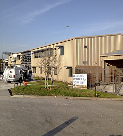
The redo of this Chenevert St. warehouse is complete, Mayor Parker announced yesterday, and the Houston Center for Sobriety is ready to give drunk people a place to dry out. Next to the Eastex Fwy., the 84-bed center at 150 N. Chenevert will operate out of a 19,000-sq.-ft. building behind the Star of Hope homeless shelter, across from Irma’s Mexican restaurant on Ruiz and just a few blocks north of Minute Maid Park.
MOBILE FOOD VENDORS MOBILIZE  A collective formed by more than 2 dozen food-truck operators plans to roll on city hall later this month — to present the mayor and council members with a list of proposed changes to city ordinances, fire code, and health regulations that restrict where and how Houston’s growing fleet of mobile food units can operate. The changes promoted by Mobile Food Unit Houston would get rid of current rules requiring food trucks and trailers to park more than 60 ft. away from each other, allow a single propane permit to cover multiple locations, and lift the ban on using propane fuel in the Med Center and Downtown. The changes would also allow their customers to sit down, lifting current rules that prohibit the sale of food-truck food near seating areas and letting them to set up limited numbers of tables and chairs on their own. [Mobile Food Unit Houston; previously on Swamplot]
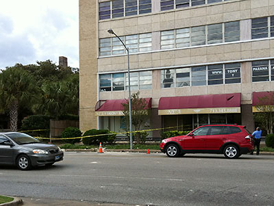
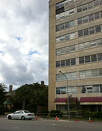 A stone panel from the 9th floor of the vacant 10-story 3400 Montrose office building crashed to the sidewalk over the weekend, according to a reader report. “Was at Starbucks [Saturday] morning and all was good. An hour later things had fallen apart,” Swamplot’s informant writes. One of the submitted photos shows a policeman looking up at the jumping-off point: a now blank dark space where a panel had been mounted, in the top left corner of the building’s Montrose Blvd. facade.
Houstonians and Woodlanders: Be on the lookout for: 1) loner backpacks; 2) sneaky, pouty model types with cameras and notebooks; 3) sketchy, overdressed dudes wearing out-of-season clothes; 4) overly polite door-openers; 5) illegally parked vehicles in crowded locations. Or really, any other potential threats.
Be aware. Trust your instincts. You make the call.
- If You See Suspicious Behavior, Make the Call [Regional Catastrophic Planning Initiative]
- Houston Says: Make the Call on Suspicious Activities, Or Just Things You Think Are Suspicious [Hair Balls]
Video: iWatchHouston.org
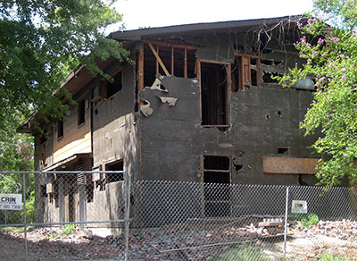
Cities throughout Texas are slowing down the process of knocking down dangerous structures because of fears that angry owners might come back to bite them — even after their buildings have been demolished. By a 5-4 vote, the Texas Supreme Court last month struck a blow for the property rights of rotting, undead buildings throughout the state, giving their owners the right to sue in court for compensation even if a hearing before a city administrative board has already declared a condemned structure a hazard to public safety. If it isn’t overturned in a rehearing, the decision will likely force Texas cities to pick their demolition battles more carefully, and possibly get courts involved in what has traditionally been something handled by city departments.
Where are all the demolitions scheduled to take place Saturday, in Houston’s annual mass celebration of destruction? Reader Ed from Westbury has put together a handy-dandy map using BatchGeo that shows the locations of the buildings targeted by the city’s Neighborhood Protection department that have received demolition permits since last Friday. There should be more than 400 in there. Is your favorite condemned building missing from the map? Ed promises to update it over the weekend with any permits taken out today. Click here to see a larger version.
- Houston Dangerous Building Demolitions 2011 [BatchGeo]
- Owners prey on poor with dangerous rentals [Houston Chronicle]
Map: Ed from Westbury
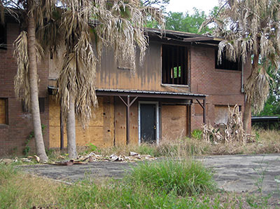
The owner of 4 vacant apartment buildings and 4 carports just north of the future site of the Idylwood Walmart now has 9 days left to get a permit and tear them down — or the city will do it for him and send a bill. Zion Ohana bought the already somewhat-decrepit properties bordering Idylwood at 6634 Sylvan Rd. in January 2009, a few years after the previous owner — who had lived in one of the units — passed away. About 20 neighborhood residents and representatives of nearby businesses showed up to yesterday’s city hearing, but Ohana didn’t, and didn’t send anyone to speak for him. One Idylwood resident thinks that might be part of the reason the owner ended up with a $72,000 fine for leaving the structures in their current condition — $1,000 per day per structure for the 9 days since a notice was posted on the properties.
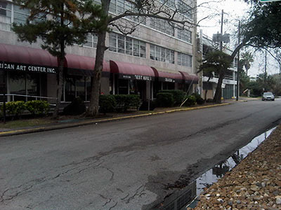
A reader tells Swamplot a sticker on the front door of the 10-story mixed-use building at 3400 Montrose notes the building is unsafe and does not have a working fire-alarm system:
They have gated off the garage and also all the first level tenants have now moved out. Any word on what is going on? Is the building being closed up? Torn down?
Renovated?
The building’s highest-profile (and -altitude) tenant, Scott Gertner’s Skybar, moved out over the summer, after complaining that the building’s new owner, a company out of Waco called FH Properties, wasn’t responding to maintenance concerns.
APARTMENT INSPECTIONÂ REPORT How’s that new apartment-inspection program going? The city has given the new owner of the Garden Oaks Place Apartments across Griggs Rd. from the Palm Center until the middle of this month to make required repairs, after an inspection in August found broken railings, rusted-out columns, exposed wiring, and a host of other problems with the complex. But reporter Ted Oberg says at their current pace it’ll take inspectors 14 years to get to everyone. “According to the law, city crews are supposed to inspect every apartment complex in the city. So far, they’ve visited 217 — less than one a day.” [abc13; previously on Swamplot]
WILL NEIGHBORHOOD PROTECTION BE RELEASED FROM POLICE CUSTODY? Mayor Parker wants the city’s Neighborhood Protection division — responsible for policing dangerous buildings, illegal dumping, and runaway weed farms — moved out of the Houston Police Department. She tells abc13’s Andy Cerota she wants the enforcement group set up with “its own identity”: “The Houston police officers handling code enforcement violations would no longer be permanently assigned there. They would, instead, be moved elsewhere. . . . ‘This is not about saving money. It’s not about reducing overtime for the police department. It is about making sure the civilian side of the neighborhood protection division is unleashed to be doing what it should be doing out in the neighborhoods,’ Parker said.” [abc13]
Note: Story updated below.
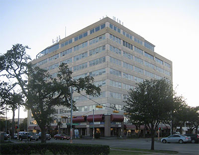
News comes from a reader that Scott Gertner’s Skybar, on the top floor of 3400 Montrose, will be closing for good this Saturday — “due to the building closing its doors.” We don’t have further information about why the entire 10-story office building across Hawthorne from the Montrose Kroger might be shutting down, but a Twitter-fed rumor is that it’s for “safety concerns.”
Scott Gertner’s Sports Bar, safely ensconced on the ground- (and only) floor of a parking-lot site on Fountainview just north of Richmond, is apparently in no danger of collapse, and will remain open. The complete message passed onto us from Gertner after the jump:
HOUSTON’S DAY OF DESTRUCTION IS LESS THAN 2 MONTHS AWAY Grab your front-end loaders and join the fun! From Mayor Parker’s Wednesday State of the City address: “As part of my desire to make our neighborhoods safer, I am declaring Demolition Day in Houston. 200 abandoned, dangerous buildings and crack houses located across this city will come down on this day, targeted for May 22nd. This would not be possible without the help of the Houston Contractors Association, which is donating the demolition services for this effort. It’s a win-win-win: good for neighborhoods, good for public safety and good for public health.” [Mayor’s Office, via Swamplot commenter Matt]
Meanwhile, in West U:
The Gami family purchased the lot directly behind their own house to transform it into a new backyard, and they said they wanted to somehow give back to the community in the process. That’s when they decided to donate the old cottage in the 4200 block of Byron Street to the fire department for a few weeks before demolishing the house. . . .
The training at the Byron Street house has been so lifelike it has garnered attention from many residents on the street. Henry Stelzig, who lives right next to the house, said he thought it was a real emergency, and he wished firefighters would have notified neighbors not to worry.
“We were alarmed because, gosh, they had two ambulances out here, they had two fire trucks, they had everything,†Stelzig said. “We thought the house was on fire.â€
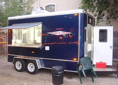
Sure, Houston has about 1,000 licensed mobile food vendors. (Yes, most of them are taco trucks.) Why aren’t there more? Ruthie Johnson explains a few of the regulations — and other roadblocks:
Most of the standards are a welcome way to ensure food safety, but some are annoying — or downright ironic. Street vendors, for example, must be at least 100 feet from any seating area, yet must have notarized proof of a usable restroom within 500 feet. The tiniest of carts must have a massive vent hood. And vendors are never allowed to be on a sidewalk. Jason Jones of Haute Texan Tacos says that actually “the biggest problem is that there aren’t really any decent pedestrian areas for street vendors in Houston.” Jones, who recently put his truck up for sale, goes on to explain that a fire code which prevents propane-powered businesses from selling anywhere downtown or in the Medical Center takes away a street vendor’s two largest pedestrian areas.
Other obstacles? Powerful restaurateurs don’t want the competition from street vendors, consumers don’t appreciate them, and city officials make it difficult to get questions answered and inspections scheduled. Sean Carroll of Melange Creperie says that “Anyone looking to start a mobile food service business in Houston should expect to be on the sidelines for six months at the very least.
- The Street Vendor Blues [Eating Our Words]
- Mobile Food Units [Food Inspection & Safety]
Photo of taco trailer, for sale: Haute Texan Tacos

