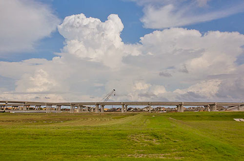
If you were dazzled by the wide swaths of concrete laneage and complicated color-coded spaghetti interchange entanglements in the TxDOT renderings released last week — but had trouble comprehending the massive scale of the proposed reroute of I-45 around Downtown — you’ll want to try this second go at it. The state transportation agency has now produced a video version of its freeway-rewrapping proposal, complete with tiny little animated cars and trucks moving along 3-D representations of those new wide surfaces. It’s so mesmerizing, many viewers may not even notice what happened to the Pierce Elevated.
- Previously on Swamplot: The 5 Wackiest Images from TxDOT’s Plans To Reroute I-45 and Abandon the Pierce Elevated
Video: TxDOT, via Houston Chronicle
North Freeway Downtown Rewrap

 “Pretty sure inside the Loop/outside the Loop won’t matter once TXDOT completes the planned half twist there at the 610/59 interchange. Cars will then be able to drive on the top and bottom of the Möbius 610 Loop, which should greatly reduce congestion.” [
 “
“
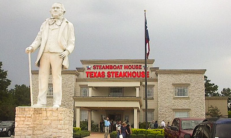
 “I’ve heard 610 called a lot of things, but never ‘prestigious,'” writes a Swamplot reader who is curious to learn


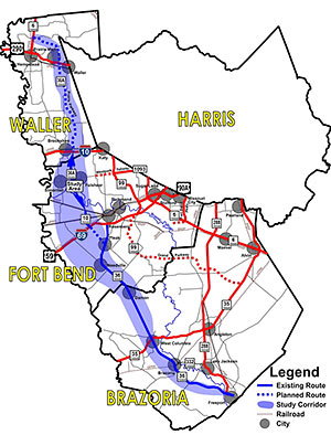 There’s the 610 Loop, Beltway 8, Highway 6 and FM 1960, and the Grand Parkway. What will come next in the grand sequence of giant highways encircling Houston? Why that might be Highway 36A, also dubbed the Prairie Parkway, possibly because the segment of the Grand Parkway opened just a few months ago through similar natural landscape is now already too urbanized to hold onto a prairie-styled name. But the apparent eagerness of Waller County commissioners to have additional tolled segments added to link Highway 36 to State Hwy. 6 (the Waller one, not the West Houston road of the same name) to form what would likely become Houston’s fifth ring-road orbit path hit a slight bump yesterday, possibly because of opposition led by the Katy Prairie Conservancy, whose lands stand in the path. A scheduled vote on a proposed resolution in support of a highway-boosting support group called the Highway 36A Coalition and its request for TxDOT funds to study the proposed 107-mile corridor was withdrawn before it could be discussed, according to

 “The fact that its not facing the freeway is progress. For too long, Houston has used its freeways as a super fast main street.
One of the reasons why the traffic is so bad in this area is that people gawk at the purdee buildins facing the freeway in addition to the excessive on/off ramps within a 2 mile stretch.” [
“The fact that its not facing the freeway is progress. For too long, Houston has used its freeways as a super fast main street.
One of the reasons why the traffic is so bad in this area is that people gawk at the purdee buildins facing the freeway in addition to the excessive on/off ramps within a 2 mile stretch.” [


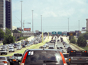
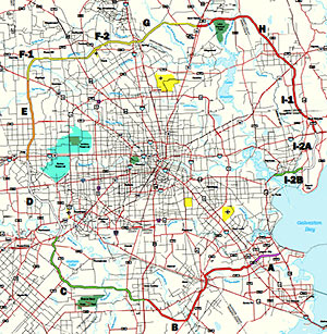 From Dug Begley’s report on next weekend’s dual openings of the North Line light-rail extension and the Hempstead-to-Katy Segment E of the Grand Parkway: “[Judge] Emmett frequently notes that about 500,000 people live within Loop 610, about 1.5 million live between Loop 610 and the Sam Houston Tollway and about 2 million live outside the tollway within Harris County. ‘We’re seeing a lot of people moving inside the Loop,’ Emmett said. ‘That growth is going on. But
 “I’d rather see parking garages under 45 and 59 than retail. I’d rather not have to worry about car fires and 18-wheeler accidents on the roof of my building. The insurance costs would be incredible.
Tens of thousands of parking spaces could be made under 45 and 59. Vast quantities of free, or very cheap, parking would reduce the demand for surface parking in the Downtown area. Owners of empty lots would be more inclined to develop the empty lots if drivers were no longer willing to pay $10 to $20 per car for every sporting event. For $1 parking I’d be willing to walk half a dozen blocks or hop on the light rail to get to my destination. Direction way finding for parking for out-of-town visitors would be easy — ‘park under the freeway.’ Developers would gain an advantage as supplying parking levels would no longer be a given necessity of building in Downtown Houston. Even typical parking garage congestion come rush hour wouldn’t be an issue due to the linear nature the 45 and 59 garages would have to take. Multiple entrances and exits could face Pierce and Chartres with dedicated right-of-way lanes to the street. Line the lengthy parking garages with a spine of moving sidewalks so ‘prime’ parking spots are minimized. You’ll always be five minutes from a rail stop.” [
“I’d rather see parking garages under 45 and 59 than retail. I’d rather not have to worry about car fires and 18-wheeler accidents on the roof of my building. The insurance costs would be incredible.
Tens of thousands of parking spaces could be made under 45 and 59. Vast quantities of free, or very cheap, parking would reduce the demand for surface parking in the Downtown area. Owners of empty lots would be more inclined to develop the empty lots if drivers were no longer willing to pay $10 to $20 per car for every sporting event. For $1 parking I’d be willing to walk half a dozen blocks or hop on the light rail to get to my destination. Direction way finding for parking for out-of-town visitors would be easy — ‘park under the freeway.’ Developers would gain an advantage as supplying parking levels would no longer be a given necessity of building in Downtown Houston. Even typical parking garage congestion come rush hour wouldn’t be an issue due to the linear nature the 45 and 59 garages would have to take. Multiple entrances and exits could face Pierce and Chartres with dedicated right-of-way lanes to the street. Line the lengthy parking garages with a spine of moving sidewalks so ‘prime’ parking spots are minimized. You’ll always be five minutes from a rail stop.” [


 Houston loops, 2113:
1.) 610.
2.) Beltway 8.
3.) 1960/Highway 6.
4.) Grand Parkway.
5.) Uber loop: Angelton to Rosenberg to Fulshear to Katy/Brookshire to Waller to Magnolia to Conroe to Cleveland to Liberty.
6.) Mega loop: Freeport to Bay City to El Campo / Wharton to Columbus to Brenham to Navasota to Huntsville to Liberty to Beaumont.
7.) GIGA LOOP: Port Lavaca to Victoria to Schulenberg to La Grange to Giddings to College Station to Madisonville to Crockett to Lufkin to Jasper to Orange.
8.) I-35. [
Houston loops, 2113:
1.) 610.
2.) Beltway 8.
3.) 1960/Highway 6.
4.) Grand Parkway.
5.) Uber loop: Angelton to Rosenberg to Fulshear to Katy/Brookshire to Waller to Magnolia to Conroe to Cleveland to Liberty.
6.) Mega loop: Freeport to Bay City to El Campo / Wharton to Columbus to Brenham to Navasota to Huntsville to Liberty to Beaumont.
7.) GIGA LOOP: Port Lavaca to Victoria to Schulenberg to La Grange to Giddings to College Station to Madisonville to Crockett to Lufkin to Jasper to Orange.
8.) I-35. [