10/24/17 12:45pm

Not too much in the way of timelapse settings, drone footage, pulsating but string-infused soundtracks, supertitles, or accompanying sound effects appears to have been spared in the making of this video ode to the Arch-Con crane assembly now hovering over the southeast corner of Washington Ave and S. Heights Blvd. That’s the location of the planned H-E-B Market with the office space and 5-story apartment building on top of it soon to be known as the first phase of Midway’s Buffalo Heights development, on the northwest corner of the former Memorial Heights apartments.

Video: Midway Companies

Going Vertical
10/19/17 11:00am

Here are a few shots of 195 Yale St. just south of I-10 from yesterday afternoon, showing workers a few letters away from spelling out the long-delayed LA Fitness at the Yale Street Market shopping center. The sign, which faces the freeway, was completed by the end of the day:

CONTINUE READING THIS STORY

Fitn In
10/06/17 4:15pm

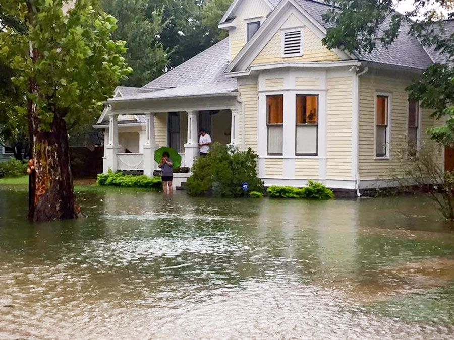
THE HEIGHTS HISTORIC DISTRICTS’ NEW HEIGHTS The public comment period for the latest (and presumably final) draft of the design guidelines for the Houston Heights’s 3 historic districts ends today. The latest version of the 223-page document dates from August and covers a range of issues important to the historic districts, including proposed standards for construction and renovation — from roof pitches and “character defining elements” to maximum allowable foundation height (30 inches from natural elevation for new construction and additions) — but does not appear to include any mention of flooding. The guidelines, once adopted, would be used by the Houston Archeological and Historical Commission in its determinations of what proposed building projects would be allowed. [Planning & Development Dept.; previously on Swamplot] Photo of home at 8th St. and Arlington St., in Houston Heights Historic District South, during Harvey: Swamplot inbox  
09/25/17 4:30pm

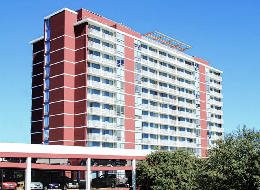
COMMENT OF THE DAY: BEHIND THE ‘EVERYBODY OUT’ ORDER AT 2100 MEMORIAL “I’ve volunteered there and can tell you the entire ‘sub-basement’ electrical/fire control room was completely submerged. I assume that entities receiving government rent subsidies must meet current NEC (nat’l elect code) standards on renovations/repairs. . . . Thus, if entire elect/fire control room is gutted/replaced then all rooms’ receptacles, fixtures, elevators, laundries . . . etc. must be replaced to meet current NEC also. I doubt you can ‘scab on’ new equipment to decades old equipment on a major renovations. Would you trust it? You can’t make this type of systemic overhaul while residents stay in their unflooded upper floor apts. Unfortunately, for their safety they must be moved ASAP. The existing lights and limited A/C are being run off of generators. You can’t run a hi-rise indefinitely on generators. God forbid a fire breaks out or an elevator fails due to faulty electrical system. Help is needed now finding affordable & safe housing, transport, and followup assistance. Hard enough in ‘normal’ times but that much more difficult post-Harvey.” [Steve, commenting on Residents of 2100 Memorial Senior Highrise Now Have 5 Days To Move Out of Their ‘Uninhabitable’ Apartments] Photo: 2100 Memorial
09/25/17 2:30pm

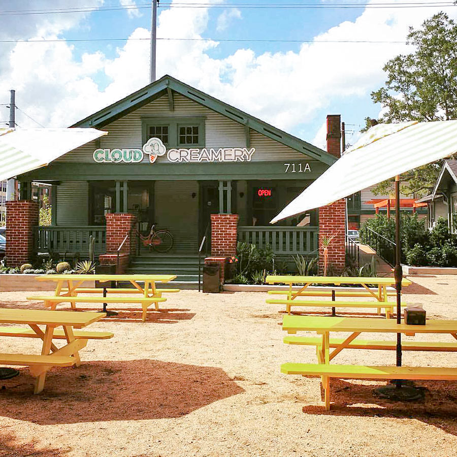
Fans of the mozzarella with balsamic, black beans & agave with lime curd, or mango & dried chilies ice creams, or the cucumber with cherries or watermelon & parsley sorbets dreamed up by pastry chef Chris Leung and offered this summer by Cloud 10 Creamery in the Rice Village will be happy to learn that the adventurous ice cream shop opened its Heights outpost late last week. Cloud 10 fills the former bungalow at 711 Heights Blvd. — now upgraded to an address of 711A in honor of a separate building added behind it — anchoring one end of the boulevard-facing section of the Heights Mercantile development.

CONTINUE READING THIS STORY

Cloud 10 Creamery No. 2
09/25/17 12:15pm

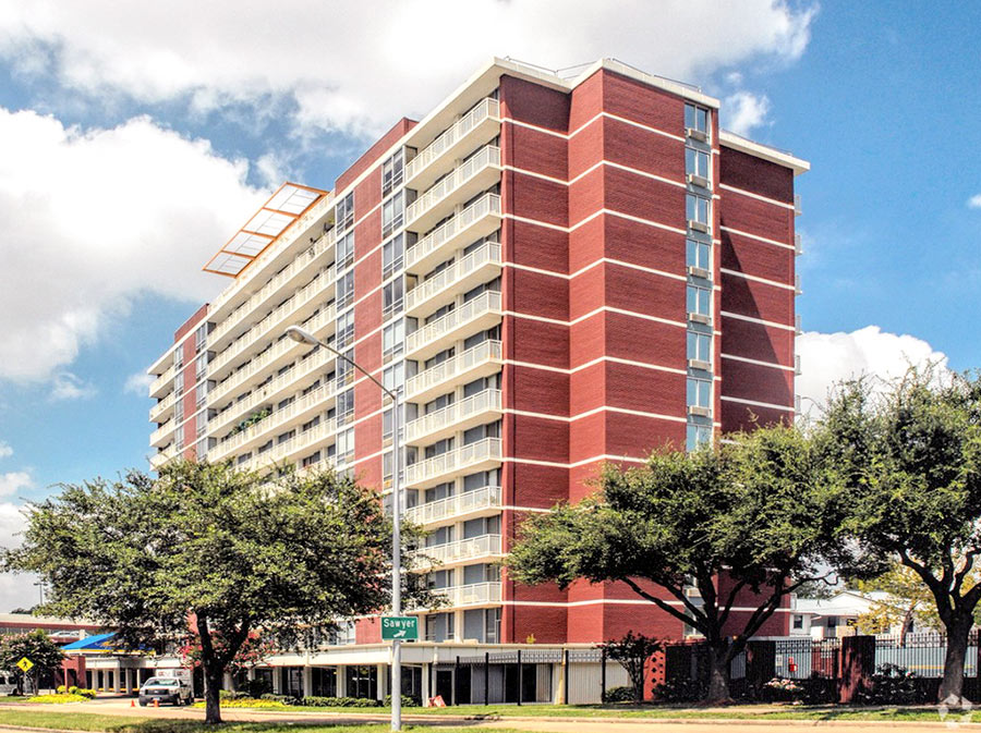
2100 MEMORIAL LAWSUIT: LET THESE PEOPLE STAY Three tenants of the Sixth Ward senior housing facility known as 2100 Memorial filed suit against the Houston Housing Authority on Friday, a day before Saturday’s unenforced deadline for all residents to leave the building. Acting for the tenants, Lone Star Legal Aid claims the agency violated the rights of the building’s residents by failing to hold a hearing in which tenants could contest the decision. The agency has not given residents “any evidence to support any of the allegations of unreasonable danger which rendered the apartments uninhabitable,” the lawsuit claims. Although the building’s first floor flooded, the tenants’ apartments suffered “little, or no, damage” from the storms, the lawsuit states. Lone Star Legal Aid claims the lawsuit means the HHA will now have to “produce the facts that support its decision.” [Lone Star Legal Aid; KHOU; previously on Swamplot] Photo: Realtor.com  
09/22/17 11:00am

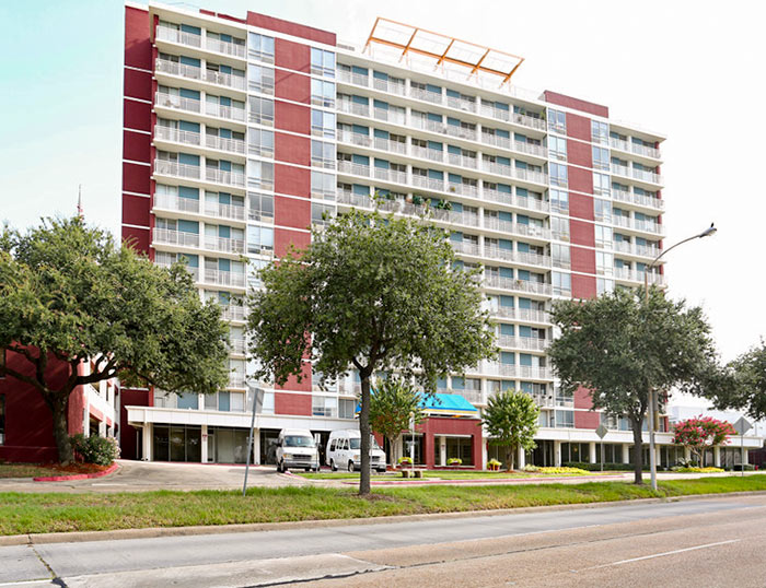
A spokesperson for the Houston Housing Authority tells Swamplot the city agency is not and will not be enforcing the previously announced 5-day deadline for all residents of 2100 Memorial to move out with their belongings. A notice delivered earlier this week by the building’s owner, an affiliate organization of the agency, to all 188 residents of the low-income-housing-tax-credit senior living facility labeled the structure “totally unusable for residential purposes due to health and safety reasons” after it was discovered that floodwaters had damaged the 14-story former Holiday Inn’s fire, electrical, and water systems.

The move-out deadline has not been altered, but the agency says it “understands it will take time to pack and move so they are working closely with the residents to help move in an orderly fashion.”

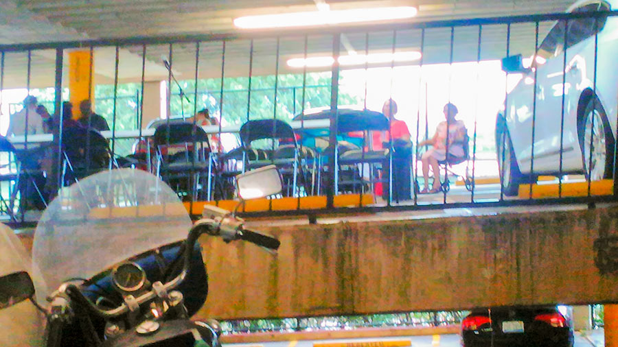
The photo at top shows the setup for a well-attended emergency meeting held yesterday afternoon on the second level of the building’s parking garage. At the meeting the HHA’s Board of Commissioners approved a $250,000 loan to the building’s management for relocation expenses, which it will then ask FEMA to cover. The funds will provide movers at no cost to residents to help them relocate their belongings to available residences in “Greater Houston” it has identified: 230 tax-credit units with similar rules to those governing 2100 Memorial — or 250 affordable housing units of other types.

Residents who have already hired their own movers, the spokesperson says, will be reimbursed. The agency says displaced residents will be given preference in returning to the building when it can be determined to be safe.

Photos: Swamplot inbox (meeting setup) Realtor.com (building)

Sixth Ward Exodus
09/21/17 1:00pm

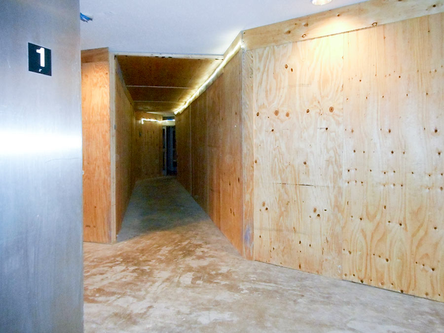
The apartments inside 2100 Memorial are “quite hale and hearty,” a reader tells Swamplot — and were not individually affected by the flooding that caused enough damage to the building’s fire-safety systems to trigger a 5-day move-out notice to all tenants in the 14-story structure. That notice was issued Monday night to all 188 residents of the tax-credit elderly housing facility; prior to that, construction crews and volunteers had worked to mitigate the damage and help residents left for days without water and without easy transportation between floors. Above: a view of the first-floor hallway, lined with plywood. In the building’s computer room, the removal of wood paneling revealed wallpaper left over from the building’s days as a Holiday Inn:

CONTINUE READING THIS STORY

Repair Zone
09/19/17 11:30am

A notice sent yesterday to all tenants of the 2100 Memorial senior-living facility just west of Downtown declares that the 14-story former Holiday Inn has been rendered “totally unusable for residential purposes” in the aftermath of Hurricane Harvey. All 198 elderly residents have been given 5 days to remove themselves and their belongings from their apartments.

The building is a tax-credit property of the Houston Housing Authority that includes both low-income and market-rate units. The notice, which came from V.J. Memorial Corp., a nonprofit entity owned by the authority, states that the company only recently learned that the building’s electrical and fire control systems were compromised by the flooding.

“Due to the damage and health & safety reasons, the building is uninhabitable and we must exercise our right under your lease to terminate the lease effective September 23, 2017,” reads the notice, a copy of which was obtained by Swamplot. A separate lease termination document sent in by a reader declares that “the damage to the Apartment is so extensive the Apartment has become as a practical matter totally unusable for residential purposes due to health and safety reasons. Furthermore, the damage could cause health and safety hazards to you and your family, if you returned to live in the Apartment in its present condition.” Residents have until 5 pm on the 23rd to get out: “If you do not remove your personal possessions by that time. we will be forced to remove your possessions and store them at a cost to you,” the document states.

CONTINUE READING THIS STORY

Everybody Out
09/18/17 3:00pm

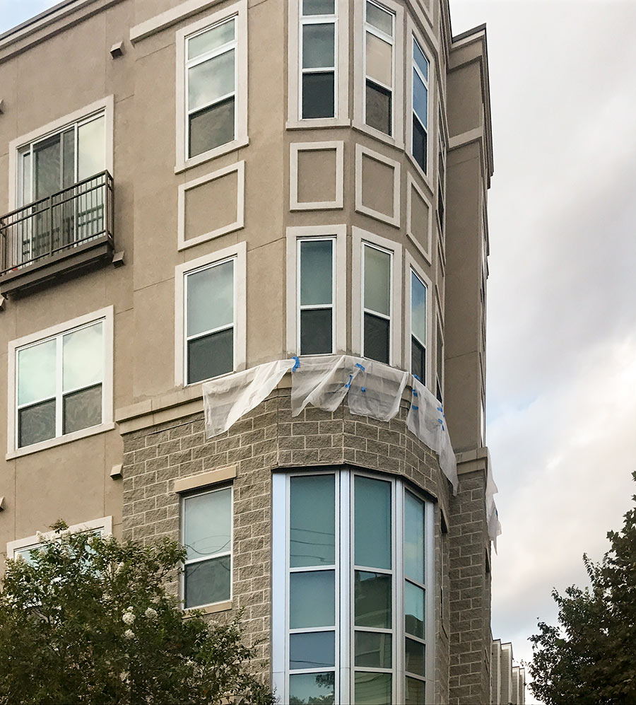
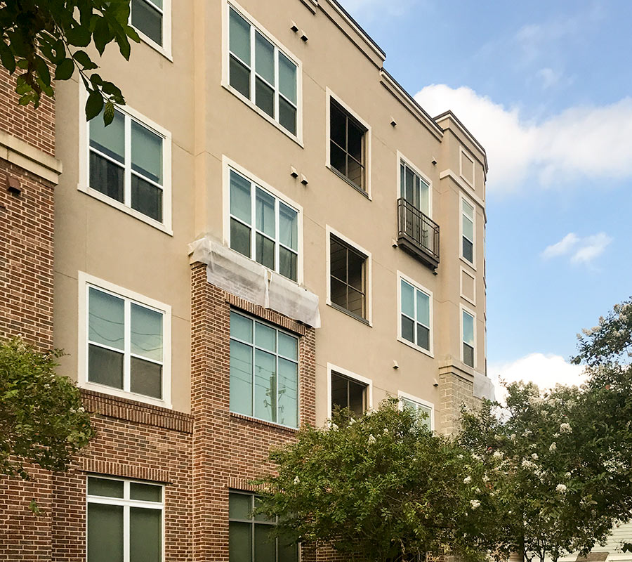
The District at Washington Apartments at the corner of T.C. Jester and Schuler in Cottage Grove now feature apron-like attachments of plastic sheeting meant to provide cover to select masonry-stucco intersections on the façade. The reader who sent the photos to Swamplot says the tarps have been up for a few weeks now, and that repair work appears to be underway:

CONTINUE READING THIS STORY

Flashing News
09/18/17 11:15am

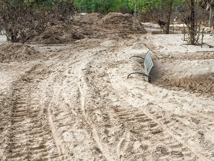
The retreat of floodwaters has revealed the extent of the silt that Harvey-triggered flooding deposited along Buffalo Bayou. A beachgoing reader sends Swamplot these pics of the new dust-colored landscapes that have taken shape along Buffalo Bayou Park and adjacent former green spaces.

The silt-covered bench shown above sits across Buffalo Bayou from the Houston Police Officers Memorial, near Glenwood Cemetery. Here’s a view from further back:

CONTINUE READING THIS STORY

Silt Deposits
09/08/17 5:00pm

WHAT THE HARVEY FLOODING DID TO BUFFALO BAYOU PARK “Please know that Buffalo Bayou Park was designed to flood, although we did not anticipate three historic flooding events in 1-1/2 years,” Buffalo Bayou Partnership president Anne Olson remarks drily in an email update this afternoon. So what’s the damage? “The bottom two thirds of the park are still under water, and we expect that they will remain so for several more weeks as water is released from the Addicks and Barker reservoirs. Due to these circumstances, it is difficult for our staff to assess the impact the flowing water has had on the footpaths and landscape in these areas. We do know that the Johnny Steele Dog Park, which is still submerged, will be closed for two or three months.” Water and sediment that flooded the Buffalo Bayou Cistern is still draining, slowly, but the electrical system installed when the long-hidden underground space was made available for tours and art installations appears to be working. The Wortham Fountain and the trail lighting system have been damaged, Olson reports. The Bayou City Adventures kayak kiosk at Lost Lake and the Bike Barn at Sabine St. has been shut down for the remainder of the year at least; areas east of the Sabine St. bridge are mostly still underwater. But Olson reports landscaped areas in the upper areas of the park, where trails have already reopened, survived with only a small amount of damage: “We are extremely fortunate that the Lost Lake and Wortham Insurance Visitor Centers did not take on water. Both facilities are open and the Kitchen at The Dunlavy is operating with normal hours. Food trucks also are back in the entry court at Sabine Street from Thursday-Sunday.” Update: The Bike Barn at Sabine St. has resumed normal hours as of September 9. [Buffalo Bayou Partnership] Photo: Adam Brackman.  
08/28/17 4:30pm

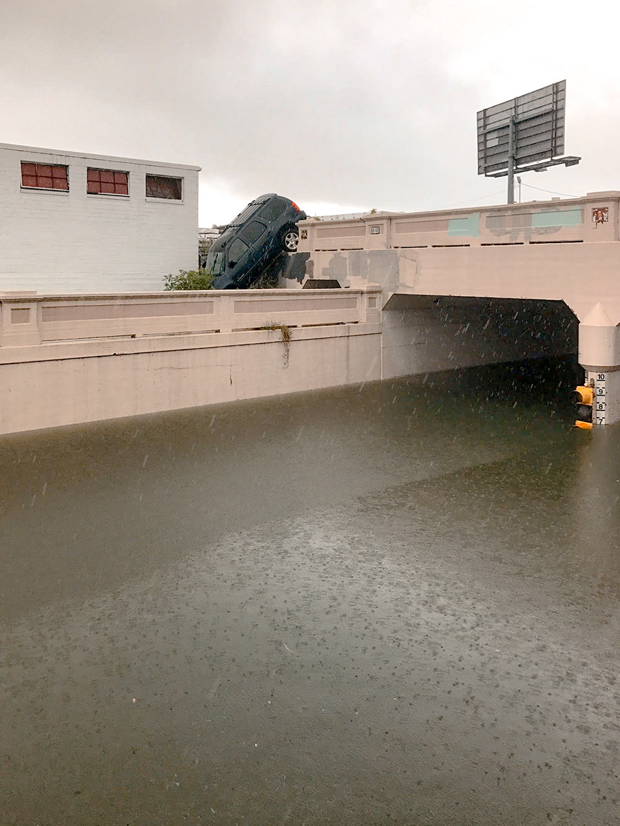
Water levels from Harvey have made the underpass just north of Center St., where Houston Ave. tucks under the rail lines, impassable. But there are consequences to trying to drive around the underpass structure, as this photo taken yesterday afternoon by a Swamplot reader attests: The ground drops off sharply on the south side of the tracks to the west of the street, and that’s not so easy to see if you’re driving south.

Photo: Kelsie H. Dos Santos

Avoiding High Water
08/28/17 11:00am

With water levels on Buffalo Bayou around Shepherd Dr. now forecast to recede, this drone video of one stretch of the waterway — taken yesterday during a lull in the rains — may turn out to be one of the best views available of the extent of flooding at the northwest corner of Montrose. A few video highlights, still visible above the floodwaters: The top floor of The Dunlavy, high above the now-complete-subsumed Lost Lake; the fuzzy treetop semi-circles formed by the twin stands of crape myrtles at Waugh Dr.; the Waugh Dr. bridge itself, now looking like a causeway; and the patterned grounds of the Beth Yeshurun Cemetery.

Video: Evan Mallett

Dunlavy to Waugh
08/18/17 12:30pm

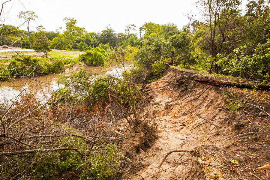
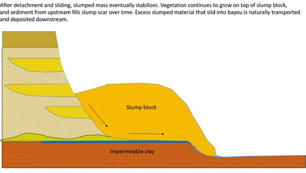
The folks fighting a longstanding battle to prevent the reconfiguration of a section of Buffalo Bayou fronting the southeast corner of Memorial Park and the River Oaks Country Club have posted a remarkable series of images showing how a section of the bayou’s bank at the Hogg Bird Sanctuary responded on its own over the course of 2 years to a soil collapse suffered during the 2015 Memorial Day flood. The geologists behind Save Buffalo Bayou claim that the promoters of the Harris County Flood Control District’s proposed $12 million Memorial Park Demonstration Project they’re trying to stop have mistaken a natural bayou-bank process called vertical slumping (or sloughing) for erosion, and that attempting to stabilize the bayou banks to fix the supposed erosion will leave the area “a wasteland of denuded and weakened banks.”

But you don’t have to buy or even follow the riverine logic the organization steps through in a lengthy article posted to its website earlier this week to appreciate one of the examples of waterway-bank adaptation exhibited there. The first image (at top) shows the immediate aftermath of the Memorial Day storm or 2 years ago on the high bluff facing the bayou at the Hogg Bird Sanctuary in Memorial Park, which stands at the downstream end of the proposed project area. According to the organization, an HCFCD consultant claims that this is one of 4 spots within the bayou area that suffers from severe lateral erosion. But to Save Buffalo Bayou, this isn’t erosion; it’s just a slump, which is what bayous do naturally, and which on their own create the distinctive bluffs on the bayou’s banks. There’s no way to fix a slump, the organization’s geologists say — if left alone it’ll restore itself.

Here’s their photo evidence. The second photo, also from June 2015, shows the slumping — and downed trees:

CONTINUE READING THIS STORY

A Bayou Demonstration Project