WHERE TO GLIMPSE METRO’S FIRST DRIVERLESS SHUTTLE IN ACTION NEXT YEAR 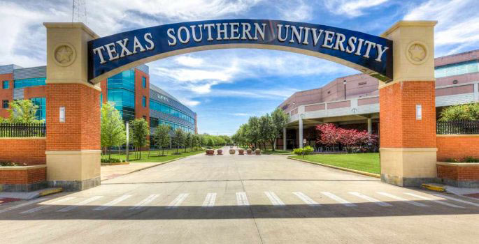 “The surge of students biking and walking” along the closed stretch of Wheeler Ave. shown above that forms TSU’s “Tiger Walk” will soon “be joined by a slow-moving, minivan-sized driverless shuttle,” reports the Dug Begley in the Chronicle‘s last Sunday edition. “Though it will run a small, circuitous route at first,” he writes, METRO’s long-term goal is to nudge the shuttle out onto Scott St., where it would stop at the Purple Line light rail station between the TSU campus and UH’s TDECU Stadium. “Transit and university officials are working on an opening day,” according to Begley, “likely in mid-to late January.” [Houston Chronicle] Photo: Campuspride.org
Tag: Metro
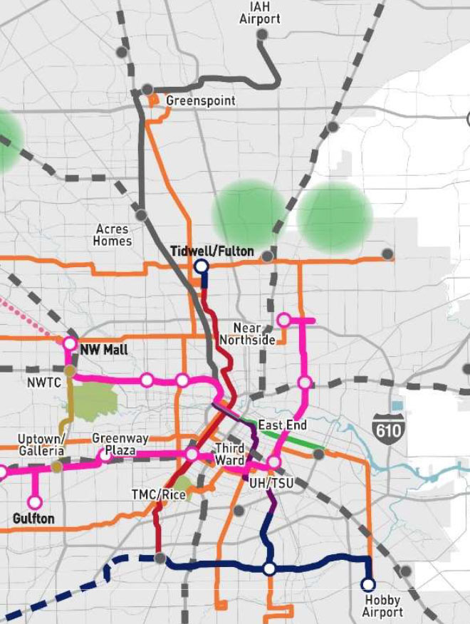
Both Red- and Purple-Line connections to Hobby Airport made METRO’s latest shortlist of proposed projects around town. They’re indicated above by the blue segment which runs east from the Red Line’s current terminus at Fannin South and past a proposed spur that’d reach up to the Purple Line’s last stop at Palm Center Transit Center. Together with all the proposed bus route upgrades colored orange, they’d cost the agency about $3 billion to build.
That price tag is on the high end of what METRO expects to have in its budget for projects over the next 2 decades: somewhere between $1 billion and $2.8 billion, according to the Chronicle‘s Dug Begley. Planning for the worst case, the agency also released a plan B — which eschews all airport rail connections in the name of frugality:
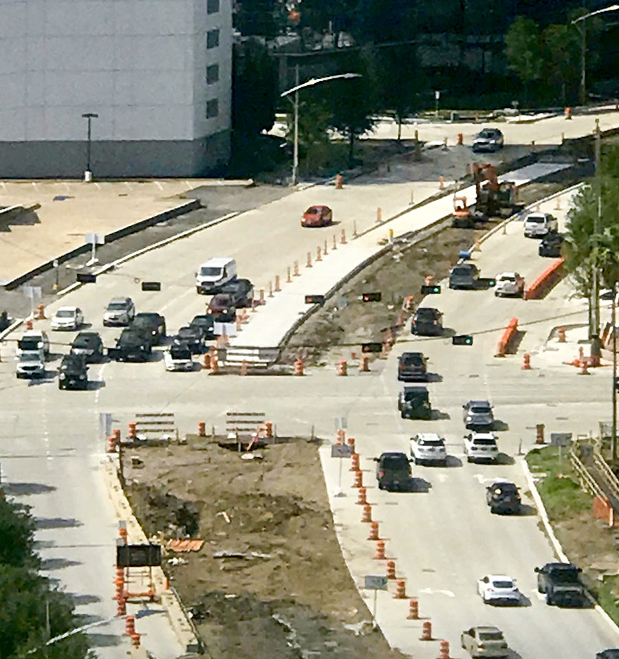
The first stretch of concrete is down along a northern portion of the dedicated bus route that’s set to run up the middle of Post Oak Blvd. between Westpark Dr. and the West Loop. The photo at top looks north to show the freshly-paved southbound lane lying in the middle of the existing roadway, where it’s now making a stop at San Felipe St.
Its next drop-off point: Ambassador Wy., as indicated in the map below:
COMMENT OF THE DAY: THE SELF-DRIVING BUS ASPHALT PALIMPSEST CHALLENGE 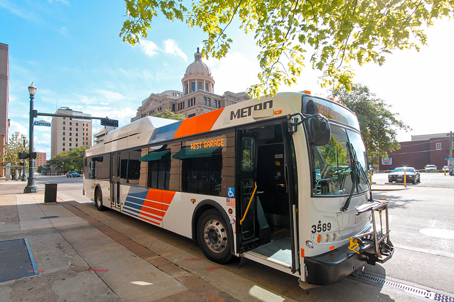 “Have any readers here taken the [southbound] exit off of 59 to the West Loop lately? If some hypothetical autonomous driving system could navigate that tangle of past and present lane markings, then they might just have something to build on.” [TimP, commenting on METRO Now Testing Out Self-Driving Buses for Houston] Photo: Roy Luck [license]
METRO NOW TESTING OUT SELF-DRIVING BUSES FOR HOUSTON 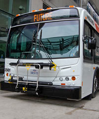 Preliminary tests of the new autonomous buses METRO is studying for potential use in Houston have gone well so far, agency board member Sanhjay Ramabhadran said at a luncheon in Cy-Fair on Tuesday — “although,” he added, “they tend to overheat in the Texas weather.” The next test phase, METRO spokesperson Jerome Gray tells abc13, “will be on the campus of Texas Southern University with a small bus at slow speeds.” If it goes well, a prototype could then graduate to real traffic. Last January, the U.S. Department of Transportation named Houston one of 10 official proving grounds for driverless buses “in part for its miles of HOV lanes that could easily work as testing lanes.” [abc13] Photo: METRO
A NEW HEIGHTS PARK FOR THE SHUTTERED BUS STOP ON N. MAIN? 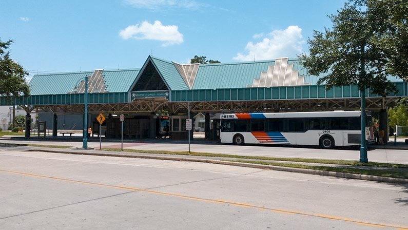 METRO rendered the Heights Transit Center just north of Cavalcade obsolete when its new bus routes went into service in 2015. Although 3 routes still converge below the southern tip of the 0.88-acre, triangular property where Studewood dies into N. Main, not all of them let on at that location and none of them arrive at the covered waiting area riders once used for boarding. Now, reports the Chronicle’s Mike Morris, the City plans to buy the unused lot. The price: $1,425,000, to be funded by fees imposed on developers who didn’t include green space in their projects as specified in a 2007 ordinance. The fees, writes Morris, “must be spent there within three years and can be used only for park improvements.” The city council will vote on the land purchase today. [Houston Chronicle] Photo: Save the Heights Transit Center
STARTING IN JULY, YOU’LL ONLY NEED 2 BUS RIDES TO GET TO GALVESTON 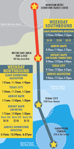 Since 2013, when the last regular bus service was canceled, taking a trip from Houston to Galveston on public transportation has been a bit of a challenge: It might take you 1 light-rail train ride, 4 buses, a 3-mile walk, and 4 hours. Thanks to a 2-year grant from TXDoT, support from Galveston County and Texas City, and an approval by Houston’s Metro Board today, it’s about to get a whole lot easier. Beginning July 10th, an Island Express route coordinated by the 2 cities’ transportation agencies will allow weekday service between the Downtown Transit Center in Houston and Island Transit’s Downtown Transit Terminal at 25th St. and the Strand in Galveston 3 times a day — with a transfer at the Bay Area Park & Ride — for $9. There’ll be a stop in Texas City, and bikes can ride too. Metro expects about 20 riders a day to use the service. [OffCite; Christof Spieler] Draft schedule for Island Express: Metro
COMMENT OF THE DAY: I AM A METRO RIDER, I CONTAIN MULTITUDES  “There are valid reasons for the increase in boardings, which sound like a lot but are only +4.65 percent year-over-year. FYI — a boarding is counted every time that a person steps across the threshold of a transit vehicle . . . To put things in perspective, that means that if I’m a park-and-ride commuter and I have to make 2 transfers each way every day of a 5-day work week to get where I’m going, I count for 30 boardings per week and 1,500 boardings per fifty-workweek year. It’d only take 60,000 of me to account for all of METRO’s users. That isn’t to try to generalize about their user base, but it is to demonstrate that not all boardings are created equal, and that the circumstances of even some modest fraction of super-users can easily help to make these big numbers possible.” [TheNiche, commenting on First Signs of This Year’s Sargassum Seaweed Invasion; Houston’s Top Crime Spots]
HOUSTON LIGHT RAIL BEATS THE COMPETITION IN PEDESTRIAN, BICYCLE COLLISIONS PER MILE 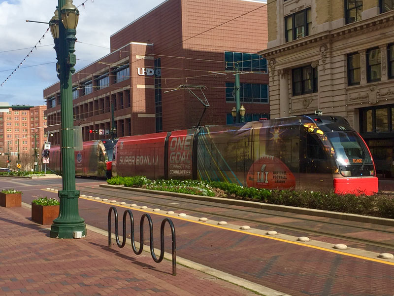 Following 2 deaths over the course of Super Bowl Week and Weekend resulting from cyclist-vs-light-rail collisions, the Chronicle‘s Dug Begley takes a look at how Houston stacks up nationally in terms of train-related accidents. The verdict, after a look through some National Transit Database data: Houston’s rail system has more walker and cyclist hits per mile “than any other major line in the country.” Houston breezes in at less that 100,000 train miles travelled per collision (compared to more than twice as many miles traveled per collision in Dallas, and more than 17 times as many in Boston). Metro CEO Tom Lambert tells Begley it may have to do with Houston’s high number of at-grade crossings and relative lack of barriers to keep people off the tracks. Begley says that the original decision to build the train at-grade isn’t itself unusual given the cost of elevated rail, but notes that “few places outside Houston have built their lines in some of the most congested and pedestrian-heavy areas of their respective urban regions.” [Houston Chronicle; previously on Swamplot] Photo of light-rail train dressed for Super Bowl Week: Christine Wilson
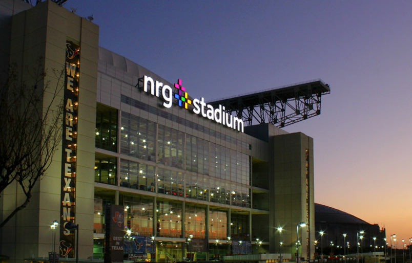
METRO is currently seeking some public input on replacing the Reliant Park light-rail stop’s outdated moniker. The agency’s preface to the poll notes that the naming rights to the station itself were never a part of Reliant’s $300-million park-branding deal back in 2002, and  says any new name “needs to be reflective of the area, but should not include any reference to a corporate entity which might require another change in years to come.”
Setting aside any potential consideration of that plan from a reader to go ahead and get nearly 30 potential future name changes over with at once, the nominated names currently in the running are (drumroll):
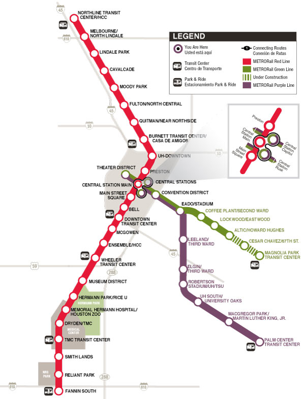
In response to word from the Chronicle‘s Dug Begley this week that the Red Line’s Reliant Park light-rail stop might get its station name updated to an even older name, a Swamplot reader jumps on the case with a system-wide list of potential station name changes that might remain unaffected by the sale, rebranding, or demise of any nearby venues or landmarks. Begley notes it could cost Metro around $486,000 to change the Reliant Park stop’s signage. The agency says it would prefer to make the switch at the same time as 2 other station name changes currently under consideration (if they’re approved) — but not until after the Super Bowl, for which a set of cheaper temporary stickers will be deployed to help visitors find NRG Stadium.
The reader, in the spirit of Houston’s budding redesign-it-yourself urban planning scene, suggests that paying up now to swap out all the names that might become a problem later might actually be a long-term cost-saver. The proposed scheme makes sure every station name mentions a cross-street (or maybe a bayou), and keeps some references to existing transit centers, parks, or neighborhoods.
Here’s the full list of suggested switch-outs, separated by rail line, with the current names on the left:
METRO SUSPECTS YOU ARE ANNOYED BY TARDY TRAINS 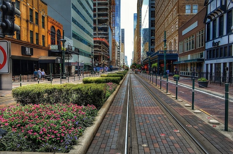 Though they don’t have the numbers to prove it, Metro officials are concerned that regularly late trains may be driving away riders, writes Dug Begley this week; even Metro board member Christof Spieler reportedly called the train’s recent timing stats “abysmal.” Begley writes that the timing problems in the last few years stem mainly from a set of sensors that count the axles of passing trains to help determine when they can be cleared to cross signaled intersections; problems with the devices (which are compounded by heat, humidity, and downtown traffic signal timing) can cause cascading delays through the rest of the train schedule. Siemens, which makes the devices, is still working on a fix at no cost to Metro. Begley notes that the trains haven’t been measured as meeting Metro’s monthly 95-percent on-time benchmark for acceptable performance since late 2013 (before the Red Line expansion opened); punctuality has dropped below 80 percent during at least 4 months in the last 2 years. [Houston Chronicle; previously on Swamplot] Photo of Main Street light rail: elnina via Swamplot Flickr Pool

While all bus and rail service is currently on hold due to widespread flooding, the route 66 bus stop sign on White Oak Dr. is still bravely performing its signaling duties (lower left above) as water from White Oak Bayou rushes past. A reader sends several studies of the area around Stude Park at the Taylor St. bridge at the southern edge of the Woodland Heights area; here’s a few more shots of the White Oak Bayou greenways gone brown this morning, with I-10 in the background to the south:
WOODLAND HEIGHTS BUS MAPPERS TO METRO: YOUR NEW ROUTE PLAN MISSES THE TARGET 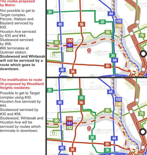 Metro says it’ll be ready to go with its new bus network on August 16, but that hasn’t prevented various groups from petitioning the transit agency to make late adjustments to its route map. One group of Woodland Heights residents is trying to get the new 30 route, which late in the process was shifted east to parallel the new 44 route down Houston Ave into Downtown, shifted west to Watson, Taylor, and Sawyer streets between Pecore and Memorial Dr. before entering Downtown from the west. The current proposed alignment leaves the Sawyer Heights shopping center and its Target without a bus stop. [Not of It] Diagram: Philip Teague
METRO KEEPING NEW BUS ROUTES UNDER WRAPS UNTIL AUGUST 16 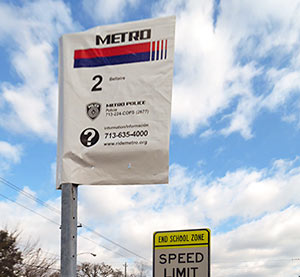 Every route sign at every bus stop in Metro’s service area should now have a plastic bag over its head, the transit agency says. Printed on those bags: the same old bus route numbers that’ve always been there, along with a couple of helpful phone numbers. Info on how the route will be changed come late summer should appear on vertical add-on signs lower on each pole. The great citywide bus-stop-sign unbagging (revealing the sign makeovers hidden underneath) is scheduled to take place just before August 16, the day Metro’s revamped route network debuts. [Metro; previously on Swamplot] Photo: Metro

