08/31/17 5:15pm

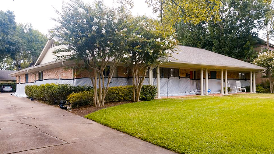
If you had been wondering whether the sandbag and tarp barrier (pictured at top) mustered around Kristin Massey’s Meyerland home was able to hold back the floodwaters once nearby Brays Bayou overflowed its banks a block to the north Monday night, here’s your answer: “We did all that we could, but it would never have been enough,” Massey wrote on Facebook the following morning.

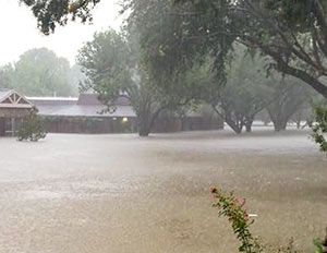
To prepare for the storm, Massey had spent close to $5,000 to arrange a perimeter defense using 18,000 pounds of sandbags. But the water reached the 9 ft. level on Braesheather Dr. a block south of Brays Bayou and just west of the 610 Loop (above) — and up to 4-and-a-half-ft. high inside her 1961 home:

CONTINUE READING THIS STORY

Harvey Defenses
08/31/17 3:45pm

Captured on Sunday between bands of Harvey downpour by an enterprising drone photographer hunkering in Friendswood, the video above includes a quick pan over the Brio Superfund site south of Beamer Rd. near the intersection with Dixie Farm Rd. The former chemical facility, once at the heart of both the long-gone Southbend neighborhood and of the series of lawsuits filed by Southbend residents over contamination-related birth defects and illnesses, makes its cameo around minute 3, as the drone passes over a waterlogged Exxon Mobil station and rotates from south to east down Beamer toward the San Jacinto College South Campus.

Might floodwaters flowing across the Brio site and all those other Superfund spots dotting the local map have stirred up toxin-laced sediments and spread them around? (Texas A&M Galveston scientist Wes Highfield was worried enough about the possibility to attempt a mid-flood outing from his home to try to get some water samples.) In the video, the Brio site appears to be a little less waterlogged than some of its surroundings — including the adjacent section of Beamer Rd., shown picking up a bit of kayak traffic — but likely got washed over by around 42 in. of rain altogether in the past week.

In a follow-up drone run flown on Wednesday, the site (making an appearance about 2-and-a-half minutes in) looks like it might have dried off a bit:

CONTINUE READING THIS STORY

Superfund and Beyond
08/31/17 11:15am

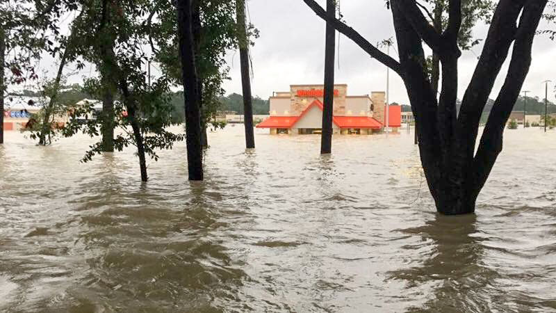
How’s this image for establishing flood cred? The photo above — of the submerged Whataburger at 4545 Kingwood Dr. in Kingwood — accompanied the fast-food chain’s announcement yesterday of plans to spend a million bucks helping its own employees recover from Hurricane Harvey and donate half a million to local food banks and $150K to the Red Cross. If the water-waisted burger joint located near the intersection of the appropriately named W. Lake Houston Pkwy. otherwise looks kinda shiny and new in the pic (you can see more of its flooding experience here, here, and here), it’s because it is. Whataburger Unit 1125 at this location opened for the first time on July 31.

Photo: Whataburger

In and Out
08/30/17 4:45pm

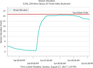
HOW IT LOOKS FROM THE DRY SIDE OF THE BAYOU Chronicle features editor Lisa Gray says her Meadowcreek Village home escaped water damage during the flood, but it was close — and many others weren’t so lucky: “Berry Bayou — the middle of which forms my back property line,” she writes, “received more than 45 in. I’ve seen it in national weather-nerd articles where people are marveling how fast a bayou can rise. My husband says we were half an inch away from the bayou coming out of its bank in our back yard. He sent a graph, showing that on Saturday night, at the monitor I can see from my back yard, it was literally at bank level. But the water broke first on the other bank, into the yard of one of my favorite people in the neighborhood, and up and down the yards on that side. Lots of houses flooded. ‘Dry privilege’: That’s the headline of the essay I ought to write.” [Previously on Swamplot] Graph of Berry Bayou water levels at Forest Oaks Blvd. on August 26th and 27th: Harris County Flood Control District
08/30/17 12:45pm

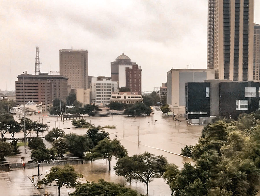
City Hall, the City Hall Annex, the Bayou Lofts, Market Square Tower, The Rice (formerly the Rice Hotel), Hogg Palace, the Theater District and Tranquillity Park parking garages, Bayou Place, the Downtown Aquarium, the Houston Ballet Center, the Wortham Theater Center, Jones Hall, the Alley Theatre, the Hobby Center, and the some of the historic homes in Sam Houston Park are all buildings that were damaged in some way by floodwaters rolling in after Hurricane Harvey’s days-long assault on the city, according to a statement released by the Downtown District today. Damage mostly came from water pouring into first-level or basement spaces, though the building at 1415 Fannin St. did catch on fire.

High water flowed to Downtown’s low points, to the north and west — primarily in the Warehouse, Historic, and Theater Districts. How did the tunnels fare? Only sections adjacent to the Theater District and Civic Center garages were damaged, according to the district.

Other structures that took on water: The Spaghetti Warehouse, the new AIA Houston offices under construction across from that restaurant on Commerce St., the Sunset Coffee Building, the Dakota Lofts, and the Cotton Exchange Building on Travis St. Here’s the complete list (with addresses):

CONTINUE READING THIS STORY

Casualty Lists
08/30/17 10:30am

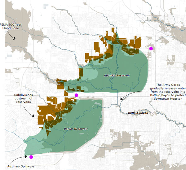
STUFF YOU PROBABLY SHOULD KNOW ABOUT THE ADDICKS AND BARKER RESERVOIRS Lived in Houston for years but still coming up to speed on how the Addicks and Barker dams are supposed to work — just as the reservoirs reach to their highest-ever levels? This brief explainer from Kiah Collier and Neena Satija of The Texas Tribune Al Shaw and Lisa Song of ProPublica should overfill you with info: “As of now, the Army Corps says there’s enough excess water in the reservoirs that some of it will flow around (not overtop) these auxiliary spillways. . . . The Army Corps can’t say exactly what areas might experience additional flooding, but local officials listed 53 subdivisions in the Addicks watershed and 40 in the Barker watershed (shown in brown in the map above) at high risk of flooding. Jeremy Justice, a hydrologic analyst at the Harris County Flood Control District, said two subdivisions near the Addicks reservoir—Twin Lakes and Lakes On Eldridge—are particularly vulnerable to flooding from the Addicks spillway. Those homes ‘probably should never have been put there,‘ he said.” Thousands of homes around the reservoirs have now flooded — some because they’re close to rising bayous, and some because of bad neighborhood drainage, they write. “But many are flooding because they are in an area that the Army Corps actually considers to be inside the reservoirs. (See map.)” [Texas Tribune; ProPublica version with links; previously on Swamplot] Map: ProPublica
08/29/17 4:15pm

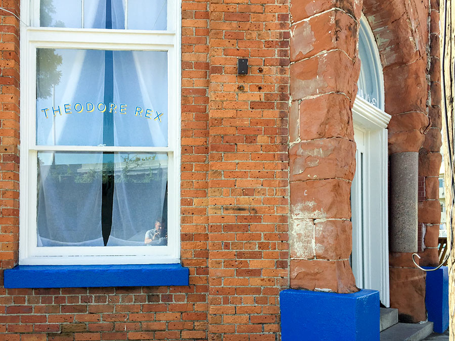
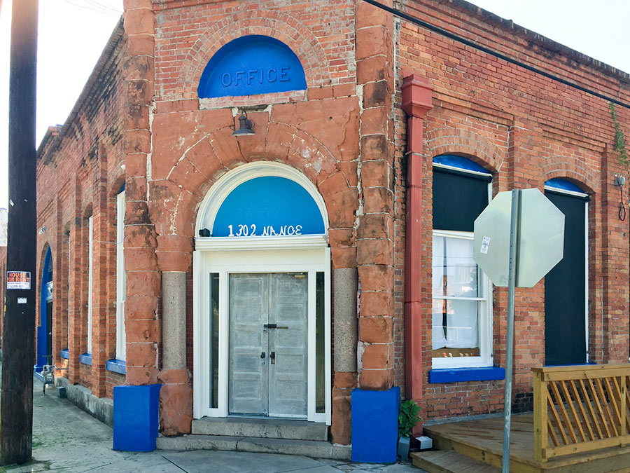
Just days before Harvey hit Houston, the newest corner restaurant at 1302 Nance St. in Downtown’s old warehouse district looked ready to debut. The photos here, taken by Swamplot reader Will Breaux shortly before the rains came and the waters swelled, show the spot formerly occupied by Oxheart sporting a new exterior paint job and window nameplate.

Inside, renovations had been taking place for months. Proprietor Justin Yu had plans to open Theodore Rex later in August. But the restaurant flooded. Now, he writes, “it might take a little more time to open.”

Photos: Will Breaux


To Redo Again
08/29/17 2:15pm

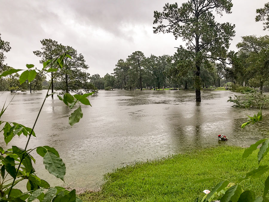
“If you don’t know that’s a big dip,” reports a reader who scouted the scene of the impromptu lake formed over the weekend on the lawn of the Near Northside’s Hollywood Cemetery, “you don’t appreciate just how much water that is.” The cemetery lies between Little White Oak Bayou and I-45, along the northeast edge of N. Main St. The water level has lowered a bit since these photos were taken on Sunday. Do note the bouquet, presumably perched above one of the completely submerged gravestones, in the right foreground of the view above.

More views of Lake Hollywood:

CONTINUE READING THIS STORY

High Water Marks in the Near Northside
08/29/17 12:15pm

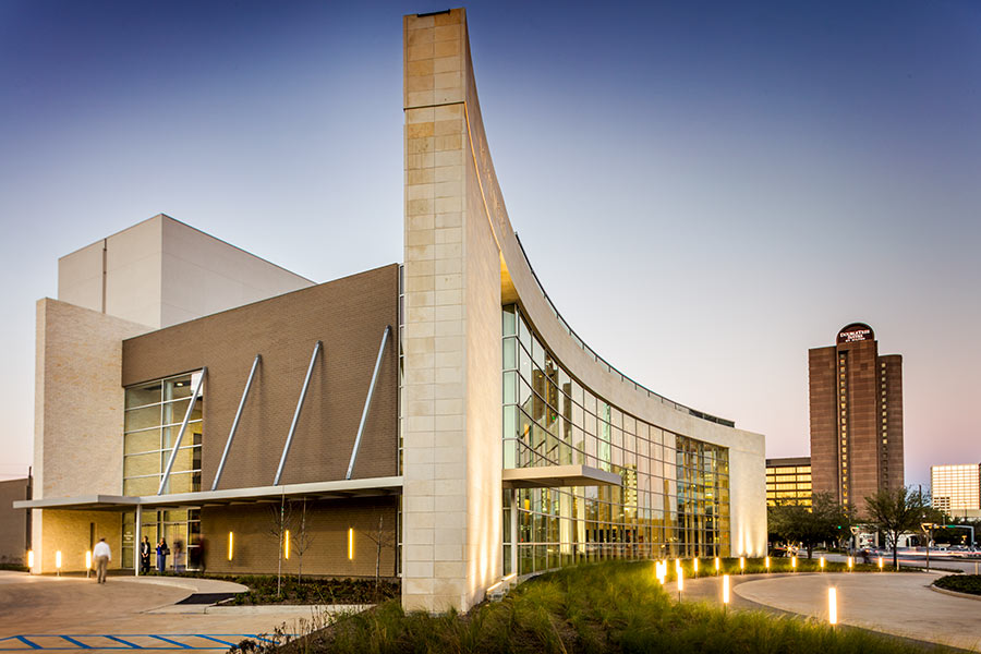
HARVEY UPSTAGES HARVEY The A.D. Players‘ new 450-seat Jeannette and L.M. George Theater at 5420 Westheimer just west of the Galleria, which opened earlier this year, “has stood the storm well,” its operators report today on Facebook. But not so much the very first set of shows in the resident theater company’s new season: Because of Hurricane Harvey’s devastation, a production of Mary Chase’s 1945 Pulitzer Prize-winning play about a 6-ft., 3-and-a-half-in.-tall invisible rabbit named Harvey (scheduled to begin a 3-and-a-half-week run on September 8th) has been put off — for a while, at least: “Harvey the storm has not been our friend. ‘Harvey’ the show will go on — more details to come,” reads a note posted by the theater last night. “When it does, we want it to be a lighthearted lift to our beloved community, which has suffered so much in just a few short days.” The theater company began planning its production of Harvey months ago, but says it had been promoting the production “in earnest” for only a little more than a week. [A.D. Players] Photo of George Theater: A.D. Players
08/29/17 10:30am

The map above outlines the actual locations of neighborhoods designated by officials yesterday as being at risk from flooding over the back sides of Houston’s dual Buffalo Bayou reservoirs — in advance of actual spillovers, which began last night and continued this morning. The map was put together by Chronicle data reporter John D. Harden, using information from the Harris County Flood Control District. Zoom in and you can identify specific streets and neighborhoods on the upstream side of Addicks (in red) and Barker (in blue) reservoirs.

Names of the affected neighborhoods are listed on the map’s fly-out panel, available by clicking on the icon at the top left corner of the map. Click on the icon at the top right corner to enlarge the map if you need to.

To lessen the risk of flooding to these areas, officials have been releasing water out the other end, through the Addicks and Barker dams into Buffalo Bayou — possibly (depending on bayou water levels) endangering neighborhoods and structures downstream.

Map: Houston Chronicle

08/28/17 4:30pm

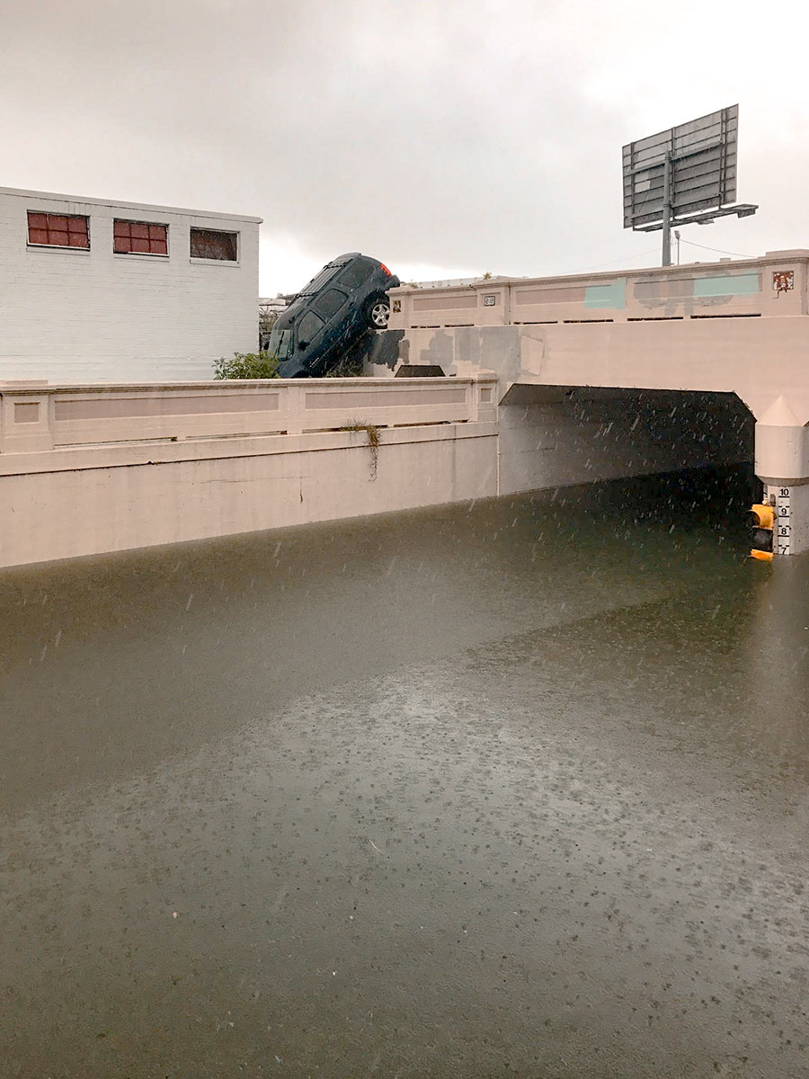
Water levels from Harvey have made the underpass just north of Center St., where Houston Ave. tucks under the rail lines, impassable. But there are consequences to trying to drive around the underpass structure, as this photo taken yesterday afternoon by a Swamplot reader attests: The ground drops off sharply on the south side of the tracks to the west of the street, and that’s not so easy to see if you’re driving south.

Photo: Kelsie H. Dos Santos

Avoiding High Water
08/28/17 11:00am

With water levels on Buffalo Bayou around Shepherd Dr. now forecast to recede, this drone video of one stretch of the waterway — taken yesterday during a lull in the rains — may turn out to be one of the best views available of the extent of flooding at the northwest corner of Montrose. A few video highlights, still visible above the floodwaters: The top floor of The Dunlavy, high above the now-complete-subsumed Lost Lake; the fuzzy treetop semi-circles formed by the twin stands of crape myrtles at Waugh Dr.; the Waugh Dr. bridge itself, now looking like a causeway; and the patterned grounds of the Beth Yeshurun Cemetery.

Video: Evan Mallett

Dunlavy to Waugh
08/25/17 3:32pm

SANDBAGGING IN MEYERLAND What kind of person would pay close to $5,000 to have 18,000 pounds of sandbags delivered and installed in a low stack in front of a 5-ft.-high waterproofing barrier surrounding her home? The owner of a Meyerland single-story 4-bedroom (pictured above) 1 block south of Brays Bayou that flooded “for the first time” in the Memorial Day deluge of 2015 (according to a real estate listing of that year) and then twice more in the past year or so. “This may not even work,” Kristin Massey tells Houston Public Media’s Marissa Cummings. “It’s just an effort to hope that it will.” Massey says she would have installed more sandbags if more had been available: “I would have liked to have gone higher than 11 inches, but I have about half or a third of what I need.” [Houston Public Media] Photo: Houston Public Media  

08/25/17 10:00am

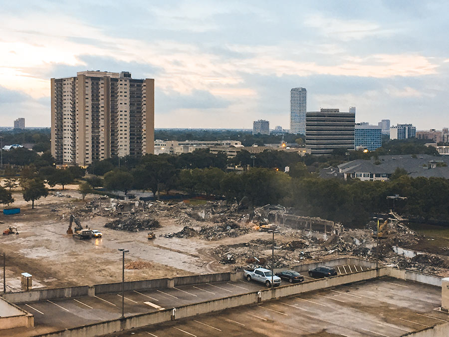
Demo crews making a mess of the former Exxon Upstream Research Facility on Buffalo Spdwy. between Richmond and W. Alabama started early this morning — at 5:30 am, reports a reader. Erick Ganzo, who’s been tracking the steady disappearance of the MacKie and Kamrath Architects 1962 office complex (as well as more recent additions) from the 16.9-acre compound, says workers lit up the site with large bright lights before the rising sun took over that job. He tells Swamplot he assumes workers are aiming to complete demo work before Hurricane Harvey arrives later today.

Photo: Erick Ganzo


3120 Buffalo Speedway