10/19/17 3:30pm

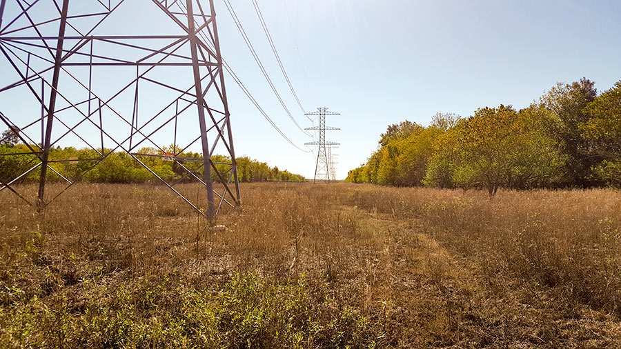
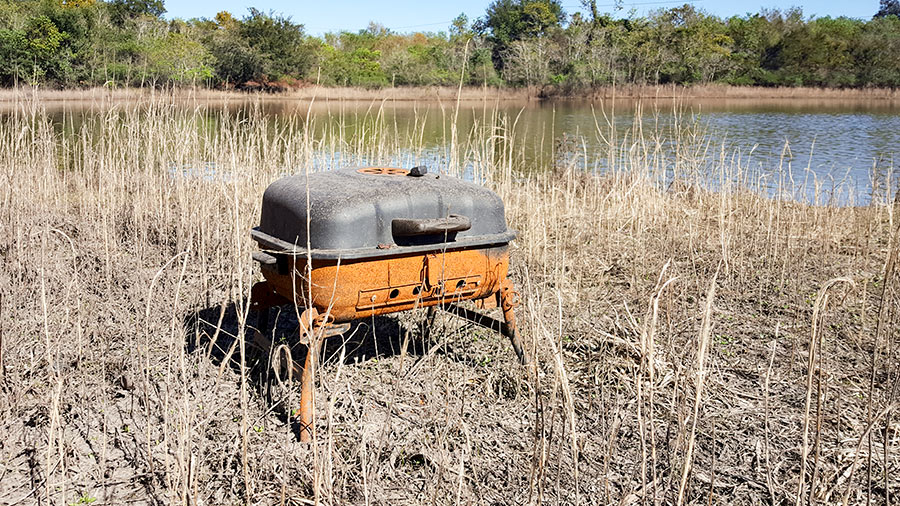
Venturing into the upper reaches of the now officially empty Barker Reservoir near Addicks Clodine Rd. and south of the Audi West Houston dealership on I-10, reader Kyle Steck finds a mostly dry landscape. (The pictured lakes in the images are features shown in maps of the area.)

“In a few weeks it will turn from brown dead apocalypse to green wonderland,” he predicts.

CONTINUE READING THIS STORY

After the Watering
10/18/17 4:00pm

COMMENT OF THE DAY: A WATERSHED APPROACH TO PAYING FOR FLOOD CONTROL “. . . I think that if we are going to be realistic about the way that we finance flood control, that the core of such a plan needs to take a page from how flood insurance gets underwritten. Everybody pays a property tax to a watershed-specific flood control entity, but that tax is adjusted based on the elevation of their first-floor living area relative to the Base Flood Elevation. If you’re more than a few feet above it, your tax is very low. If you live more than a few feet below it . . . you’re probably going to pay so much in taxes that it’ll become immediately economic to raise your structure or demolish it. Right away, the inventory and value of property subject to flood risk is reduced; and what’s left that is tolerably at-risk pays for its own reduced need for risk mitigation. And . . . if we’re too gun shy to pull the trigger on a plan like this, which would totally wipe out a lot of people’s equity in vast swaths of real estate, okay well that’s where people not at very much risk should be expected to pay more taxes even without receiving very much in the way of benefits. Yeah, I’m basically proposing Obamacare for flood control in Houston, but only as a humane alternative which reveals a startling truth: that the big money for this sort of thing is unlikely to come from up on high, from the feds or the state government (and it shouldn’t IMO). Financing this stuff locally is going to hurt. One thing is very very clear: whatever kinds of administrative bodies are created or re-jiggered to deal with this issue have got to address legacy development first and foremost. We need a plan to cope with what is already on the ground. This is not something that we can just build ourselves out of, going forward, with stricter rules for new development, feel the catharsis, hold hands and sing Kumbaya, and call it a day.” [TheNiche, commenting on An 8th Wonder Distillery; New Bridges for Brays Bayou; How Apartment Buildings Get On Your Nerves]

10/18/17 3:30pm

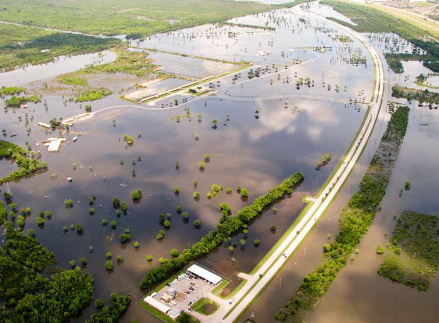
ADDICKS AND BARKER RESERVOIRS ARE NOW COMPLETELY EMPTY AND READY FOR THE NEXT FLOOD All water stuck behind the Addicks and Barker dams has now been released, the Army Corps of Engineers announced late yesterday. That means that for the first time since Hurricane Harvey-triggered rains began filling the 24,520-acre reservoirs, they are now dry and available for use again as parkland. The last bits of water actually left the Addicks and Barker reservoirs last Thursday, October 12th, and Friday the 13th respectively; the announcement was delayed, a public-affairs officer tells reporter Amelia Brust, in order to “receive legal guidance.” The Corps, writes Brust, “is now a defendant in multiple lawsuits brought by surrounding property owners who say their homes and businesses were flooded as a result of the dams’ releases.” [Community Impact] Photo of American Shooting Centers and Millie Bush Dog Park off Westheimer Pkwy. in Barker Reservoir, flooded after Memorial Day, 2015: U.S. Army Corps of Engineers [license]

10/17/17 3:30pm

COMMENT OF THE DAY: WHAT YOU’RE SEEING AND SMELLING IN FLOODED APARTMENTS “I have a question regarding the apartments in Kingwood. There is a statement in the letter from the apartments indicating that there is a clear difference between mold and mildew. I understand it as they are both one and the same when it comes to interior livable spaces. If it smells and-or is visible you have a problem irregardless of the classification of mold or mildew. Is this not correct? Is there a legal distinction per Texas Law? Can someone please chime in? Thanks.” [It Smells, commenting on The City That Will Be Building and Rebuilding Forever; Houston’s Long Amazon Odds; The Latest Poke Place] Illustration: Lulu

10/17/17 12:45pm

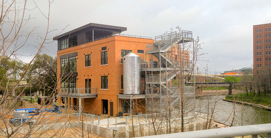
SURVEYING THE SOGGY AFTERMATH OF HOUSTON’S ULTIMATE HOME-TOUR TEST Talk about timing: The Rice Design Alliance’s annual home tour this past March opened to inspection 6 structures built in Houston floodplains with some sort of strategy to make it through a major water event. How’d these properties survive the cataclysm that followed only 5 months later? A 1965 Meyerland home on the tour by Houston architects Brooks and Brooks one block north of Brays Bayou was damaged, Jack Murphy reports. And his follow-up story on the RDA’s H2Ouston tour includes no word on the Harvey experiences of François de Menil’s 5-story Temple Terrace townhome or the 3-story butterfly-roof home on Logan Ln. backing up to Buffalo Bayou Taft Architects built in 1996. But 2 more recently built homes on the tour — 2-story structures by architects Brett Zamore in Linkwood and Nonya Grenader in Shirkmere survived without much more than messes in their garages (and a flooded-out car), according to Murphy. Then there’s the Sunset Coffee Building fronting Buffalo Bayou Downtown, which serves as the offices of the Buffalo Bayou Partnership, and which in its recent redo by Lake Flato and BNIM (pictured), was designed to take on water: “All sources indicate that the design performed as anticipated. . . . The staff moved exhibit materials to the second floor and secured the elevator on an upper floor. But there are always issues. The grease trap filled with water, thermostats need to be replaced, and the elevator shaft had five feet of standing water at the bottom, causing electrical issues. Security cameras mounted on the building filled with water and malfunctioned. The fire alarm went off for four days, making the area sound like a war zone, even catching the attention of a CNN reporter. Still, water didn’t crest into the offices on the second floor. (It was almost this high during Allison.) Shortly after the waters receded, the building was habitable again.” But this sort of resilience wasn’t just added to the building by its renovators: “The BBP’s Rebecca Leija and Anne Olson told me their insurance adjuster said the Sunset Building, built in 1910, was well-suited to handle floods due to its height and angle relative to the bayou. Sure enough, in plan the building is set at an angle to the bayou’s flow, presenting a corner to floodwaters rather than a flat face. And, its east façade breaks slightly, perhaps to further reduce the surface area ‘seen’ by floodwaters and therefore reduce their force on the walls and foundation.” [OffCite] Photo of Sunset Coffee Building renovation: Adam Williams  

10/16/17 2:30pm

COMMENT OF THE DAY: A SIMPLE QUESTION ABOUT BUYING A HOME IN HOUSTON “I’m in the market for a new place. Where can I find if the house was flooded or is otherwise in a compromised zone? It appears in Harris County such information wasn’t recorded or readily available. Thanks.” [Sparta, commenting on What Makes West Houston the Bermuda Triangle of Real Estate Disclosure] Illustration: Lulu

10/13/17 3:30pm

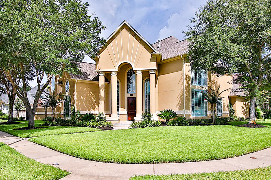
WHAT MAKES WEST HOUSTON THE BERMUDA TRIANGLE OF REAL ESTATE DISCLOSURE None of the more than half a dozen residents interviewed by The Texas Tribune and ProPublica after the floods said they knew they were living inside Addicks or Barker — many of their neighborhoods are several miles away from the dams. Several local officials — including Houston’s ‘flood czar’ and a neighboring county executive — said they had no idea the neighborhoods had been built inside the flood pools. Several real estate agents said they didn’t realize they were selling homes inside the pools.” This from the latest exposé on how 14,000 homes came to be located in designed-to-flood areas inside the Addicks and Barker reservoirs. First, the good news: Of those 14,000 homes, only 5,138 of them flooded this time! Among the many additional OMG-worthy revelations from this latest report from the crack Houston-flooding investigations team of Neena Satija, Kiah Collier, and Al Shaw: Of those homes built inside the reservoirs, at least 4,000 of them were built after Tropical Storm Allison hit in 2001. That’s interesting to note, considering that a Harris County Flood Control District report published in 2003 warned that as many as 2,000 acres of private land inside the reservoirs might easily have flooded in that storm if the rains had fallen in a slightly different location. Also included: this little glance at the area’s real-estate future: “One five-bedroom home in Lakes on Eldridge . . . was listed for $678,000 about two weeks before it flooded during Harvey. The seller’s agent, Moira Holden, tried to put a positive spin on things when she updated the online listing that decreased the asking price by $10,000. ‘Unfortunately this stunning home did flood and is being refurbished to the highest spec!’ it says. ‘Fabulous chance to choose your finishes!‘ When asked if she would disclose to potential buyers that the home was inside Addicks Reservoir, Holden didn’t have a clear answer. ‘I will obviously disclose whatever we are required to disclose,’ she said, pointing out that the home wasn’t in a floodplain. ‘I would hope that the buyer’s Realtor would do their due diligence on that.'” [Texas Tribune; previously on Swamplot] Photo of 13119 Shermons Pond, for sale in Lakes on Eldridge: HAR

10/12/17 3:00pm

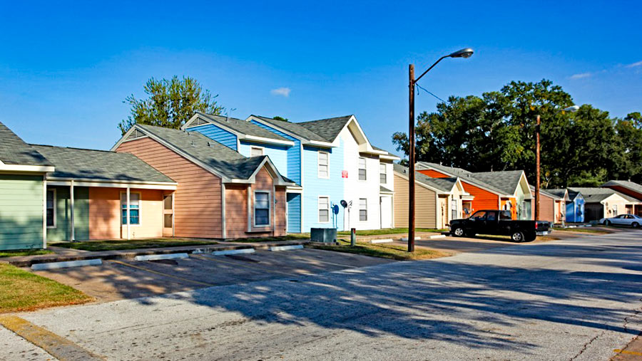
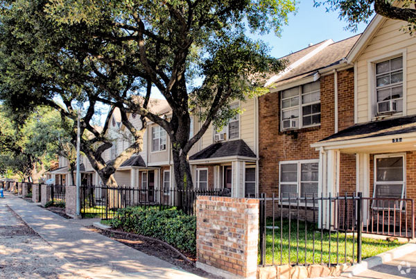
HOUSING AUTHORITY: OUR FLOODED CLAYTON HOMES DEVELOPMENT WAS GOING TO BE DEMOLISHED ANYWAY A new statement from the Houston Housing Authority provides a little more background on its decision to demolish 112 of the 296 units at the authority’s Clayton Homes low-income housing neighborhood just east of Hwy 59 at the northern tip of EaDo. The homes were deemed “uninhabitable” after flooding from Hurricane Harvey triggered mold and other health concerns: “HHA decided demolition was the best course of action for the damaged units since the entire property is located on land acquired by eminent domain and will face eventual demolition for TxDOT’s I-45 freeway extension. When the remainder of Clayton units are demolished in a few years, the remaining residents will either be relocated to another public housing unit or receive HCVs.” Housing Choice (formerly Section 8) Vouchers — along with moving assistance and payments — are also being provided to residents of 82 out of the 100 units at another Housing Authority development, Forest Green Townhomes at 8945 Forest Hollow St. in northeast Houston, which the authority today announced had also been rendered unlivable by the storm. [Houston Housing Authority; previously on Swamplot] Photo of pre-Harvey Forest Green Townhomes: Forest Green

10/12/17 11:00am

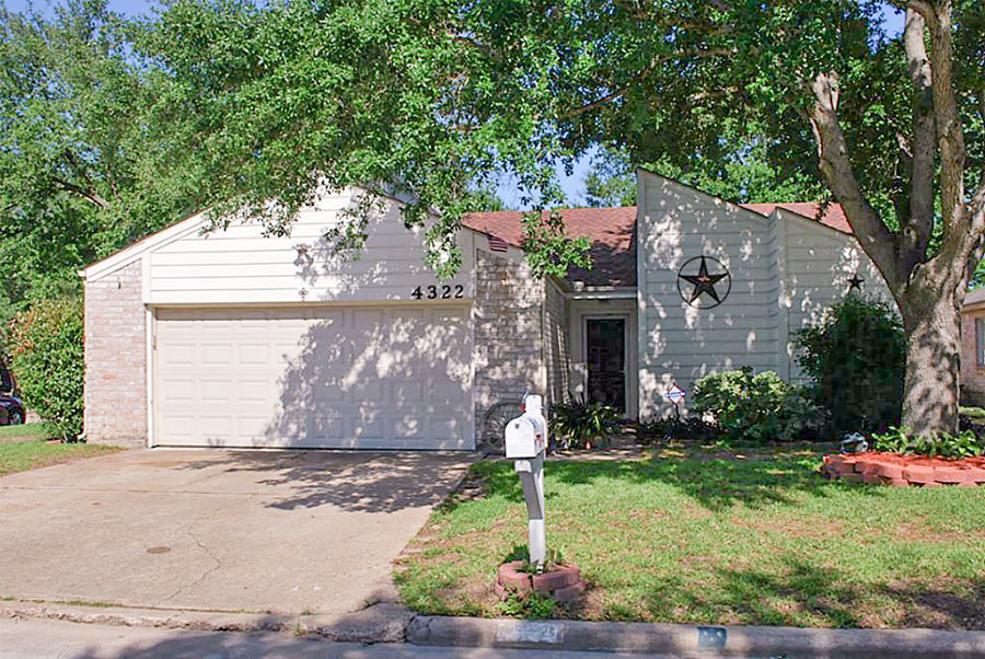
HERE COME THE HARVEY LOW BALLERS Outsiders moving into town to buy up homes from distressed owners for pennies on the dollar in the wake of local catastrophe is a proud and longstanding Houston tradition: It keeps the city’s reputation for real-estate shenanigans intact, even as oldtimers mellow. It’s how Sir Allen Stanford got his illustrious start! Plus: Investments that must be recouped can help keep zombie neighborhoods that maybe-shouldn’t-have-been-built-there-or-that-way-in-the-first-place alive. But you don’t have to be a wet-carpetbagger to get in on the fun: Reporter Prashant Gopal heads to the Redneck Country Club on Airport Blvd. in Stafford for a well-attended pep talk by local trashed-home recycler Eddie Gant, then follows local real-estate agent Bryan Schild as he drives through neighborhoods looking for deals: “One of Schild’s prospects is Joseph Hernandez, a disabled U.S. Army veteran married to a housekeeper. The couple are living in a hotel and saving money by eating only two meals a day. Schild has made them a painful offer. If they walk away from their two-bedroom house, worth $127,000 before Hurricane Harvey, Schild will pick up the mortgage payments, paying nothing else. Although he says he sympathizes with the Hernandezes’ plight, he thinks the offer is fair because he figures the home is now worth less than its $65,000 mortgage. Hernandez is in a bind. He didn’t buy flood insurance because his house wasn’t in a high-risk area. He can’t afford to rebuild, and he’s been told he’s eligible for only $23,000 in federal assistance. If he turns over the deed, he’s looking at losing the entire $60,000 in equity he had before the flood. ‘It’s blurry, what’s coming,’ he says. ‘We’ll probably have to sell to an investor, and that’s not good. We were forced out.’” [Bloomberg BusinessWeek] Photo of Hernandez’s home in Bear Creek Village, before it flooded: HAR

10/11/17 5:00pm

EPA: YEAH, BETTER CLEAN OUT THE DIOXIN PITS FROM THE SAN JACINTO RIVER NOW THAT THEY’VE LEAKED A bit later than had been urged by those alarmed by the longterm presence of pits full of toxic waste sealed only with a tarp on top hanging out in the San Jacinto River, the EPA has now approved a plan to remove most of the dioxin stored within them. “As exemplified today, EPA is prioritizing Superfund clean-up by making decisions in a decisive, timely manner,” reads a statement from administrator Scott Pruitt released this afternoon. “The San Jacinto Waste Pits site was added to the National Priority List nearly a decade ago.” What’s the rush? As predicted by EPA studies and many a casual observer, the pits appeared to have leaked extensively after Hurricane Harvey flooding. Under the new $115 million plan, cofferdams will be installed around the pits and almost 212,000 cubic yards of dioxin-contaminated material will be excavated — leaving just enough behind that the agency can, it says, ensure controls that will “prevent access, eliminate off-site migration, and monitor the natural recovery into the future.” [EPA; more info; Houston Chronicle; previously on Swamplot] Video of waste pits after Harvey flooding: Greg Moss

10/06/17 4:45pm

COMMENT OF THE DAY: DON’T SAY I DIDN’T WARN YOU ABOUT THE WHOLE MOLD BUSINESS “So for homeowners you just cut the sheetrock, and rebuild all of the stuff at 3 feet and go down the road? My feeling is that every house that flooded has some trace of E. Coli and mold. Pretty soon you’ll see mold lawyer commercials suing every contractor that worked in these places. Doctors will soon get in on the action too. Hell, back in 2000 when mold lawsuits were born my framer had a magnetic door sign for ‘mold testing and remediation’ in the back seat of his pick-up. Get ready for it again.” [Sporey McGee, commenting on Housing Authority Ready To Demolish More Than a Third of Clayton Homes After Harvey Flooding] Illustration: Lulu

10/05/17 3:00pm

HOUSING AUTHORITY READY TO DEMOLISH MORE THAN A THIRD OF CLAYTON HOMES AFTER HARVEY FLOODING 112 of the 296 apartments at Clayton Homes have been deemed “uninhabitable” by its owner, the Houston Housing Authority, which is now seeking to demolish them. The affordable-housing complex tucked between Hwy. 59 and Buffalo Bayou north of Runnels St. in the northwest corner of the East End was flooded after Hurricane Harvey; subsequent investigations conducted by local researchers led by the New York Times and by the authority found numerous health and safety problems in the residences, including festering mold and high levels of E. coli. Submitting a demolition request for those units allowed the authority to receive and distribute “tenant protection vouchers” that will allow their residents to relocate to any voucher-accepting unit in the city, a spokesperson for the agency says: “Since Hurricane Harvey caused extensive damage to many of HHA’s public housing properties, housing options within HHA’s public housing program are now exhausted, which is why residents are receiving vouchers.” The agency says it is also helping Clayton Homes residents not eligible for the vouchers as well to find new homes — with relocation assistance services and one-time payments — and that it is refunding rents collected for periods when homes in the complex were uninhabitable. Photo: Apartments.com

10/05/17 10:30am

Here’s a commandeerable after-and-before flooding shot, taken from a drone hovering 300 ft. above Hwy. 6 just north of the Barker Reservoir spillway. Move the slider at the bottom of the image to toggle slowly between the 2 views, taken Thursday, August 24th (on the right, not long before the arrival of Hurricane Harvey) and Tuesday, August 29th (on the left, after stormwater filled the reservoir and the flooded the area). You can also rotate and zoom the image with your pointing device or finger.

In the initial view, the camera is facing straight down Addicks-Howell Rd.; the wider Hwy. 6 appears to veer off to the left. Addicks-Howell marks the entrance to Fleetwood, the adjacent neighborhood. Rotate the view 180 degrees to see the spillway.

Houston visualization firm Reality Imaging & Mapping Technologies took the panoramic images and stitched them together to create the immersive and zoomable view, which can also be experienced as a VR image. Click here to view the image in its own browser window.

Image: Reality Imaging & Mapping Technologies

Harvey Media
10/03/17 10:30am

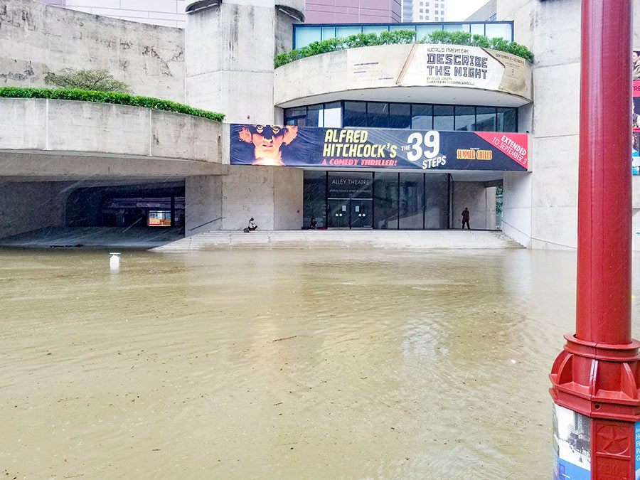
ALLEY THEATRE FLOODING DRAMA CAME FROM AN ALLEY THIS TIME, NOT THE TUNNEL Harvey flooding caused an estimated $15 million of damage to the Alley Theatre’s basement-level stage, lobby, and dressing rooms, but for the most part spared its recently renovated box-office entrance, main stage, and upper-level lobbies. The good news, relayed by theater managing director Dean Gladden in an email to members: Submarine doors in the tunnel prevented water flowing from the Theater District’s underground parking garage from entering the theater as it had during Tropical Storm Allison. But this time there was another way in: a fresh-air intake vent in the Alley’s drive-thru Alleyway driveway fronting Jones Plaza on Texas Ave. (pictured at left in the above photo): “Harvey’s waters crested so high that this in-take vent provided an opening that enabled the flood waters to enter the building unimpeded. The water was so powerful it knocked through a cement block wall and blew open locked doors. When the cement block wall collapsed, it broke a 2-foot fire line that started spewing water out at 150 gallons a minute. About 900,000 gallons of water would come from this source before it was turned off. The flood water from the bayou would account for 2.8 million gallons of water. The water would reach 10-feet high in the Neuhaus Theatre and lobby and 15-feet high in the basement level. The Alley Theatre below ground was completely flooded.” [Alley Theatre] Photo: Jason Hrncir  
10/02/17 1:30pm

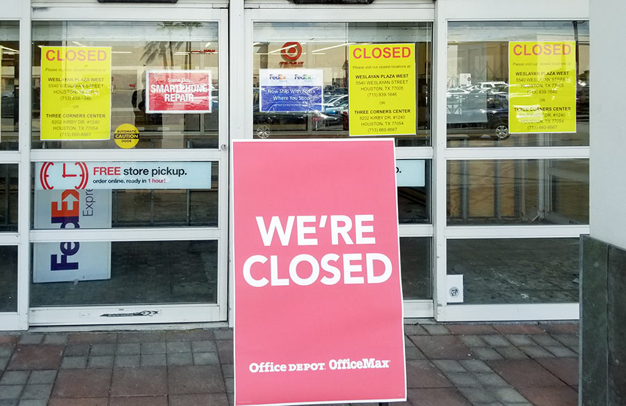
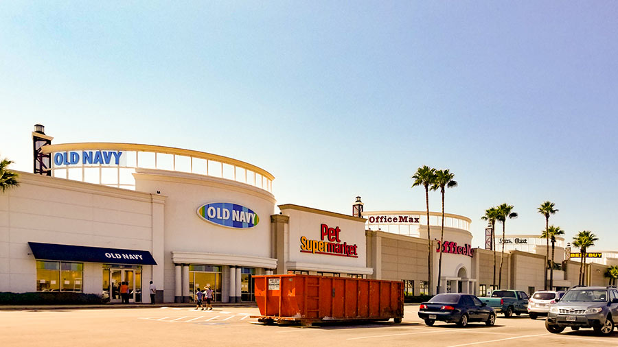
Pet Supermarket in Meyerland Plaza has reopened after taking on water after Hurricane Harvey, but it appears to be an exception among big-box stores lined in a row on the former mall site. Signs in front of Old Navy, OfficeMax, and Dressbarn declare the stores are closed — and direct customers to other locations, according to these photos and a report from a Swamplot reader. Here’s the scene in front of Old Navy, where notes in the window declare the store is closed “until further notice“:

CONTINUE READING THIS STORY

Old Navy Underwater