06/25/12 2:46pm

“It was very eerie to see the stern deck of the ship so close to the water,” writes Swamplot reader J.W. Lodge IV, who visited the leaking Battleship Texas by boat yesterday, and who notes that a news story from Friday linked to in this morning’s Headlines post — which claimed that the dual-world-war veteran parked by the San Jacinto Monument had been repaired and reopened — seemed a bit off. “As far as I can tell they’ve got a long way to go with the pumps,” he reports. The ship was reopened for tours on Saturday, but beginning that evening more problems developed. As of this morning, about 1,500 gallons of ship-channel water were pouring in each minute, from 2 separate areas of new leaks in the vessel’s rear port side. Also developing in the water around the ship: an oil sheen.

Photo from Sunday: J.W. Lodge IV

03/13/12 1:18pm

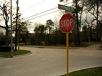
LAWSUIT CLAIMS PINEY POINT VILLAGE IS USING HUNTERS CREEK VILLAGE AS DETENTION POND A waterflow restrictor the city of Piney Point Village secretly installed in a new stormwater system it shares with Hunters Creek Village is now the focus of 2 separate lawsuits. The latest, filed last week, includes claims that the bricked-up storm drain — narrowing a culvert under Hedwig Rd. connecting the 2 Memorial villages from 36 to about 8 inches — effectively turns Hunters Creek Village into a stormwater storage facility for its downstream neighbor. Piney Point Village officials claim the restrictor prevents Hunters Creek from draining more water from Kemwood Dr. through the new culvert than the 2 municipalities had originally agreed upon. Rainstorms on January 9th and 25th flooded Kemwood with 4 ft. of water, which backed up into residents’ yards. Hunters Creek’s second lawsuit calls the narrowing of the culvert “deliberate sabotage” put in place to force the city to sign off on a drainage study. [Memorial Examiner] Photo of Kemwood at Hedwig Rd.: Rusty Graham
02/13/12 10:35am

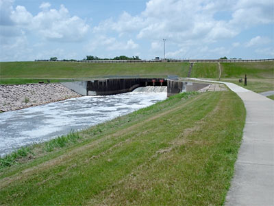
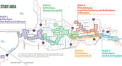
Looks like that Charting Buffalo (as in Buffalo and Lower White Oak Bayous) draft report might not have gone over so well. A popup note shown to first-time visitors to the project’s website, posted just last Friday, dryly notes the entire report has been pulled — only 2 days after it first went out for community feedback: “In light of compelling issues regarding the presentation of certain concepts in the Charting Buffalo draft report, the Harris County Flood Control District is in the process of modifying the report. The District is suspending the report’s distribution, review period and all scheduled community meetings until further notice,” it reads. The feedback period for the report, intended to form the foundation of a master plan for reducing flood damage along the entire Buffalo Bayou and lower White Oak watersheds from the Barker Reservoir to the Ship Channel Turning Basin, was originally scheduled to extend until April 1. Possible flashpoint: the “more than 40 options for reducing flooding risks and damages” spelled out in the report. The Charting Buffalo project was the flood control district’s response to a City of Houston request to “provide land” for stormwater detention.

Map of Study Area: Charting Buffalo

11/14/11 9:40pm

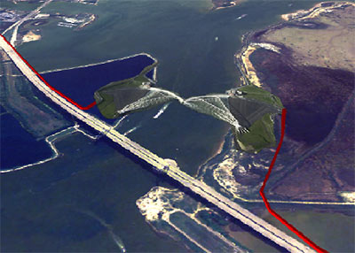
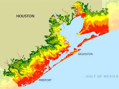
What could possibly have been worse than Hurricane Ike? Super Ike, a stronger hurricane aimed 30 miles further west, causing a larger storm surge, more deaths, and significantly greater damage to Houston’s industrial infrastructure. To protect against that hypothetical $100 billion threat, a Rice University team is recommending some bolstered defenses for the region. Included among the suggestions: a “moveable gate structure” just upstream from Baytown’s Fred Hartman Bridge, to block the Ship Channel and San Jacinto River from rising waters in Galveston Bay (pictured above); elevating Hwy. 146 along the west edge of Galveston Bay so that it forms a levee protecting much of La Marque, Dickinson, League City, Clear Lake, and La Porte; a “baywall” to protect Galveston Island’s backside from sneaky storm surge waters; and preserving a 130-mile-long stretch of existing coastal wetlands between High Island and Matagorda as a recreation area and when-needed storm barrier.

CONTINUE READING THIS STORY

08/26/11 12:20pm

In what appears to be a last-ditch effort to block construction of Segment E, the straight-throught-the-Katy-Prairie section of the Grand Parkway scheduled to begin construction this month, the Sierra Club has filed a new suit against the Army Corps of Engineers, the DOT, the FHA, the Texas Transportation Commission, and several public officials. But the lawsuit also focuses attention on the health of the Addicks and Barker Dams on Buffalo Bayou, which control waterflow through west and Downtown Houston. According to a July 2010 document unearthed by the environmental group this past March through an information request, the Army Corps has rated the status of both dams as “urgent and compelling” since September 2009; that rating indicates the Corps considers them to be 2 of the 6 most dangerous dams in North America.

CONTINUE READING THIS STORY

05/03/11 4:15pm

Houston ranks 5th — below Long Island, Miami, Virginia Beach, New Orleans, and Tampa — in potential property damage from storm surges, according to an annual report from Corelogic. The company figures the resulting storm surge from a Category 5 Hurricane here would likely produce $20 billion in property loss — well behind Long Island’s $99 billion score. Can’t this city do a little better? We’ve got the high-hurricane-risk and low-lying-properties parts down cold. If we can just boost the property values a bit in those areas, we’ll be rolling with the high-stakes big boys next time.

The top at-risk area Zip Codes, according to the company’s report: 77573, 77554, 77059, 77571, 77062, 77566, 77586, 77539, 77546, and 77521. Locally, League City leads the way!

Image: Corelogic

11/03/10 11:41am

A COME-FROM-BEHIND VICTORY FOR HOUSTON’S DRAINAGE FUND Surprise! A late flood of support turned the tide for the “Renew Houston” campaign. Proposition 1, the city charter amendment that sets up a separate pool of money for drainage improvements and establishes new taxpayer fees to pay for it, ended up passing by a very narrow margin: a little more than 7,000 votes. The amendment was supported heavily by engineering and construction firms. [Bay Area Citizen]

09/28/10 6:15pm

Parts of Jersey Village have been subsiding by about 2 inches a year, according to 2 UH professors and a former grad student who’ve been studying a decade’s worth of GPS data from 2 dozen area measurement points. Associate professor of geology Shuhab Khan, geology professor Kevin Burke, and former Ph.D. student Richard Engelkemeir note there’s been gradual subsidence in a “sprawling” 324-square-mile area of northwestern Harris County, but Jersey Village is the fastest to fall.

Just what is it that makes this little community so down-to-earth? Reports Khan:

The most likely reason for the sinking of Jersey Village is the withdrawal of water from deep beneath the surface. While groundwater withdrawal has ceased in most of the Houston area, it continues in the northwestern part of the county that has seen a rapid growth in population.

Continued subsidence, of course, will also help the entire northwest Houston area collect more water when it rains. But it isn’t all downhill for Houston.

CONTINUE READING THIS STORY

08/19/10 2:57pm

COMMENT OF THE DAY: WEST END WALMART IN DETENTION “. . . The only negative to the city to me has to deal with drainage. The developer (under current city policy) can claim the site was previously developed which means no storm water detention needs to be provided for the tract. The mayor and several other local groups believe that all new large scale development should provide detention regardless of the previous conditions of the site. It’s not an easy policy change to implement even in the strictest of regulatory environments.” [kjb434, commenting on In the Mail: Walmart Gets Its Game on for Central Houston]

08/13/10 9:10am

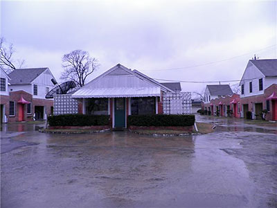
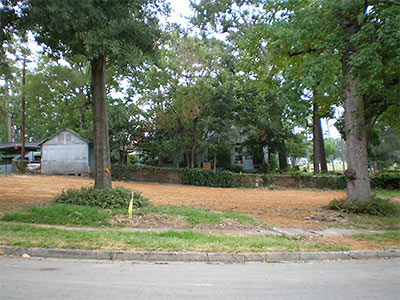
Then you saw it, now you don’t: Part 2 of FEMA’s buy it, then demolish it plan for the oft-flooded home at 1954 N. MacGregor Way in Idylwood is now complete, reports a reader. “The plants around the trees seem to be all that’s left. And, that funny knotty thing on the tree on the right.” A source scores the low-lying property as the 10th FEMA buyout of Hurricane Ike-damaged homes in the neighborhood, though more residents have turned down similar offers. Just across the street from the property: The uppity banks of Brays Bayou.

Photos: Swamplot inbox

07/13/10 11:57am

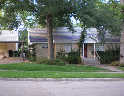
Readers in Idylwood have been watching Swamplot’s Daily Demolition Report for the appearance of this house at 1954 North MacGregor Way, as it wraps around to Sylvan Rd. in their neighborhood. A local resident tells us the 1950 home will be the 10th Hurricane Ike-flooded house bought up by FEMA and torn down. (Other homeowners on the same street have turned down similar early-retirement deals for their properties, claims the resident.) But focusing on that singular pre-storm flooding event in 2008 only doesn’t do justice to this home’s long history of seaworthiness: Our source says this house had 4 feet of water in it on at least 2 occasions, along with several less dramatic Brays Bayou baptisms. Water from the bayou came back to play in the street in front of the house just 2 Fridays ago.

Idylwood scored 3 FEMA buyouts in the wake of Tropical Storm Allison, in 2001.

Photo: Swamplot inbox

07/12/10 10:41am

AND NOW A TALL BLAST OF HOT AIR FROM THE GULF See, this ginormous methane fart is gonna shoot up from deep beneath the Gulf of Mexico, and then we’ll all be outta here like the dinosaurs: BP’s Deepwater Horizon drilling operation may have triggered an irreversible, cascading geological Apocalypse that will culminate with the first mass extinction of life on Earth in many millions of years. . . . If the methane bubble—a bubble that could be as big as 20 miles wide—erupts with titanic force from the seabed into the Gulf, every ship, drilling rig and structure within the region of the bubble will immediately sink. All the workers, engineers, Coast Guard personnel and marine biologists participating in the salvage operation will die instantly. Next, the ocean bottom will collapse, instantaneously displacing up to a trillion cubic feet of water or more and creating a towering supersonic tsunami annihilating everything along the coast and well inland. Like a thermonuclear blast, a high pressure atmospheric wave could precede the tidal wave flattening everything in its path before the water arrives. When the roaring tsunami does arrive it will scrub away all that is left.” [Helium; deprogramming available on Reddit; both via Rex Hammock]

07/09/10 4:29pm

GALVESTON’S NEW RINSE-OFF NIGHTSPOT A lawsuit will determine whether Scott Arnold can collect the remainder of the insurance money he expects for the loss of the famed Balinese Room to Hurricane Ike. In the meantime, the former owner of the waterside bar wanted to make sure his next nightspot would survive another big Galveston flood. So . . . is his new Granite Room, which opened on July 4th as part of the Voodoo Lounge complex at 26th and Mechanic streets, on an upper floor or something? Naaah. It’s mop-down friendly: “This building got nine feet of water during Ike,” he tells HBJ reporter Allison Wollam. “So I designed the club with granite and marble so that if it floods again, we can just hose everything down and be open again within a week or two.” [Houston Business Journal; previously on Swamplot] Photo: Granite Room