COMMENT OF THE DAY: A BETTER IDEA FOR WHAT TO DO WITH THE SPACES UNDER FREEWAYS IN HOUSTON  “. . . This gave me an idea. That land under freeways isn’t good for retail or anything inhabited. But it could be a perfect place to dig down and create auxiliary stormwater detention facilities.
Yeah the water will be filthy, like your friends bikes usually are, but floodwater usually is. And as auxiliary detention they would only be used in extreme rainfall events (once or twice a year during so-called ‘hundred year’ storms).” [ZAW, commenting on Comment of the Day Second Runner-Up: Things To Think About Before You Start Planning Under-Freeway Developments] Illustration: Lulu
Tag: Water Detention
ALL THE DAMS AND MAGIC WETLANDS CAN DO 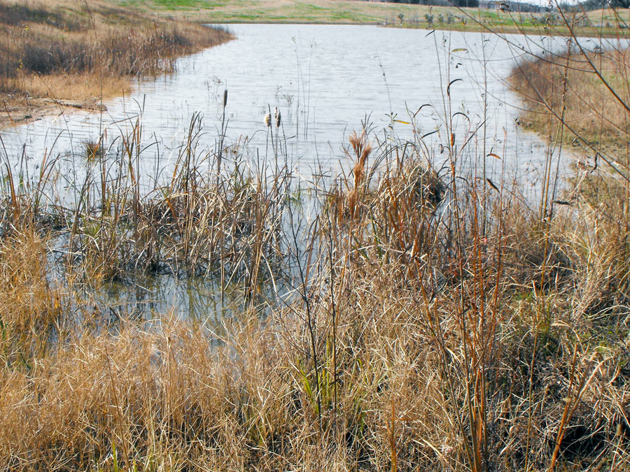 Big, fat, cleared floodplains are the best way to handle a very large storm, explains wetlands scientist John Jacob — because nothing else is going to: “An average rainfall of 35 inches over all of Harris County (Harvey) is just over 1 trillion gallons. At most, there are about 50 billion gallons of stormwater detention capacity in Harris County wetlands (no one has measured this — I had to make some very broad assumptions). So that means that the wetlands at best could handle about 5% of the total volume of Harvey rainfall. In the large scheme of things, it’s not much. And the scheme of things in Harvey is indeed very large.
So much for the magic wetlands. But what about our engineered drainage system? I calculate a somewhat larger detention capacity — between our large US Army Corps of Engineers Katy Prairie reservoirs (~400,000 acre-ft) and Harris County Flood Control District detention (about 34,000 acre-feet), we have about 130 billion gallons of detention volume. More than what we have for wetlands, but still only about 14% of Harvey. As we painfully saw, also overwhelmed.
And what of green stormwater infrastructure — rain gardens, bioswales, green roofs, etc.? We don’t have any good numbers here, but you can be sure that even if these practices were widespread, the volume would be very small relative to wetlands and detention basins. These practices are designed to capture at best a 2 inch storm.” [Watershed Texas] Photo of Willow Waterhole Greenspace: Luz (license)
COMMENT OF THE DAY RUNNER-UP: ABANDONED NEIGHBORHOODS MAKE GREAT DETENTION PONDS  “I grew up off Fairbanks/West Little York area. TS Allison was the third time Creekside Estates and Woodland Trails West II had flooded which meant those homes wouldn’t be insured for future floods. Both of those neighborhoods are almost completely gone now, mainly just streets people use to cut through. Even with all the new construction/neighborhoods built near Breen Rd, nothing around has flooded since. The south side of WTW where Gulf Bank runs through flooded twice in late ’90s, along with Philippine St. in Jersey Village. Neither of those areas have had a third flood event; not Ike, Memorial Day flood, Tax Day flood or Harvey could flood them. A huge reason why has got to be because old Creekside Estates and WTW II hold so much of the water that would’ve flooded them out that costly third time years ago. Sometimes you have to cut loose some fat for the overall good and I know it sounds heartless but I’ve seen it work. These very flood prone neighborhoods just have to be made into retention areas because it works.” [mas, commenting on How About We Don’t Sell People Homes in Areas That Keep Flooding, and Other Crazy Ideas for Houstonians To Discuss Amongst Themselves] Illustration: Lulu
COMMENT OF THE DAY: HERE COMES YOUR PERIODIC REMINDER OF WHO’S AHEAD IN THE ONGOING COMPETITION BETWEEN DETENTION AND DEVELOPMENT  “Looks like we’re in for a real wet weekend. It will be interesting to see if all the detention ponds constructed in the past 10 to 15 [years] combined with the loss of open land due to development results in net positive flood compared to events like Allison, Rita and Ike.” [Dana-X, commenting on Here Comes Harvey; Lone Star Flight Museum’s Opening Day; A Texas Castles Primer] Illustration: Lulu
COMMENT OF THE DAY: LAY OFF THOSE FLOODED UNDERGROUND FREEWAYS, THEY’RE JUST DOING THEIR JOB  “Trenched roads include sumps that are capable of keeping the roadways from flooding from ordinary rain events, but are designed to become flooded in an emergency, acting as additional stormwater detention. Every cubic foot of stormwater that goes in there is a cubic foot that isn’t at the same elevation as city streets, businesses, and houses. It is a feature, not a bug.” [TheNiche, commenting on Watch as Unfunded Parks Appear on Top of Houston Freeways Before Your Very Eyes!]
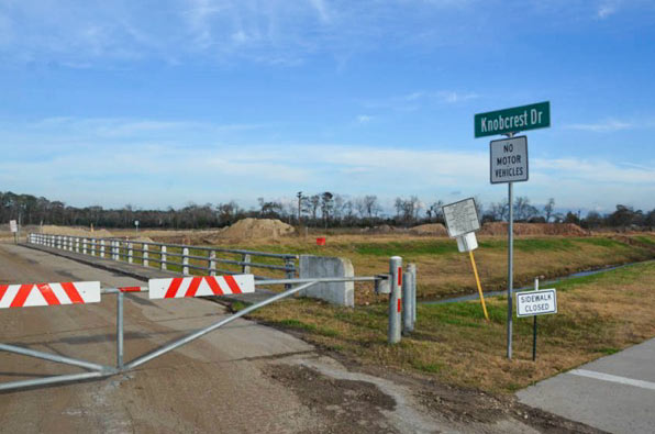
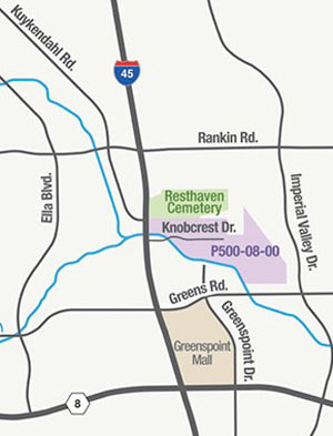 Just south of the Earthman Resthaven Funeral Home and Cemetery on I-45 — and just north of Greens Bayou — the Harris County Flood Control District is in the process of digging up more than 2 million cubic feet of soil from the Glen Forest Stormwater Detention Basin-to-be. (That’s the purple shaded area in the map shown here, right upstream from the cluster of bayou-side apartment complexes that flooded on Tax Day and helped spur the pre-dawn conversion of Greenspoint Mall into an emergency shelter.) If the name “Glen Forest†strikes you as a bit mid-century-suburban-neighborhood, that’s because it is: the 160-acre site is named after the sixties-era Glen Forest subdivision formerly constructed on the property. The neighborhood was purchased and demolished as part of HCFCD’s buyout program in the early 2000’s, but the roadways and signs had mostly stuck around, at times serving as a convenient backdrop for unsanctioned motor sports, as demonstrated in the video below:
The footage above captures Ed Nelson’s high-water trek last Monday through an overflowing detention basin at the corner of Bob White Dr. and Reamer St. just north of Brays Bayou. Nelson narrates his soggy expedition through the basin (which sits at the south end of the Robindell and Braes Timbers neighborhoods, between Hillcroft Ave. and Fondren Rd.) as he attempts to document different flows of water into and out of the pond; he ultimately claims that water is flowing into the detention pond from Brays, and moving from there into the floodway easement running behind nearby houses on Reamer.
Nelson and other neighbors claim that the surrounding area did not flood prior to the detention basin’s completion in 2008, and that the detention pond was intended to collect water from the surrounding neighborhood and prevent it from flowing too quickly into Brays bayou  — whereas during the Tax Day and Memorial Day floods, the basin purportedly collected water from the bayou and channeled it into the neighborhood, causing houses to flood that neighbors believe might not have otherwise.
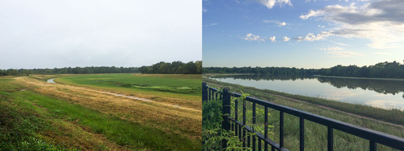
A water-watching reader sends some south-facing photos from yesterday evening (right) and last October, comparing views over the fenceline of the 400-ft.-wide diversion channel at the northern edge of the Addicks reservoir. The channel picks up most of the flow from Langham and Horsepen creeks where they join up as they flow south into Addicks. The 400-ft.-wide floodway was dug in the 1980s; the flow usually lurks down in the narrow channel seen in the shot on the left.
The scene above is less than a mile east of Bear Creek Village, where water is now moseying into neighborhoods from the western edge of the reservoir (and washing some wildife and livestock around). The Army Corps of Engineers has been releasing water from both Addicks and Barker dams to minimize the pooling (and relieve stress on the dam structures themselves) — but those releases have to be done slowly enough to avoid causing additional flooding downstream along Buffalo Bayou. Meanwhile, water is still flowing into the reservoirs from western watersheds; the measured levels behind the 2 dams topped all previous water level records and normally allowed pooling limits in the reservoir by Tuesday, and has been rising since. Here’s a shot of water gushing out through some of the gates of the Barker dam this afternoon:
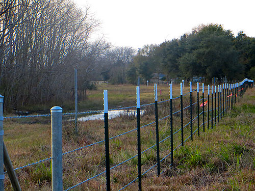
Having succeeded in somewhat reducing the planned amount of tree carnage at the southern end of their neighborhood bounding a portion of the Willow Waterhole Stormwater Detention Basin, residents of Post Oak Manor now have another curious byproduct of those flood-reduction efforts to contend with. Contractors working on the Harris County Flood Control District project are now lining a section of the new detention basin with actual barbed-wire fencing. “This is public paid-for lands,” complains neighborhood resident Valerie Runge. “I can’t help but feel this is retaliation for the trouble we caused trying to keep a few of the trees.”

That vague line of pink barely visible low in the forested area just beyond the backyard of this house on Warm Springs Dr. in Post Oak Manor marks a few of the hundreds of trees the Harris County Flood Control District plans to knock down as part of a second phase of work on the easternmost portion of the Willow Waterhole Stormwater Detention Basin complex. Most of the trees slated for removal are in a 5-acre zone to the southeast of Post Oak Manor (outlined at the bottom right of the aerial map below), just north of South Main St. and directly to the southwest of Beren Academy. But the pink line is part of a separate 2-acre strip that’s slated for thinning just south of Post Oak Manor. And that’s got some residents there — and in adjacent ‘W’ neighborhoods Willowbend, Willow Meadows, Willowbrook, and Westbury — upset.
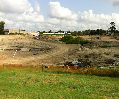
A Swamplot reader offers a trade: A few photos of the retention ponds going in north of White Oak Bayou where 6th St. was blocked between Yale and Shepherd (above and below) — in exchange for more details on the park that’s apparently planned for that location, including a scheduled completion date for the construction. “I have no ‘official’ information, only old data and hearsay,” reports the reader. Which includes this map dating from 2010:
COMMENT OF THE DAY: WEST END WALMART IN DETENTION “. . . The only negative to the city to me has to deal with drainage. The developer (under current city policy) can claim the site was previously developed which means no storm water detention needs to be provided for the tract. The mayor and several other local groups believe that all new large scale development should provide detention regardless of the previous conditions of the site. It’s not an easy policy change to implement even in the strictest of regulatory environments.” [kjb434, commenting on In the Mail: Walmart Gets Its Game on for Central Houston]
COMMENT OF THE DAY: I-10 AND BUNKER HILL PAVING REPORT “. . . as someone who lives on Westview and who has lived in the area mentioned (or near it) for 15 years… let me tell you what was paved over. -Ditches on either side of Bunker Hill between Longpoint and Katy freeway. -Old Katy road, which had grass on both sides and a ditch. -A little shop (maybe a car dealership I dont remember) that was on an island between both sides of bunker hill, dirt and green was taken from there -the already mentioned quarry which was NOT all pavement. I went there often and it was very much dirt. Cars would get stuck there when it rained. -The daniel area that was also not all paved where those new apartments are (where there is standing water when it DOESNT rain due to poor drainage). This is not a flooding that hasnt happened in 20 years, the houses here are much older than 20 years… these houses are 50+ years old and it has NEVER happened.” [Alma, commenting on The Detention Battle of Bunker Hill: Flooding Above the New Katy Freeway]
MORE PONDS, HUGGING BAYOUS Houston will spend $30 million in the upcoming fiscal year on detention ponds like those built under Project Brays. “About $20 million in federal Hurricane Ike relief money and $10 million in city capital improvements funding will be used to buy land and design and build basins that can hold hundreds of acre feet of water when the bayous become full, [Mayor] White said. City officials are evaluating sites along the Hunting, Greens, White Oak, and Halls bayous for new detention basins, said Andy Icken, deputy director of the Public Works and Engineering Department.” [Houston Chronicle]
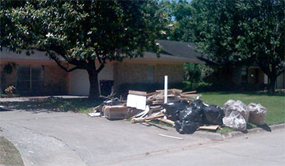
Some residents of Long Point Woods are blaming the new and well-paved 48-acre Village Plaza at Bunker Hill shopping center along the north feeder road of the expanded Katy Freeway for the late-April flooding that damaged many homes between Bunker Hill Rd. and Blalock, south of Westview. Abc13’s Miya Shay reports, opting not to mention the neighborhood or the development by name:
[Resident Barbara] Hunt says homeowners grew worried when a large development along I-10 and Bunker Hill [was] allowed to be built without additional retention, and when heavy rain fell, it ran off the parking lots and into their homes. . . .
But Mayor White says the developers didn’t get special treatment because the property was already covered in asphalt before the developers bought the land and began building.
“If something is built, and somebody buys it from somebody where it already has some paved over and is already developed, we don’t have new detention requirements,” said Mayor White.

