A LAWSUIT OVER RIVERSTONE’S VANISHED LEVEE 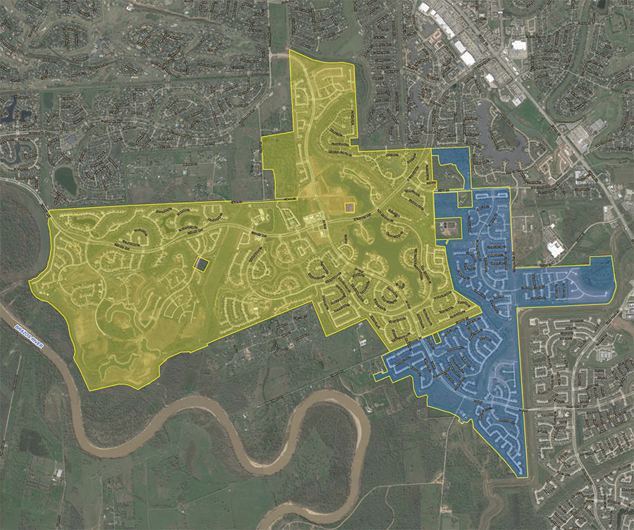 More than 400 residents of Fort Bend County’s Riverstone development — between Hwy. 6 and the Brazos River — are suing the engineering firm that designed their stormwater systems, alleging that the design left one portion of the community flooded by the runoff from the other during Harvey. The roughly 3,700-acre area is divided into 2 Levee Improvement Districts — LID 19 (shaded blue on the map) and 15. “It became very clear when we passed into LID 15 that something was not right,” one LID 19 homeowner said in a press conference. “We were inundated with water in our neighborhood, and just on the other side of the street everything seemed to be perfectly fine.” Both LIDs were designed by Costello, Inc. the company founded by Houston’s flood czar Steve Costello. (He’s said he divested from it in 2015.) That firm’s failure to consider what would happen when a levee that ran between the 2 districts — along Hagerson Rd. — was removed is what downstreamers say is to blame for much of their soggy state. In total, reports the Chronicle’s Rebecca Elliott, about a third of the 1,760 homes in LID 19 flooded. [Houston Chronicle] Map of Riverstone LIDs 15 and 19: Riverstone LIDs
Tag: Flood Control
COMMENT OF THE DAY: BACK TO NATURE  “Cities with a ‘home flood rate’ of over 25 percent — like Bellaire — should really consider mandatory green space, meaning some property owners simply cannot rebuild. Tough in the short term but the city can front good money to buy them out . . . because all that park land, trails, fishing, sports fields will pay back multi-fold when these communities are Edens in the midst of a major city.” [movocelot, commenting on Bellaire’s Flooded Home Count; Chicken Salad Chain Making Houston Debut] Illustration: Lulu
THE MIND-BOGGLING UNDERGROUND MULTI-BAYOU TUNNEL DRAINAGE SYSTEM NOW PROPOSED FOR HARRIS COUNTY 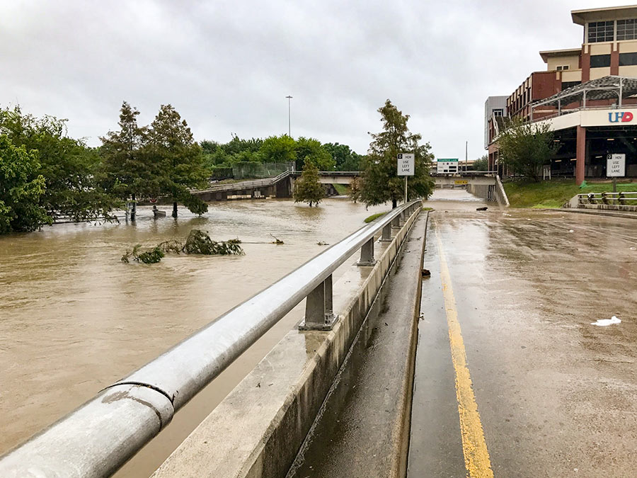 The Harris County Flood Control District is considering digging the nation’s largest network of high-volume tunnels 100 to 200 ft. underground to drain stormwater from several waterways, including — write the Chronicle‘s Mike Morris and Mihir Zaveri — Buffalo Bayou, White Oak Bayou, Hunting Bayou, Greens Bayou, Halls Bayou, Clear Creek, and Cypress Creek. “The goal under the plan,” they report, “would be for those waterways to be able to keep a 100-year storm event within their banks.” Flood czar Steve Costello argues that despite the project’s enormity, the tunnels might actually be the cheapest way to bring the all the county’s major waterways up to 100-year capacity. Even if such a one-shot solution does cost less than a series of smaller mitigation efforts, the pricetag for the tunnels would still be in the billions, or “perhaps $100 million per mile,” Costello says. On Tuesday, the Commissioners Court is set to vote on whether to pursue a contract with Fugro USA Land — a global engineering firm — for a feasibility study of the proposed project that would cost around $400,000. [Houston Chronicle ($)] Photo of Harvey flooding near UHD: Kelsie H. Dos Santos
FUNDING FOR DOWNTOWN HOUSTON’S NEW ISLAND 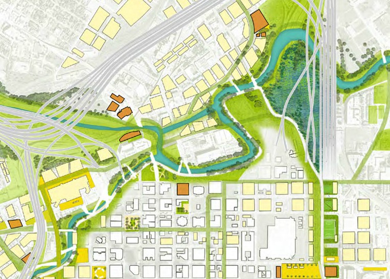 Houston’s flood czar Steve Costello tells the Chronicle’s Mike Morris that the city plans to apply for FEMA resiliency grants in order to build the North Canal Bypass — the long-whispered diversion channel that would relink White Oak and Buffalo bayous between Main and Elysian streets. The waterway concept bubbled up last year in Plan Downtown where its course formed an island northwest of Allen’s Landing indicated in the imagined map above. By bypassing the bayou’s oxbow, the channel is expected not only to reduce flooding downtown — it could also “help lower the water level in White Oak Bayou all the way to the 610 Loop and in Buffalo Bayou as far west as Gessner,” according to a county study. The result: “A little more than half of the 854 structures in the 100-year floodplain along White Oak and an adjacent tributary, Turkey Gully, would be removed from the floodplain.” [Houston Chronicle; previously on Swamplot] Map: Plan Downtown
DIGGING UP THE LATEST ADDICKS AND BARKER RESERVOIR DIRT 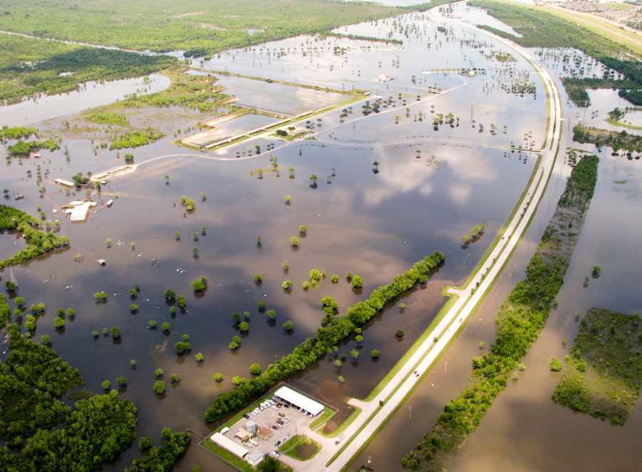 The Army Corps of Engineers is exploring the possibility of deepening the Addicks and Barker reservoirs in order to increase their floodwater capacities. The Chronicle’s Mihir Zaveri digs up a request the Corps posted online quietly in January for specifics on how to remove soil from the reservoirs. The notice says the Corps is “evaluating the level of interest” from contractors, government agencies, and others “to allow for the beneficial use of material by interested parties while increasing capacity of the Government project.” Respondents are asked how much how much soil they would remove from the reservoirs, what methods they’d use to collect and transport it, where they’d deposit it, and how long the work would take. The deadline for responding to the agency was last Thursday. [Houston Chronicle; posting] Photo of American Shooting Centers and Millie Bush Dog Park off Westheimer Pkwy. in Barker Reservoir, flooded after Memorial Day, 2015: U.S. Army Corps of Engineers [license]
JUDGE EMMETT: KATY PRAIRIE DEVELOPMENT SHOULD STOP ONCE AND FOR ALL 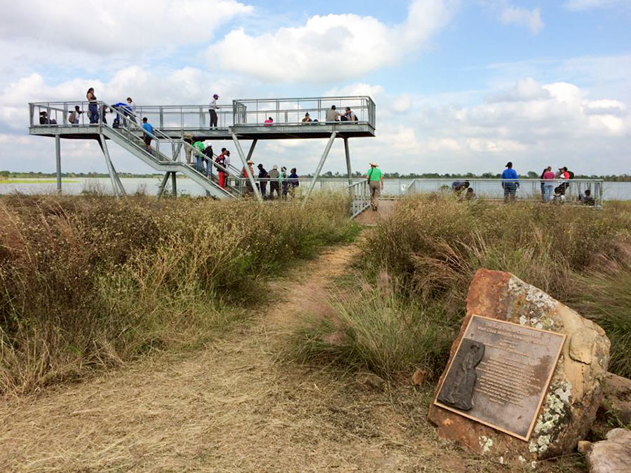 Here’s Harris County Judge Ed Emmett’s declaration Wednesday at a Rice University flooding conference: “We need to completely protect the Katy Prairie. Just set it aside and not touch it.” Or . . . what’s left of it. Last October, he called for a third reservoir in west Houston to “be part of a larger project to create a state or national park for the Katy Prairie.” And he wants Gov. Abbott to tap the state’s “rainy day fund” in order to build the prairie pond. (As for where it would go, a 2015 Harris County Flood Control District study proposed several sites, all on not-yet-developed parcels west of the Grand Pkwy. between Hwy. 290 and FM 529.) [Travis Bubenik] Photo of Matt Cook Wildlife Viewing Area on Warren Lake, south of Hockley: Katy Prairie Conservancy
COMMENT OF THE DAY: WAKE ME UP WHEN HOUSTON’S WAKE-UP CALLS ARE OVER  “The idea that the Houston area has just been complacent all this time and needs to ‘wake up’ is ridiculous. Houston has been steadily improving its situation for decades through various means (infrastructure, regulation, mitigation, response, etc.). This progression got particular boosts by these larger events and we will see the same needed boost post-Harvey. But realize these rainfall events over the last 2+ years have been off the charts and applying these lessons learned takes years.” [Rex, commenting on Comment of the Day: The Even Bigger Reason Houston Might Want To Address Its Flooding Problems] Illustration: Lulu
INWOOD FOREST GOLF COURSE NEXT IN LINE FOR STORMWATER DETENTION BASIN TREATMENT 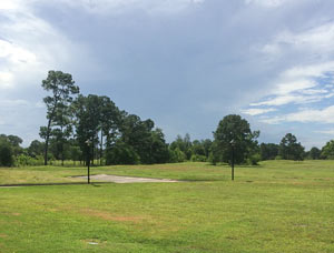 One of the next spots up for retrofitting as a series of flood detention ponds: the rest of the Inwood Forest Golf Course, which the city bought in 2011 after that lawsuit over whether it could be developed as anything else. The Chronicle’s Mike Morris reports that a set of 10 new ponds were approved by city council on Wednesday for the former fairways, which sprawl on either side of Antoine Rd. between Victory Dr. and W. Gulf Bank Rd. interspersed with bits of residential neighborhood. (A pair of basins was previously dug out on the site; the new project could increase the course’s water feature storage volume from 56 to more than 1000 acre-feet, potentially.) The former clubhouse for the course, at 7603 Antoine Dr., has also found new employment as the White Oak Conference Center, and currently houses some operations of the Near Northwest Management District. Inwood Forest isn’t the first golf course in Houston being put to new flood-conscious uses — across town, an ongoing project in Clear Lake has been converting the former Clear Lake City Golf Course into a series of detention basins and park spaces going by the name Exploration Green. It potentially isn’t the last, either — the Sims-Bayou-side Glenbrook Park Golf Course may eventually be converted into the Houston Botanic Garden, the Seussical early renderings of which include large sections designed to flood. [Houston Chronicle; previously on Swamplot] Photo of former Inwood Forest Golf Course green near White Oak Conference Center: White Oak Conference Center
COMMENT OF THE DAY: WHERE THE RUNOFF TAX FLOWS MATTERS LESS THAN COLLECTING IT  “Just collecting the tax on impermeable surfaces is valuable on its own. It makes landowners think twice about creating (or even keeping) flood-worsening pavement. Where the money goes sort of morally determines whether the fee is a form of legally-imposed direct responsibility for flood costs, or just pure financial disincentive that helps the city with flood costs or whatever else — it would be better with the spending restriction, but I’ll gladly take either one.” [Sid, commenting on City Loses Latest Appeal on 2010 Drainage Fee Election] Map of past, ongoing, and planned drainage and street projects: ReBuild Houston interactive map
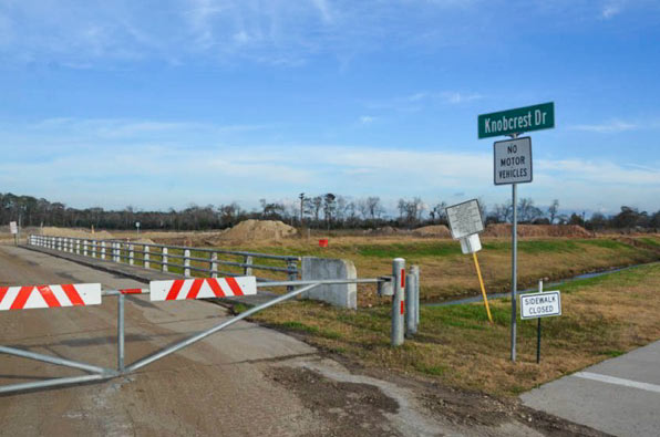
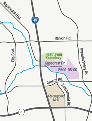 Just south of the Earthman Resthaven Funeral Home and Cemetery on I-45 — and just north of Greens Bayou — the Harris County Flood Control District is in the process of digging up more than 2 million cubic feet of soil from the Glen Forest Stormwater Detention Basin-to-be. (That’s the purple shaded area in the map shown here, right upstream from the cluster of bayou-side apartment complexes that flooded on Tax Day and helped spur the pre-dawn conversion of Greenspoint Mall into an emergency shelter.) If the name “Glen Forest†strikes you as a bit mid-century-suburban-neighborhood, that’s because it is: the 160-acre site is named after the sixties-era Glen Forest subdivision formerly constructed on the property. The neighborhood was purchased and demolished as part of HCFCD’s buyout program in the early 2000’s, but the roadways and signs had mostly stuck around, at times serving as a convenient backdrop for unsanctioned motor sports, as demonstrated in the video below:
COMMENT OF THE DAY: WATER BORDER PROS AND CONS 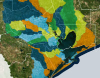 “Abolishing arbitrarily-bounded entities with taxing powers like the HCFCD and instead creating entities that are specific to individual watersheds seems like it might make some sense. I do worry that certain areas, especially less affluent ones, would suffer from poor or corrupt leadership; and you can’t simply merge watersheds as the T.E.A. would merge school districts. However, that’d certainly be more democratic and accountable. That’s a trade-off which might be worth making.” [TheNiche, commenting on Group Petitions for 13-County Flood Planning] Watershed boundaries superimposed across Houston-area county boundaries: Galveston Bay Foundation and Houston Area Research Council’s Find Your Watershed map
JUST HOW MUCH FLOODING IS TOO MUCH FLOODING FOR HOUSTON? 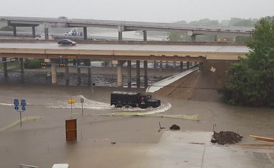 We pretty much know what we would have to do to stop most Houston flooding, writes Dylan Baddour as the calendar flips to 2017.  Potential paths to drier ground for the city include a multitude of complex region-wide tasks, including changes to waterways across the county, adding thousands of acres of detention space, and potentially addressing the cumulative impacts of seemingly minor small-scale building practices.  The cost of upgrading the whole system, including buyouts, bayou widenings, and utility rerouting, is estimated by the county flood control folks at around $27 billion — and that’s just to get protection up to so-called 100-year storm levels; Houston has had 8 such storms in the past 27 years, and the Tax Day flood was fueled by a much larger event. “What needs to be decided,” Baddour writes, “is how far taxpayers are willing to go. Cars don’t have airbags to absorb a hit from a train. Should Houston have a drainage system to contain a biblical storm? Where does the city draw the line?” City flood czar Steve Costello tells Baddour that the city has to do something, however, to avoid passing on a “potentially insurmountable problem” to future Houstonians. [Houston Chronicle] Photo of N. Braeswood Dr. at 610 on April 17, 2016: Chris Klesch
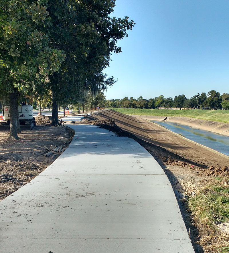
A mobile reader sends some fresh shots of not-quite-green-yet redone greenway along Brays Bayou, looking west from Buffalo Spdway. along S. Braeswood Blvd. The Harris County flood control folks have been widening this section of the channelized stream this fall as they work their way through the Project Brays checklist; the stretch seen above and below is about 2 miles downstream of some of those more submersion-prone areas of Meyerland near the Brays crossing under 610.
The new trail is a fair bit wider and smoother than the one it’s replacing — for some soggy comparison, here’s a view of the trail from around noon on Tax Day, just up past the next bend near where Ilona Ln. meets S. Braeswood:
COMMENT OF THE DAY: ONE SET OF HOUSE RULES FOR ALL HOUSTON LOCATION GAMBLES  “So, whenever anyone in Houston gets upset about the impact a new development will have on their neighborhood, the chorus rises up and yells at them about how they should have seen it coming when they bought in a no zoning area. Fingers wag in their face about expecting government to save them from the impact of development when they had a choice to buy in a deed restricted neighborhood in the ‘burbs but chose Houston’s zoning-free wilds instead. But, when it is Mother Nature at work, the same [logic] gets thrown out the window. Everyone buying land along the bayou knows that it is a very active waterway that is constantly reshaping its banks. But when a few dozen owners of very expensive real estate . . .  come crying to the government to protect them from a problem that was very open and obvious to them when they developed their properties, suddenly they are given a free pass from having to be responsible for their decisions. . . . Buffalo Bayou is just fine the way it is. Anyone with a stabilization issue can pay their own way to deal with it.” [Old School, commenting on  Comment of the Day: Keeping Buffalo Bayou in its Place] Photo of Buffalo Bayou: Save Buffalo Bayou
COMMENT OF THE DAY: KEEPING BUFFALO BAYOU IN ITS PLACE 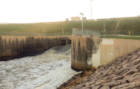 “Sounds nice — but that little part about the bayou being in the middle of the city, that’s why it can’t be left up to nature. . . . I understand the need to conserve and protect, but the Buffalo Bayou we know today is man-made. Ship Channel, Turning Basin, the resevoirs, Allen’s Landing, even the ill-fated Shepherd’s Dam all took a meandering stream and turned it into an industrial workhorse for Houston. Basically the ‘natural flow’ is impossible to get back; for that matter it never was something that the majority of Houstonians wanted. There are other bayous and creeks in the area that can take up the cause that don’t happen to be in one of the most expensive and sought-after flood plains in America. It is a noble battle but it was doomed to be one of beautification, not naturalization the moment the Allen Brothers decided to build a better New York City in Texas.” [SimplySid, commenting on Stop Trying To Fix Buffalo Bayou, Says Save Buffalo Bayou] Photo of Barker Dam outlet structure on Buffalo Bayou: Swamplot inbox

