HARVEY UPSTAGES HARVEY  The A.D. Players‘ new 450-seat Jeannette and L.M. George Theater at 5420 Westheimer just west of the Galleria, which opened earlier this year, “has stood the storm well,” its operators report today on Facebook. But not so much the very first set of shows in the resident theater company’s new season: Because of Hurricane Harvey’s devastation, a production of Mary Chase’s 1945 Pulitzer Prize-winning play about a 6-ft., 3-and-a-half-in.-tall invisible rabbit named Harvey (scheduled to begin a 3-and-a-half-week run on September 8th) has been put off — for a while, at least: “Harvey the storm has not been our friend. ‘Harvey’ the show will go on — more details to come,” reads a note posted by the theater last night. “When it does, we want it to be a lighthearted lift to our beloved community, which has suffered so much in just a few short days.” The theater company began planning its production of Harvey months ago, but says it had been promoting the production “in earnest” for only a little more than a week. [A.D. Players] Photo of George Theater: A.D. Players
Tag: Disaster Aftermath
The map above outlines the actual locations of neighborhoods designated by officials yesterday as being at risk from flooding over the back sides of Houston’s dual Buffalo Bayou reservoirs — in advance of actual spillovers, which began last night and continued this morning. The map was put together by Chronicle data reporter John D. Harden, using information from the Harris County Flood Control District. Zoom in and you can identify specific streets and neighborhoods on the upstream side of Addicks (in red) and Barker (in blue) reservoirs.
Names of the affected neighborhoods are listed on the map’s fly-out panel, available by clicking on the icon at the top left corner of the map. Click on the icon at the top right corner to enlarge the map if you need to.
To lessen the risk of flooding to these areas, officials have been releasing water out the other end, through the Addicks and Barker dams into Buffalo Bayou — possibly (depending on bayou water levels) endangering neighborhoods and structures downstream.
- A weary Houston likely to endure catastrophic flooding through Wednesday [Houston Chronicle]
- Officials fear rising rivers, failing levees [Houston Chronicle]
Map: Houston Chronicle
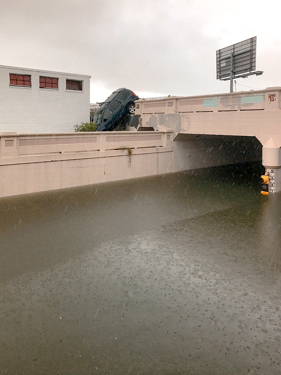
Water levels from Harvey have made the underpass just north of Center St., where Houston Ave. tucks under the rail lines, impassable. But there are consequences to trying to drive around the underpass structure, as this photo taken yesterday afternoon by a Swamplot reader attests: The ground drops off sharply on the south side of the tracks to the west of the street, and that’s not so easy to see if you’re driving south.
Photo: Kelsie H. Dos Santos
WHERE SWAMPLOT READERS CAN CHECK IN ON EACH OTHER AND SHARE THEIR HARVEY STORIES 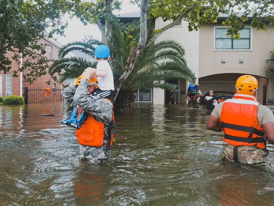 Got a story to share? Or just want to let folks on Swamplot — who might only know you by your commenting handle — know how you’ve been weathering the rising waters? No, the rains aren’t done yet, but if today or in the coming days you’d like a space to report on your experience or neighborhood, or just let everyone know if things are okay, please do so by adding a comment below. Photo:Â Lt. Zachary West , 100th Mobile Public Affairs Detachment [License]
WHY YOU MIGHT WANT TO FILE YOUR HARVEY INSURANCE CLAIMS BEFORE FRIDAY 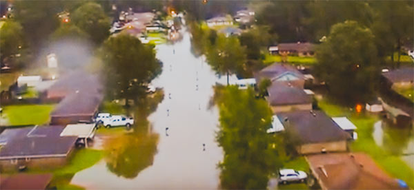 Suffered property damage from Hurricane Harvey and have access to a smartphone, computer, pen and paper, or your insurance agent? Forget about waiting for waters to recede before filing any insurance claim. You’ll want to do it now — or at least before Friday. What’s the rush? The new Texas law formerly known as House Bill 1774, passed by the Texas Legislature this session and signed by Governor Abbott in May, goes into effect on September 1. The “hailstorm lawsuit reform” measure reduces property owners’ leverage with insurance companies in weather-related claims — by making it more difficult for homeowners to sue agents successfully, increasing the obstacles to filing and carrying through with lawsuits over insurance coverage, and limiting the penalties insurance companies could face if they lose a lawsuit against you. To prevent your coverage from falling under these stipulations, notify your insurance provider of your claims before the law goes into effect, and document your correspondence. [Community Impact; Texas Tribune; Property Insurance Coverage Law Blog] Photo: Randy Poole
With water levels on Buffalo Bayou around Shepherd Dr. now forecast to recede, this drone video of one stretch of the waterway — taken yesterday during a lull in the rains — may turn out to be one of the best views available of the extent of flooding at the northwest corner of Montrose. A few video highlights, still visible above the floodwaters: The top floor of The Dunlavy, high above the now-complete-subsumed Lost Lake; the fuzzy treetop semi-circles formed by the twin stands of crape myrtles at Waugh Dr.; the Waugh Dr. bridge itself, now looking like a causeway; and the patterned grounds of the Beth Yeshurun Cemetery.
Video:Â Evan Mallett
WHERE THE SHELTERS ARE OPEN NOW 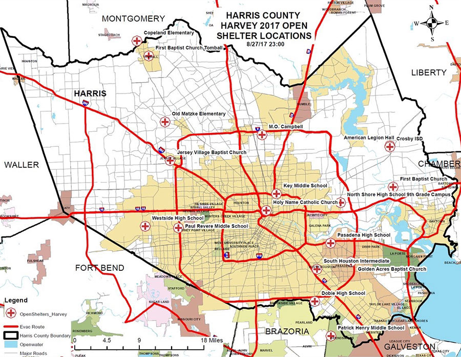 A few places you can hunt for shelters open now, whether you’re hunting for family or friends, looking for a volunteer opportunity, or have suddenly discovered your area is now under an evacuation order (as parts of Conroe and Missouri City found themselves this morning, following orders for Bay City and parts of Ft. Bend County and Rosenberg yesterday): Harris County’s Office of Homeland Security and Emergency Management has this list (last updated just before midnight last night, as of this writing), accompanied by the map above (though do ignore its overly optimistic delineation of evacuation routes). The Red Cross maintains a map of its own facilities, which covers a wider area but does overlap with the county’s list. Not yet included on either list: shelters that opened for the first time this morning at Katy ISD’s Morton Ranch and Cinco Ranch high schools. Update, 10:15 am: The list for Galveston.[ReadyHarris; Red Cross; Katy ISD] Map: Harris County Office of Homeland Security and Emergency Management
THE NEXT BIG HURRICANE REBUILD WILL GO MUCH FASTER IF YOU START ON IT NOW Meanwhile, in Brownsville: Housing advocates in Dolly-battered South Texas have since developed a disaster response program optimistically called Rapido; new legislation (similar to a bill that failed in the last Texas legislative session) is in the works to make Rapido-style “precovery” response a statewide standard. The program involves the fast deployment of permanent 1-room housing “cores” that can be quickly assembled by local workers and then added onto later; the bigger component of the program, Leah Binkovitz writes this week, is extensive pre-planning initiatives in potential disaster areas, instead of what housing advocate John Henneberger calls “reinventing disaster recovery from a blank sheet of paper every time there’s a disaster.†Binkovitz writes that the program calls for preemptive outreach “to determine what kind of disaster housing would be most appropriate, who could build it, who would be eligible to receive it and what resources would be available. That conversation should even include whether folks want to rebuild in vulnerable neighborhoods and how to offer alternatives.” [Urban Edge; previously on Swamplot]
BRYAN POLICE: PLEASE STOP DRIVING INTO FLOODWATER SO WE CAN WORK ON TORNADO PROBLEMS 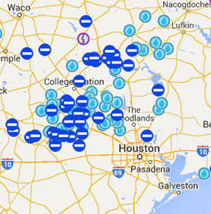 Dozens of roads are still closed this morning following yesterday’s heavy storms to the north and west. The National Weather Service reports that the nearly 17 inches of rain measured over 24 hours at its Brenham station would by itself beat the total for the 3rd-wettest month on station record (and fall less than an inch short of second place). Bryan-College Station’s The Eagle reported yesterday that the Bryan Police Department was urging drivers to stay off the roads, as first responders were getting tied up with sinking vehicle calls while also trying to respond to calls related to the tornado that touched down near Highway 6 and Briarcrest Dr. At least 50 houses were reported damaged and 3 destroyed; other possible tornado-related incidents reported in the area include damage to the Miramont Country Club and to the Wallace Pack Unit prison in Navasota. [National Weather Service, The Eagle] Map of road closures: TxDOT
A BETTER FENCE FOR THE AXIS APARTMENTS SITE 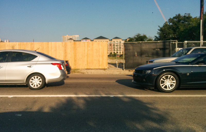 The construction fence surrounding the burned site of JLB Partners’ planned Axis Apartments at 2400 West Dallas St. in North Montrose is receiving an upgrade — from veiled chain link to wood plank. A reader who wonders if the property still qualifies as a construction site notes that the fence still blocks the sidewalk along W. Dallas. This photo shows the current intersection of the 2 fence types along Montrose Blvd. The apartments burned during construction last year. [Previously on Swamplot] Photo: Swamplot inbox
WESTBURY CENTERETTE SITE WILL REMAIN DRY Hot off the presses from the latest Westbury Crier — amid reports on the aftermath of May’s bayou overflow events, which flooded 267 homes in the neighborhood: An update on the status of the site of the former Westbury Centerette at the corner of W. Bellfort and Chimney Rock, which was demolished in March. “Originally,” the newsletter reports, “the property owner planned to construct a facility for LA Fitness; however, we regret to announce that this plan will not proceed. The property owner continues to evaluate options for the site.” [Westbury Crier; previously on Swamplot] Video of Westbury Centerette demolition: Brays Oaks Management District
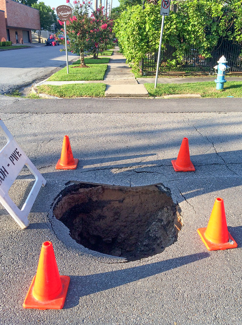
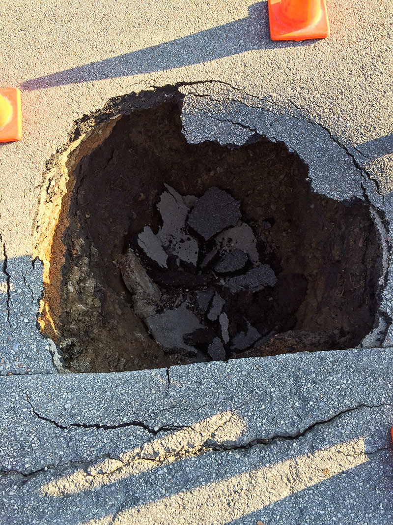
Here are views of a couple of holes that appeared at the eastern edge of East Montrose after last week’s flood. The sizable tire-grabber at the corner of Hyde Park Blvd. and Mason St. shown here was decorated by nearby residents who repurposed the cones and barricade from a nearby construction site, explains reader Brittanie Shey.
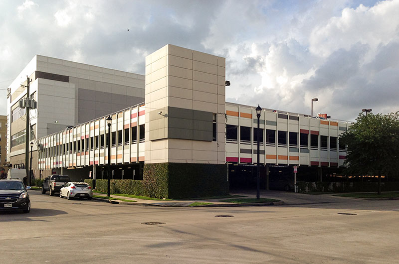
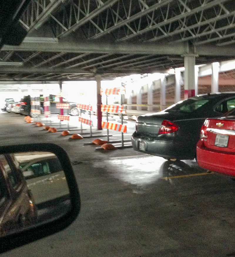 The parking garage behind the Mix at Midtown retail center between Louisiana and Milam south of Elgin St. is still in operation after last week’s fire, but photos sent to Swamplot yesterday from the scene show that the steel 3-level structure behind 24 Hour Fitness, Holley’s Seafood Restaurant, Piola, and other businesses facing Milam St. isn’t operating at capacity. At least a dozen parking spaces on the middle and top level are blocked off, noted as unsafe because of fire damage to the structure:
DISTRIBUTING DISASTER RELIEF FUNDS THROUGH TIRZ 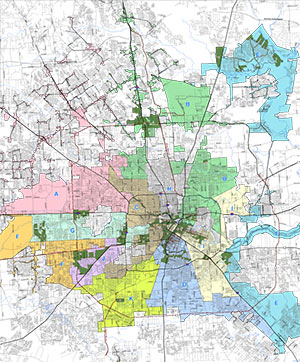 A reader has a question about a particular Tax Increment Reinvestment Zone in Houston: “In this example scenario, the city of Houston is giving [Hurricane Ike] money to a developer for infrastructure improvements on their lot (located in a TIRZ) but the requirement is that the developer must build some affordable homes on that lot.
The twist to this is that the city would give the developer money, but only if it is given through the TIRZ. Speaking with the TIRZ board, they said that they plan to distribute that money around the entire TIRZ and not just to that single development. This of course has the neighboring residents and the developer worried about how the funds will be given.
Is this the normal process for distributing Ike funding? And can a TIRZ take money away from the developing area?” Map of area Tax Increment Reinvestment Zones: City of Houston
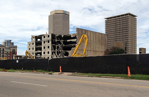
Remember the fire back in March at those apartments under construction on West Dallas next to the cemetery that destroyed the whole complex except for the parking garage? No big deal if you don’t, because you’d need to adjust your memory anyway. A reader notes to Swamplot that the surviving parking garage is now being demolished as well, months after the singed stick-frame structures around it at JLB Parters’ would-have-been Axis Apartments were carted away. So now you can remember the fire so bad they had to tear the whole thing down — though it took them a while to give up on the garage.

