COMMENT OF THE DAY: HERE COMES YOUR PERIODIC REMINDER OF WHO’S AHEAD IN THE ONGOING COMPETITION BETWEEN DETENTION AND DEVELOPMENT  “Looks like we’re in for a real wet weekend. It will be interesting to see if all the detention ponds constructed in the past 10 to 15 [years] combined with the loss of open land due to development results in net positive flood compared to events like Allison, Rita and Ike.” [Dana-X, commenting on Here Comes Harvey; Lone Star Flight Museum’s Opening Day; A Texas Castles Primer] Illustration: Lulu
Tag: Flooding
HOW TO BUILD A ‘SPONGE CITY’ Meanwhile, in Berlin: Landscape architects and designers in the German capital have identified a strategy designed to keep water where it lands, to imitate the natural water cycle otherwise absent from built-up areas. The goal: To cool environments otherwise dominated by hard and reflective surfaces by deploying green roofs and façades on buildings and urban wetlands and swales at ground level. [Bloomberg Businessweek] Video: Bloomberg Businessweek
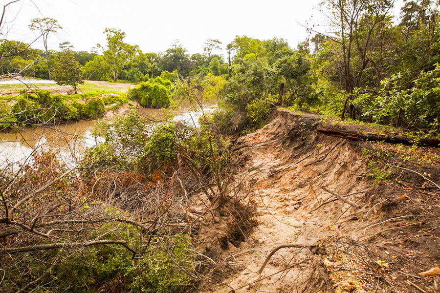
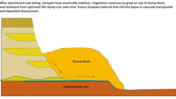
The folks fighting a longstanding battle to prevent the reconfiguration of a section of Buffalo Bayou fronting the southeast corner of Memorial Park and the River Oaks Country Club have posted a remarkable series of images showing how a section of the bayou’s bank at the Hogg Bird Sanctuary responded on its own over the course of 2 years to a soil collapse suffered during the 2015 Memorial Day flood. The geologists behind Save Buffalo Bayou claim that the promoters of the Harris County Flood Control District’s proposed $12 million Memorial Park Demonstration Project they’re trying to stop have mistaken a natural bayou-bank process called vertical slumping (or sloughing) for erosion, and that attempting to stabilize the bayou banks to fix the supposed erosion will leave the area “a wasteland of denuded and weakened banks.”
But you don’t have to buy or even follow the riverine logic the organization steps through in a lengthy article posted to its website earlier this week to appreciate one of the examples of waterway-bank adaptation exhibited there. The first image (at top) shows the immediate aftermath of the Memorial Day storm or 2 years ago on the high bluff facing the bayou at the Hogg Bird Sanctuary in Memorial Park, which stands at the downstream end of the proposed project area. According to the organization, an HCFCD consultant claims that this is one of 4 spots within the bayou area that suffers from severe lateral erosion. But to Save Buffalo Bayou, this isn’t erosion; it’s just a slump, which is what bayous do naturally, and which on their own create the distinctive bluffs on the bayou’s banks. There’s no way to fix a slump, the organization’s geologists say — if left alone it’ll restore itself.
Here’s their photo evidence. The second photo, also from June 2015, shows the slumping — and downed trees:
HOW THE NEW ARCHITECTURE CENTER HOUSTON WILL BATTEN DOWN THE HATCHES WHEN HIGH WATER COMES What’s going to happen to the new exhibition, meeting, and office spaces at the Architecture Center Houston — set to reopen next month in its new location in the ground floor and former boiler room of the 1906 B.A. Riesner Building at 900 Commerce St., next to the Bayou Lofts and across from the Spaghetti Warehouse Downtown — in the very likely event that floodwaters rise from nearby Buffalo Bayou? Kyle Humphries of Murphy Mears Architects, the firm chosen to lead the reconfiguration of the space after a competition last year, tells the Architect’s Newspaper’s Jason Sayer that the designers imagined the interior as a bathtub, and accordingly wrapped a quarter-inch-thick plate made of aluminum around the interior on 2 sides: “’Our storefront system that faces Commerce Street is sealed and uses structural steel panels up to 3.5 feet long all along that facade,’ described Humphries. Furthermore, custom fills and seals on the doors (the profiles of which were manufactured in Switzerland) were prescribed with a custom-designed drop-in flood panel that can be operated by one person standing outside.” [The Architect’s Newspaper] Video walkthrough: Murphy Mears Architects
COMMENT OF THE DAY: WHY HOUSTON FREEWAYS SHOULD BE BUILT TO FLOOD  “. . . Why would you NOT want a massive freeway that would otherwise be empty in the event of a true emergency to flood? Spend the money on barriers/signage for flooding, throw in some pumps and you have a perfect deterrent for neighborhood flooding in the event of an emergency. I don’t remember any of the surrounding areas along 59 complaining about it being a great place to store flood water during Allison.” [joel, commenting on What Could Go Under When I-45 Moves Underground and East of Downtown] Illustration: Lulu
WHAT COULD GO UNDER WHEN I-45 MOVES UNDERGROUND AND EAST OF DOWNTOWN  Jeff Balke tallies some of the expected carnage just east of Downtown should TXDoT proceed with its planned rerouting of I-45 from the west side to the east side of Downtown, widening the path of that stretch of Hwy. 59 (aka I-69) to Saint Emanuel St. Among the establishments expecting to have to shut down or relocate as a result of the expansion: the Bayou City Barber Shop, Vietnamese restaurant Huynh, Ahh Coffee, Tout Suite, one building of the Ballpark Lofts, low-income housing development Clayton Homes, a couple of nonprofits, SEARCH Homeless Services’ new building, the Loaves and Fishes soup kitchen — plus other assorted bars, barbecue joints, artist spaces, and office space. Among the questions Balke keeps hearing in reference to plans to put this portion of a new I-45-69 combo below grade, possibly (only if separate funding can be found) with a greenspace “cap” planted on top of it: “why [would] a freeway would be constructed lower than street level in a city that floods with seeming regularity, particularly when the highway in question is a hurricane evacuation route? TxDOT is quick to point out that we already have roadways below grade throughout the city that have not suffered major flooding problems since Tropical Storm Allison in 2001, which broke records and is widely considered a 500-year flood. Still, flooding is something the agency appears to have taken seriously. ‘No matter the situation, there’s a potential for flooding,‘ [TXDoT spokesperson] Perez explains, ‘but with anything below grade, additional pumps and detention ponds come into play.’ [Houston Press; previously on Swamplot] Rendering showing possible park behind GRB: HNTB and TxDOT
COMMENT OF THE DAY: WHAT FLOOD INSURANCE FLOWS FROM  “The NFIP is a creation of Congress meant to insure against a peril which the private insurance industry refuses to insure against. The reason private insurance refuses is because there is no actuarially sound method to do so. Effectively, federal flood insurance is not pure risk insurance but actually a type of social insurance. To move the conversation forward on flood insurance reform, that fact has to be acknowledged first. By properly characterizing it as social insurance, we can start talking about how much more people in flood prone areas should pay.” [Jardinero1, commenting on The Limits of Mapping Flood Risk; Original Beaver’s Takes a Summer Vacation] Illustration: Lulu
COMMENT OF THE DAY RUNNER-UP: WATCH FOR TOMORROW’S FLOODING TODAY! “ Homeowners in the area would be wise to keep a keen eye as to the elevation of the current Fiesta property, document with photos and watch as the builders elevate the ground of the property two or more feet above existing grade. This elevation of property will push water off the commercial property and onto lower lying homeowners and existing small businesses. I attended a talk this week with a flooding expert from Texas A and M who pinpointed development as the primary driving cause of Houston’s flooding. This was a highly intelligent and well regarded college professor and researcher. He says he gets phone calls from first time flood victims and always asks if anything was recently built in the area. Often they will say that a Wal-Mart or something similar was built immediately before their flooding problem started. This is real, everyone. Document your lawsuit evidence today.” [Tired of flooding, commenting on H-E-B To Scoot Groundbreaking Back to End of Summer Break, Scoot Building Up Toward N. Shepherd] Illustration: Lulu
CINDY LIKELY TO SKIP THE HOUSTON HOTSPOTS, MAKE A BREAK FOR THE STATE LINE 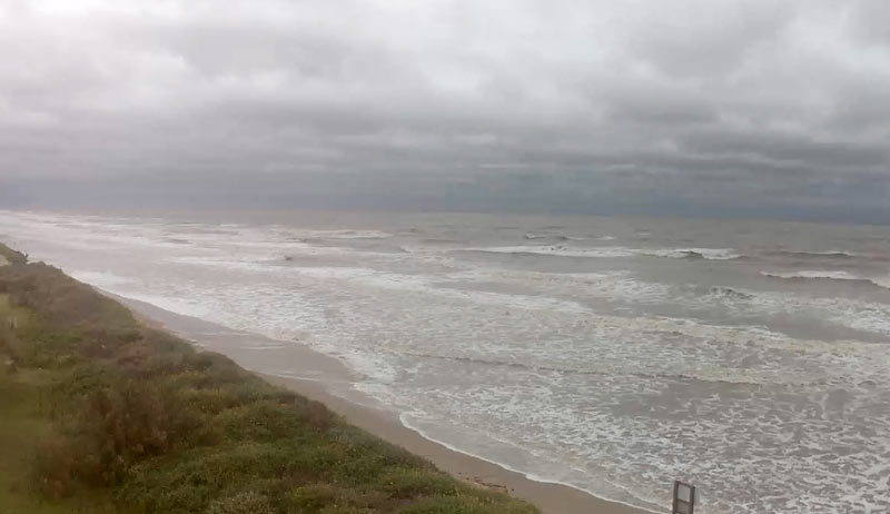 Voluntary evacuation is the name of the game this morning for folks on parts of the Bolivar peninsula (at least for those with health conditions that make the possibility of power failure a big gamble to take). To the east, much of the upper Gulf Coast is already getting hammered with touring bands of pre-landfall rain from Tropical Storm Cindy, and the governor of Louisiana has declared a preemptive state of emergency in anticipation of flooding and tornadoes. But today’s weather models generally peg the bulk of the wind and water from the storm as veering back to the east of Houston itself, Eric Berger notes over on Space City Weather this morning. The worst of the storm seems likely to pull northward toward the swampy, beachy stretch around Beaumont, Port Arthur, the Sabine River, and western Louisiana; only a few feet of higher-than-normal tides and a (relatively) few inches of rain are expected around Houston and near the Ship Channel’s pretty lucky-so-far chemical complexes, along with some pockets of high winds. [Space City Weather] Capture of current conditions on Sunrise Beach: Bolivar Peninsual, TX
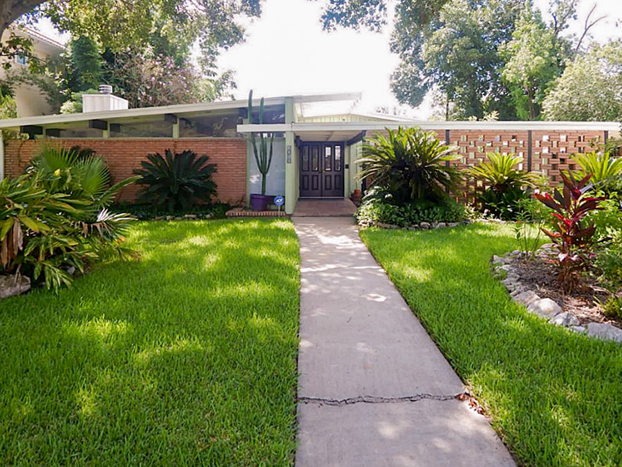
Noticed that striking Meyerland Mod headlining our demolition report this morning? The 1956 home at 4815 Braesvalley Dr. first came to Swamplot’s attention 9 years ago, as the site of a remarkable scene. The then-86-year-old architect Lars W. Bang, a prolific purveyor of Modern Houston homes, was driven to the property in hopes that the real estate agent listing the 4-bedroom property might confirm that he was indeed its designer. “My husband, Jim, helped him out of the car and invited him into the house,” Meg Zoller wrote, “but Mr. Bang’s knees aren’t what they used to be . . . and he just wanted to stand out front and look at the house. After some time he decided that he could not confidently say whether the home was one of his designs or not.”
Bang passed away the following year, but not before his authorship of 4815 Braesvalley was confirmed. (It turned out his name was on a set of plans kept by the Meyerland Homeowner’s Association.) Writing in the next edition of the Houston Architectural Guide, Stephen Fox labeled it a home that “rescues Meyerland from being boring.” The plan contains 3 courtyard spaces, one of them now topped by a screen roof:
HOUSTON’S PREMIER FLOATING TOURIST ATTRACTION SHUT DOWN AGAIN AFTER MORE LEAKS 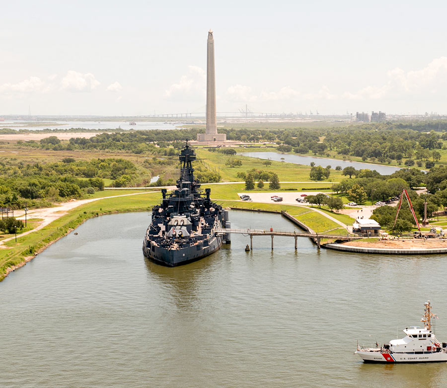 A 6-by-8-in. hole 15 inches below the water line discovered yesterday on the starboard side of the Battleship Texas caused the San Jacinto Battleground tourist attraction to tilt a “pretty serious” 6 degrees overnight, KPRC’s Cathy Hernandez reports this morning. The battleship — which was built long after the Battle of San Jacinto, but is a veteran of 2 world wars and a whole lot of 21st Century rust — has now been closed to the public until further notice. At last report, approximately 2,000 gallons of water per minute had been pumped out of the ship for more than 15 hours. Funds originally allocated to move the retired sea vessel to a dry berth were used instead to repair previous leaks. [Click2Houston; Texas Parks & Wildlife; previously on Swamplot] Photo: Coast Guard News [license]
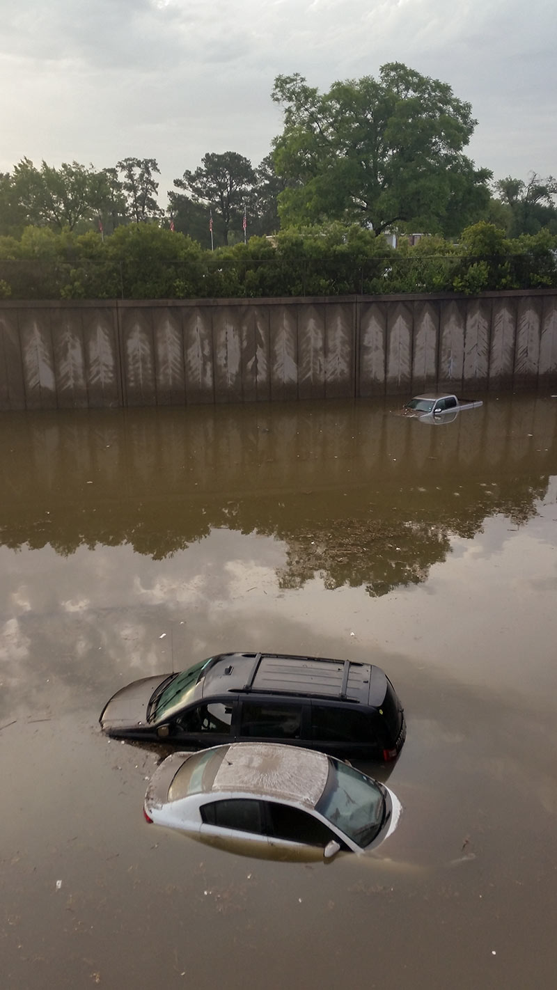
Okay. So. There’s a little bit of rain scheduled for Monday — but so far none of the forecasts seem to be showing anything like what turned up during the last few Memorial Day weekends. Swamplot’s gonna go ahead and take the day off anyway. Here’s hoping you and yours have a fun, safe, and largely dry break, if you’re getting one. (And if you don’t — we’ll still meet you back here on Tuesday to wade back into the Bayou City’s murky real estate waters, together.)
Photo of I-45, May 2015:Â Marc Longoria
COMMENT OF THE DAY: LAY OFF THOSE FLOODED UNDERGROUND FREEWAYS, THEY’RE JUST DOING THEIR JOB  “Trenched roads include sumps that are capable of keeping the roadways from flooding from ordinary rain events, but are designed to become flooded in an emergency, acting as additional stormwater detention. Every cubic foot of stormwater that goes in there is a cubic foot that isn’t at the same elevation as city streets, businesses, and houses. It is a feature, not a bug.” [TheNiche, commenting on Watch as Unfunded Parks Appear on Top of Houston Freeways Before Your Very Eyes!]
COULD HARRIS COUNTY SAVE UP SOME FLOODWATER FOR WHEN IT’S REALLY NEEDED? 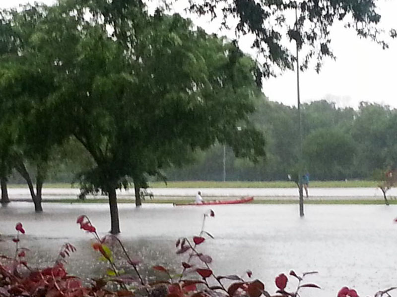 Finding a way to stockpile floodwater during years of plenty, commissioner Jack Cagle tells Mihir Zaveri this week, might not only help to make more water available for use during Houston’s drought years. It might also be a way to check the Houston region’s tendency for subsidence (that slow, permanent sinking that can happen when groundwater is pulled out of Houston’s soft clay layers too quickly). Or maybe, Zaveri adds, it could be used to help keep seawater from being sucked into aquifers as fresh water gets sucked out the other side — as long as doing so didn’t accidentally contaminate those same aquifers with junk from the surface. Who knows? Nobody, yet — but the county commissioners have given the $160,000 okay to a study team to shed light on whether it would be possible, feasible, or advisible for Harris County to pump floodwater underground for storage during major storms. [Houston Chronicle; previously on Swamplot] Photo of Meyerland flooding on Tax Day 2016: Tamara Fish
FLOODED-OUT FLOODING SYMPOSIUM TO TRY AGAIN IN APRIL 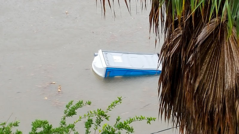 That January meeting of city officials, scientists, urban planners, business folks, engineers, conservationists, architects, and other flood-minded citizens — the one that was cancelled due to flash flooding — has now been rescheduled for April 5th. The symposium is still slated to take place at the George R. Brown Convention Center, and the same panelists appear to be on the docket. The event is free and open to all high water spectators, but you’ll need to register online by March 29th.  [Previously on Swamplot] Photo of flooding along Brays Bayou on April 17th, 2016: Chris Klesch

