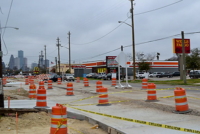
- 1120 N. Luzon St. [HAR]


Found relaxing in the Waugh Dr. median over the weekend, just north of Peden.
Photo: Paul Viscontini
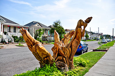
 Galveston Mayor Joe Jaworski now says he will waive the $10 annual permit fees the city had planned on charging 3 homeowners whose dead-tree sculptures stand in the public right-of-way. Homeowner Donna Leibbert started a small local-media firestorm late last week after she received a permit renewal form in the mail for the sculpture of a Geisha that artist Jim Phillips had carved out of an oak tree outside Leibbert’s home at 1717 Ball St. After the Hurricane Ike storm surge killed an estimated 30,000 trees on the island, artists turned almost 2 dozen of them into sculptures. But Leibbert’s Geisha is one of only 3 of the works that sits on city property.
City spokesperson Alice Cahill, who has helped to publicize the sculpture program as a tourist attraction, tells Amanda Casanova of the Galveston County Daily News that the license-to-use fee is normally required for any designed object that occupies a portion of the right-of-way. “A carved tree is treated the same as a cafe table.” Leibbert tells Casanova she was aware of the permit requirement at the time the Geisha was carved — getting approval for the sculpture required a formal application with the city’s planning commission. But she notes that the tree had stood in the same position for about 100 years, and for free.
Over the summer, Swamplot photographer Candace Garcia tracked down 22 of the tree sculptures, including Leibbert’s Geisha. Here’s her photo tour:

Mike Morris hitches a ride on the city’s $500,000 Street Surface Assessment Vehicle, a modified van that’s been hard at work studying street bumps and cracks since last May. Operators hope to complete a pass on more than 16,000 miles of Houston streets by this coming June.
Inside the van, [Patrick] Johnson uses a modified PlayStation controller and a black box with 16 white buttons to run the system, from recording the type of pavement being scanned — cement or asphalt — to marking potholes.
The van’s front lasers, mounted where the bumper used to be, evaluate the pavement surface for rough patches. A second laser device, the “crackscope,” is mounted at the back of the van, recording a continuous bird’s-eye photograph of the street to reveal fissures in the pavement.
A round, 11-lens camera — looking not unlike a disco ball — sits atop the van, recording nearby street features, including culverts and fire hydrants.
Each street starts with a score of 100, but as the lasers find rough patches or cracks and Johnson records each pothole, the score drops.
COMMENT OF THE DAY: WHERE THE MONEY IS ON KIRBY “Yes, it was getting tedious having to drive 75 more feet to find a bank.” [SH snooty, commenting on Children’s Kirby Assessment: Bike Barn Site Bank and Drive-Thru]
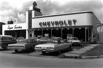
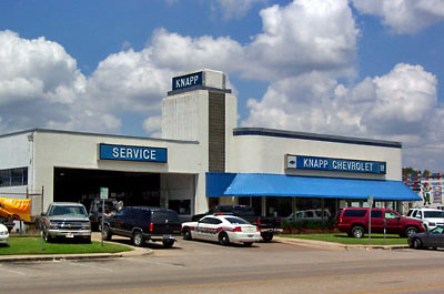
The president of a local real estate organization is hoping Swamplot readers can help her put together a slide show illustrating changes that have taken place over the years to the Washington Ave streetscape. How many of you have access to really old photos of Washington Ave? Well, you probably don’t have to go back too far to find images of a street that looked rather different than it does today. Send your old images — and please include captions and credit info — to the Swamplot tipline, and we’ll forward them to CCIM Houston/Gulf Coast‘s Ann-Marie Daleo, for inclusion in that organizations’ Washington Corridor Overview and Networking Event on November 4th. Daleo promises she’ll post the presentation online after the event, for anyone to download. And if any good before-and-after views come out of it we’ll post them here as well.
Photos: Houston Metropolitan Research Center, Houston Public Library (top) and GHPA (bottom)
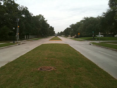
Got a question about something going on in your neighborhood you’d like Swamplot to answer? Sorry, we can’t help you. But if you ask real nice and include a photo or 2 with your request, maybe the Swamplot Street Sleuths can! Who are they? Other readers, just like you, ready to demonstrate their mad skillz in hunting down stuff like this:
Well, our readers didn’t come up with answers to these questions from last time, so Swamplot did a little digging:
Got an answer to one of these reader questions? Or just want to be a sleuth for Swamplot? Here’s your chance! Add your report in a comment, or send a note to our tipline.

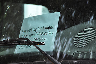
 Shhhhhhhh! It’s still parking! Roving Swamplot photographer Candace Garcia happens upon this swan-label vehicle, hanging out late Tuesday a few streets off Westheimer: “My only guess is that since we are so close to Mango’s there may be a performer in town. Or, I guess it could be someone at KPFT. The plates are from Cali. Anyway it’s a really nice truck with a great design on it. The small windows on either side of the cab have curtains hanging on the inside.”
COMMENT OF THE DAY: KICKING OFF THE GOLDEN AGE OF MONTROSE BLVD. EXTENDED PATIO DINING “This is so Houston it hurts. This has got to be nominated for some kind of best of/worst of award at the end of the year. I don’t know what the category is, but making a building less sidewalk and pedestrian friendly in order to accommodate a billboard is a classic.” [Cap’n McBarnacle, commenting on Must See This: Billboard Bunny Pushes Back New Montrose Office Tower]
An in-depth investigation.
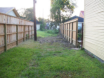
A reader writes:
There is an overgrown 12 foot wide city-owned “alley” behind my house in Riverside Terrace that due to weeds and trees is no longer navigable by anything larger than a “mini hydraulic excavator.” I know this because Centerpoint drove one back there when they put in my new gas meter in October.
My busy-body retired neighbor informs me that I am responsible for maintaining the alley by keeping the weeds and grass down, though when I look a few houses down in both directions from my house, I see a forest – and no one other than my neighbor complaining about it. So I quit mowing it 2 months ago, much to her chagrine. I’d like to treat it more like a green belt. Occasionally I’ll see a screech owl hunting back there during the late evening from its perch on my wooden fence. IMO the more trees, the better.
Am I really legally bound to mow back there? Mowing that small strip of grass would equate to another 2 pints of sweat lost, according to my experiences this past month.â€
Photo: Swamplot inbox
Video: emill
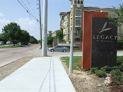
Blogging machine Charles Kuffner returns to the scene of a Memorial Heights sidewalk he photographed 2 years ago, and finds it’s grown. The Ed Sacks Waste Paper Company building that stood at the non-intersection of Memorial and Studemont has been replaced by the 25-story Legacy at Memorial. That apartment tower opened recently, but the set of sidewalks that wraps around it is still under construction:
COMMENT OF THE DAY: PUBLIC MEDIAN FRUIT-FOR-ALL “Private property should be respected, but I was really happy the time I saw a person gathering the fruit from a Mexican plum tree on the median near the Judiway post office.” [mary t., commenting on The High-Security Fruits of West University]