COMMENT OF THE DAY: THE MORE WEST HOUSTON FLOODS, THE MORE IT STAYS THE SAME 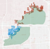 “Why does it matter? Even after the flood, I am okay with them building there on private land. Flood risk is just one of a million things that you should look at when buying a home. Heck, even knowing what we know now, I might still buy there in the right situation. If I was looking to buy a home in that general area, and the only way I can get one is to build one on the far back end of the reservoir, I would still do it today. Even after we calibrate the models to include the recent rainfall events, we will still find that this is an outlier.” [Rex, commenting on How It Came To Pass That Hundreds of Families Purchased Homes Inside Houston’s Reservoirs; previously on Swamplot] Map of subdivisions in or along the edge of the Addicks and Barker reservoirs: ProPublica
Tag: Flooding
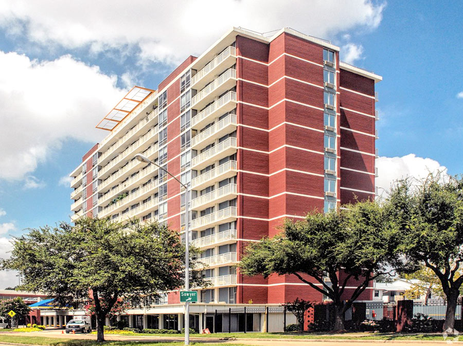
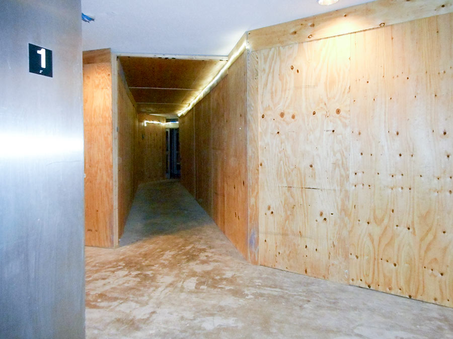
The apartments inside 2100 Memorial are “quite hale and hearty,” a reader tells Swamplot — and were not individually affected by the flooding that caused enough damage to the building’s fire-safety systems to trigger a 5-day move-out notice to all tenants in the 14-story structure. That notice was issued Monday night to all 188 residents of the tax-credit elderly housing facility; prior to that, construction crews and volunteers had worked to mitigate the damage and help residents left for days without water and without easy transportation between floors. Above: a view of the first-floor hallway, lined with plywood. In the building’s computer room, the removal of wood paneling revealed wallpaper left over from the building’s days as a Holiday Inn:
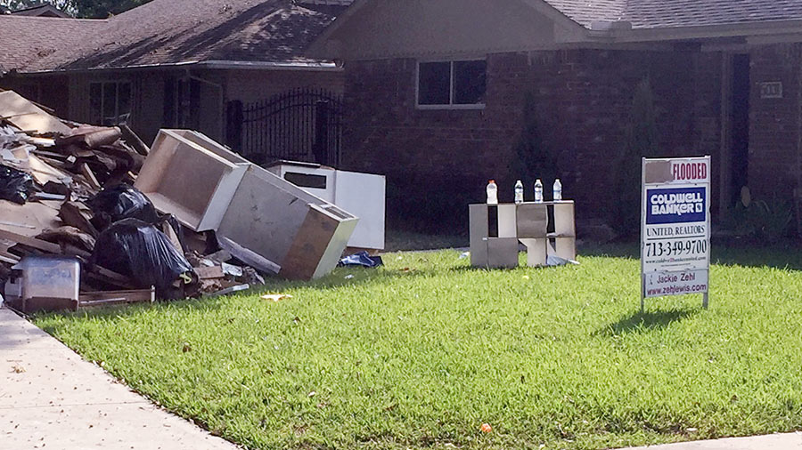
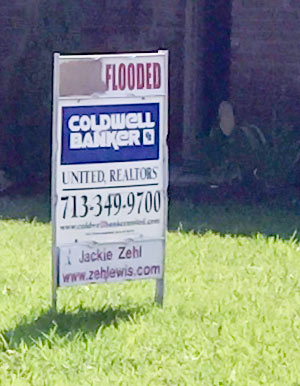 Here’s a cruel twist on all those DID NOT FLOODÂ signs popping up in front of homes in Harvey’s wake — and perhaps a cautionary tale for potential buyers of some of them: When it was offered for sale this summer, this 3-bedroom 1957 home on Yarwell Dr. in Meyerland between Chimney Rock and S. Post Oak featured a proud NEVER FLOODEDÂ topper on its for-sale sign. But Hurricane Harvey permanently altered that situation. Reader James Thomson snapped this shot of the front yard on September 4th, showing the first part of the sign painted over to reflect the home’s new status. The property has since been taken off the market.
- Previously on Swamplot:Â Here Comes Another Surge of ‘Did Not Flood’ Signs
Photo: James Thomson
HOW IT CAME TO PASS THAT HUNDREDS OF FAMILIES PURCHASED HOMES INSIDE HOUSTON’S RESERVOIRS 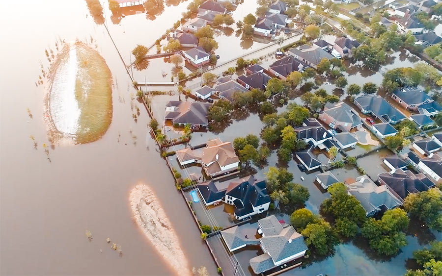 Many of the flooding victims upstream of Addicks and Barker dams learned for the first time that their homes were inside government-designated reservoirs only after rains from Harvey flooded their neighborhoods, reports Naomi Martin. How had they come to live there? “The corps didn’t feel the need to acquire all the land at the time the reservoirs were built, [the Army Corps of Engineers’ Richard] Long said, because that land was nothing but rice farms and fields where cattle grazed. It didn’t stay that way. In 1997, developers came before Fort Bend County government for approval to put subdivisions on the pastures. Aware of the flood risk to the area, the county was in a bind. It didn’t have the authority to prohibit development or establish zoning rules, said County Judge Robert Hebert, who has been in office since 2003. So the county insisted, ‘over great objection’ by developers, on including a warning on the plat, Hebert said. The county, he said, ‘felt it was a defect on the land that should be pointed out.'” The warning appeared as a small note on the plat document establishing some later Fort Bend County subdivisions, but equivalent declarations were absent on documents establishing nearby Harris County subdivisions. [Dallas Morning News] Aerial view of flooding in Canyon Gate, Cinco Ranch: Michael Fry
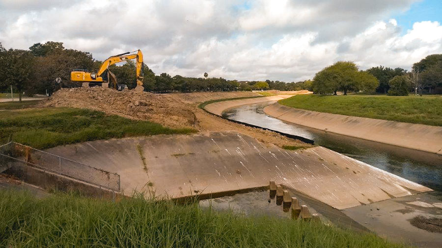
It’s coming a little late for many homes in Meyerland, but excavation crews are once again at work widening the segment of Brays Bayou just downstream of that flooded neighborhood. Work on the segment between Buffalo Speedway and S. Rice Ave. began this past summer. The widening is a part of the decade-plus-old Project Brays, begun before but accelerated as a result of flooding during Tropical Storm Allison in 2001.
Water levels on the bayou have returned to a manageable level; this photo, sent in by a Swamplot reader, shows an excavator at work on its south bank just west of the inlet between Timberside Dr. and Bevlyn Dr.
Photo: Swamplot inbox
The 2 very different videos above give a taste of what the last few weeks have been like in Nottingham Forest, the Memorial neighborhood along the north side of Buffalo Bayou between Dairy Ashford and Kirkwood south of Memorial Dr. Nottingham Forest filled with water after Hurricane Harvey — and releases of water from the oversubscribed Addicks and Barker reservoirs. The first video, taken by Swamplot reader Gatewood Brown from a GoPro mounted on a kayak, shows portions of the neighborhood underwater during rescue operations 3 days after Houston was first hit by the storm. The second video was taken yesterday by reader Kyle Steck, using a mobile phone he carried while biking hands-free through Nottingham Forest’s now dry but extensively garbage-lined streets.
Videos: Gatewood Brown; Kyle Steck
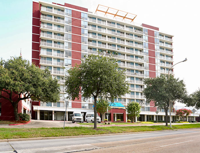
A notice sent yesterday to all tenants of the 2100 Memorial senior-living facility just west of Downtown declares that the 14-story former Holiday Inn has been rendered “totally unusable for residential purposes” in the aftermath of Hurricane Harvey. All 198 elderly residents have been given 5 days to remove themselves and their belongings from their apartments.
The building is a tax-credit property of the Houston Housing Authority that includes both low-income and market-rate units. The notice, which came from V.J. Memorial Corp., a nonprofit entity owned by the authority, states that the company only recently learned that the building’s electrical and fire control systems were compromised by the flooding.
“Due to the damage and health & safety reasons, the building is uninhabitable and we must exercise our right under your lease to terminate the lease effective September 23, 2017,” reads the notice, a copy of which was obtained by Swamplot. A separate lease termination document sent in by a reader declares that “the damage to the Apartment is so extensive the Apartment has become as a practical matter totally unusable for residential purposes due to health and safety reasons. Furthermore, the damage could cause health and safety hazards to you and your family, if you returned to live in the Apartment in its present condition.” Residents have until 5 pm on the 23rd to get out: “If you do not remove your personal possessions by that time. we will be forced to remove your possessions and store them at a cost to you,” the document states.
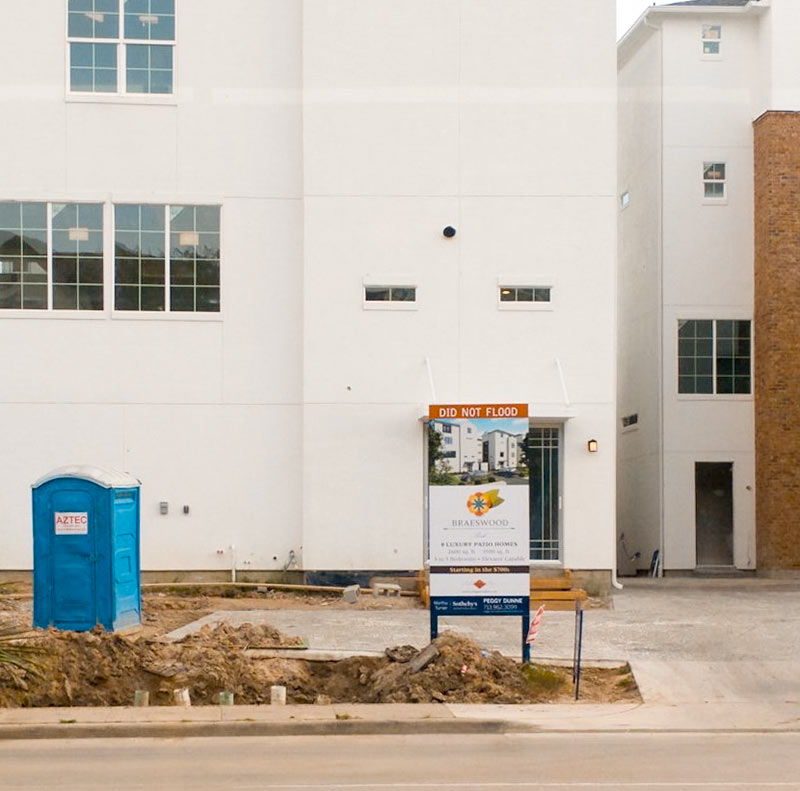
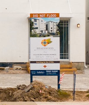 Popular yet again in Houston: The DID NOT FLOOD sign topper. Here’s a new one spotted by wandering photographer Joshua House in front of the Covington Builders 4-story townhome development at 3821 N. Braeswood Blvd., one block north of Brays Bayou and a couple blocks east of Stella Link.
Where have you spotted signs like these in Harvey’s aftermath? Please send pics and coordinates to us. Swamplot wants to know what DID NOT FLOOD.
- 3821 N. Braeswood Blvd. [HAR]
Photo: Joshua House
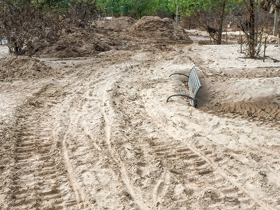
The retreat of floodwaters has revealed the extent of the silt that Harvey-triggered flooding deposited along Buffalo Bayou. A beachgoing reader sends Swamplot these pics of the new dust-colored landscapes that have taken shape along Buffalo Bayou Park and adjacent former green spaces.
The silt-covered bench shown above sits across Buffalo Bayou from the Houston Police Officers Memorial, near Glenwood Cemetery. Here’s a view from further back:
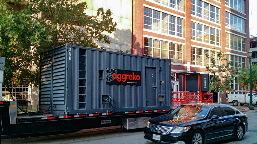
Residents of the 79 apartments in the Hogg Palace Lofts are expecting air conditioning in their units to be restored sometime today — for the first time since power went out early on the morning of August 27th. At a meeting earlier this week, attorneys for and representatives of the Randall Davis Company told tenants of the 8-story building at 401 Louisiana St. that they were aiming for Friday for the AC to be turned on, though could not guarantee it — but that work would continue over the weekend if it couldn’t.
A somewhat parallel sequence of events played out after the promised trailer-mounted Aggreko 1 MW generator pictured above was parked along Preston St. in front of the building last Friday; difficulties in connecting it to the electrical system — including a hunt for the unknown owner of a white BMW parked in a tenant spot in the parking garage that stood in the way of a hook-up — delayed the restoration of electrical power until Monday.

One hundred seventy 3-to-6-year-old students restarted their school year at the Post Oak School in Bellaire this week in one very large classroom: the school’s basketball gym. Harvey flooded the lower school campus at Bissonnet St. and Avenue B in Bellaire with 4 inches of water throughout its first floor late last month. The result: 15 classrooms and other learning spaces were temporarily closed as a result of water damage.
Five elementary-school classes were moved to Episcopal High School, which is next door to the 54-year-old Montessori school. But the Post Oak School’s 6 separate primary-level classes are staying on campus at 4600 Bissonnet — only relocated into its largest available unflooded space. Over 3 days prior to the reopening, Post Oak employees, parents, and volunteers from Austin Montessori School set up a giant six-pack of Montessori classrooms using whatever undamaged furniture and materials they could find. And — as the video above shows — they filmed it all.
More views of classes, now in session:
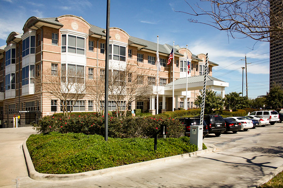
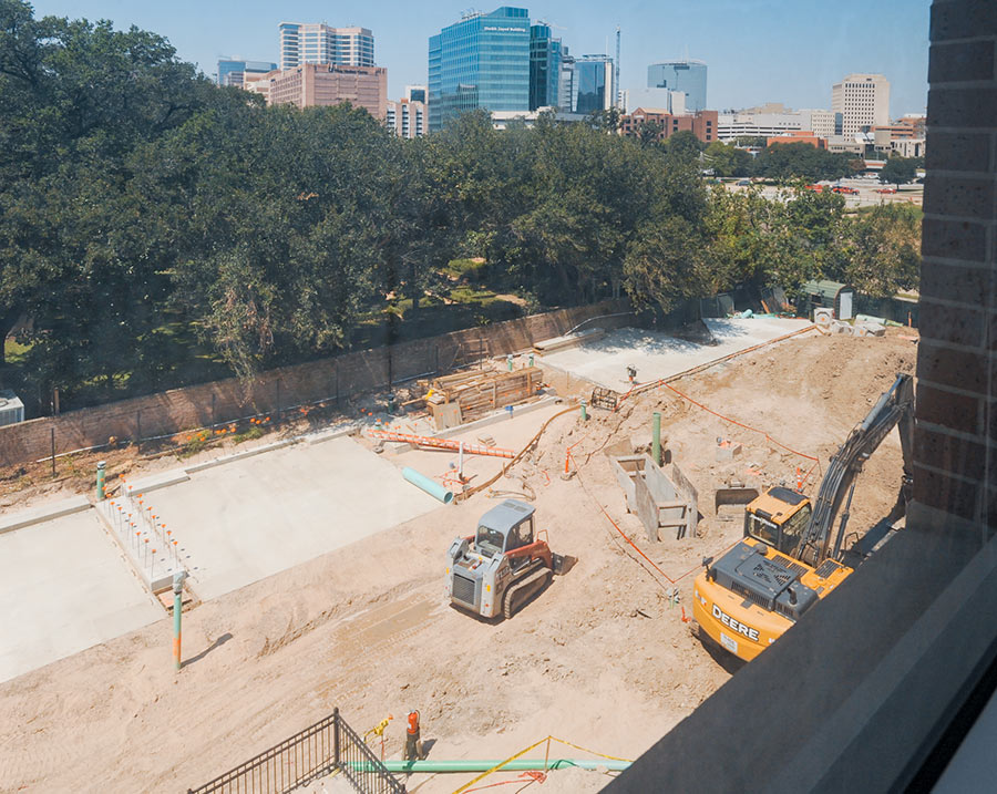
Construction began in June, but the new administration of Houston’s Ronald McDonald House chose this past Tuesday — 2 and a half weeks after water spilling over the banks of adjacent Brays Bayou made Holcombe Ave. in front of the property difficult to pass — to hold an official groundbreaking ceremony for its new 3-phase expansion and renovation project. The facility at 1907 Holcombe Blvd., which sits across the Texas Medical Center’s official southern border between Holcombe and the bayou just west of Cambridge St., serves as a temporary home for families with children receiving treatment for serious illnesses.
Now going up: a new 2-story bedroom wing directly to the west of the main building. A complete renovation of the 50-bedroom existing building — dubbed Holcombe House — will follow. The photo immediately above, taken from the third floor of that building, shows the construction site as it looked earlier this week.
The official rendering below is still being used to raise the $22.5 million needed for the project; it shows the new bedroom wing on the left and the existing building on the right:
WEST HOUSTON CAN NOW FLUSH IN GOOD CONSCIENCE 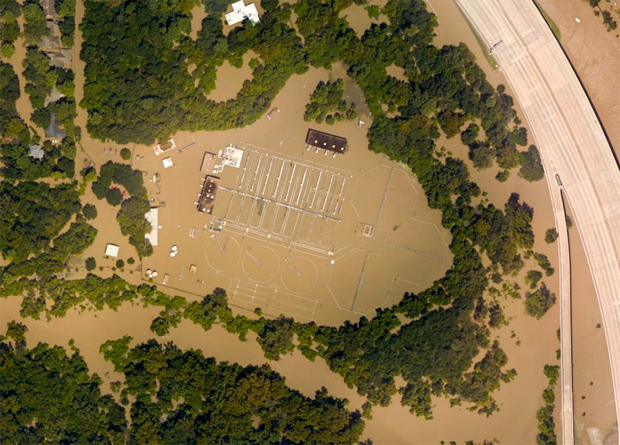 When last we (and the aircraft supplying aerial images to NOAA) left the West District wastewater treatment plant along Buffalo Bayou just outside Beltway 8 at the flooded southeast corner of Memorial Glen, it looked like this: shut down and surrounded by muddy floodwaters sorely in need of its services. That was September 3rd. As of this morning, the city’s Office of Emergency Management reports, both this plant and the one on Turkey Creek off Eldridge between Briar Forest Dr. and Memorial have been restored to full operation. This means persons in ZIP Codes 77024, 77041, 77043, 77055, 77077, 77079, 77080 and 77094 who had been following guidelines to limit their water use are once more free to shower, flush, brush, and otherwise send wastewater down their drains without special consideration of the consequences. [Alert Houston; previously on Swamplot] Aerial image of West District plant from September 3: NOAA
COMMENT OF THE DAY: THE EVEN BIGGER REASON HOUSTON MIGHT WANT TO ADDRESS ITS FLOODING PROBLEMS  “People in Houston need to talk with people in other parts of the country to be able to understand the need for funding massive improvements in our flood control infrastructure. I had friends and family from LA to Philly telling me to get out of the city and come stay with them as soon as it was possible to travel out of the city. My sister even offered to drive her minivan over 1,200 miles to come rescue me. I still have family asking me whether they should cancel plans to visit over Thanksgiving for fear that hotels will be full and no rental cars are available.
It is easy to get all worked up about taxes when you did not get flooded and go into the usual red state “don’t tax me, tax that guy behind the tree†mode. But much more is at stake for Houston than whether parts of the city keep flooding. We run the risk of being seen as a city that is not worth the risk for existing and prospective businesses. People in Houston are getting used to these flood events and are not pressed into action by aerial footage on CNN showing Buffalo Bayou turning into a raging torrent. But everywhere else in the US, people see that and are completely freaked out by it. If we continue with applying band aids and do not make any big dramatic moves to improve our flood control infrastructure, we will not only be risking future catastrophic flooding but will also be risking losing current and future business to cities that are on higher ground away from the path of hurricanes and tropical storms.” [Old School, commenting on Comment of the Day: Abandoned Neighborhoods Make Great Detention Ponds] Illustration: Lulu
COMMENT OF THE DAY RUNNER-UP: ABANDONED NEIGHBORHOODS MAKE GREAT DETENTION PONDS  “I grew up off Fairbanks/West Little York area. TS Allison was the third time Creekside Estates and Woodland Trails West II had flooded which meant those homes wouldn’t be insured for future floods. Both of those neighborhoods are almost completely gone now, mainly just streets people use to cut through. Even with all the new construction/neighborhoods built near Breen Rd, nothing around has flooded since. The south side of WTW where Gulf Bank runs through flooded twice in late ’90s, along with Philippine St. in Jersey Village. Neither of those areas have had a third flood event; not Ike, Memorial Day flood, Tax Day flood or Harvey could flood them. A huge reason why has got to be because old Creekside Estates and WTW II hold so much of the water that would’ve flooded them out that costly third time years ago. Sometimes you have to cut loose some fat for the overall good and I know it sounds heartless but I’ve seen it work. These very flood prone neighborhoods just have to be made into retention areas because it works.” [mas, commenting on How About We Don’t Sell People Homes in Areas That Keep Flooding, and Other Crazy Ideas for Houstonians To Discuss Amongst Themselves] Illustration: Lulu

