07/22/10 11:13am

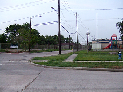
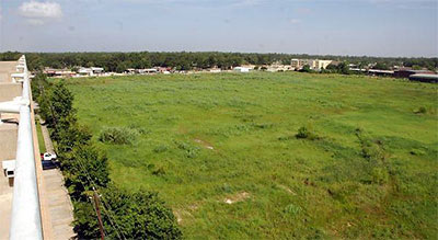
A little more detail on that other Walmart headed for I-10, from Memorial Examiner reporter Rusty Graham: Construction will begin within a couple of months on the 185,000 sq. ft. Supercenter just north of the Marq*E Entertainment Center, on the remaining 23 acres of the former Cameron Iron Works plant. The company has quietly owned a portion of the TCEQ remediation site, which features soil and groundwater rich in cleaning solvents, since 2008. (“Most of the soil at the site has now been cleaned to meet residential standards,” Cooper Cameron claims.) Six of 7 surrounding pad sites will line Silber Rd. The Walmart itself will form a scenic backdrop to an expansive 880-space parking lot:

CONTINUE READING THIS STORY

07/09/10 8:46pm

RICE VILLAGE BARBECUE AND POT LUCK BRINGS ON THE CHEMICALS AND HAZMAT CREW As abc13 reports it this evening, both sides in everyone’s favorite ongoing Rice Village feud contributed what they could to today’s neighborly resolution of that little rotting-meat problem. To neutralize the odor emanating from the tens of pounds of stinky flesh that had been dumped on an adjacent private alley a week ago, workers from Hans’ Bier Haus reportedly poured calcium hydroxide (or lime) onto it. And the friendly folks next door at the 2520 Robinhood at Kirby condos hired a hazardous-materials crew to remove the resulting stew: “It’s a corrosive and it could be toxic also,” Bernard Nelson of Legacy Environmental told a station reporter. “If it gets on the skin it could burn. It carries [a] pH of 14 to 16 so that’s definitely caustic.” [abc13; previously on Swamplot]

05/11/10 11:20am

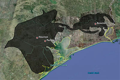
Playing around with a super-fun online tool that lets you superimpose the blobbish outline of the 2500-sq.-mile (and growing!) Gulf of Mexico oil slick from the Deepwater Horizon offshore-rig disaster onto various cities, Houstonist editor Marc Brubaker tries it on Houston — for size.

“It’s almost creepy how the slick follows I-10 out to Beaumont,” he comments. Of course, Brubaker should have nudged the oily blob a bit more to the east. Sure, he might have lost a few of those shiny exploration-company offices that have fled to the western stretches of Katy that way, but you’d be picking up lots of fun storage tanks and chug-chugging industrial plants at the northern reaches of Galveston Bay, and you’d get better coverage of Texas City, too.

Oh — but the outline is only up to date as of May 6th? Maybe we’ve got full coverage by now, then!

Image: Houstonist

05/04/10 1:34pm

COMMENT OF THE DAY: CLEARING THE AIR AROUND CLEAR LAKE CITY “As a resident of the area, I’m very interested in your comment about ‘knowing what was going on around and within Clear Lake City before Exxon developed it as a community…’ Are you aware of anything specific that might raise concerns, or is this just a baseless consumer scare?” [C.T., commenting on Comment of the Day: Clear Lake City Cleans Up Nicely]

04/28/10 1:54pm

COMMENT OF THE DAY: CLEAR LAKE CITY CLEANS UP NICELY “Is there a discount [for homes near chemical plants]? Hell yes! And it’s for lots of reasons: 1) real or perceived pollution, 2) real or perceived high crime, 3) low elevations, 4) higher property insurance rates, 5) fewer nearby white collar jobs, and 6) living there indicates to snobs that you’ve got a low social status. Most of the discount is unwarranted, but it’s a self-fulfilling prophecy. Look at Clear Lake City; parts of it are only about 1.5 miles from the nearest chemical plants. It was developed upon depleted oil fields and is adjacent to still-active fields. (It was developed by a subsidiary of Exxon!) It’s adjacent to an airport. It has a low elevation. But all that stuff is out of sight, out of mind, and so there’s no stigma.” [TheNiche, commenting on House Shopping in the Chemical Discount Zones: Finding Houston’s Less-Toxic Neighborhoods]

04/27/10 2:41pm

HOUSE SHOPPING IN THE CHEMICAL DISCOUNT ZONES: FINDING HOUSTON’S LESS-TOXIC NEIGHBORHOODS “A commenter on your blog who says he works at a chemical plant recently wrote that a neighborhood 1 mile from a chemical plant ‘is never going to be an “OK” neighborhood.’ Is there a single citywide map that shows where all these plants are, so I can find a place to live accordingly? And how far do I have to be from a chemical plant to be ‘OK’? 5 miles? 20? I presume there’s no absolute answer. But there’s got to be a de facto ‘discount’ on homes in neighborhoods that are within certain radiuses of the toxic stuff, right? If so, how far do the discount zones extend? Could someone draw that map for me?” [Swamplot inbox]

04/20/10 3:22pm

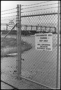
HOW TO PREPARE SAN JAC RIVER STEW What’s the local recipe for that San Jacinto River fishin’ favorite, toxic redfish? “The dioxins come from submerged waste pits north of the Interstate 10 bridge. McGinnes Industrial Maintenance Corp., which is no longer in business, owned and operated the pits in the 1960s, filling a 20-acre site on dry land with waste from a now-closed paper mill near the Washburn Tunnel. In the bleaching process, paper mills generated large amounts of dioxins, a family of compounds so toxic that scientists measure them in trillionths of a gram. The EPA says there is no safe level of exposure to the chemicals, which are known to cause cancer and disrupt immune and reproductive systems. The San Jacinto River began to run through the waste pits by the early 1970s because of subsidence — the sinking of soft soils as water is pumped from underground. With the McGinnes pits under water, the dioxins spread into the river and worked their way through the ecosystem, becoming more concentrated at each step in the food chain. For more than a decade, the Texas Department of Health has warned that fish and crab caught along this stretch of water, north of the Lynchburg Ferry, are tainted with cancer-causing dioxin, pesticides and PCBs. . . . In July, the EPA identified the International Paper Co. and McGinnes, which became part of Waste Management through a series of mergers and acquisitions, as the firms responsible for the dioxins problem. Under the Superfund law, the two companies will be required to evaluate and clean up the contamination. They paid about $65,000 for the fencing and roughly 50 warning signs in English, Spanish and Vietnamese, a McGinnes spokesman said.” [Houston Chronicle]

12/02/09 3:05pm

COMMENT OF THE DAY: THE UNCHARTED INNER LOOP “. . . you really haven’t got a clue if you think that suburban soil toxicity is a good reason to live inside the loop. The oldest parts of the city experienced the longest duration of industrial activity prior even to the creation of the EPA, much less even an understanding of what chemical agents were toxic. Check out the EPA’s EnviroMapper applet for an account of all known toxic waste sites (you’ll be amazed at the number), and even then bear in mind that that information is far from complete because there’s no telling what kind of crud was being mindlessly dumped on bare earth way back when and never reported. The Inner Loop isn’t supplied with well water anymore, so the toxic soils below us fortunately aren’t much of a problem…but that redeeming characteristic is shared by most of the City of Houston. The municipal water supply certainly doesn’t just abruptly stop all at once at the 610 Loop.” [TheNiche, commenting on My Toxic Houston Childhood]

11/30/09 5:35pm

Blogger Maritza Valle grew up in Southbend, next to the Brio Superfund site, just west of San Jacinto College’s South Campus:

I lived in a toxic waste dump when I was young.

Yes, let it sink in like the waste sank into our ground and somehow contaminated the water.

When I was young, I can’t remember how young, my mother and I moved in with Gamma, my maternal grandmother. Maybe I was about 7 because my brother was there too.  I still remember the address: 11606 South Arbor, Houston Texas 77089. It was a subdivision, pretty new, with a nice school just around the block, and our house had a back yard opposite a huge field. Every once in a while, men in weird space-suit looking outfits would come out and mess around with the ground, which concerned me because there were cows out there, and then leave. . . .

CONTINUE READING THIS STORY

09/22/09 3:12pm

COMMENT OF THE DAY: NOT MUCH HAPPENING SOUTH OF CLEAR BROOK LANDING “. . . Beamer Road is a special case because of the Brio Superfund Site. There was a waste processing plant that had disposed of a great deal of material from various refineries by dumping it into earthen pits. That was not standard practice; this was Houston’s Love Canal. The Brio site has been contained to prevent additional seepage through the groundwater, but the pollution that’s there would be far too expensive to remediate. So yeah, unless your friend got a chunk of that sweet sweet settlement, he’s probably **** out of luck.” [TheNiche, commenting on Comment of the Day: Where the Townhomes Ain’t]

08/17/09 12:23pm

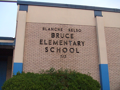
The old Bruce Elementary School on Bringhurst St. in the Fifth Ward — featured on Swamplot just last week and apparently just about ready to go up for sale — went up in flames last Friday night, reports our neighborhood correspondent. A story featured on Abc13 news says the building did suffer major damage from the flames, and makes it sound as if arson is suspected. Did any of the asbestos do its job?

Photo of former Bruce Elementary School, 713 Bringhurst St.: Vaughn Mueller

08/10/09 11:17am

Swamplot’s new “Bottom” of the Fifth Ward correspondent Vaughn Mueller reports from the site of the old Bruce Elementary School, where a sign indicates the property is for sale. A source tells Swamplot that a few details need to be worked out before it’s “officially” on the market, but an HISD web page provides some information about the property.

The school, which was closed at the end of the spring 2007 semester, sits along Cage and Bringhurst on the I-10 feeder road, and comprises a little more than 2 blocks. Mueller reports that the new Bruce Elementary (built by a 2002 HISD bond) less than a mile away on Jensen opened its doors in the fall of 2007.

Why the move?

CONTINUE READING THIS STORY

07/17/09 4:27pm

Katy residents living near a pool supply company got breathtaking views of the spectacular black plumes emanating from the RAM Chemical and Supply warehouse at 4949 Greenhouse Rd. during last weekend’s fire.

But the fun wasn’t entirely over: A separate episode yesterday resulted in a shelter-in-place order for a few hours last night — for downwind neighborhoods east of the Windstone Colony subdivision, stretching from Greenhouse Rd. to Barker Cypress. Fire officials warned of toxic clouds billowing out from a supply of hazardous chemicals still housed in the singed remains of the warehouse.

Video: Kevin Neugebauer

06/01/09 12:03pm

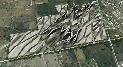
You saw the video. Now comes the detail: OffCite has more on recent Rice University architecture grad Lysle Oliveros’s proposal for turning that putrid pile of garbage next door to Shadow Creek Ranch into an exciting outdoor playplace! The fun comes in 3 phases.

In phase 1, trash haulers would start a new pile with each year’s take, completing a mound every 12 months:

Each monument compared to the next would create an awareness of the massive amount of disposed consumer goods. For example, the 2008 “index” created by Hurricane Ike debris would have been 400 feet tall.

Too bad about the City of Pearland’s recent agreement with Republic Services limiting those piles to a mere 130 ft. Oh, well — just wait until 2029!

CONTINUE READING THIS STORY

05/21/09 3:35pm

Shadow Creek Ranch residents worried that the Blue Ridge Landfill just across FM 521 would turn into a 170-ft.-tall mountain of smelly garbage can breathe deeply again, now that the City of Pearland has reached a settlement agreement with the landfill’s operator, Republic Services (formerly Allied Waste).

Among the most important changes: the landfill will be limited to its current height of 60 ft. for 12 more years. Will that be enough time for Shadow Creek Ranch’s homebuilders and Las Vegas developers to sell off whatever remaining inventory they own in the master-planned community? After that, the pile of trash will be restricted to hillock status, at 130 ft. tall — “for an additional 8 years.”

Also good for home sales: Garbage trucks will be banned from using Shadow Creek Parkway west of FM 521!

More details of the agreement from City Attorney Darrin Coker, quoted in The Journal of Pearland:

CONTINUE READING THIS STORY